

Bradford District Local Plan - Publication Draft (Regulation 19) (October 2026)
Policy BSE1: Bradford South East
Introduction
The Local Plan settlement hierarchy identifies Bradford South East as one of four quadrant areas within the wider Regional City of Bradford. It is broadly defined by the extended (Southern Gateway) Bradford City Centre boundary to the north and Leeds Road to the northeast of the area, A641 Manchester Road to the west, and Green Belt land to the east and south. It covers an area of approximately 1,747 hectares and contains a diverse range of residential areas plus some of Bradford’s prime industrial and business areas with good connectivity to the M606 and west Leeds.
Bradford South East includes the wards of Holme Wood and Bierley, the majority of Wyke, about half of Little Horton and a small element of Wibsey Ward plus a large proportion of Bowling and Barkerend Ward.
The sub area can be characterised as a densely developed and populated urban environment comprising some of the largest areas of employment and industry in the District with main areas at Bowling Back Lane, Staithgate Lane/Euroway estate, Low Moor and Cutler Heights. In terms of residential areas, these typically comprise large sections of mostly terraced homes in east and west Bowling and Laisterdyke together with the large former Council estates of Holme Wood and Bierley interspersed by formal and informal greenspaces including parks, golf courses and woodland.
POLICY BSE1: BRADFORD SOUTH EAST Comment
Settlement Plan
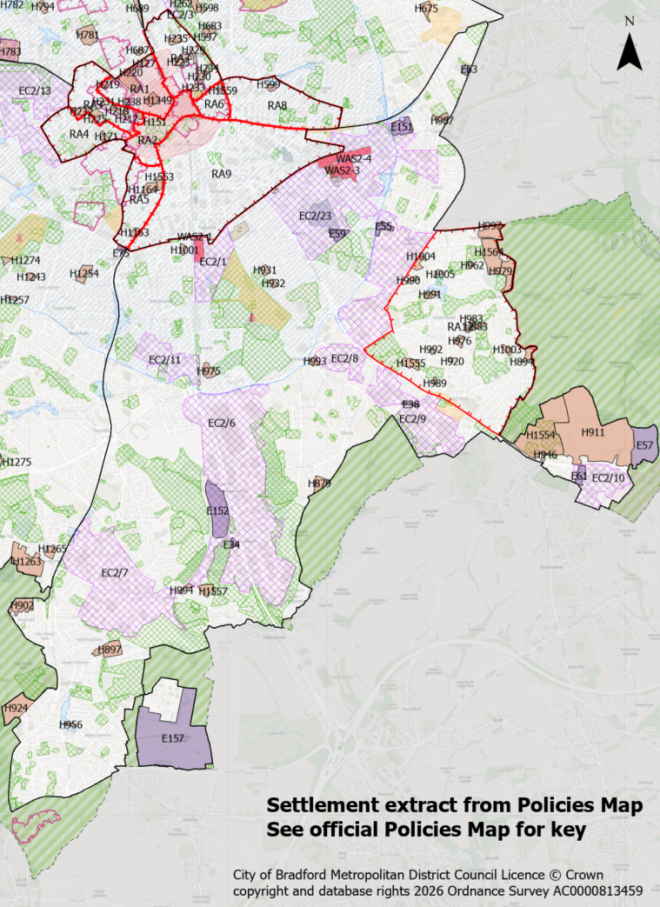
Settlement Hierarchy and Spatial Directions
- Bradford South East is defined on the Policies Map and forms part of the Regional City. It will support significant additional housing growth in sustainable locations and new employment opportunities, supported by existing local services and improved connectivity through improvements to infrastructure provision
- Housing growth will be primarily focussed upon a large urban extension at Holme Wood together with a maximisation of previously redeveloped site opportunities to drive forward the regeneration of this area, together with further development opportunities in other urban fringe areas and new sites within the settlement boundary. A range of house types will be supported which will broaden the diversity, tenure and quality of housing in the area and provide new opportunities for access to the countryside.
- Employment opportunities will be supported through the delivery of a strategic employment allocation of 40ha[1] to the south of Nufarm alongside a series of medium sized employment allocations totalling over 26ha of new employment land. This in turn will be supported by a significant coverage of Employment Zones (Policy EC2) in the SE safeguarding existing employment floorspace meaning local businesses will continue to be supported including those specialising in advanced manufacturing, engineering and technology together with those specialising in logistics.
Meeting Growth Needs
- Housing development in the Bradford South East will deliver approximately 2,934 dwellings through a combination of sites within the urban area and land released from the Green Belt from sites under construction, with planning permission and new site allocations during the plan period, as set out in Table BSE 1.1
Table BSE1.1 – Bradford South East
|
Under Construction |
Planning Permission |
Site Allocations |
|
|
Totals |
463 |
28 |
2,443 |
- Deliver housing site allocations as shown on the Policies Map and the site proformas within section 5. Proposals for new homes within the settlement boundary on additional small sites outside of the town centre, including the redevelopment of previously developed land, will also be supported subject to meeting policies HO3 and DS3.
- Proposals for new homes on the settlement boundary will be subject to meeting in particular policies DS1, DS2 and NE7 and those within the urban area subject to policies DS3 TO DS5 together with housing policies HO2 to HO4. The Council will work with developers to secure quality housing schemes which take in the needs of the area and the communities being served
Holme Wood:
- Holme Wood has been identified as an area for wide-ranging economic, social, community and housing renewal for many years and is a key a Regeneration Area (RA12: Holme Wood) in the SE and an area of strategic release for housing and employment growth through allocations H911, H1554 and E57.
- Regeneration Area – (RA1: Holme Wood) The Local Plan will allocate a series of housing sites in the Holme Wood RA and through these allocations aim to deliver over 600 new homes. This combined with the strategic growth will deliver significant market investment into the area stimulating and supporting the renewal and transformation of the existing housing stock. To maximize the impact of this growth, social housing providers should aim to align their asset management strategies with these new development opportunities. This coordinated approach ensures that new housing delivery runs parallel with targeted regeneration and estate investment.
- The defined Local Centre remains a key feature of Holme Wood but there is a need to tackle commercial vacancy levels and environmental improvements to support its use and overall viability. Community uses will continue to be supported in the Local Centre. Opportunities to support service delivery and secure the longer term viability of the Local Centre through regeneration and limited redevelopment will be supported where they maintain the core function of the Local Centre.
- The levels of growth proposed through the Local Plan alongside the existing community need to have access to key employment areas through improved public transport connections, in the short to medium term this will be through key bus routes and longer term exploring the potential connections to Mass Transit routes to the north of the RA. These will also need to sit alongside the development of strategic greenways and cycle-ways that better integrate the Holme Wood area to the eastern conurbations of Leeds and ensure that the area is well connected to key employment areas in South Bradford.
- Strategic Growth (H1554/H911/E57) - The three allocations are shown on the Policies Map, when taken together they will deliver approximately 1240 dwellings and 9ha of new employment land over the plan period. The three site allocations are all accessed off Westgate Hill Street (A650), alongside Tong Leadership Academy and existing businesses and residential properties to the north and south of the road. Therefore, any cumulative issues such as highways access, transport, landscape, infrastructure and other policy requirements must be considered across all three sites either through a comprehensive masterplan or individual masterplan’s that demonstrate how these issues have been addressed. In particular the development should respond positively to the prominent location through high-quality design, layout and structural landscaping to minimise impact on the landscape in the immediate and wider Tong Valley Rolling Enclosed Pasture landscape character area.
Local Services and Facilities
- The Council will take a positive approach to retail growth and the vitality of the designated District and Local Centres, as defined on the Policies Map, through enhancing their diverse range of retail, service and leisure uses, and supporting the retention and improvement of other local services and facilities.
- Protect and enhance existing open spaces and green and blue infrastructure to support the delivery of the opportunities identified in the GBI Focus Area A (Bradford Inner City) together with new accessible multifunctional open spaces and active routes for walking and cycling. These will help to create a network of green corridors to connect habitats and improve ecology both within the Bradford South East area and wider corridors beyond.
Landscape
- The landscape to the immediate SE of the city centre is predominately urban in form, moving to the east is the Tong Valley Rolling Enclosed Pasture landscape character area and to the south the South Bradford Settled Valley character area. It is important to maintain and enhance these landscapes as they are important features between the larger built-up areas both within and outside of Bradford.
Historic and Natural Environment
- Protect and enhance the designated Local Wildlife sites as well as habitat networks and priority habitats within and adjacent to the settlement.
- Ensure that future development conserves and enhances key heritage assets and their settings within and adjacent to the settlement including the four Conservation Areas and Listed Buildings as well as non-designated heritage assets.
Local Infrastructure
- The implementation of the West Yorkshire Local Transport Plan and the Bradford District Transport Strategy will secure a high-quality public transport network for the city, along with a comprehensive and attractive network for walking, wheeling and cycling, to improve the environment for residents, businesses and visitors.
- Mass Transit, expected to principally take the form of a street-running tram, will provide local opportunities for growth and densification where it’s stops are located in the SE running through to Bradford City Centre and Leeds in the other direction.
- New build development projects, in close proximity to the city centre, should support and where possible connect to available city centre energy networks or be 'connection ready' to take advantage of any future phases or extensions of the existing network or new networks. This will support the opportunities for existing buildings to utilise both the existing and future phases of the network through market delivery (Policy CR3).
- Contributions towards improvements in community infrastructure, including consideration of additional education, healthcare and recreation provision as a result of an increased residential population.
Bradford South East: Site Allocations
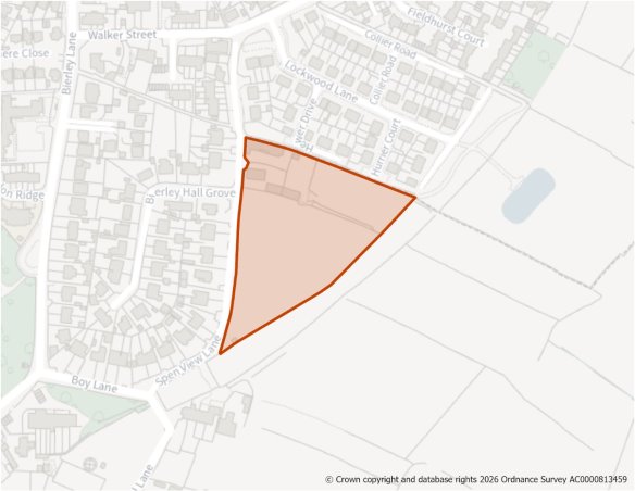
Site Size (ha) Gross: 1.51
Proposed Land Use: Housing
Minimum Development Capacity (Dwellings): 56
Site Type: Greenfield
Ward: Holme Wood & Bierley
Settlement: Bradford South East
Ownership: Private
Delivery Timescale: Short 2025- 2030 (1-5)
Site Specific Requirements
Design Principles
- The site should be developed for 56 family dwellings at a net site density of 35dph min in line with Policy HO2 and provide a mix of house types and tenures in line with Policy HO3 and Policy HO4. The identified site capacity is shown as 56 units. This relates to the pending planning application currently under consideration and equates to a net overall site density of around 43dph
- The design of those closest to the listed farm house to the north western corner should be sympathetic to the character of this building with a landscaped buffer being required to mitigate against the impact of the development on this heritage asset.
Site Access, Highways and Transport
- Site access can be taken from Spen View Lane, which will need to be widened, with footways provided for pedestrians. Further access is available from Lockwood Lane.
Flooding, Water and Drainage
- The site contains a strip of surface water pooling to the eastern boundary, close to the former railway line. Surface water run-off rates post development should be no higher than pre development rates.
- Above ground SuDs should be used to capture water run off, which should be discussed and agreed with the Local Lead Flood Authority (City of Bradford MDC) and the Environment Agency at the planning application stage.
Natural and Built Environment
- Protected hedgrows adjoin the site which should be retained, enhanced with native species and maintained.
- Lockwood Farmhouse located to the north-west corner of the site should be retained and a suitable buffer provided to mitigate against any negative impacts from the development on the listed building.
Open Space and Green / Blue Infrastructure
- The site adjoins a former railway embankment which should be enhanced by landscaping and linked to the recently completed development at the north and Boy Lane at the south to provide a longer off road recreational route.
Landscape
- The site is located within the South Bradford Settled Valley Floor Landscape Character area/type (G5). No landscape sensitivity assessment was undertaken for this site. Consideration should be given to the guidance set out in the Landscape Character Assessment SPD.
- Landscaping will be required to the eastern site boundary to soften the new development edge when viewed from higher ground beyond.
Infrastructure Requirements
- Proportionate contributions to community infrastructure will be required, where appropriate, in line with Policies ID1 and ID2, and having regard to the Local Infrastructure Plan.
Planning Permission
- A detailed planning application is pending for 56 homes on this site which could be determined before the Local Plan is adopted.
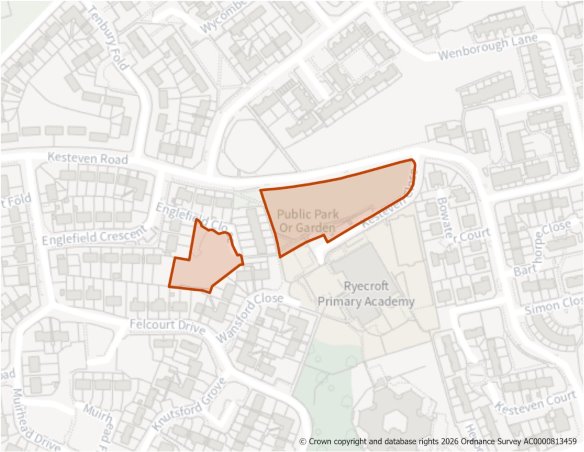
Site Size (ha) Gross: 0.66
Proposed Land Use: Housing
Minimum Development Capacity (Dwellings): 21
Site Type: Greenfield
Ward: Holme Wood & Bierley
Settlement: Bradford South East
Ownership: Mixed
Delivery Timescale: Medium 2030-2035 (6-10)
Site Specific Requirements
Design Principles
- Two sites in close proximity which have been developed previously but are now considered to be greenfield which should be developed for at least 21 homes at 35dph. Affordable homes are most appropriate for the site (Policy HO4), where possible they should be mixed in size and type in accordance with Policy HO3.
Site Access, Highways and Transport
- Site access from Kesteven Close and Englefield Close where a pedestrian footway will need to be provided.
Natural and Historic Environment
- Trees alongside Kesteven Road will need to be retained.
Open Space and Green / Blue Infrastructure
- The steepest parts of the Kesteven Road site should not be developed but be retained outside of the residential curtilage as public open space, with residential curtilage further set back from the public footpath which runs along the sites western edge.
Infrastructure Requirements
- Proportionate contributions to community infrastructure will be required, where appropriate, in line with Policies ID1 and ID2, and having regard to the Local Infrastructure Plan.
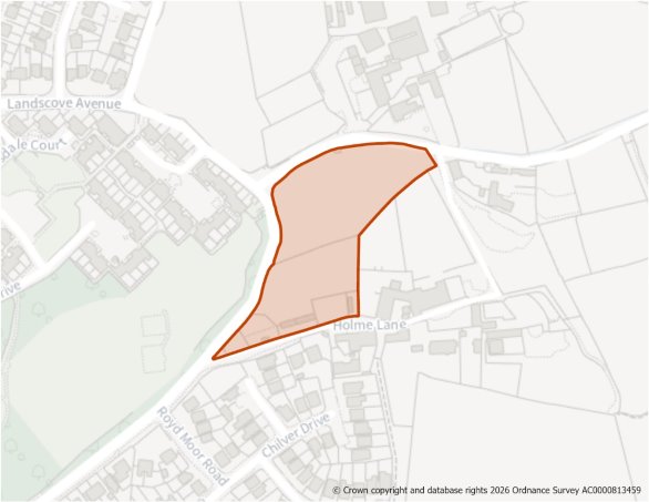
Site Size (ha) Gross: 1.01
Proposed Land Use: Housing
Minimum Development Capacity (Dwellings): 27
Site Type: Greenfield
Ward: Holme Wood & Bierley
Settlement: Bradford South East
Ownership: Private
Delivery Timescale: Long 2035+ (11+)
Site Specific Requirements
Design Principles
- The site should be developed for at least 27 homes at 35dph in line with Policy HO2. The development should include homes of mixed tenure and type in line with Policies HO3 and HO4.
- New hedgerow planting and an area of landscape to Holme Lane and Raikes Lane will be required to mitigate any harm from the development on neighbouring listed buildings and provide a habitat for wildlife.
Site Access, Highways and Transport
- Access shoud be taken from Raikes Lane which will require a footway to link to connect with those on Holme Lane and Landscove Avenue.
Natural and Historic Environment
- The site is within a bat alert area. An Ecology survey may be required at the planning application stage. Early engagement with the Council's Biodiversity Officer is recommended.
- Partly within the buffer of listed buildings on Raikes Lane. The design of the site will be required to show mitigation measures to protect these buildings from the impact from development.
Environmental Protection
- The site is within 150m buffer of a former landfill site. A Land Contamination Assessment – Phase 1 Report will be required as part of any planning application.
- Site is within a Mineral Safeguarding Area (MSA) for coal. A mineral resource assessment will be required as part of any planning application to determine the extent and availability of any coal resource.
Landscape
- The site is located within the South Bradford Settled Valley Floor Landscape Character area/type (F3).
- The site is open to the north. Hedgerow and tree planting will be required to help soften the new urban edge.
Other Constraints
- The site is bordered by a high-pressure gas pipeline. Design and layout of any development should ensure that appropriate clearances are taken into consideration. Consultation should take place with the Health and Safety Executive, National Gas and Northern Gas Networks, as appropriate.
Green Belt (and Golden Rules)
- Site has been removed from the Green Belt. Development on the site should be consistent with the “Golden Rules” set out in the NPPF in relation to affordable housing, necessary improvements to infrastructure and accessible green space provision.
Infrastructure Requirements
- Proportionate contributions to community infrastructure will be required, where appropriate, in line with Policies ID1 and ID2, and having regard to the Local Infrastructure Plan.
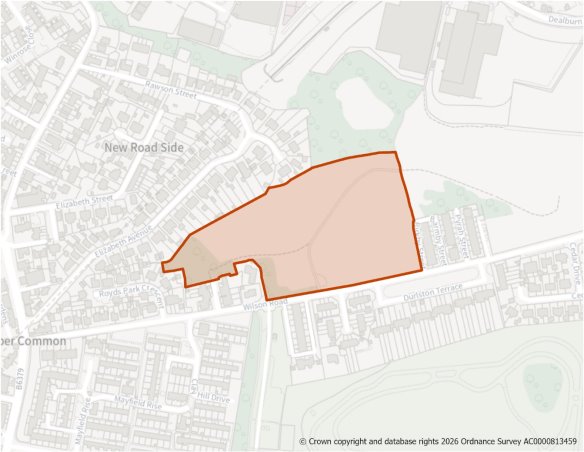
Site Size (ha) Gross: 3.26
Proposed Land Use: Housing
Minimum Development Capacity (Dwellings): 116
Site Type: Greenfield
Ward: Wyke
Settlement: Bradford South East
Ownership: Private
Delivery Timescale: Short 2025-2030 (1-5)
Site Specific Requirements
Design Principles
- This level site lies in a sustainable location close to transport, employment and local amenities and should be developed for at least homes at a net site density of 50dph in line with Policy HO2*. The design of the development should ensure a mix of homes by type and tenure in line with Policies HO3 and HO4 and reflect the development form of the adjacent area and improve the visual impact of Wilson Road. (*A planning application is pending for 116 homes on a slightly larger site and this figure is indicated in the table above).
- Landscaping will be required to the northern edge of the site to provide a connection to wider greenspace to the north and east and provide space for wildlife.
Site Access, Highways and Transport
- Site access should be taken from Wilson Road where footways and street lights are present.
- A public footpath crosses the site and provides access to the employment area to the north and open space to the east. This should be retained and improved to the satisfaction of the Local Authority.
Natural and Historic Environment
- The developer will need to ensure that mature and semi mature trees on the site are retained as part of the development with new ones planted within and on the edge of the site where possible.
Environmental Protection
- Site is within 150m buffer of a former landfill site. A Land Contamination Assessment – Phase 1 Report will be required as part of any planning application. Potential risk of land contamination from historic land use- former brick works and clay pit.
- Site is within a Development High Risk Area for coal mining, indicating that it contains one or more recorded former related features at surface or shallow depth. A Coal Mining Risk Assessment (CMRA) will be required as part of any planning application.
- Potential for noise and smells and potential risk from hazardous installation from adjacent industrial premises to the north. Risk Assessement togther with suitable landscaping will be necessary to offset against the potential impact.
- Site is within/partially within a Mineral Safeguarding Area (MSA) for coal. A mineral resource assessment will be required as part of any planning application to determine the extent and availability of any coal resource.
Open Space and Green / Blue Infrastructure
- Site has an informal open space function currently and strategic infrastructure corridor. Improvements and connection to wider area of open space together with some on site open space will be requried as part of the development of the site in line with the Policy NE2.
Landscape
- The site is located within the South Bradford Settled Valley Floor Landscape Character area/type (G5). No landscape sensitivity assessment was undertaken for this site. Consideration should be given to the guidance set out in the Landscape Character Assessment SPD.
Other Constraints
- The north eastern section of the site is crossed by a high voltage electricity transmission line. Development should include a strategy for responding to the National Grid Overhead Cable Route present within the site which demonstrates how the National Grid Design Guide and Principles have been as part of the design and layout and how the impact of the assets has been reduced through good design.
Infrastructure Requirements
- Proportionate contributions to community infrastructure will be required, where appropriate, in line with Policies ID1 and ID2, and having regard to the Local Infrastructure Plan.
Planning Permission
- A planning application is pending for 116 homes on a slightly larger site which may be determined before the Local Plan is adopted.
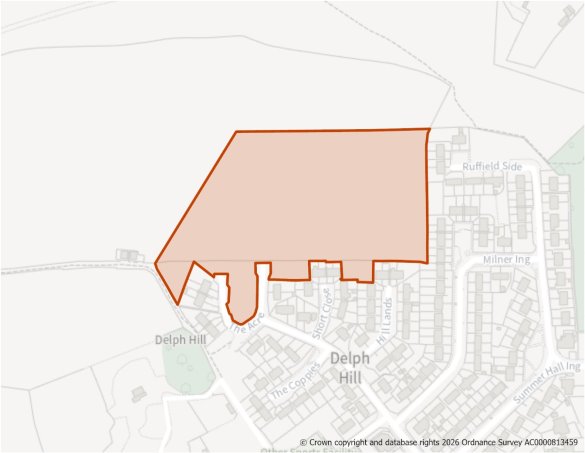
Site Size (ha) Gross: 2.96
Proposed Land Use: Housing
Minimum Development Capacity (Dwellings): 78
Site Type: Greenfield
Ward: Royds
Settlement: Bradford South East
Ownership: Private
Delivery Timescale: Long 2035+ (11+)
Site Specific Requirements
Design Principles
- The site should deliver at least 78 new homes at a net site density of 35dph These should be of varying tenure and type to meet the needs of the local community in line with Policy HO3 with affordable homes also provided in line with Policy HO4.
- Strong landscaping will be required along the northern site boundary to mitigate against the impact of the development from views from the north together with on site open space and active travel connections to the public footpaths to the north and west of the site.
Site Access, Highways and Transport
- Site access from the Acre via Summer Hall Ing. Off site improvements to other road junctions up to Woodside Road may also be necessary which should be discussed with the Local Authority.
Natural and Historic Environment
- Site is partly within a bat alert area. An Ecology survey may be required at the planning application stage. Early engagement with the Council's Biodiversity Officer is recommended.
- The design of the site should provide landscaped areas which link via pedestrian routes to existing footpaths to the north of the site and include natural areas to encourage wildlife.
Environmental Protection
- Site within 200m of an operational/permitted waste site (Carr House Lane).
- Site is within a Mineral Safeguarding Area (MSA) for coal. A mineral resource assessment will be required as part of any planning application to determine the extent and availability of any coal resource.
Open Space and Green / Blue Infrastructure
- Open space should be provided in line with Policy NE2, having regard to the standards set out in Appendix 11. Linkages outward from the site to link up with neighbouring open areas should be considered.
Landscape
- The site is located within the Royds Hall Urban Edge Wooded Valleys and Slopes Landscape Character area/type (H3).
- The site sits high on a plateau of level land above which is visible from the north. A landscaped buffer to the northern and western site boundaries will be required.
Other Constraints
- Within buffer zone of high volatge overhead power line. The developer will need to consider any potential impact on the future occupants of the site from this facility.
Infrastructure Requirements
- Proportionate contributions to community infrastructure will be required, where appropriate, in line with Policies ID1 and ID2, and having regard to the Local Infrastructure Plan.
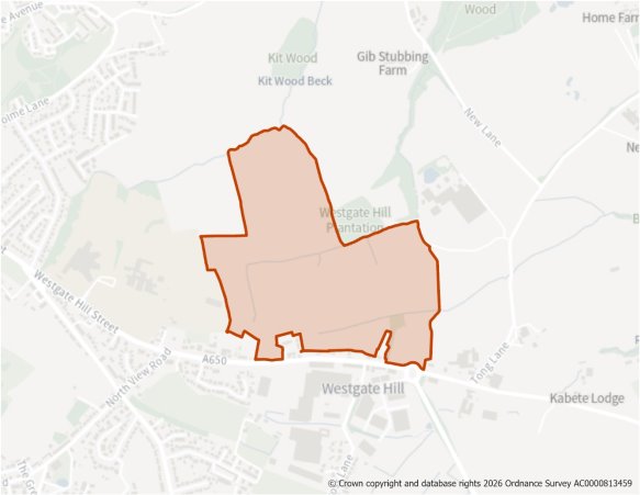
Site Size (ha) Gross: 38.50
Proposed Land Use: Housing
Minimum Development Capacity (Dwellings): 1011
Site Type: Greenfield
Ward: Holme Wood & Bierley
Settlement: Bradford South East
Ownership: Mixed
Delivery Timescale: Medium 2030-2035 (6-10)
Site Specific Requirements
Design Principles
- Land at Westgate Hill, Holme Wood as identified on the Policies Map is allocated for a Strategic Housing Site to deliver a minimum 1011 dwellings over the plan period.
- The site is adjacent to Housing Site H1554 and Employment Site E57, with all three to be accessed of Westgate Hill Street, alongside existing access points for other uses in the area. Whilst individual access points maybe technically achievable to facilitate the levels of growth on site as demonstrated through a Transport Assessment, proposals should facilitate access into the employment site and housing sites through shared access points wherever possible.
- Any planning application should include an illustrative masterplan and phasing schedule with supporting parameter plans to allow for a comprehensive and coordinated approach to development, which demonstrates how the parameters and the quantum of development being applied for can be effectively accommodated on the site.
- Parameter Plans set out the design parameters for future reserved matters stages to adhere to, and should include:
- Land uses and layout
- Landscape, green infrastructure and open spaces
- Ecology and habitat framework
- Movement framework/ access/connections (including to adjacent sites)
- Heritage features and character areas
- Building heights
- Retained features
- Views/landmarks/focal points/building lines etc
- Development should provide at least 1011 dwellings as part of a high-quality built environment in line with Policies ST4 and DS1, at a net density of 35 dph in line with Policy HO2. Development along the ridge line and the northern part of the site will need to be more sensitively designed due to the undulating landform to maintain the presence of Kit Wood Beck and open views to the north in line with Policy DS2. This should include affordable housing (in line with Policy HO4) and an appropriate mix of dwellings (in line with Policy HO3 and having due regard to relevant housing needs evidence and the character of the area).
- The site should be developed for a range of house types and tenures to meet the needs of the local community and provide any new community facilities required as determined by officers at the time of application.
Site Access, Highways and Transport
- The site access would be taken from Westgate Hill Street (A650). Provision should be made for a principal access point from the existing roundabout through the creation of a 5-arm roundabout serving both the residential and employment uses (E57), a secondary point of access to the west of Booth Holme Close will be for residential development only.
- A Transport Assessment and Travel Plan will be required in accordance with Policy TR2.
- Provide safe and convenient pedestrian and cycle infrastructure within the site and with connections to the wider network. Footways on the roads within the site to meet requirements of Inclusive Mobility and cycling provision on internal roads to meet LTN1/20 requirements with measures undertaken to ensure connectivity through the site and upgrades to existing paths connecting the development to established cycling and walking networks, including traffic free routes.
- A plan for servicing the site by bus will need to be agreed with Bradford Council and WYCA. Consideration will need to be given to a new bus service to the development serving appropriate local destinations, or to enhancing and diverting the existing services. The route through the site will need to serve the local centre and the adjoining housing (H1554) and employment site (E57) with appropriately located bus stops.
Flooding, Water and Drainage
- A nominal flood risk site assessment has been prepared the following are key recommendations that any site specific flood risk assessment should address:
- Development should be possible at this site given the low fluvial and very low surface water flood risk to the site.
- The site is not modelled to be at significant additional fluvial or surface water risk as a result of climate change.
- This is subject to additional modelling to understand the fluvial risk posed by the existing drainage ditches through the centre and south of the site. The drainage ditches should be kept in place and remain unobstructed. The ditches should be maintained and included within the landscaping design of the residential development.
- Groundwater conditions should be considered further as part of a site-specific FRA.
- To address surface water flooding along the northern site boundary and flooding arising from fluvial sources and run off from new development there is a need to deliver a comprehensive sustainable urban drainage system which forms an integral part of the site design, landscaping and open space features.
Natural and Historic Environment
- The site is partly within a bat alert area. An Ecology survey may be required at the planning application stage. Early engagement with the Council's Biodiversity Officer is recommended.
- Biodiversity Net Gain requirements are set out in Policy NE5 with strategic scale sites encouraged to exceed the statutory minimum requirement.
- The design of the site should provide green linkages throughout the site with grass and wildflower planting alonsgide improved hedgerow planting to encourage wildlife. These should where possible be in the public areas of the site such as alongside wide fooptaths.
- The site lies close to the site of a registered battlefield (Battle of Adwalton Moor 1643) in addition to listed buildings including Grade II Ryecroft Hall. An assessment will be required to determine what contribution the development of the site will have on those elements which contribute to the signficance of the heritage assets. If harm is noted then mitigation will be required.
Environmental Protection
- Site is within 150m buffer of a former landfill site. A Land Contamination Assessment – Phase 1 Report will be required as part of any planning application.
- Part of the upper and central part of the site falls within a Development High Risk Area for coal mining, indicating that it contains one or more recorded former related features at surface or shallow depth. A Coal Mining Risk Assessment (CMRA) will be required as part of any planning application.
- Site is within a Mineral Safeguarding Area (MSA) for coal. A mineral resource assessment will be required as part of any planning application to determine the extent and availability of any coal resource.
- The site is crossed from east to west by a consultation zone for a high-pressure gas pipeline (7669- Northern Gas Networks Inner, middle & outer zones). Design and layout of any development should ensure that appropriate clearances are taken into consideration. Consultation should take place with the Health and Safety Executive, National Gas and Northern Gas Networks, as appropriate.
Open Space and Green / Blue Infrastructure
- On site open space should be provided in line with Policy NE2, having regard to the standards set out in Appendix 11.
- Site falls within a strategic green infrastructure corridor. Development of the site should ensure connectivity through the site to adjacent open spaces and the wider countryside to ensure linkages for walking, cycling and active sport together with on site open space provision including play space.
Landscape
- The site is located within the South Bradford Settled Valley Floor Landscape Character area/type (F3).
- Woodland is characteristic of the area and would help screen development and integrate it into the wider landscape. This should be linked to exiting woodland to the north east. The northern part of the site should be designed sensitively due to the more intricate landform, the presence of Kit Wood Beck and the openness of this area in views from the north.
Other Constraints
- The site is crossed by a high voltage electricity transmission line. Development should include a strategy for responding to the National Grid Overhead Cable Route present within the site which demonstrates how the National Grid Design Guide and Principles have been as part of the design and layout and how the impact of the assets has been reduced through good design.
- A high pressure gas pipeline adjoins the site. Design and layout of any development should ensure that appropriate clearances are taken into consideration. Consultation should take place with the Health and Safety Executive, National Gas and Northern Gas Networks, as appropriate. The site is crossed by a high voltage electricity transmission lines running south west to north east through the centre of the site.
Green Belt (and Golden Rules)
- Site has been removed from the Green Belt. Development on the site should be consistent with the “Golden Rules” set out in the NPPF in relation to affordable housing, necessary improvements to infrastructure and accessible green space provision
Infrastructure Requirements
- Proportionate contributions to community infrastructure will be required, where appropriate, in line with Policies ID1 and ID2, and having regard to the Local Infrastructure Plan.
- In accordance with Policy TC 1 the creation of a new local centre commensurate with the scale of growth proposed will be supported.
- The provision of one new primary school may be required during the plan period this should be included in the masterplan layout.
Planning Permission
- An outline planning application (24/04889/MAO) is currently pending on this site which may be determined before the Local Plan is adopted
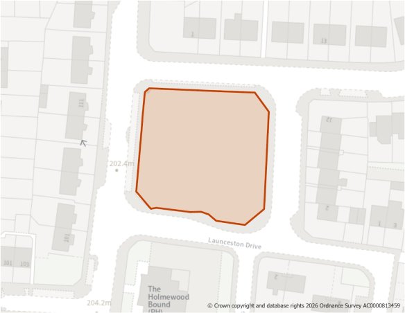
Site Size (ha) Gross: 0.23
Proposed Land Use: Housing
Minimum Development Capacity (Dwellings): 12
Site Type: Greenfield
Ward: Holme Wood & Bierley
Settlement: Bradford South East
Ownership: Public
Delivery Timescale: Long 2035+ (11+)
Site Specific Requirements
Design Principles
- Development should achieve no less than 12 dwellings at a net site density of 50dph but has the capacity for more subject to design. The site is in a sustainable location adjacent to a bus route and could be developed for apartments, potentially for older people or town houses.
Site Access, Highways and Transport
- Site access should be taken from Landscove Avenue or Launceston Drive. No direct access from Broadstone Way.
Open Space and Green / Blue Infrastructure
- Site lies within a strategic green infrastructure corridor.
Infrastructure Requirements
- Proportionate contributions to community infrastructure will be required, where appropriate, in line with Policies ID1 and ID2, and having regard to the Local Infrastructure Plan.
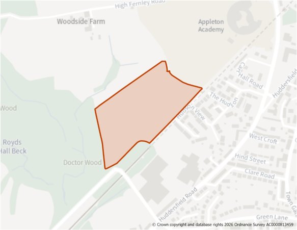
Site Size (ha) Gross: 5.26
Proposed Land Use: Housing
Minimum Development Capacity (Dwellings): 90
Site Type: Greenfield
Ward: Wyke
Settlement: Bradford South East
Ownership: Private
Delivery Timescale: Short 2025-2030 (1-5)
Site Specific Requirements
Design Principles
- The development should deliver at least 90* new homes in line with Policy HO2. These should be of mixed tenure and type in line with Policies HO3 and HO4. (*in line with current planning application).
- The design of the site should ensure suitable landscaping to the west and north to offset the impacts of the development on wider views to the north and potential impact on Judy Woods with linkages through the site for wildlife in line with Policy NE5. More sensitive development design will be required to the northern boundary with lower density development preferred in this area in line with Policy NE7.
Site Access, Highways and Transport
- A new access should be taken from Hudson View.
Flooding, Water and Drainage
- Small area of surface water flood risk close to the southern boundary of the site. Surface water discharge rates should not exceed pre development rates. Any increases will require prevention measures in line with SuDs design principles.
Natural and Historic Environment
- Site is adjacent to Judy woods which is a Local Wildlife Site, part of the local wildlfe network and ancient woodland inventory. A suitable buffer between development and the edge of the woodland with new tree planting and natural landscape provision will be required.
Environmental Protection
- Site partly within 250m buffer of former landfill site. The developer will need to determine risk of contamination.
- Site is within a Mineral Safeguarding Area (MSA) for coal. A mineral resource assessment will be required as part of any planning application to determine the extent and availability of any coal resource.
- The site is located within a bat alert area. An ecological survey will be required as part of any planning application to establish the extent/impacts as well as to identify appropriate mitigation.
Open Space and Green / Blue Infrastructure
- The developer will need to maintain links to open space and provide additional opportunities where appropriate in line with Policy NE2 and the standards set out in Appendix 11.
Landscape
- The site is located within the South Bradford Settled Valley Floor Landscape Character area/type (F3).
- Development of this site will need to ensure that the views of the site from longer distance views from the north will need to be mitigated with suitable landscaping to the northern boundary.
Green Belt (and Golden Rules)
- Site has been removed from the Green Belt. Development on the site should be consistent with the “Golden Rules” set out in the NPPF in relation to affordable housing, necessary improvements to infrastructure and accessible green space provision.
Infrastructure Requirements
- Proportionate contributions to community infrastructure will be required, where appropriate, in line with Policies ID1 and ID2, and having regard to the Local Infrastructure Plan.
Planning Permission
- A planning application is pending for this site which may be determined before the Local Plan is adopted.
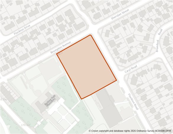
Site Size (ha) Gross: 0.66
Proposed Land Use: Housing
Minimum Development Capacity (Dwellings): 34
Site Type: PDL
Ward: Bowling & Barkerend
Settlement: Bradford South East
Ownership: Private
Delivery Timescale: Short 2025- 2030 (1-5)
Site Specific Requirements
Design Principles
- The development should deliver at least 34* new homes. These should be of mixed tenure and type in line with Policies HO3 and HO4, In line with permission.
Site Access, Highways and Transport
- Access from Brompton Avenue and Flockton Road.
Natural and Historic Environment
- The development of the site should ensure that the design of the development enures no undue harm on Bolling Hall (listed building) and provides appropriate mitigation.
- The site is located within a bat alert area. An ecological survey will be required as part of any planning application to establish the extent/impacts as well as to identify appropriate mitigation.
Infrastructure Requirements
- Proportionate contributions to community infrastructure will be required, where appropriate, in line with Policies ID1 and ID2, and having regard to the Local Infrastructure Plan.
Planning Permission
- The site benefits from planning permission for 34 affordable family homes under application ref 25/00939/MAF approved after 1 April 2025 (the base date for the Local Plan). Accordingly, it has been identified as a site allocation. Development of this site should take place in line with the approved planning permission.
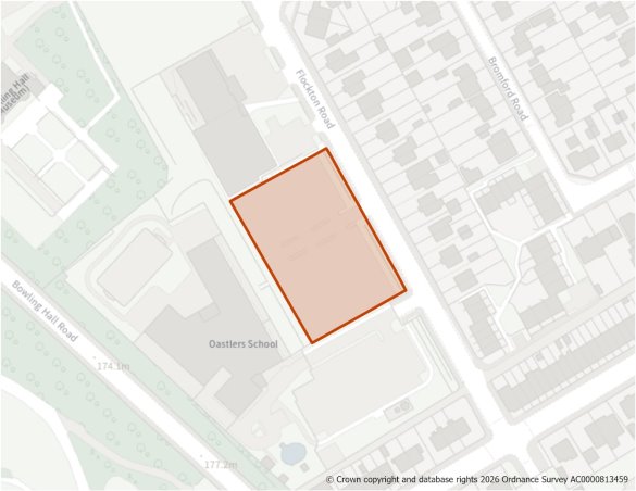
Site Size (ha) Gross: 0.42
Proposed Land Use: Housing
Minimum Development Capacity (Dwellings): 20
Site Type: PDL
Ward: Bowling & Barkerend
Settlement: Bradford South East
Ownership: Private
Delivery Timescale: Short 2025- 2030 (1-5)
Site Specific Requirements
Design Principles
- The development should deliver at least 20* new homes at 50dph. These should be of mixed tenure and type in line with Policies HO3 and HO4, in line with permission.
Site Access, Highways and Transport
- Access from Flockton Road.
Natural and Historic Environment
- The development of the site should ensure that the design of the development enures no undue harm on Bolling Hall (listed building) and provides appropriate mitigation
- The site is located within a bat alert area. An ecological survey will be required as part of any planning application to establish the extent/impacts as well as to identify appropriate mitigation.
Infrastructure Requirements
- Proportionate contributions to community infrastructure will be required, where appropriate, in line with Policies ID1 and ID2, and having regard to the Local Infrastructure Plan Planning Permission.
- The site benefits from planning permission for 20 affordable family homes under application ref 25/00940/MAF approved after 1 April 2025 (the base date for the Local Plan). Accordingly, it has been identified as a site allocation. Development of this site should take place in line with the approved planning permission.
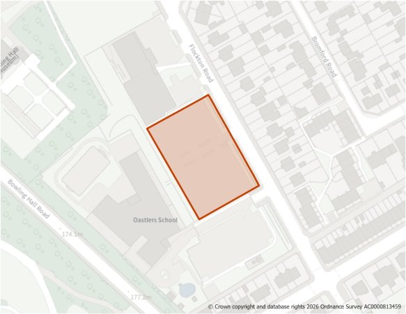
Site Size (ha) Gross: 0.26
Proposed Land Use: Housing
Minimum Development Capacity (Dwellings): 9
Site Type: Greenfield
Ward: Holme Wood & Bierley
Settlement: Bradford South East
Ownership: Public
Delivery Timescale: Medium 2030-2035 (6-10)
Site Specific Requirements
Design Principles
- The site lies in a sustainable location close to Westgate Hill Street. It should provide at least 9 dwellings at 35dph in line with Policy HO2. These could be a row of smaller town houses or a small apartment block.
- The northern site boundary should be left undeveloped and landscaping will be required on the Westgate Hill Street frontage.
Site Access, Highways and Transport
- A new access onto Westgate Hill Street will need to be created.
Environmental Protection
- Site adjoins a major road where carbon monoxide levels are above safe levels. Development will need to be set back from the road and new tree planting provided.
- Site is within a Development High Risk Area for coal mining, indicating that it contains one or more recorded former related features at surface or shallow depth. A Coal Mining Risk Assessment (CMRA) will be required as part of any planning application.
- Northern gas networks pipeline runs close to the northern site boundary. Development will need to be set back form this facility.
Open Space and Green / Blue Infrastructure
- Site within strategic green infrastructure corridor.
Landscape
- The site is located within the South Bradford Settled Valley Floor Landscape Character area/type (F3). No landscape sensitivity assessment was undertaken for this site. Consideration should be given to the guidance set out in the Landscape Character Assessment SPD.
Infrastructure Requirements
- Proportionate contributions to community infrastructure will be required, where appropriate, in line with Policies ID1 and ID2, and having regard to the Local Infrastructure Plan.
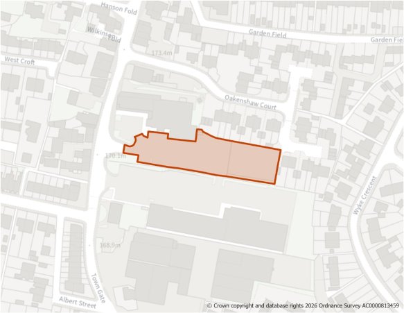
Site Size (ha) Gross: 0.29
Proposed Land Use: Housing
Minimum Development Capacity (Dwellings): 9
Site Type: PDL
Ward: Wyke
Settlement: Bradford South East
Ownership: Private
Delivery Timescale: Long 2035+ (11+)
Site Specific Requirements
Design Principles
- The site should be developed at 50dph for at least 9 homes in line with Policy HO2. These could be town houses or semi detached properties or a small apartment block
Site Access, Highways and Transport
- Access from the existing road which exits onto Towngate.
Other Constraints
- Potential for noise from neighbouring retail use from delivery vehicles. Accoustic fencing to the western boundary alongside the delivery bay may be necessary.
Infrastructure Requirements
- Proportionate contributions to community infrastructure will be required, where appropriate, in line with Policies ID1 and ID2, and having regard to the Local Infrastructure Plan.
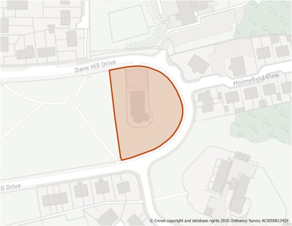
Site Size (ha) Gross: 0.32
Proposed Land Use: Housing
Minimum Development Capacity (Dwellings): 11
Site Type: PDL
Ward: Holme Wood & Bierley
Settlement: Bradford South East
Ownership: Private
Delivery Timescale: Medium 2030-2035 (6-10)
Site Specific Requirements
Design Principles
- The site comprises a former church which could be converted or the land redeveloped for new homes. The land could accommodate at least 11 family homes at 35dph. These could be town house style around a crescent or apartments. Careful consideration should be given to the sites boundary with existing open space to the west for security and to ensure a satisfactory design.
Site Access, Highways and Transport
- Site access direct to Dane Hill Drive.
Open Space and Green / Blue Infrastructure
- Site within strategic green infrastructure corridor. The development of the site should ensure new trees are provided.
Infrastructure Requirements
- Proportionate contributions to community infrastructure will be required, where appropriate, in line with Policies ID1 and ID2, and having regard to the Local Infrastructure Plan.
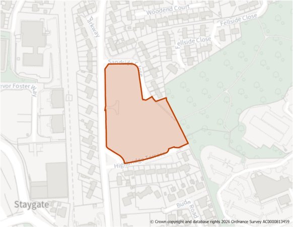
Site Size (ha) Gross: 1.33
Proposed Land Use: Housing
Minimum Development Capacity (Dwellings): 42
Site Type: Greenfield
Ward: Little Horton
Settlement: Bradford South East
Ownership: Public
Delivery Timescale: Short 2025-2030 (1-5)
Site Specific Requirements
Design Principles
- The development of the site should provide at least 42 homes at 35dph and reflect those around the site which are town houses and semi detached homes of mixed tenure in line with Policy HO3 with affordable homes being provided in line with Policy HO4.
- The design of the site should respond to the topography and also provide an area of public open space. This could be in the form of an informal chldrens play area or community allotments together with appopriate landscaping and new trees.
Site Access, Highways and Transport
- Acess from Sandside Close which will need to be widened and HIghbridge Terrace.
- Access to the public right of way should be maintained.
Flooding, Water and Drainage
- Small area of surface water flood risk linked to road run off. Where possible mitigation should be provided to allow surface water run off to soak away naturally.
Natural and Historic Environment
- Site is within a priority habitat area and a bat alert area. An Ecology survey may be required at the planning application stage. Early engagement with the Council's Biodiversity Officer is recommended together with new tree planting close to the woodland area east of the site.
Environmental Protection
- Within clean air zone and area where carbon monoxide levels are higher than average.
- Site is within 150m buffer of a former landfill site. A Land Contamination Assessment – Phase 1 Report will be required as part of any planning application.
The development of the site will need to mitigate any risk from contamination and ensure street trees and landscaping to help absorb air pollutants. - Site is partially within a Development High Risk Area for coal mining, indicating that it contains one or more recorded former related features at surface or shallow depth. A Coal Mining Risk Assessment (CMRA) will be required as part of any planning application.
- Site is within a Mineral Safeguarding Area (MSA) for coal. A mineral resource assessment will be required as part of any planning application to determine the extent and availability of any coal resource.
Open Space and Green / Blue Infrastructure
- The site lies within the Bradford City Centre Opportunity Area, as identified in the Green and Blue Infrastructure Strategy (GBIS). The strategy should be consulted to identify opportunities for incorporating measures within the development that enhance the quality of, and connectivity to, the green and blue infrastructure network in this area.
Infrastructure Requirements
- Proportionate contributions to community infrastructure will be required, where appropriate, in line with Policies ID1 and ID2, and having regard to the Local Infrastructure Plan.
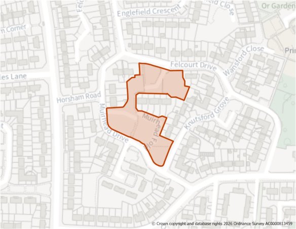
Site Size (ha) Gross: 0.61
Proposed Land Use: Housing
Minimum Development Capacity (Dwellings): 19
Site Type: Mixed
Ward: Holme Wood & Bierley
Settlement: Bradford South East
Ownership: Other
Delivery Timescale: Long 2035+ (11+)
Site Specific Requirements
Design Principles
- The site contains access roads and parking areas for adjacent homes. It may also contain foundations from the previous development.
- The layout of the site will need to be mindful of the relationship between existing homes and private space and ensure new development is well designed. It should provide at least 19 homes at 35dph with units types similar in style and design to those in the area already. The site is most apppropriate for affordable housing (Policy HO4).
Site Access, Highways and Transport
- Site access should be taken from existing roads where footways and streetlights already exist- Knutsford Grove, Muirhead Fold, Muirhead Drive and Felcourt Drive
The public right of way through the site will need to be incorporated into the design.
Natural and Historic Environment
- The site is located within a bat alert area. An ecological survey will be required as part of any planning application to establish the extent/impacts as well as to identify appropriate mitigation.
Open Space and Green / Blue Infrastructure
- A small open space could be retained on the site, which could be set close to the public footpath.
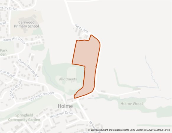
Site Size (ha) Gross: 2.90
Proposed Land Use: Housing
Minimum Development Capacity (Dwellings): 76
Site Type: Greenfield
Ward: Holme Wood & Bierley
Settlement: Bradford South East
Ownership: Private
Delivery Timescale: Long 2035+ (11+)
Site Specific Requirements
Design Principles
- The development of the sites should provide at least 76 new homes at 35dph, which should be of mixed type and tenure in line wirh Policies HO3 and HO4.
- The development should be designed to respond to sloping nature of the site and maintain and create new footpaths and active travel routes between the existing urban area to the west and south and open countryside to the east.
- The site adjoins H1564 and a development masterplan will be needed to ensure that both sites are developed comprehensively which should complement listed buildings on Ned Lane.
Site Access, Highways and Transport
- Access will need to be taken from the adjoing site to the north (H1564).
No secondary access will be permitted onto Ned Lane and only pedestrian/cycling connections will be permitted. A secondary access will instead be required back into Holme Wood estate. - External junctions at A6177 Sticker Lane/Dudley Hill roundabout, Thornbury Gyratory and the A647 Bradford Rd/ A6110 Leeds Ring Road (Dawson’s Corner) junction should be assessed and mitigation provided where necessary.
- The redundant railway bridge on Tyersal Lane will need to be removed and the road widened to provide footways to both sides. A developer commitment will be required, and the applicant will need to demonstrate that funding would be available to undertake the removal of the bridge and to implement the highway improvement prior to making a formal application for transfer of bridge and associated land.
Flooding, Water and Drainage
- Small area of surface water flood risk to the south western edge of the site. Surface water discharge rates post development should be restricted to the pre development greenfield discharge rate. Any increases will require prevention measures in line with SuDs design principles which should be discussed and agreed with the Local Lead Flood Authority (City of Bradford MDC) and the Environment Agency at the planning
Natural and Historic Environment
- Site is partly within a bat alert area. An Ecology survey may be required at the planning application stage. Early engagement with the Council's Biodiversity Officer is recommended.
- Protected hedgerows adjoin the site which will need to be retained and enhanced as part of the development. Traditional field features will need to be retained and enhanced by additional planting to provide new habitats for birds, mammals and invertebrates particularly outisde of residential curtilages.
- The design of the development should be sensitive to the adjacent listed buildings which front onto Ned Lane and provide an area of landscaped open space which will protect their setting.
Environmental Protection
- Site is within 150m buffer of a former landfill site. A Land Contamination Assessment – Phase 1 Report will be required as part of any planning application.
- Site is within a Mineral Safeguarding Area (MSA) for coal. A mineral resource assessment will be required as part of any planning application to determine the extent and availability of any coal resource.
Open Space and Green / Blue Infrastructure
- Within strategic green infrastructure corridor. New open space will be required as part of the comprehensive developent of this and H1564 in line with Policy NE2.
Landscape
- The site is located within the South Bradford Settled Valley Floor Landscape Character area/type (F3).
- The rural eastern edge is visually sensitive and lower density housing should be developed on this edge. Trees and hedgerows along Ned Lane should be strengthened as a new settlement boundary.
Green Belt (and Golden Rules)
- Site has been removed from the Green Belt. Development on the site should be consistent with the “Golden Rules” set out in the NPPF in relation to affordable housing, necessary improvements to infrastructure and accessible green space provision.
Infrastructure Requirements
- Proportionate contributions to community infrastructure will be required, where appropriate, in line with Policies ID1 and ID2, and having regard to the Local Infrastructure Plan.
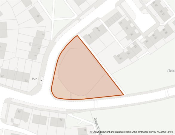
Site Size (ha) Gross: 0.21
Proposed Land Use: Housing
Minimum Development Capacity (Dwellings): 11
Site Type: PDL
Ward: Holme Wood & Bierley
Settlement: Bradford South East
Ownership: Private
Delivery Timescale: Medium 2030-2035 (6-10)
Site Specific Requirements
Design Principles
- The site should be developed for at least 11 homes at a net minimum of 50dph in line with Policy HO2. The site is most appropriate for town houses or a small apartment block with affordable homes being most suitable (Policy HO4).
- Street trees should be planted where possible.
Site Access, Highways and Transport
- Site access from Heysham Drive.
Flooding, Water and Drainage
- Small area of surface water flood risk toward the western boundary associated with road run off.
Open Space and Green / Blue Infrastructure
- Site within strategic green infrastructure corridor.
Infrastructure Requirements
- Proportionate contributions to community infrastructure will be required, where appropriate, in line with Policies ID1 and ID2, and having regard to the Local Infrastructure Plan.
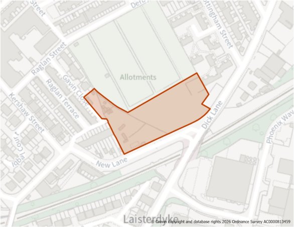
Site Size (ha) Gross: 0.78
Proposed Land Use: Housing
Minimum Development Capacity (Dwellings): 35
Site Type: Greenfield
Ward: Bradford Moor
Settlement: Bradford South East
Ownership: Public
Delivery Timescale: Long 2035+ (11+)
Site Specific Requirements
Design Principles
- The site is in a sustainable location and should be developed for a higher density of development of 50dph in line with Policy HO2 of at least 35 homes with affordable homes being provided on the site in line with Policy HO4.
- The design should respond to the sloping nature of the site and will need to be complimented by natural landscaping and enhancement in particular to the tree line to the north.
Site Access, Highways and Transport
- Access from New Lane.
- The public right of way which runs thorugh the site will need to be retained.
Natural and Historic Environment
- Site is partly within a bat alert area. An Ecology survey may be required at the planning application stage. Early engagement with the Council's Biodiversity Officer is recommended.
- The site is improved grassland/scrub and has wildlife value. The developer will be required to retain some areas of natural informal planting as part of the design of the site.
Environmental Protection
- Site within an area where area quality is of concern. Tree planting along New Lane and other parts of the site will be required.
Open Space and Green / Blue Infrastructure
- Within strategic green infrastructure corridor. Connections to adjacent areas of open space should be explored.
Infrastructure Requirements
- Proportionate contributions to community infrastructure will be required, where appropriate, in line with Policies ID1 and ID2, and having regard to the Local Infrastructure Plan.
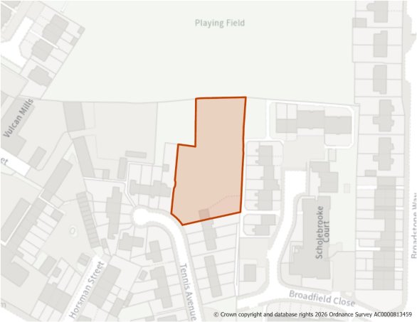
Site Size (ha) Gross: 0.23
Proposed Land Use: Housing
Minimum Development Capacity (Dwellings): 12
Site Type: PDL
Ward: Holme Wood & Bierley
Settlement: Bradford South East
Ownership: Private
Delivery Timescale: Long 2035+ (11+)
Site Specific Requirements
Design Principles
- The site is in a sustainable location close to public transport and local amenities which should be developed at a net site density of 50dph in line with Policy HO2, of at least 12 homes. Affordable homes are particulalry suitable for this site (Policy HO4).
- Trees should be planted on the northern site edge to provide a link with the adjacent open space.
Site Access, Highways and Transport
- Access from Tennis Avenue.
Open Space and Green / Blue Infrastructure
- Within strategic green infrastructure corridor. Connections to the adjacent area of open space should be explored.
Infrastructure Requirements
- Proportionate contributions to community infrastructure will be required, where appropriate, in line with Policies ID1 and ID2, and having regard to the Local Infrastructure Plan.
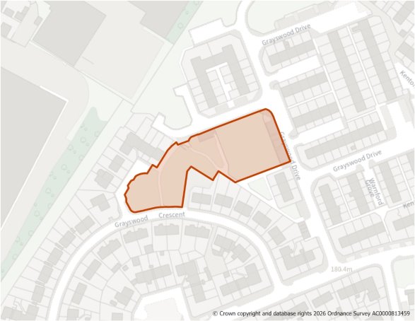
Site Size (ha) Gross: 0.43
Proposed Land Use: Housing
Minimum Development Capacity (Dwellings): 20
Site Type: Greenfield
Ward: Holme Wood & Bierley
Settlement: Bradford South East
Ownership: Other
Delivery Timescale: Long 2035+ (11+)
Site Specific Requirements
Design Principles
- The site should be developed at a net minimum of 50dph in line with Policy HO2, being particulalry suitable for low rise apartments/maisonettes or small town houses. It should provide at least 20 homes a proportion of which should be affordable (Policy HO4).
Site Access, Highways and Transport
- Access should be taken from Grayswood Drive and Belford Close. Footpath links should where possible be maintained.
Environmental Protection
- Site is partially within a Development High Risk Area for coal mining, indicating that it contains one or more recorded former related features at surface or shallow depth. A Coal Mining Risk Assessment (CMRA) will be required as part of any planning application.
Open Space and Green / Blue Infrastructure
- Within strategic green infrastructure corridor. Connections to the adjacent area of open space should be explored.
Infrastructure Requirements
- Proportionate contributions to community infrastructure will be required, where appropriate, in line with Policies ID1 and ID2, and having regard to the Local Infrastructure Plan.
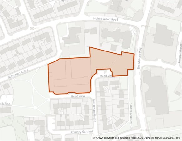
Site Size (ha) Gross: 0.68
Proposed Land Use: Housing
Minimum Development Capacity (Dwellings): 31
Site Type: Greenfield
Ward: Holme Wood & Bierley
Settlement: Bradford South East
Ownership: Mixed
Delivery Timescale: Long 2035+ (11+)
Site Specific Requirements
Design Principles
- The site should be developed at a net minimum of 50dph in line with Policy HO2, being particulalry suitable for low rise apartments/maisonettes or small town houses. It should provide at least 31 homes a proportion of which should be affordable (Policy HO4).
Site Access, Highways and Transport
- Access from Mead View.
Flooding, Water and Drainage
- The north eastern corner of the site has surface water flood risk. This should be addressed at planning application stage.
Natural and Built Heritage
- New trees sould be planted along Broadstone Way to contribute to those already present.
Open Space and Green / Blue Infrastructure
- Within strategic green infrastructure corridor. Connections to the adjacent area of open space should be maintained.
Infrastructure Requirements
- Proportionate contributions to community infrastructure will be required, where appropriate, in line with Policies ID1 and ID2, and having regard to the Local Infrastructure Plan.
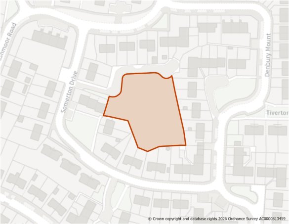
Site Size (ha) Gross: 0.27
Proposed Land Use: Housing
Minimum Development Capacity (Dwellings): 14
Site Type: Greenfield
Ward: Holme Wood & Bierley
Settlement: Bradford South East
Ownership: Other
Delivery Timescale: Medium 2030-2035 (6-10)
Site Specific Requirements
Design Principles
- The site should be developed at a net minumum of 50dph Iin line with Policy HO2 of at least 14 homes which could be low rise affordable homes which could be apartments/maisonettes or small town houses.
- Site should be designed sensitively given the size of the site and proximity to existing homes.
Site Access, Highways and Transport
- Site access from Somerton Drive which will need to be widened.
Infrastructure Requirements
- Proportionate contributions to community infrastructure will be required, where appropriate, in line with Policies ID1 and ID2, and having regard to the Local Infrastructure Plan.
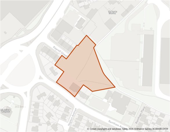
Site Size (ha) Gross: 0.62
Proposed Land Use: Housing
Minimum Development Capacity (Dwellings): 18
Site Type: Greenfield
Ward: Holme Wood & Bierley
Settlement: Bradford South East
Ownership: Private
Delivery Timescale: Medium 2030-2035 (6-10)
Site Specific Requirements
Design Principles
- The site lies in a sustainable location close to public transport and local amenities and should be developed at a net site density of 50dph in line with Policy HO2.
- Outline planning approval has been approved for at least 18 new homes but the site has capacity for for more which could include low rise apartments.
- Access to the the public footpath to the north easten corner of the site should be ensured.
Site Access, Highways and Transport
- Access from Kaycell Street.
- Development should ensure that pedestrian link is provided to the public right of way to the north eastern site boundary.
Environmental Protection
- The site is in an area where carbon monoxide levels are of concern. New trees will be required a apart of the development.
- Potential site contamination from historic land use (brick works) which should be explored.
- Site is within a Development High Risk Area for coal mining, indicating that it contains one or more recorded former related features at surface or shallow depth. A Coal Mining Risk Assessment (CMRA) will be required as part of any planning application.
Infrastructure Requirements
- Proportionate contributions to community infrastructure will be required, where appropriate, in line with Policies ID1 and ID2, and having regard to the Local Infrastructure Plan.
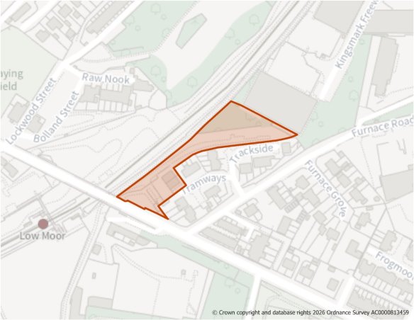
Site Size (ha) Gross: 0.43
Proposed Land Use: Housing
Minimum Development Capacity (Dwellings): 16
Site Type: PDL
Ward: Wyke
Settlement: Bradford South East
Ownership: Private
Delivery Timescale: Long 2035+ (11+)
Site Specific Requirements
Design Principles
- The site is in a sustainable location adjacent to bus route and Low Moor train station. It should be developed for high density development of at least 16 homes at a net development density of 50dph in line with Policy HO2. Town house or maisonette/apartment units would be particularly suitable, of which a proportion should be affordable (Policy HO4).
- Where possible trees to the northern edge of the site should be retained as part of the design in line with Policy NE6.
Site Access, Highways and Transport
- Access from Trackside/Tramways.
Flooding, Water and Drainage
- Potential for surface water flooding along the western boundary of the site connected to hard surfaced area along railway track.
Natural and Historic Environment
- Site is within a bat alert area. An Ecology survey may be required at the planning application stage. Early engagement with the Council's Biodiversity Officer is recommended.
- Deciduous woodland to the northern site boundary should be protected.
Environmental Protection
- The site is in an area where carbon monoxide levels are of concern. New trees will be required a apart of the development.
- Site is within a Development High Risk Area for coal mining, indicating that it contains one or more recorded former related features at surface or shallow depth. A Coal Mining Risk Assessment (CMRA) will be required as part of any planning application.
- Potential for contamination from previous land use- railway land.
Open Space and Green / Blue Infrastructure
- Within strategic green infrastructure corridor.
Landscape
- The site is located within the Tong Valley Rolling Enclosed Pasture Landscape Character area/type (G5). No landscape sensitivity assessment was undertaken for this site. Consideration should be given to the guidance set out in the Landscape Character Assessment SPD.
Infrastructure Requirements
- Proportionate contributions to community infrastructure will be required, where appropriate, in line with Policies ID1 and ID2, and having regard to the Local Infrastructure Plan.
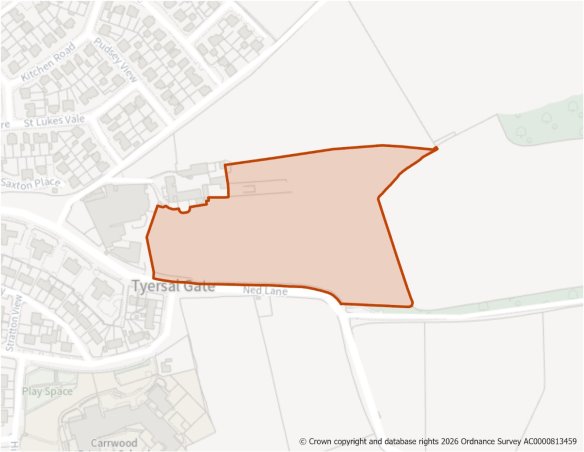
Site Size (ha) Gross: 2.58
Proposed Land Use: Housing
Minimum Development Capacity (Dwellings): 68
Site Type: Greenfield
Ward: Holme Wood & Bierley
Settlement: Bradford South East
Ownership: Private
Delivery Timescale: Medium 2030-2035 (6-10)
Site Specific Requirements
Design Principles
- The development of the site should ensure that consideration is given to adjacent sites to the south of the site preferably with a comprehensive masterplan.
The site should deliver at least 68 new homes at 35dph which should be of mixed tenure and type in line with Policies HO3 and HO4. - Strong landscaping including new deciduous trees should be provided to the eastern and northern site boundaries in line with Policies NE6 and NE7.
Site Access, Highways and Transport
- Site access from Ned which should ensure that full consideration to a wider access arrangement for other sites accessing Ned Lane is provided. The external route along Ned Lane/Tyersal Lane will need to be assessed with a view to provision of mitigation measures such footway along the site frontage and to the north side on both Ned Lane and Tyersal Lane. The redundant railway bridge on Tyersal Lane will need to be removed and the road widened to provide footways to both sides.
Flooding, Water and Drainage
- Small area of surface water flood risk to the northeast corner. Post development flood risk levels should be no greater than currently. On site SuDs maybe necessary which should be discussed with the local authority and environment agency.
Natural and Historic Environment
- Site is within a bat alert area. An Ecology survey may be required at the planning application stage. Early engagement with the Council's Biodiversity Officer is recommended.
- Bird breeding survey may be required to determine presence of Lapwing.
- Site lies close to Black Carr Woods and ancient woodland and local wildlife site. The eastern edge of the site will need to include woodland.
Environmental Protection
- Site is within a Mineral Safeguarding Aera (MSA) for coal. A mineral resource assessment will be required as part of any planning application to determine the extent and availability of any coal resource.
Open Space and Green / Blue Infrastructure
- Within strategic green infrastructure corridor. On site open space will be required in line with Policy NE2, which should link to open areas to the north, east and south of the site.
Landscape
- The site is located within the South Bradford Settled Valley Floor Landscape Character area/type (F3).
- The site is highly visible from the north and east when viewed from Pudsey as it forms part of an extensive area of undulating landscape on the edge of Bradford, however the recently completed development (in Leeds) to the north of Tyersal Lane has already caused some harm with limited integration into the landscape.
- Development should respond to the topography of the site with development avoiding the northeastern corner adjoining Black Carr woodland.
Green Belt (and Golden Rules)
- Site has been removed from the Green Belt. Development on the site should be consistent with the “Golden Rules” set out in the NPPF in relation to affordable housing, necessary improvements to infrastructure and accessible green space provision.
Infrastructure Requirements
- Proportionate contributions to community infrastructure will be required, where appropriate, in line with Policies ID1 and ID2, and having regard to the Local Infrastructure Plan.
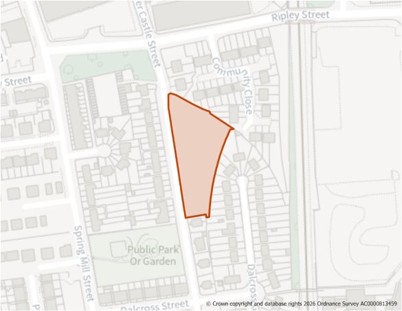
H1001: Upper Castle Street, West Bowling Comment
Site Boundary
Site Size (ha) Gross: 0.43
Proposed Land Use: Housing
Minimum Development Capacity (Dwellings): 20
Site Type: Greenfield
Ward: Little Horton
Settlement: Bradford South East
Ownership: Private
Delivery Timescale: Medium 2030-2035 (6-10)
Site Specific Requirements
Design Principles
- Development should provide at least 20 dwellings at a net site density of 50dph in line with Policy HO2. These could be family homes or apartments and should include affordable housing in line with Policy HO4.
- The site fronts the highway and could be developed partly in linear form with secondary cul de sac in the northern section of the site.
- Street trees should be planted where possible.
Site Access, Highways and Transport
- Site access will be taken from Upper Castle Street.
Environmental Protection
- The sites location within the clean air zone means that trees will be required to help improve air quality in the area.
- Site is within 150m buffer of a former landfill site. A Land Contamination Assessment – Phase 1 Report will be required as part of any planning application.
- A small part is within within a Development High Risk Area for coal mining, indicating that it contains one or more recorded former related features at surface or shallow depth. A Coal Mining Risk Assessment (CMRA) will be required as part of any planning application.
Open Space and Green / Blue Infrastructure
- The site lies within the Bradford City Centre Opportunity Area, as identified in the Green and Blue Infrastructure Strategy (GBIS). The strategy should be consulted to identify opportunities for incorporating measures within the development that enhance the quality of, and connectivity to, the green and blue infrastructure network in this area.
Infrastructure Requirements
- Proportionate contributions to community infrastructure will be required, where appropriate, in line with Policies ID1 and ID2, and having regard to the Local Infrastructure Plan.
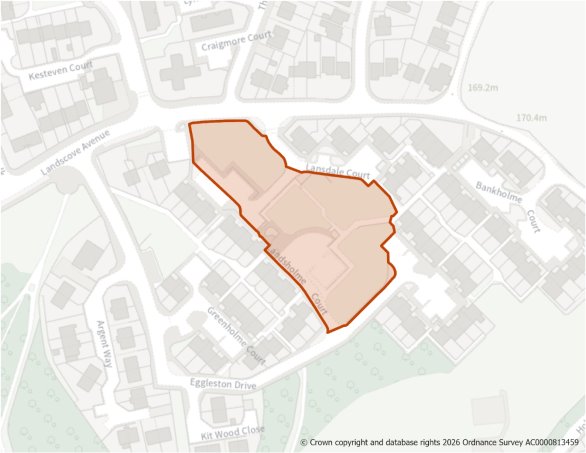
Site Size (ha) Gross: 0.59
Proposed Land Use: Housing
Minimum Development Capacity (Dwellings): 19
Site Type: Mixed
Ward: Holme Wood & Bierley
Settlement: Bradford South East
Ownership: Mixed
Delivery Timescale: Long 2035+ (11+)
Site Specific Requirements
Design Principles
- The development of the should should provide at least 19 dwellings at a net density of 35dph in line with Policy HO2 which should also include affordable housing in line with Policy HO4.
- The site contains access roads and parking areas for adjacent homes left from historic development. The layout of the site will need to be mindful of the relationship between existing homes and private space and ensure new development is well designed in line with Policies DS1 and DS3.
Site Access, Highways and Transport
- The existing road layout with footways and street lights already present should be retained where possible.
Natural and Historic Environment
- Site is within a bat alert area. An Ecology survey may be required at the planning application stage. Early engagement with the Council's Biodiversity Officer is recommended.
Environmental Protection
- Site is within 150m buffer of a former landfill site. A Land Contamination Assessment – Phase 1 Report will be required as part of any planning application.
Open Space and Green / Blue Infrastructure
- Site contains a small area of open space and lies within a green infrastructure corridor. The developer will need to consider whether to retain this area or provide an alternate open space.
Infrastructure Requirements
- Proportionate contributions to community infrastructure will be required, where appropriate, in line with Policies ID1 and ID2, and having regard to the Local Infrastructure Plan.
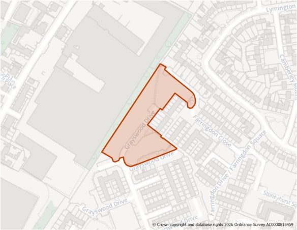
Site Size (ha) Gross: 0.85
Proposed Land Use: Housing
Minimum Development Capacity (Dwellings): 43
Site Type: Greenfield
Ward: Holme Wood & Bierley
Settlement: Bradford South East
Ownership: Mixed
Delivery Timescale: Long 2035+ (11+)
Site Specific Requirements
Design Principles
- Development should provide at least 43 dwlellings at a net density of 50dph in line with Policy HO2. This should include affordable homes in line with Policy HO4 and an appropriate mix of homes in line with Policy HO3.
- The site contains access roads and parking areas for adjacent homes left from historic development. The layout of the site will need to be mindful of the relationship between existing homes and private space and ensure new development is well designed in line wIth Policies DS1 and DS3.
Site Access, Highways and Transport
- The existing road layout with footways and street lights already present should be retained where possible.
Flooding, Water and Drainage
- Surface water run-off rates post development should not exceed the existing greenfield run-off rates. Where these are greater, above ground SuDs should be used which should be discussed and agreed with the Local Lead Flood Authority (City of Bradford MDC) and the Environment Agency at the planning application stage.
Environmental Protection
- Site is within a Development High Risk Area for coal mining, indicating that it contains one or more recorded former related features at surface or shallow depth. A Coal Mining Risk Assessment (CMRA) will be required as part of any planning application.
- Potential noise impact from industrial neighbour to the north of the site. Acoustic fencing may be appropriate to mitigate any noise into dwellings backing on to this building.
Open Space and Green / Blue Infrastructure
- The site has been used as informal open space and lies within a green infrastrcuture corridor where new provision would be appopriate. The developer should consider the appropriateness of a small area of on site open space.
Infrastructure Requirements
- Proportionate contributions to community infrastructure will be required, where appropriate, in line with Policies ID1 and ID2, and having regard to the Local Infrastructure Plan.
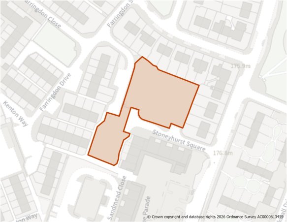
Site Size (ha) Gross: 0.31
Proposed Land Use: Housing
Minimum Development Capacity (Dwellings): 11
Site Type: Greenfield
Ward: Holme Wood & Bierley
Settlement: Bradford South East
Ownership: Other
Delivery Timescale: Long 2035+ (11+)
Site Specific Requirements
Design Principles
- Development should provide at least 11 dwellings at a net density of 50dph which should also include affordable homes in line with Policy HO4.
Site Access, Highways and Transport
- Site access can taken from Stoneyhurst Square or Farringdon Square where footways and lighting are already present.
Environmental Protection
- Site is partially within a Development High Risk Area for coal mining, indicating that it contains one or more recorded former related features at surface or shallow depth. A Coal Mining Risk Assessment (CMRA) will be required as part of any planning application.
Open Space and Green / Blue Infrastructure
- The site has been used as informal open space and lies within a green infrastrcuture corridor where new provision would be appopriate. The developer should consider the appropriateness of on site open space.
Infrastructure Requirements
- Proportionate contributions to community infrastructure will be required, where appropriate, in line with Policies ID1 and ID2, and having regard to the Local Infrastructure Plan.
H1554: Tong Academy and Yorkshire Martyrs Comment
Site Boundary
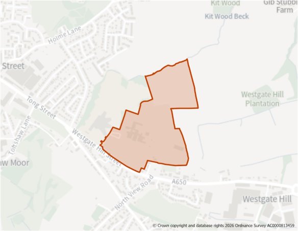
Site Size (ha) Gross: 18.62
Proposed Land Use: Housing
Minimum Development Capacity (Dwellings): 228
Site Type: Mixed
Ward: Tong
Settlement: Bradford South East
Ownership: Mixed
Delivery Timescale: Medium 2030-2035 (6-10)
Site Specific Requirements
Design Principles
- The development of the site represents an opportunity to deliver a scheme which addresses the issue of a long term derelict vacant former school buildings and disjointed school amenity spaces. It should provide at least 228 dwellings at an overall minimum net density of 35dph with opportunity for a higher density of development in the areas closer to Tong Street.
- The site is adjacent to Housing Site H911 and Employment Site E57 with all three to be accessed of Westgate Hill Street, alongside existing access points for other uses in the area. Whilst individual access points maybe technically achievable to facilitate the levels of growth on site as demonstrated through a Transport Assessment, proposals should facilitate access into the employment and housing sites through shared access points wherever possible.
- The development should provide a mix of homes together with affordable housing in line with Policy HO3 and HO4 and be well designed with particular consideration taken of Policies DS1 to DS6.
- The site should be developed comprehensively and sensitively alongside H911 with a masterplan detailing site phasing together with linked road and active travel routes comprising footways and cycle routes. These should be connected to open spaces, community facilities and the wider countryside supported by quality landscaping and new tree planting in line with Policies NE1, NE4 to NE7.
Site Access, Highways and Transport
- The access would be taken from Westgate Hill Street (A650) and subject to paragraph 2 and the option to deliver a residential access through H911. The principal access point off Westgate Hill will need to go through the existing school grounds and ensure that a safe and seperate access is created for the residential use.
- The public footpath along the eastern site boundary should be maintained with linkages into the development.
Natural and Historic Environment
- Trees and hedgerows on the northern boundary of the site will need to be retained and enhanced. The developer should also look at new opportunities to create additional hedgrows and natural areas, outside of private curtilage, which can provide shelter for birds and invertebrates.
Environmental Protection
- The site adjoins Tong Street where levels of carbon monoxide are a concern.
- Site is partially within a Development High Risk Area for coal mining, indicating that it contains one or more recorded former related features at surface or shallow depth. A Coal Mining Risk Assessment (CMRA) will be required as part of any planning application.
Open Space and Green / Blue Infrastructure
- The school grounds have existing sport and recreation provision on site a masterplan will need to demonstrate how existing and future provision is in accordance with Policy NE2. Open Space will need to be provided in line with Policy NE2 having regard to the standards set out in Appendix 11.
Landscape
- The site is located within the South Bradford Settled Valley Floor Landscape Character area/type (F3).
- Development and site layout should respond positively to the site’s prominent location through high-quality design, layout and structural landscaping to minimise impact on the landscape in the immediate and wider Tong Valley Rolling Enclosed Pasture landscape character area.
- The site is open from the north, significant tree planting will need to be undertaken to mitigate the views of the site from the north.
Other Constraints
- The site is crossed by a high pressure gas pipeline. The design and layout of any development should ensure that appropriate clearances are taken into consideration. Consultation should take place with the Health and Safety Executive, National Gas and Northern Gas Networks, as appropriate.
- The site is also crossed by a high voltage electricity transmission line. Development should include a strategy for responding to the National Grid Overhead Cable Route present within the site which demonstrates how the National Grid Design Guide and Principles have been as part of the design and layout and how the impact of the assets has been reduced through good design.
Green Belt (and Golden Rules)
- Site has been removed from the Green Belt. Development on the site should be consistent with the “Golden Rules” set out in the NPPF in relation to affordable housing, necessary improvements to infrastructure and accessible green space provision.
Infrastructure Requirements
- Proportionate contributions to community infrastructure will be required, where appropriate, in line with Policies ID1 and ID2, and having regard to the Local Infrastructure Plan.
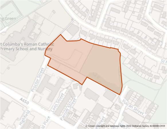
Site Size (ha) Gross: 1.48
Proposed Land Use: Housing
Minimum Development Capacity (Dwellings): 67
Site Type: Greenfield
Ward: Holme Wood & Bierley
Settlement: Bradford South East
Ownership: Mixed
Delivery Timescale: Medium 2030-2035 (6-10)
Site Specific Requirements
Design Principles
- Development should provide at least 67 homes at 50dph in line with Policy H02. It lies in a sustainable location close to public transport, community and health facilities and would suit town house style development or bungalows/apartments aimed at older people and affordable homes in accordance with Policy HO4.
- The design of the site should retain existing trees and maintain access to the two public rights of way to the east and west of the site.
Site Access, Highways and Transport
- Site access from Proctor Street.
Natural and Historic Environment
- Site is within a bat alert area. An Ecology survey may be required at the planning application stage. Early engagement with the Council's Biodiversity Officer is recommended.
Environmental Protection
- The sites location within the clean air zone means that trees will be required to help improve air quality in the area.
- Site is within/partially within a Mineral Safeguarding Area (MSA) for coal. A mineral resource assessment will be required as part of any planning application to determine the extent and availability of any coal resource.
Open Space and Green / Blue Infrastructure
- The design of the site should ensure links are created from the site to adjacent areas. New open space requirements will need to be considered in line with Policy NE2 having regard to the standards set out in Appendix 11.
Other Constraints
- The site is bounded by a high-pressure gas pipeline. Design and layout of any development should ensure that appropriate clearances are taken into consideration. Consultation should take place with the Health and Safety Executive, National Gas and Northern Gas Networks, as appropriate.
Infrastructure Requirements
- Proportionate contributions to community infrastructure will be required, where appropriate, in line with Policies ID1 and ID2, and having regard to the Local Infrastructure Plan.
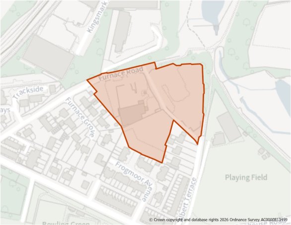
Site Size (ha) Gross: 1.31
Proposed Land Use: Housing
Minimum Development Capacity (Dwellings): 59
Site Type: PDL
Ward: Wyke
Settlement: Bradford South East
Ownership: Private
Delivery Timescale: Long 2035+ (11+)
Site Specific Requirements
Design Principles
- The development of the site shold provide 59 homes at a net development density of 50dph in line with Policy HO2 and provide a mix of homes, a proportion of which should be affordable in line with Policies HO3 and HO4. The site lies in a sustainable location lying close to Low Moor Station and bus services on Cleckheaton Rd. The developer should ensure a quality development, with town houses or apartments being particularly suitable and in accordance particularly with with Policies DS1 and DS3.
- The design of the development should also be sensitive to the neighbouring listed building.
Site Access, Highways and Transport
- Access to be taken from Furnace Road where footpaths and street lighting exist. Furnace Road will need to be made up to adoptable standard to the requirements of the Councils HIghways department. A secondary access is available from Frogmoor Avenue for a limited number of homes.
Flooding, Water and Drainage
- Site contains an area of surface water pooling to the eastern boundary and a shallow Topographic Flow Path (TPF) through the centre of the site. The TPF should ideally be included in the design of the site with an above ground SuDs located to capture water when required. Left.
- Surface water run-off rates post development will need to be reduced by 30%. Proposals will need to be discussed and agreed with the Local Lead Flood Authority (City of Bradford MDC) and the Environment Agency at the planning application stage.
Natural and Historic Environment
- The site adjoins Toad Holes Beck wildlife site. New tree planting and natural area will be required to mitigate against the impact of the development on local wildlife area.
- Development should conserve and where possible enhance those elements which contribute to the significance of the Grade II Listed former goods station to the north of the site.
- Site is within/partially withinan area of low provision and high need for green and blue infrastructure. Development proposals should focus on carefully designed green and blue infrastructure to contribute towards site specific issues e.g. flood mitigation, urban cooling etc.
- The site is located within a bat alert area. An ecological survey will be required as part of any planning application to establish the extent/impacts as well as to identify appropriate mitigation.
Environmental Protection
- Site is within a Development High Risk Area for coal mining, indicating that it contains one or more recorded former related features at surface or shallow depth. A Coal Mining Risk Assessment (CMRA) will be required as part of any planning application.
- Site is within within a Mineral Safeguarding Area (MSA) for coal. A mineral resource assessment will be required as part of any planning application to determine the extent and availability of any coal resource.
Landscape
- The site is located within the South Bradford Settled Valley Floor Landscape Character area/type (G5). No landscape sensitivity assessment was undertaken for this site. Consideration should be given to the guidance set out in the Landscape Character Assessment SPD.
Infrastructure Requirements
- Proportionate contributions to community infrastructure will be required, where appropriate, in line with Policies ID1 and ID2, and having regard to the Local Infrastructure Plan.
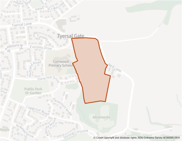
Site Size (ha) Gross: 7.25
Proposed Land Use: Housing
Minimum Development Capacity (Dwellings): 140
Site Type: Greenfield
Ward: Holme Wood & Bierley
Settlement: Bradford South East
Ownership: Mixed
Delivery Timescale: Medium 2030-2035 (6-10)
Site Specific Requirements
Design Principles
- Development should provide at least 140 homes at 35dph min with a mix of homes and tenures in line with Policies HO3 and HO4.
- The site should be designned to respond to sloping nature of the site and provide a sensitive layout with strong landscaping in line with Poilcy DS2 particularly on the eastern boundary where a substancial buffer will need to be provided to mitigate against the development impact on the adjacent listed buildings.
- The development should maintain and create new footpaths and active travel routes between the existing urban area to the west and south and open countryside to the east.
- The site adjoins H979 and a development masterplan will be needed to ensure that both sites are developed comprehensively.
Site Access, Highways and Transport
- Access will need to be taken from the northern end of Ned Lane which will need to be widened to incorporate a replacement new footway along the north side. The new road should take the form of a spine road which would need to loop through the site.
- No secondary access will be permitted onto Ned Lane and only pedestrian/cycling connections will be permitted. A secondary access will instead be required back into Holme Wood estate.
- External junctions at A6177 Sticker Lane/Dudley Hill roundabout, Thornbury Gyratory and the A647 Bradford Rd/ A6110 Leeds Ring Road (Dawson’s Corner) junction should be assessed and mitigation provided where necessary.
- The redundant railway bridge on Tyersal Lane will need to be removed and the road widened to provide footways to both sides. A developer commitment will be required, and the applicant will need to demonstrate that funding would be available to undertake the removal of the bridge and to implement the highway improvement prior to making a formal application for transfer of bridge and associated land.
Flooding, Water and Drainage
- The site contains some areas of surface water pooling close to the western boundary of the site with the current estate. Suface water discharge rates post development should be restricted to the pre development Greenfield discharge rate. Any increases will require prevention measures in line with SuDs design principles which should be discussed and agreed with the Local Lead Flood Authority (City of Bradford MDC) and the Environment Agency at the planning stage.
Natural and Historic Environment
- The site lies partly within a bat alert area. An Ecology survey may be required at the planning application stage. Early engagement with the Council's Biodiversity Officer is recommended.
- Existing patchy and unmaintained hedgerows will need to be retained and enhanced with native species together with an unmanaged grassland margin, preferably outside of private curtilages to provide new habitats for birds, mammals and invertebrates.
- Traditional field features (dry stone walling) will need to be retained and enhanced.
- The design of the development should be sensitive to the adjacent listed buildings which front onto Ned Lane and provide an area of landscaped open space which will protect their setting.
Environmental Protection
- The north eastern section of the site falls within a Development High Risk Area for coal mining, indicating that it contains one or more recorded former related features at surface or shallow depth. A Coal Mining Risk Assessment (CMRA) will be required as part of any planning application.
- Site is within within a Mineral Safeguarding Area (MSA) for coal. A mineral resource assessment will be required as part of any planning application to determine the extent and availability of any coal resource.
Open Space and Green / Blue Infrastructure
- The development of the site should ensure the retention of some open space close to tower blocks and provide links to adjoining open areas through the estate and countryside beyond in line with Policy NE2. The secondary access for the development could also run through this area.
Landscape
- The site is located within the South Bradford Settled Valley Floor Landscape Character area/type (F3).
- The rural eastern edge is more sensitive and there is the potential to develop lower density housing on this edge. The existing settlement has a well vegetated edge which should be maintained with new planting provided along the Ned Lane boundary which will form th new settlement edge.
Green Belt (and Golden Rules)
- Site has been removed from the Green Belt. Development on the site should be consistent with the “Golden Rules” set out in the NPPF in relation to affordable housing, necessary improvements to infrastructure and accessible green space provision.
Infrastructure Requirements
- Proportionate contributions to community infrastructure will be required, where appropriate, in line with Policies ID1 and ID2, and having regard to the Local Infrastructure Plan.
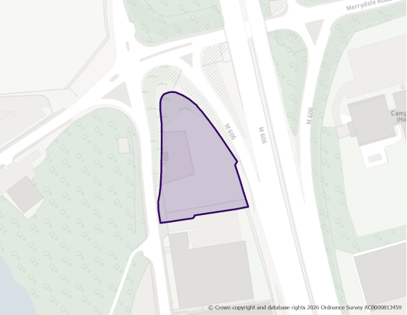
Site Size (ha) Gross: 0.46
Net Developable Area (ha): 0.46
Proposed Land Use: Employment (Eg(i), B2 and B8)
Site Type: Greenfield
Ward: Wyke
Settlement: Bradford South East
Ownership: Private
Delivery Timescale: 2030-2035
Site Specific Requirements
Site Access, Highways and Transport
- A new access to Commondale Way Street is required. A direct access from M606 slip road will be unacceptable. Highways England may need consulting as site boundary is with M606.
Natural and Historic Environment
- Site is adjacent to identified Priority Habitat (Deciduous Woodland) and within bat alert area. An ecology survey may be required at the planning application stage. Early engagement with the Council's Biodiversity Officer is recommended.
- The site is identified in the LNRS with the preferred measure T2_M04: Extend and connect tree and woodland cover across the White Rose Forest area in West Yorkshire.
Environmental Protection
- This site is located within the Clean Air Zone and development must be in accordance with the requirements set out in Policy CR1.
- Site is located adjacent to a former landfill, which may pose contamination issues.
- Site is within/partially within a Development High Risk Area for coal mining, indicating that it contains one or more recorded former related features at surface or shallow depth. A Coal Mining Risk Assessment (CMRA) will be required as part of any planning application.
Open Space and Green / Blue Infrastructure
- Site is partially within an area of medium provision and high need for green and blue infrastructure. Development proposals should focus on carefully designed green and blue infrastructure to contribute towards site specific issues e.g. flood mitigation, urban cooling, etc.
- Where appropriate, the site should seek to provide on-site open space in line with Policy NE2.
Landscape
- The site is located within the South Bradford Settled Valley Floor Landscape Character area/type (G5). No landscape sensitivity assessment was undertaken for this site. Consideration should be given to the guidance set out in the Landscape Character Assessment SPD.
Infrastructure Requirements
- Proportionate contributions to community infrastructure will be required, where appropriate, in line with Policies ID1 and ID2, and having regard to the Local Infrastructure Plan.
E38: Land at Wharfedale Business Centre, Shetcliffe Lane Comment
Site Boundary
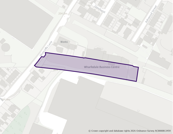
Site Size (ha) Gross: 0.48
Net Developable Area (ha): 0.48
Proposed Land Use: Employment (B2)
Site Type: Greenfield
Ward: Holme Wood and Bierley
Settlement: Bradford South East
Ownership: Private
Delivery Timescale: 2030-2035
Site Specific Requirements
Site Access, Highways and Transport
- A new site access is required from Shetcliffe Lane.
Environmental Protection
- Site is partially within a Development High Risk Area for coal mining, indicating that it contains one or more recorded former related features at surface or shallow depth. A Coal Mining Risk Assessment (CMRA) will be required as part of any planning application.
Open Space and Green / Blue Infrastructure
- Site is within an area of low provision and high need for green and blue infrastructure. Development proposals should focus on carefully designed green and blue infrastructure to contribute towards site specific issues e.g. flood mitigation, urban cooling etc.
- Where appropriate, the site should seek to provide on-site open space in line with Policy NE2.
Other Constraints
- Evidence of previous use - land may require remediation.
Infrastructure Requirements
- Proportionate contributions to community infrastructure will be required, where appropriate, in line with Policies ID1 and ID2, and having regard to the Local Infrastructure Plan.
E55: Land East of Sticker Lane Comment
Site Boundary
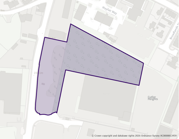
Site Size (ha) Gross: 1.35
Net Developable Area (ha): 1.35
Proposed Land Use: Employment (Eg(i), B2 and B8)
Site Type: Greenfield
Ward: Bowling and Barkerend
Settlement: Bradford South East
Ownership: Private
Delivery Timescale: 2035-2040
Site Specific Requirements
Site Access, Highways and Transport
- A new access to Sticker Lane is required.
Flooding, Water and Drainage
- The site is not required to pass the exception test as it is proposed for less vulnerable uses.
- The proposed development would see a change in the risk classification from water compatible to less vulnerable, according to the NPPF.
- Given the change in use and therefore vulnerability of the site, the FRA must show that the development can be designed to be safe and that there is adequate emergency planning provision (para 014 FRCC-PPG).
Environmental Protection
- This site is located within the Clean Air Zone and development must be in accordance with the requirements set out in Policy CR1.
- Site is in a former landfill, which may pose contamination issues.
- The site is adjacent to residential dwellings, giving rise to potential impacts from employment uses. Relevant assessments should be provided to determine the nature and extent of any impacts together with appropriate mitigation measure as part of any planning application.
- The design and layout of development should not compromise the operation of existing residential uses and ensure that the amenity of future occupiers is protected.
- Site is within a Mineral Safeguarding Area (MSA) for coal. A mineral resource assessment will be required as part of any planning application to determine the extent and availability of any coal resource.
Open Space and Green / Blue Infrastructure
- Site is within an area of low provision and high need for green and blue infrastructure. Development proposals should focus on carefully designed green and blue infrastructure to contribute towards site specific issues e.g. flood mitigation, urban cooling, etc.
- Where appropriate, the site should seek to provide on-site open space in line with Policy NE2.
Infrastructure Requirements
- Proportionate contributions to community infrastructure will be required, where appropriate, in line with Policies ID1 and ID2, and having regard to the Local Infrastructure Plan.
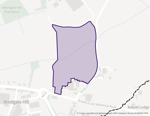
Site Size (ha) Gross: 9.06
Net Developable Area (ha): 5.44
Proposed Land Use: Employment (Eg(i), B2 and B8)
Site Type: Greenfield
Ward: Holme Wood and Bierley
Settlement: Bradford South East
Ownership: Private
Delivery Timescale: 2030-2043
Site Specific Requirements
Site Access, Highways and Transport
- To provide an access to this site, a new arm from Westgate Hill roundabout will be required. Access from Tong Street would not be acceptable.
Natural and Historic Environment
- Extreme south eastern edge of the site is within 50m buffer of listed building (Grade II). Extreme South and South East edge of the site is within 50m buffer of Historic Battlefield (Battle of Adwalton Moor)
- Site is adjacent to an identified Wildlife Habitat Network (Grassland) and partially within a bat alert area. Mature trees and hedgerow forms part of the site edge along Tong Lane. An ecology survey may be required at the planning application stage. Early engagement with the Council's Biodiversity Officer is recommended.
- The site is identified in the LNRS with the preferred measure G1_M03: Restore and enhance existing species-rich grasslands.
Environmental Protection
- Site is located adjacent to a former landfill, which may pose contamination issues.
- Site is within/partially within a Development High Risk Area for coal mining, indicating that it contains one or more recorded former related features at surface or shallow depth. A Coal Mining Risk Assessment (CMRA) will be required as part of any planning application.
- Site is within a Mineral Safeguarding Area (MSA) for coal. A mineral resource assessment will be required as part of any planning application to determine the extent and availability of any coal resource.
Open Space and Green / Blue Infrastructure
- Site is within/partially within an area of low provision and medium need for green and blue infrastructure. Development proposals should focus on carefully designed green and blue infrastructure to contribute towards site specific issues e.g. flood mitigation, urban cooling, etc.
- Where appropriate, the site should seek to provide on-site open space in line with Policy NE2.
Landscape
- The site is located within the South Bradford Settled Valley Floor Landscape Character area/type (F3).
- Development should be integrated with tree belts and existing gappy hedgerows should be restored where possible. A woodland belt should be planted along the western edge of the site, if developed. The site is less sensitive to development further south. The proposed development type for this commercial site is a mix of small/medium commercial/industrial buildings (2-3 storeys) (box units). This is in keeping with the scale of built form to the southwest and, to a certain extent, to the north within Tong Garden Centre. Care should be taken to ensure that proposed buildings do not exceed these existing buildings in scale.
Green Belt (and Golden Rules)
- Site has been removed from the Green Belt. Development on the site should be consistent with the “Golden Rules” set out in the NPPF in relation to affordable housing, necessary improvements to infrastructure and accessible green space provision.
Infrastructure Requirements
- Proportionate contributions to community infrastructure will be required, where appropriate, in line with Policies ID1 and ID2, and having regard to the Local Infrastructure Plan.
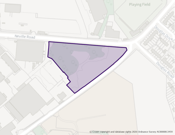
Site Size (ha) Gross: 1.57
Net Developable Area (ha): 1.57
Proposed Land Use: Employment (Eg(i), B2 and B8)
Site Type: Mixed
Ward: Bowling and Barkerend
Settlement: Bradford South East
Ownership: Private
Delivery Timescale: 2025-2030
Site Specific Requirements
Site Access, Highways and Transport
- A new access to Neville Road is required.
Flooding, Water and Drainage
- Risk of surface flooding to western half of site.
Natural and Historic Environment
- The site is identified in the LNRS with the preferred measure B3_M02: Enhance (rather than replace) existing habitats on some areas of brownfield.
Environmental Protection
- This site is located within the Clean Air Zone and development must be in accordance with the requirements set out in Policy CR1.
- Site is in a former landfill, which may pose contamination issues.
- Within 200m of operational/permitted waste management site
- Site is within a Mineral Safeguarding Area (MSA) for coal. A mineral resource assessment will be required as part of any planning application to determine the extent and availability of any coal resource.
Open Space and Green / Blue Infrastructure
- The site lies within the Bradford City CentreOpportunity Area, as identified in the Green and Blue Infrastructure Strategy (GBIS). The strategy should be consulted to identify opportunities for incorporating measures within the development that enhance the quality of, and connectivity to, the green and blue infrastructure network in this area.
- Site is within an area of low provision and high need for green and blue infrastructure. Development proposals should focus on carefully designed green and blue infrastructure to contribute towards site specific issues e.g. flood mitigation, urban cooling, etc.
- Where appropriate, the site should seek to provide on-site open space in line with Policy NE2.
Infrastructure Requirements
- Proportionate contributions to community infrastructure will be required, where appropriate, in line with Policies ID1 and ID2, and having regard to the Local Infrastructure Plan.
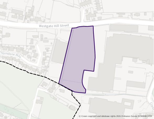
Site Size (ha) Gross: 1.50
Net Developable Area (ha): 1.50
Proposed Land Use: Employment (Eg(i), B2 and B8)
Site Type: Greenfield
Ward: Holme Wood and Bierley
Settlement: Bradford South East
Ownership: Private
Delivery Timescale: 2035-2040
Site Specific Requirements
Site Access, Highways and Transport
- A new access to Westgate Hill Street is required.
Natural and Historic Environment
- Site is within an identified Wildlife Habitat Network (Grassland) and adjacent to a Local Nature Reserve (Tong Moor). Ecology survey may be required at the planning application stage. Early engagement with the Council's Biodiversity Officer is recommended.
- The site is identified in the LNRS with the preferred measureT2_M04: Extend and connect tree and woodland cover across the White Rose Forest area in West Yorkshire.
Environmental Protection
- Site is located adjacent to a former landfill, which may pose contamination issues.
- Site is within/partially within a Development High Risk Area for coal mining, indicating that it contains one or more recorded former related features at surface or shallow depth. A Coal Mining Risk Assessment (CMRA) will be required as part of any planning application.
- Site is within a Mineral Safeguarding Area (MSA) for coal. A mineral resource assessment will be required as part of any planning application to determine the extent and availability of any coal resource.
Open Space and Green / Blue Infrastructure
- Site is partially within an area of low provision and medium need for green and blue infrastructure. Development proposals should focus on carefully designed green and blue infrastructure to contribute towards site specific issues e.g. flood mitigation, urban cooling, etc.
- Where appropriate, the site should seek to provide on-site open space in line with Policy NE2.
Landscape
- The site is located within the South Bradford Settled Valley Floor Landscape Character area/type (F3). No landscape sensitivity assessment was undertaken for this site. Consideration should be given to the guidance set out in the Landscape Character Assessment SPD.
Infrastructure Requirements
- Proportionate contributions to community infrastructure will be required, where appropriate, in line with Policies ID1 and ID2, and having regard to the Local Infrastructure Plan.
E151: Former site of Argonaut Works, Laisterdyke Comment
Site Boundary
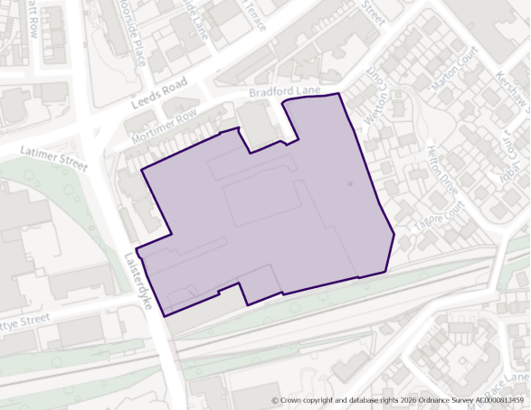
Site Size (ha) Gross: 2.81
Net Developable Area (ha): 2.53
Proposed Land Use: Employment (Eg(i), B2 and B8)
Site Type: PDL
Ward: Bradford Moor
Settlement: Bradford South East
Ownership: Private
Delivery Timescale: 2030-2035
Site Specific Requirements
Site Access, Highways and Transport
- An improved access to Laisterdyke is required.
Flooding, Water and Drainage
- Risk of surface water flooding.
Natural and Historic Environment
- A significant row of heritage assets (Grade II) adjacent to the northern edge of the site.
- Site is a partially within a bat alert area. Ecology survey may be required at the planning application stage. Early engagement with the Council's Biodiversity Officer is recommended.
- The site is identified in the LNRS with the preferred measureT2_M04: Extend and connect tree and woodland cover across the White Rose Forest area in West Yorkshire.
Environmental Protection
- This site is located within the Clean Air Zone and development must be in accordance with the requirements set out in Policy CR1.
- Site is located adjacent to a former landfill, which may pose contamination issues.
- The site is adjacent to residential dwellings, giving rise to potential impacts from employment uses. Relevant assessments should be provided to determine the nature and extent of any impacts together with appropriate mitigation measure as part of any planning application.
- The design and layout of development should not compromise the operation of existing residential uses and ensure that the amenity of future occupiers is protected.
- Within 200m of operational/permitted waste management site
Open Space and Green / Blue Infrastructure
- Site is within an area of low provision and high need for green and blue infrastructure. Development proposals should focus on carefully designed green and blue infrastructure to contribute towards site specific issues e.g. flood mitigation, urban cooling, etc.
- Where appropriate, the site should seek to provide on-site open space in line with Policy NE2.
Infrastructure Requirements
- Proportionate contributions to community infrastructure will be required, where appropriate, in line with Policies ID1 and ID2, and having regard to the Local Infrastructure Plan.
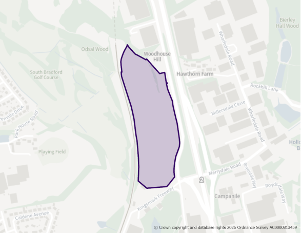
Site Size (ha) Gross: 8.69
Net Developable Area (ha): 4.35
Proposed Land Use: Employment (Eg(i), B2 and B8)
Site Type: Greenfield
Ward: Wyke
Settlement: Bradford South East
Ownership: Private
Delivery Timescale: 2030-2035
Site Specific Requirements
Site Access, Highways and Transport
- A new access to Staithgate Lane is required.
Flooding, Water and Drainage
- The proposed development would see a change in the risk classification from water compatible to less vulnerable, according to the NPPF.
- Given the change in use and therefore vulnerability of the site, the FRA must show that the development can be designed to be safe and that there is adequate emergency planning provision (para 014 FRCC-PPG).
- Development should avoid the areas of the site modelled to be at risk of deep surface water flooding.
- Topographic flow paths should be considered and included in site design and ideally left in place to flood naturally when required. Any regrading of land must include for like for like volumes to ensure risk is contained safely onsite for the lifetime of development.
Natural and Historic Environment
- Site is within an identified Wildlife Habitat Network (Grassland), adjacent to a Priority Habitat Network (Deciduous Woodland) and within a bat alert area. There are protected hedgerows on site and the site is located adjacent to a Local Nature Reserve) An ecology survey may be required at the planning application stage. Early engagement with the Council's Biodiversity Officer is recommended.
- The site is identified in the LNRS with the preferred measure G1_M03: Restore and enhance existing species-rich grasslands.
Environmental Protection
- This site is located within an area where NO2 = 30 parts per million (plus) and development must be in accordance with the requirements set out in Policy CR1.
- Site is in a former landfill, which may pose contamination issues.
- Site is within/partially within a Development High Risk Area for coal mining, indicating that it contains one or more recorded former related features at surface or shallow depth. A Coal Mining Risk Assessment (CMRA) will be required as part of any planning application.
- Site is within a Mineral Safeguarding Area (MSA) for coal. A mineral resource assessment will be required as part of any planning application to determine the extent and availability of any coal resource.
- The site is crossed by electricity transmission lines. Development should include a strategy for responding to the Northern Powergrid equipment present within the site which demonstrates how the Northern Powergrid and HSE Guidance have been applied as part of the design and layout and how the impact of the assets has been reduced through good design. Enquiries should be made with Northern Powergrid.
Open Space and Green / Blue Infrastructure
- Site is partially within an area of medium provision and high need for green and blue infrastructure. Development proposals should focus on carefully designed green and blue infrastructure to contribute towards site specific issues e.g. flood mitigation, urban cooling, etc.
- Where appropriate, the site should seek to provide on-site open space in line with Policy NE2.
Landscape
- The site is located within the South Bradford Settled Valley Floor Landscape Character area/type (G5). No landscape sensitivity assessment was undertaken for this site. Consideration should be given to the guidance set out in the Landscape Character Assessment SPD.
Infrastructure Requirements
- Proportionate contributions to community infrastructure will be required, where appropriate, in line with Policies ID1 and ID2, and having regard to the Local Infrastructure Plan.
[1] Gross
