

Bradford District Local Plan - Publication Draft (Regulation 19) (October 2026)
Section 5: Settlement Policies & Site Allocations for South Pennine Towns and Villages
POLICY CU1 – CULLINGWORTH Comment
Settlement Plan
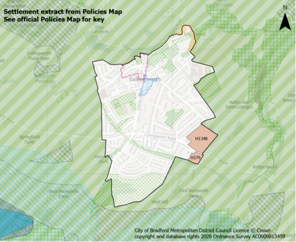
Settlement Hierarchy and Spatial Directions
- The village boundary is defined on the policies map. The focus for sustainable development of this medium village reflects its function and character balanced against heritage and environmental constraints.
Meeting Growth Needs
- Housing development includes a combination of development within the settlement boundary and land to be released from the Green Belt during the plan period and will:
- Deliver approximately 147 dwellings through a combination of sites under construction, planning permissions and new site allocations through the plan period as set out in Table CU1.1.
- Deliver housing site allocations as shown on the policies map and section 5:
- H1348: Hallas Lane, Cullingworth
- H279: Cullingworth Road/Doll Lane, Cullingworth
Table CU1.1 - Cullingworth
|
Under Construction |
Planning Permission |
Site Allocations |
|
|
Totals |
37 |
2 |
108 |
- Proposals for new homes within the settlement boundary on additional small sites, including the redevelopment of previously developed land, will be supported subject to meeting policies relevant Local Plan policies.
- The diversification of Cullingworth Local Centre will be supported to retain local employment.
Local Services and Facilities
- Support the range and quality of uses within the designated Cullingworth Local Centre as a key hub for the community to meet their day-to-day retail and leisure needs as well as the retention and improvement of local services and facilities.
- Protect and enhance designated open spaces and compliance with Policy NE2 and support proposals which address deficiencies in open space provision as set out on the Open Spaces Study, seeking opportunities to increase provision of allotment, amenity greenspace, and parks and gardens where possible.
- Maintain and enhance sport and recreation facilities with support for widened community access.
Landscape
- Maintain and enhance the landscape setting with its Moorland Fringe and Upland Wooded River Valleys landscape character areas, landscape features, fields and overall settlement pattern.
Historic and Natural Environment
- Protect and enhance strategic green and blue corridors and habitat networks which surround the village, to enhance biodiversity and recreation within and adjacent to the settlement as well as incorporating sufficient green space and connections within new developments. Consideration should be given to the Green and Blue Infrastructure Strategy.
- Protect and enhance the designated five Local Wildlife Sites and the Goitstock Waterfall Local Geological Sites as well as habitat networks and priority habitats within and adjacent to the settlement. Development proposals should also pay particular attention to avoiding impact on the Great Northern railway trail and habitat network which runs through the settlement and the ancient woodlands to the east of the settlement.
- Where development is located within SPA/SAC Zone C (recreational pressure) residential development resulting in a net increase in dwellings will be required to mitigate any recreational pressure on the SPA/SAC caused by such development in accordance with the South Pennine Moors SPD and Policy NE3.
- Ensure that future development conserves and enhances key heritage assets and their settings within and adjacent to the settlement including the Conservation Areas and Listed Buildings as well as non-designated heritage assets.
Local Infrastructure
- Support improvements and access to public transport and active travel, including enhanced links to Keighley and Bingley railway stations
- Proportionate contributions to new or enhanced community infrastructure will be required, where appropriate, in line with Policies ID1 and ID2, as well as having regard to the Local Infrastructure Plan.
Cullingworth: Site Allocations
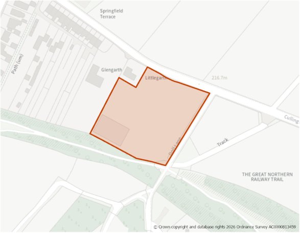
Site Size (ha) Gross: 0.72
Proposed Land Use: Housing
Minimum Development Capacity (Dwellings): 23
Site Type: Greenfield
Ward: Bingley West
Settlement: Cullingworth
Ownership: Private
Delivery Timescale: Long 2035+ (11+)
Site Specific Requirements:
Design Principles
- Development should provide at least 23 dwellings as part of a high-quality built environment in line with Policies ST4 and DS1, at a net density of 35 dph. This should include affordable housing (in line with Policy HO4) and an appropriate mix of dwellings (in line with Policy HO3) and having due regard relevant housing needs evidence and the character of the area.
- Development proposals must respond to the rural setting by retaining the natural screening provided by trees along the road frontage, where possible. Enhancements should be made to the surrounding Green Belt land including improvements to the adjacent public rights of way which may offer opportunties for residents to access the countryside.
- A dismantled railway footpath runs along the southern boundary and forms part of a wildlife corridor. This must be protected and enhanced and an appropriate buffer included within the development.
Site Access, Highways and Transport
- Access can be taken from Cullingworth Road. There are footways and streetlights present on this road.
Flooding, Water and Drainage
- Across the majority of the site, groundwater levels are between 0.5m and 5m below the ground surface. There is a risk of flooding to subsurface assets but surface manifestation of groundwater is unlikely.
Natural and Historic Environment
- Residential development resulting in a net increase in dwellings will be required to mitigate any recreational pressure on the SPA/SAC caused by such development in accordance with the South Pennine Moors SPD and Policy NE3.
- The site is located within a bat alert area, is adjacent to the woodland Wildlife Habitat Network. Development proposals should respond positively to these assets. An ecological survey will be required as part of any planning application to establish the extent/impacts as well as to identify appropriate mitigation.
- The land adjoiing the southern boundary is identified in the LNRS with a preferred measure of T1_M02: Significantly improve the biodiversity and structure within established ancient woodlands and of ancient/veteran trees.
Environmental Protection
- The site is located within the 150m buffer of a former landfill site. A Land Contamination Assessment – Phase 1 Report will be required as part of any planning application to determine any potential impacts. Impacts should be addressed in line with Policy CR2.
- The majortity of the site is classed as 3b on the Agricultural Land Classification (ALC).
Open Space and Green / Blue Infrastructure
- The Open Space Assessment states that Cullingworth as a whole has more than a sufficient amount of open space to meet the needs of its population but as noted above there are imbalances between the different typologies whch could be rebalanced. However, there is currently no allotment provision within Cullingworth and opportunities to identify suitable sites should be pursued. Open space should be provided in line with Policy NE2, having regards to the standards set out in Appendix 11.
- The site is within an area of moderate provision and low need for green and blue infrastructure. However, development in this location may increase the need going forward, therefore development proposals should focus on enhancing and improving existing assets as well as the creation of new green and blue infrastructure.
Landscape
- The site is located within the Cullingworth and Haworth Moorland Fringe Landscape Character area/type (B2), where the contrasting textures between rough unenclosed moorland and geometric pasture informs a unique sense of place and adds depth and interest to the landscape. Drystone walls should be retained as they form a distinctive geometric pattern across the landscape.
- The Landscape Sensitivity Assessment states that additional tree planting on the boundaries of the site and throughout the site would provide screening and integration. The use of native species could enhance some of the naturalistic qualities.
Green Belt (and Golden Rules)
- Site has been removed from the Green Belt. Development on the site should be consistent with the “Golden Rules” set out in the NPPF in relation to affordable housing, necessary improvements to infrastructure and accessible green space provision.
Infrastructure Requirements
- Proportionate contributions to community infrastructure will be required, where appropriate, in line with Policies ID1 and ID2, and having regard to the Local Infrastructure Plan.
H1348: Hallas Lane, Cullingworth Comment
Site Boundary:
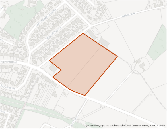
Site Size (ha) Gross: 3.23
Proposed Land Use: Housing
Minimum Development Capacity (Dwellings): 85
Site Type: Greenfield
Ward: Bingley West
Settlement: Cullingworth
Ownership: Private
Delivery Timescale: Medium 2030-2035 (6-10)
Site Specific Requirements:
Design Principles
- Development should provide at least 85 dwellings as part of a high-quality built environment in line with Policies ST4 and DS1, at a net density of 35 dph. This should include affordable housing (in line with Policy HO4) and an appropriate mix of dwellings (in line with Policy HO3) and having due regard relevant housing needs evidence and the character of the area. Enhancements should be made to the surrounding Green Belt land including improvements to the adjacent public rights of way which may offer opportunties for residents to access the countryside.
Site Access, Highways and Transport
- Access can be taken from Cullingworth Road. There are footways present on the opposite side of this road.
Flooding, Water and Drainage
- Across the site, groundwater levels are between 0.5m and 5m below the ground surface. There is a risk of flooding to subsurface assets but surface manifestation of groundwater is unlikely.
Natural and Historic Environment
- Residential development resulting in a net increase in dwellings will be required to mitigate any recreational pressure on the SPA/SAC caused by such development in accordance with the South Pennine Moors SPD and Policy NE3.
- The site is located within a bat alert area. An ecological survey will be required as part of any planning application to establish the extent/impacts as well as to identify appropriate mitigation.
- The site is not identified in the LNRS as a priority area for nature recovery.
Environmental Protection
- The southern portion of site is located within the 250m buffer of a former landfill site. Impacts should be addressed in line with Policy CR2.
- The majortity of the site is classed as 3b on the Agricultural Land Classification (ALC).
Open Space and Green / Blue Infrastructure
- The Open Space Assessment states that Cullingworth as a whole has more than a sufficient amount of open space to meet the needs of its population but as noted above there are imbalances between the different typologies whch could be rebalanced. However, there is currently no allotment provision within Cullingworth and opportunities to identify suitable sites should be pursued. Open space should be provided in line with Policy NE2, having regards to the standards set out in Appendix 11.
- The site is within an area of moderate provision and low need for green and blue infrastructure. However, development in this location may increase the need going forward, therefore development proposals should focus on enhancing and improving existing assets as well as the creation of new green and blue infrastructure.
Landscape
- The site is located within the Cullingworth and Haworth Moorland Fringe Landscape Character area/type (B2), where the contrasting textures between rough unenclosed moorland and geometric pasture informs a unique sense of place and adds depth and interest to the landscape. The site is adjacent to the settlement and provides a gateway which transistions from a more rural landscape to the urban area. No landscape sensitivity assessment was undertaken for this site. Consideration should be given to the guidance set out in the Landscape Character Assessment SPD.
Green Belt (and Golden Rules)
- Site has been removed from the Green Belt. Development on the site should be consistent with the “Golden Rules” set out in the NPPF in relation to affordable housing, necessary improvements to infrastructure and accessible green space provision.
Infrastructure Requirements
- Proportionate contributions to community infrastructure will be required, where appropriate, in line with Policies ID1 and ID2, and having regard to the Local Infrastructure Plan.
POLICY DH1 – DENHOLME Comment
Settlement Plan
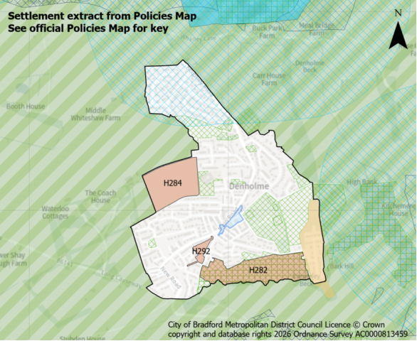
Settlement Hierarchy and Spatial Directions
- The village boundary is defined on the Policies Map with the settlement centred around the main arterial route of the A629. The focus for sustainable development of this medium village reflects its function and character balanced against key environmental constraints.
Meeting Growth Needs
- Housing development includes a combination of development within the settlement boundary and land to be released from the Green Belt during the plan period and will:
- Deliver approximately 240 dwellings through a combination of sites under construction, planning permissions and new site allocations through the plan period as set out in Table DH1.1.
- Deliver housing site allocations as shown on the policies map and section 5:: - H282: Old Road / Station Road, Denholme
- H284: Hill Top Farm, Denholme
- H292: Old Road, Denholme
Table DH1.1 - Denholme: Under Construction
|
Under Construction |
Planning Permission |
Site Allocations |
|
|
Totals |
23 |
20 |
197 |
- Proposals for new homes within the settlement boundary on additional small sites, including the redevelopment of previously developed land, will be supported subject to meeting relevant Local Plan policies.
- Support the diversification of Denholme’s Local Centre to help retain and create employment opportunities within the settlement and ensure its long-term sustainability.
Local Services and Facilities
- Support the range and quality of uses within the designated Denholme Local Centre as a key hub for the community to meet their day-to-day retail and leisure needs as well as the retention and improvement of local services and facilities.
- Protect and enhance designated open spaces, such as Foster Park, in compliance with Policy NE2 and support proposals which address deficiencies in open space provision as set out in the Open Spaces Study, seeking opportunities to increase the provision of outdoor sports space, amenity greenspace and play space.
- Maintain and enhance sport and recreation facilities with support for widened community access.
Landscape
- Maintain and enhance the landscape setting of the settlement within the character areas of the Cullingworth and Haworth Moorland Fringe and Harden Upland Wooded River Valleys as well as key landscape features, fields and overall settlement pattern.
Historic and Natural Environment
- Protect and enhance strategic green and blue networks and corridors including the Great Northern Railway Trail, helping to enhance biodiversity and recreation within and adjacent to the settlement as well as incorporating sufficient green space and connections within new developments.
- Protect and enhance the designated Local Wildlife Sites at Doe Park Reservoir and Careperley Beck, as well as the habitat networks and priority habitats within and surrounding the settlement, particularly those to the east and south.
- Where development is located within SPA/SAC Zone B (supporting habitat functionally linked land) residential development proposals must assess potential impacts on foraging habitat used by SPA qualifying species and provide ecological evidence where required, in accordance with the South Pennine Moors SPD and Policy NE3.
- Where development is located within SPA/SAC Zone C (recreational pressure) residential development resulting in a net increase in dwellings will be required to mitigate any recreational pressure on the SPA/SAC caused by such development in accordance with the South Pennine Moors SPD and Policy NE3.
- Ensure that future development conserves and enhances key heritage assets and their settings within and adjacent to the settlement including the limited number of Listed Buildings.
Local Infrastructure
- Support improvements and access to public transport and active travel, including enhanced links to Bradford and Keighley, and the Great Northern Railway Trail.
- Proportionate contributions to new or enhanced community infrastructure will be required, where appropriate, in line with Policies ID1 and ID2, as well as having regard to the Local Infrastructure Plan.
Denholme: Site Allocations
H282: Old Road/Station Road, Denholme Comment
Site Boundary:
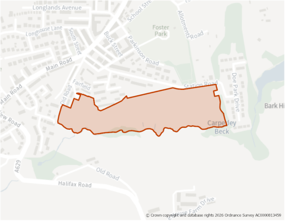
Site Size (ha) Gross: 5.96
Proposed Land Use: Housing
Minimum Development Capacity (Dwellings): 58
Site Type: Greenfield
Ward: Worth Valley
Settlement: Denholme
Ownership: Private
Delivery Timescale: Medium 2030-2035 (6-10)
Site Specific Requirements:
Design Principles
- Development should provide at least 58 dwellings[1] as part of a high-quality built environment in line with Policies ST4 and DS1. This should include affordable housing (in line with Policy HO4) and an appropriate mix of dwellings (in line with Policy HO3) and having due regard relevant housing needs evidence and the character of the area.
- A sensitive design and layout will be required taking into account the site's location on the edge of the settlement and the elevated topography of the site. Development should be restricted to the northern part of the site with compensatory measures for the loss of open space and wildlife areas. The design should include appropriate landscaping and avoid areas of flood risk. Where appropriate improvements to the public rights of way that run through the site should be made.
Site Access, Highways and Transport
- A new access would be required which would join Station Road, where there are footways and streetlights.
Flooding, Water and Drainage
- The site was included in the Level 1 Strategic Flood Risk Assessment, however no further risk assessment has been carried out. The majority of the site falls within Flood Zone 1 of the Environment Agency's (EA) Flood Map for Planning which indicates it is at low risk of flooding from rivers. However, along the southern edge of the site there are areas of Flood Zone 2, 3a and 3b. Development must be avoided in this part of the site. There are also areas of surface water flood risk in the central and northern parts of the site. A full site specific FRA will be required to fully ascertain the flood risk on the site and appropriate drainage measures will need to be put in place to mitigate any risk.
Natural and Historic Environment
- The site lies within Zone B (Supporting Habitat/Functionally Linked Land). Development proposals must assess potential impacts on foraging habitat used by SPA qualifying species and provide ecological evidence where required, in accordance with the South Pennine Moors SPD and Policy NE3.
- The site is located within a bat alert area and is designated as a Local Wildlife Site (Carperley Beck). The majority of the site is within the habitat network (Semi-improve acid grassland) and it adjacent to lowland heathland priority habitat, to the south. Development proposals should respond positively to the assets which make up the network. An ecological survey will be required as part of any planning application to establish the extent/impacts as well as to identify appropriate mitigation.
- The site is identified in the LNRS with mutliple layer, the prefered measures include: B4_M02: Significantly boost biodiversity wherever possible where there are existing habitats alongside transport infrastructure; T2_M07 - Re-establish and maintain clough woodland areas; Q2_M01: Significantly enhance the quality of the habitats in existing Local Wildlife Sites and (along Stubden Beck), and; W3_M02: In all catchments, significantly enhance the biodiversity of existing habitats to help them hold more water in the landscape. This is a site with many opportunities to improve the nature recovery network.
Environmental Protection
- The western side of the site is located within the 150m and 250m buffer of a former landfill site. A Land Contamination Assessment – Phase 1 Report will be required as part of any planning application to determine any potential impacts. Impacts should be addressed in line with Policy CR2.
- The majority of the site is classed as 3b on the Agricultural Land Classification (ALC).
- The site is partially within a Mineral Safeguarding Area (MSA) for coal. A mineral resource assessment will be required as part of any planning application to determine the extent and availability of any coal resource.
Open Space and Green / Blue Infrastructure
- The site currently consists of an area of natural and semi-natural open space and replacement provision or improvements should be made through new development. Open space should be provided in line with Policy NE2, having regards to the standards set out in Appendix 11. The Open Space Assessment indicates that in Denholme there is a need for increased provision of amenity greenspace, outdoor sports and play provision for older children.
- The site is located in an area with moderate to high provision, and a moderate need, for existing green and blue infrastructure. Development proposals should focus on the protection and enhancement of these assets.
Landscape
- The site is predominantly located within the Harden Upland Wooded River Valleys LCA (C3) which is recognised as a diverse landscape of parkland, pasture and wooded valleys linked by a strong network of public rights of way, together with the sense of time depth displayed in the area creates a strong sense of place. The site is within the settlement and no landscape sensitivity assessment was undertaken for this site. Consideration should be given to the guidance set out in the Landscape Character Assessment SPD.
Infrastructure Requirements
- Proportionate contributions to community infrastructure will be required, where appropriate, in line with Policies ID1 and ID2, and having regard to the Local Infrastructure Plan.
Planning Permission
- An outline planning application, with all matters reserved accept access, is currently pending on part of this site which may be determined before the Local Plan is adopted. Accordingly it has been identified as a site allocation.
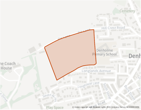
Site Size (ha) Gross: 4.91
Proposed Land Use: Housing
Minimum Development Capacity (Dwellings): 129
Site Type: Greenfield
Ward: Worth Valley
Settlement: Denholme
Ownership: Private
Delivery Timescale: Long 2035+ (11+)
Site Specific Requirements:
Design Principles
- Development should provide at least 129 dwellings as part of a high-quality built environment in line with Policies ST4 and DS1, at a net density of 35 dph. This should include affordable housing (in line with Policy HO4) and an appropriate mix of dwellings (in line with Policy HO3) and having due regard relevant housing needs evidence and the character of the area.
- A sensitive design and layout will be required taking into consideration the site's elevated location on the edge of the settlement. An appropirate landscaping scheme will be required to ensure the development responds to the hillside position.
- Enhancements should be made to the surrounding Green Belt land including improvements to the adjacent public rights of way which may offer opportunities for residents to access the countryside.
Site Access, Highways and Transport
- A new access would be required on to Hill Crest Road, through improvements and upgrades to Pit Lane. There are footways and streetlighting on Hill Crest Road.
Natural and Historic Environment
- The site lies within Zone B (Supporting Habitat/Functionally Linked Land). Development proposals must assess potential impacts on foraging habitat used by SPA qualifying species and provide ecological evidence where required, in accordance with the South Pennine Moors SPD and Policy NE3.
- The site is located within a bat alert area. An ecological survey will be required as part of any planning application to establish the extent/impacts as well as to identify appropriate mitigation.
- A small area in the centre of the site is identified in the LNRS with the preferred measure U1_M01 - Fully restore the hydrology of all peatlands.
- A Heritage Impact Assessment has been carried out for this site and indicates that its development would have no impact on any known designated heritage assets and would likely be acceptable. However, an archaeological evaluation would need to be undertaken to ascertain and potential impacts on any archaeological assets present.
Environmental Protection
- The north-eastern side of the site located within the 150m and 250m buffers of a former landfill site. A Land Contamination Assessment – Phase 1 Report will be required as part of any planning application to determine any potential impacts. Impacts should be addressed in line with Policy CR2.
- The site is crossed from southwest to northeast by a lower voltage electricity transmission cable. Development should include a strategy for responding to the Northern Powergrid equipment present within the site which demonstartes how the Northern Power Grid and HSE Guidance have been applied as part of the desgin and layout and how the impact of the assets has been reduced through good design. Enquiries should be made with Northern Powergrid.
- The majority of the site is classed as Grade 4 on the Agricultural Land Classification (ALC).
- The site is within a Mineral Safeguarding Area (MSA) for coal and partially in a MSA for sandstone. A mineral resource assessment will be required as part of any planning application to determine the extent and availability of any coal and sandstone resource.
Open Space and Green / Blue Infrastructure
- Open space should be provided in line with Policy NE2, having regards to the standards set out in Appendix 11. The Open Space Assessment indicates that in Denholme there is a need for increased provision of amenity greenspace, outdoor sports and play provision for older children.
- The site is located in an area which has low provision and moderate need for green and blue infrastructure. Development proposals should focus on green and blue infrastructure creation, carefully designed to contribute towards site-specific issues e.g. flood mitigation, urban cooling etc.
Landscape
- The site is located within the Cullingworth and Haworth Moorland Fringe LCA, where the contrasting textures between rough unenclosed moorland and geometric pasture informs a unique sense of place and adds depth and interest to the landscape. The site is adjacent to the settlement and is in a prominent hillside location. No landscape sensitivity assessment was undertaken for this site. Consideration should be given to the guidance set out in the Landscape Character Assessment SPD.
Green Belt (and Golden Rules)
- Site has been removed from the Green Belt. Development on the site should be consistent with the “Golden Rules” set out in the NPPF in relation to affordable housing, necessary improvements to infrastructure and accessible green space provision.
Infrastructure Requirements
- Proportionate contributions to community infrastructure will be required, where appropriate, in line with Policies ID1 and ID2, and having regard to the Local Infrastructure Plan.
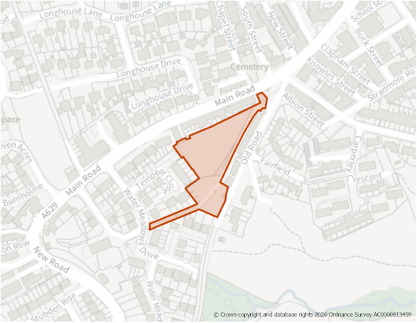
Site Size (ha) Gross: 0.54
Proposed Land Use: Housing
Minimum Development Capacity (Dwellings): 10
Site Type: Greenfield
Ward: Worth Valley
Settlement: Denholme
Ownership: Private
Delivery Timescale: Short 2025-2030 (1-5)
Site Specific Requirements:
Design Principles
- This should include affordable housing (in line with Policy HO4), an appropriate mix of dwellings (in line with Policy HO3) and having due regard relevant housing needs evidence and the character of the area.
Site Access, Highways and Transport
- A new access would be required which would lead on to Chartist Close. There are footways and streetlighting on this road.
Natural and Historic Environment
- The site lies within Zone B (Supporting Habitat/Functionally Linked Land). Development proposals must assess potential impacts on foraging habitat used by SPA qualifying species and provide ecological evidence where required, in accordance with the South Pennine Moors SPD and Policy NE3.
- The site is located within a bat alert area. An ecological survey will be required as part of any planning application to establish the extent/impacts as well as to identify appropriate mitigation.
- The site is identified in the LRNS with the preferred measure B4_M02 - Significantly boost biodiversity wherever possible where there are existing habitats alongside transport infrastructure.
Environmental Protection
- The site is mostly located within the 150m buffer of a former landfill site. A Land Contamination Assessment – Phase 1 Report will be required as part of any planning application to determine any potential impacts. Impacts should be addressed in line with Policy CR2.
Open Space and Green / Blue Infrastructure
- Open space should be provided in line with Policy NE2, having regards to the standards set out in Appendix 11. The Open Space Assessment indicates that in Denholme there is a need for increased provision of amenity greenspace, outdoor sports and play provision for older children.
- The site is located in an area with moderate to high provision, and a moderate need, for existing green and blue infrastructure. Development proposals should focus on the protection and enhancement of these assets.
Landscape
- The site is located within the Cullingworth and Haworth Moorland Fringe LCA (B2), where the contrasting textures between rough unenclosed moorland and geometric pasture informs a unique sense of place and adds depth and interest to the landscape. The site is within the settlement and no landscape sensitivity assessment was undertaken for this site. Consideration should be given to the guidance set out in the Landscape Character Assessment SPD.
Infrastructure Requirements
- Proportionate contributions to community infrastructure will be required, where appropriate, in line with Policies ID1 and ID2, and having regard to the Local Infrastructure Plan.
Planning Permission
- This site benefits from outline planning permission for residential development for 10 dwellings requesting consideration of access, layout and scale (24/03110/MAO) granted in January 2025. Accordingly it has been identified as a site allocation.
POLICY HR1 – HARDEN Comment
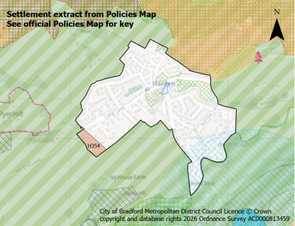
Settlement Plan
Settlement Hierarchy and Spatial Directions
- The village boundary is defined on the policies map. The focus for sustainable development of this small village reflects its function and character balanced against heritage and environmental constraints.
- Development proposals should have regard to, and be consistent with, the made (adopted) Harden Neighbourhood Development Plan.
Meeting Growth Needs
- Housing development includes a combination of development within the settlement boundary and land to be released from the Green Belt during the plan period and will:
- Deliver approximately 47 dwellings through a combination of sites under construction and new site allocations through the plan period as set out in Table HR1.1.
- Deliver housing site allocations as shown on the policies map and section 5:
-
H354: Long Lane
-
Table HR1.1 - Harden: Under Construction
|
Under Construction |
Planning Permission |
Site Allocations |
|
|
Totals |
4 |
- |
43 |
- Proposals for new homes within the settlement boundary on additional small sites, including the redevelopment of previously developed land, will be supported subject to meeting relevant Local Plan and made (adopted) Neighbourhood Development Plan policies.
- Support the Harden’s Local Centre and its diversification where appropriate, to help retain employment opportunities within the settlement and ensure its long-term sustainability. Employment uses will continue to be concentrated within the settlement as set out under Policy HNDP22 of the made (adopted) Neighbourhood Development Plan.
Local Services and Facilities
- Support Harden’s Local Centre, shown on the Policies Map, as a key hub for the community to meet their day-to-day retail and leisure needs as well as the retention and improvement of local services and facilities, in compliance with Policy HNDP13 of the made (adopted) Neighbourhood Development Plan.
- Protect and enhance designated Local Green Spaces and open spaces in compliance with Policy HNDP18 of the made (adopted) Neighbourhood Development Plan such as Harden Memorial Hall Park and St Ives and support proposals which address deficiencies in open space provision as set out on the Open Spaces Study including the provision of allotments, natural and semi-natural greenspace, and expand areas of play.
- Maintain and enhance sport and recreation facilities with support for widened community access.
Landscape
- Maintain and enhance the landscape setting with its Harden Upland Wooded River Valleys character area, landscape features, fields and overall settlement pattern.
Historic and Natural Environment
- Protect and enhance strategic green and blue networks and corridors and habitat networks which surround the village, to enhance biodiversity and recreation within and adjacent to the settlement as well as incorporating sufficient green space and connections within new developments. Consideration should be given to the Green and Blue Infrastructure Strategy.
- Protect and enhance Local Wildlife Sites, the National Nature Reserve, wildlife habitat networks and priority habitats within and surrounding the settlement to the north, south and east, particularly around Harden Moor and across to St Ives, and also along the Harden Beck corridor.
- Where development is located within SPA/SAC Zone C (recreational pressure) residential development resulting in a net increase in dwellings will be required to mitigate any recreational pressure on the SPA/SAC caused by such development in accordance with the South Pennine Moors SPD and Policy NE3.
- Development should conserve and enhance key heritage assets and their settings within and adjacent to the settlement, in line with Policy HE1. This includes Ryecroft Conservation Area and Listed Buildings as well as non-designated heritage assets, as identified in the made (adopted) Neighbourhood Development Plan.
Local Infrastructure
- Support improvements and access to public transport and active travel, including enhanced links to Bingley railway station, in compliance with Policy HNDP10 of the made (adopted) Neighbourhood Development Plan.
- Contributions towards improvements in community infrastructure, including consideration of additional education and healthcare provision.
- Continue to support opportunities to improve walking and cycling links between the settlements of Keighley, Cullingworth, Wilsden and Bingley.
Harden: Site Allocations
H354: Long Lane, Harden Comment
Site Boundary:
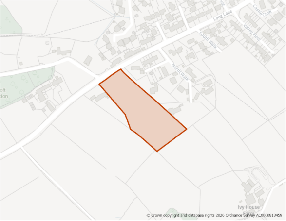
Site Size (ha) Gross: 1.37
Proposed Land Use: Housing
Minimum Development Capacity (Dwellings): 43
Site Type: Greenfield
Ward: Bingley West
Settlement: Harden
Ownership: Private
Delivery Timescale: Long 2035+ (11+)
Site Specific Requirements:
Design Principles
- Development should provide at least 43 dwellings as part of a high-quality built environment in line with Policies ST4 and DS1, at a net density of 35 dph in line with Policy HO2. This should include affordable housing (in line with Policy HO4 and an appropriate mix of dwellings (in line with Policy HO3 and having due regard relevant housing needs evidence and the character of the area).
- A sensitive design and layout will be required taking into consideration the site’s location on the edge of the settlement as well as its proximity to agricultural uses. Care should be given to the impact on the setting of nearby heritage assets. Enhancements to the surrounding Green Belt land should be made, including improving connections to offer opportunities for residents to access the countryside.
- Design and layout should also reflect relevant policies within the Harden Design Code found in the Harden Neighbourhood Development Plan.
Site Access, Highways and Transport
- A new access would be required off Long Lane, where footways and streetlighting are present.
Natural and Historic Environment
- The site lies within Zone C (Recreational Pressure) - Residential development resulting in a net increase in dwellings will be required to mitigate any recreational pressure on the SPA/SAC caused by such development in accordance with the South Pennine Moors SPD and Policy NE3.
- There are trees protected by Tree Preservation Orders located along the eastern boundary of the site. The design and layout of any development should ensure these trees are preserved and enhanced in line with Policy NE6. An arboricutural study should be provided as part of any planning application.
- The site is located within a bat alert area. An ecological survey will be required as part of any planning application to establish the extent/impacts as well as to identify appropriate mitigation.
- The site is within the setting of two Grade II Listed Buidlings (Hill End Farm and Ivy House Farm). A Heritage Impact Assessment (HIA) has been carried out on this site and indictes that it is likely that it will be possible to mitigate the impact of development on the site so that the levels of harm are considered acceptable. The retention of the trees around the boundaries of the site and the strengthening of the landscaping along the southern edge of the site will be essential to maintain the sense of separation and to limit the visual impact of development upon the setting of the nearby listed buildings.
- Development of the site will need to be informed by and respond to the nearby heritage assets. It is likely that the layout, design and scale of dwellings within the site should take design cues from the nearby traditional and/or high quality buildings and that this should also be reflected in the materials. Careful consideration of the landscape will be important with a strategy that includes the retention of the existing trees. The existing stone boundary wall along the frontage to Hill End Lane/Long Lane should also be incorporated to ensure that this element of the rural character of the site is retained.
Environmental Protection
- The majority of the site is classed as 3b on the Agricultural Land Classification (ALC).
Open Space and Green / Blue Infrastructure
- Open space should be provided in line with Policy NE2, having regards to the standards set out in Appendix 11. The Open Space Assessment indicates that in Harden there is a need to increase provision of allotments, and natural/semi-natural greenspace, as well as encouraging opportunities to expand play provision catering for older aged children.
- Harden is well catered for in terms of green and blue infrasturcture provision, but with some additional need to the northwest. There is opportunity to further enhance the existing green and blue infrastructure assets within the settlement.
Landscape
- The site is located within the Harden Upland Wooded River Valleys LCA (C3) which is recognised as a diverse landscape of parkland, pasture and wooded valleys linked by a strong network of public rights of way, together with the sense of time depth displayed in the area creates a strong sense of place.
- The Landscape Sensitivity Assessment indicates that existing tree belts should be maintained where possible and opportunities to integrate low-density housing with tree planting should be taken throughout the site and along the boundaries. This is a well wooded landscape where tree planting would be both in character and would further enhance character. Development should be sited slightly back from the minor ridgeline forms where the slope becomes steeper to retain the natural character to the south.
- The local topography, views and vistas will be effected from development of the site. Outlined in Policy HNDP21 of the Harden Neighbourhood Development Plan, development affecting these views and vistas should be designed in such a way so as not to have a significant adverse impact on their visual quality and amenity.
Green Belt (and Golden Rules)
- Site has been removed from the Green Belt. Development on the site should be consistent with the “Golden Rules” set out in the NPPF in relation to affordable housing, necessary improvements to infrastructure and accessible green space provision.
Infrastructure Requirements
- Proportionate contributions to community infrastructure will be required, where appropriate, in line with Policies ID1 and ID2, and having regard to the Local Infrastructure Plan.
POLICY HA1 – HAWORTH AND CROSS ROADS Comment
Settlement Plan
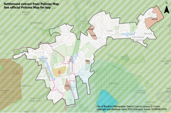
Settlement Hierarchy and Spatial Directions
- The settlement boundary is defined on the Policies Map. As a large village with public transport links that support a wider catchment for services and facilities, it is identified as a focus for sustainable development. A balanced approach to growth is required, reflecting its character as a tourist destination associated with the Brontës and the Keighley and Worth Valley heritage railway, while recognising the area's wider environmental constraints.
- Development proposals should also have regard to and be consistent with the Haworth, Cross Roads and Stanbury Neighbourhood Development Plan, where applicable.
Meeting Growth Needs
- Housing development includes a combination of development within the settlement boundary and land to be released from the Green Belt during the plan period and will:
- Deliver approximately 252 dwellings through a combination of sites under construction and new site allocations through the plan period as set out in Table HA1.1
- Deliver housing site allocations as shown on the policies map and section 5:
- H1576: Worstead Road, Cross Roads
- H311: Ivy Bank Lane, Haworth
- H339: Land North of Lees Lane (1) Lees, Cross Roads
- H340: Land North of Lees Lane (2), Lees, Cross Roads
- H341: Ashlar Close, Haworth
Table HA1.1 - Haworth. : Under Construction
|
Under Construction |
Planning Permission |
Site Allocations |
|
|
Totals |
14 |
- |
238 |
- Proposals for new homes within the settlement boundary on additional small sites, including the redevelopment of previously developed land, will be supported subject to meeting relevant Local Plan policies.
Local Services and Facilities
- Support the range and quality of uses within the three designated Local Centre’s (Main Street, Mill Hey and Cross Roads) as key hubs for the community to meet their day-to-day retail needs.
- Support the diverse mix of retail, leisure and cultural uses and strong independent business sector and established visitor attractions together with maintaining the high-quality environment, public realm, and distinctive character.
- Protect and enhance designated Local Green Spaces as identified in Policy GE2 of the adopted Neighbourhood Development Plan and support proposals which address deficiencies in open space provision as set out on the Open Spaces Study in compliance with Policy NE2.
- Maintain and enhance sport and recreation facilities with support for widened community access.
Landscape
- Maintain and enhance the landscape setting within the Worth Upland Wooded River Valleys landscape character area, landscape features, fields and overall settlement pattern.
- Integrate development within the wider landscape setting through retaining existing features, screening, trees belts and alignment with the edge of established built form.
Historic and Natural Environment
- Protect and enhance strategic green and blue infrastructure networks and corridors including the Worth Valley to enhance biodiversity and recreation within and adjacent to the settlement as well as incorporating sufficient green space and connections within new developments.
- Protect and enhance the five designated Local Wildlife Sites and Local Geological Sites as well as habitat networks and priority habitats within and adjacent to the settlement.
- Where development is located within SPA/SAC Zone B (supporting habitat functionally linked land) residential development proposals must assess potential impacts on foraging habitat used by SPA qualifying species and provide ecological evidence where required, in accordance with the South Pennine Moors SPD and Policy NE3.
- Where development is located within SPA/SAC Zone C (recreational pressure) residential development resulting in a net increase in dwellings will be required to mitigate any recreational pressure on the SPA/SAC caused by such development in accordance with the South Pennine Moors SPD and Policy NE3.
- Ensure that future development conserves and enhances key heritage assets and their settings within and adjacent to the settlement including the two Conservation Areas and 84 Listed Buildings (including the Grade I listed Haworth Parsonage and Grade II* Church of St Michael and All Angels and Ponden Hall, a Grade II Registered Historic Park (Central Park), as well as non-designated heritage assets.
Local Infrastructure
- Support improvements and access to public transport and active travel, including enhanced links to Keighley railway station.
- Contributions towards improvements in community infrastructure, including consideration of additional education and healthcare provision.
Haworth & Cross Roads: Site Allocations
H311: Ivy Bank Lane, Haworth Comment
Site Boundary:
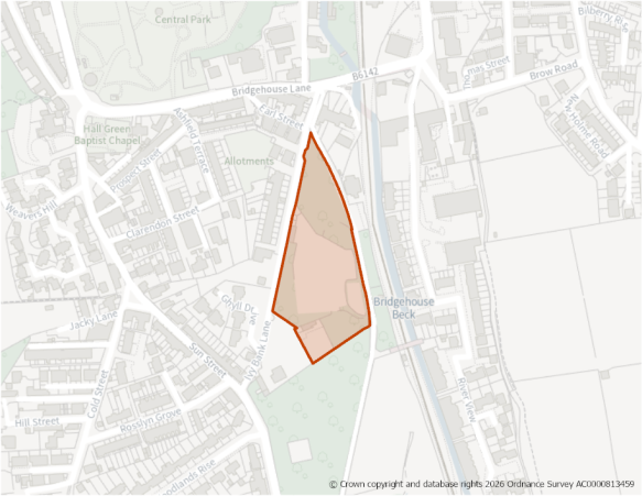
Site Size (ha) Gross: 1.16
Proposed Land Use: Housing
Minimum Development Capacity (Dwellings): 30
Site Type: Mixed
Ward: Worth Valley
Settlement: Haworth
Ownership: Private
Delivery Timescale: Short 2025- 2030 (1-5)
Site Specific Requirements:
Design Principles
- Development should provide at least 30 dwellings as part of a high-quality built environment in line with Policies ST4 and DS1, at a net density of 30 dph. This should include affordable housing (in line with Policy HO4) and an appropriate mix of dwellings (in line with Policy HO3) and having due regard relevant housing needs evidence and the character of the area.
- This is a former mill site which has constraints in terms of highways and access, ecology, heritage and surface water flooding, previous permissions indicate that with careful design, it is possible to overcome these constraints.
- The existing priority woodland on the southern portion of the site must be retained and reinforced with an appropriate buffer area.
- The site is within the boundary of the Haworth, Cross Roads and Stanbury Neighbourhood Development Plan (2019–2030).
Site Access, Highways and Transport
- Access can be achieved via Ivy Bank Lane, which would require significant improvements to link the site to the external highway. Previous highway schemes have been approved in now lapsed planning permissions.
Flooding, Water and Drainage
- There are some parts of the site which are at risk of surface water flooding. These are largely around the centre but there are also some areas to north and south-west. Surface water run-off rates post development should not exceed existing greenfield run-off rates. Measures that achieve this should be discussed and agreed with the Local Lead Flood Authority and the Environment Agency at the planning application stage. Above ground SuDs should be used as far as practicable, and discharge restricted to greenfield run-off rates and volumes.
- The site lies within a Groundwater Source Protection Zone (SPZ II). Development proposals must demonstrate that groundwater resources and public water supplies will not be adversely affected, and implement any necessary mitigation measures.
Natural and Historic Environment
- The site lies within Zone B (Supporting Habitat/Functionally Linked Land). Development proposals must assess potential impacts on foraging habitat used by SPA qualifying species and provide ecological evidence where required, in accordance with the South Pennine Moors SPD and Policy NE3.
- Southern part of site is composed of priority woodland. Existing mature trees along the southern boundary of the site are protected by a Tree Preservation Order. The design and layout of any development should ensure these trees are preserved and enhanced in line with Policy NE6. An arboricutural study should be provided as part of any planning application.
- Non-wooded parts of the site might also be of high wildlife value (50% Natural/semi-natural green space. 30% Semi-improved neutral grassland). Full ecology surveys are required prior to development.
- North of the site is identified in the LNRS with the prefered measure B4_M02: Significantly boost biodiversity wherever possible where there are existing habitats alongside transport infrastructure. The south of the site has a preferred measure of B4_M02: Significantly boost biodiversity wherever possible where there are existing habitats alongside transport infrastructure.
- Development proposals must take a positive, context-led approach to design that achieves an appropriate style, scale and massing, in order to limit negative impacts on the setting of the Haworth Conservation Area, Grade II Listed Bronte Park Nursing Home and other designated and non-designated heritage assets that are in the vicinity of the site.
Environmental Protection
- Site located within the 150m buffer of a former landfill site. A Land Contamination Assessment – Phase 1 Report will be required as part of any planning application to determine any potential impacts. Impacts should be addressed in line with Policy CR2.
Open Space and Green / Blue Infrastructure
- Open space should be provided in line with Policy NE2, having regards to the standards set out in Appendix 11. The Open Space Assessment identifies a deficiency in playing field provision within Haworth and Cross Roads. Additional playing field space is required to meet current and future recreational needs and is considered a high priority.
- The site is within an area of moderate provision but high need for green and blue infrastructure. Development proposals should concentrate on the creation of new, and enhancement of existing green and blue infrastructure.
Landscape
- The site is located within the Worth Upland Wooded River Valleys Landscape Character area/type (C2), where the wealth of topographic diversity, time depth and cultural associations displayed in the area create a strong sense of place. The site is within the settlement and no landscape sensitivity assessment was undertaken for this site. Consideration should be given to the guidance set out in the Landscape Character Assessment SPD.
Infrastructure Requirements
- Proportionate contributions to community infrastructure will be required, where appropriate, in line with Policies ID1 and ID2, and having regard to the Local Infrastructure Plan.
Planning Permission
- The site benefits from an outline planning permission (18/03530/MAO) for 33 dwellings or up to 30 retirement apartments (C2) and up to 17 residential dwellings with associated access, which was granted on 29th April 2022. The outline permission is considered extant as there is a reserved matters application pending determination. Accordingly it has been identified as a site allocation.
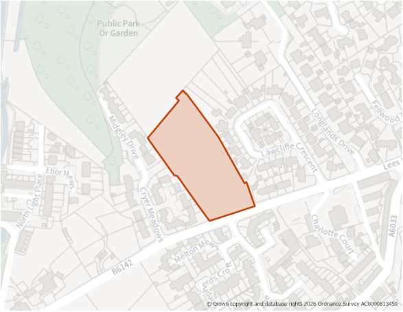
Site Size (ha) Gross: 0.87
Proposed Land Use: Housing
Minimum Development Capacity (Dwellings): 27
Site Type: Greenfield
Ward: Worth Valley
Settlement: Haworth
Ownership: Private
Delivery Timescale: Long 2035+ (11+)
Site Specific Requirements:
Design Principles
- Development should provide at least 27 dwellings as part of a high-quality built environment in line with Policies ST4 and DS1, at a net density of 35 dph. This should include affordable housing (in line with Policy HO4) and an appropriate mix of dwellings (in line with Policy HO3) and having due regard relevant housing needs evidence and the character of the area.
- The topographical nature of the site may mean that some levelling or terracing is required, a sensitive site design will be required to mitigate any impact on drainage, the surrounding landscape and nearby green infrastructure assets. The existing stone boundary walls should be retained.
- An access point should be created to the north of the site to enable the development of site allocation H340.
- Development should also be in line with the requirements of the design and other relevant policies within the made (adopted) Haworth, Cross Roads and Stanbury Neighbourhood Development Plan, including Policy H2: Lees Lane North, Cross Roads.
Site Access, Highways and Transport
- A new access will be required off Cryer Meadows.
Flooding, Water and Drainage
- A nominal flood risk assessment has been carried out for this site and shows that the site is wholly located within Flood Zone 1 of the Environment Agency's (EA) Flood Map for Planning which indicates it as at low risk of flooding from rivers. Development should be possible at this site given the low fluvial and very low surface water flood risk to the site. Any Flood Risk Assessment should include for a drainage strategy which should investigate ground conditions for infiltration SuDS suitability.
Natural and Historic Environment
- The site lies within Zone B (Supporting Habitat/Functionally Linked Land). Development proposals must assess potential impacts on foraging habitat used by SPA qualifying species and provide ecological evidence where required, in accordance with the South Pennine Moors SPD and Policy NE3.
- The site is partially located within a bat alert area. An ecological survey will be required as part of any planning application to establish the extent/impacts as well as to identify appropriate mitigation.
- There are a number of trees protected by Tree Preservation Orders located along the site's southern boundary. The design and layout of any development should ensure these trees are preserved and enhanced in line with Policy NE6. An arboricutural study should be provided as part of any planning application.
Environmental Protection
- The site is located within the 150m buffer of a former landfill site. A Land Contamination Assessment – Phase 1 Report will be required as part of any planning application to determine any potential impacts. Impacts should be addressed in line with Policy CR2.
Open Space and Green / Blue Infrastructure
- Open space should be provided in line with Policy NE2, having regards to the standards set out in Appendix 11. The Open Space Assessment identifies a deficiency in playing field provision within Haworth and Cross Roads. Additional playing field space is required to meet current and future recreational needs and is considered a high priority.
- The site is located in an area with moderate to high provision, and moderate need, for green and blue infrastructure. Development proposals should focus on the protection and enhancement of these assets.
Landscape
- The site is located within the Worth Upland Wooded River Valleys Landscape Character area/type (C2), where the wealth of topographic diversity, time depth and cultural associations displayed in the area create a strong sense of place.
- The Landscape Sensitivity Assessment indicates that this site is more prominent and visible in the wider landscape due to its rounded and sloping landform (convex).
Infrastructure Requirements
- Proportionate contributions to community infrastructure will be required, where appropriate, in line with Policies ID1 and ID2, and having regard to the Local Infrastructure Plan.
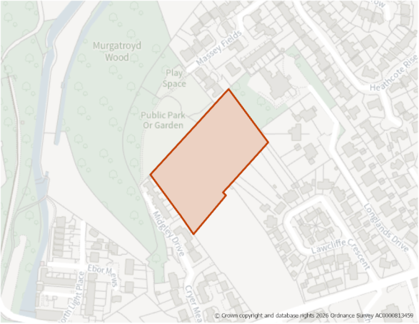
Site Size (ha) Gross: 0.97
Proposed Land Use: Housing
Minimum Development Capacity (Dwellings): 30
Site Type: Greenfield
Ward: Worth Valley
Settlement: Haworth
Ownership: Unregistered
Delivery Timescale: Long 2035+ (11+)
Site Specific Requirements:
Design Principles
- Development should provide at least 30 dwellings as part of a high-quality built environment in line with Policies ST4 and DS1, at a net density of 35 dph. This should include affordable housing (in line with Policy HO4) and an appropriate mix of dwellings (in line with Policy HO3) and having due regard relevant housing needs evidence and the character of the area.
- Development should also be in line with design and other relevant policies within the made (adopted) Haworth, Cross Roads and Stanbury Neighbourhood Development Plan.
- The site would need to be developed after H339 or together as cohesive development.
- The topographical nature of the site may mean that some levelling or terracing is required, a sensitive site design will be required to mitigate any impact on drainage, the surrounding landscape and nearby green infrastructure assets.
Site Access, Highways and Transport
- A new access will be required through H339, once it is developed.
Flooding, Water and Drainage
- A nominal flood risk assessment has been carried out for this site and shows that the site is wholly located within Flood Zone 1 of the Environment Agency's (EA) Flood Map for Planning which indicates it as at low risk of flooding from rivers. Development should be possible at this site given the low fluvial and very low surface water flood risk to the site. Any Flood Risk Assessment should include for a drainage strategy which should investigate ground conditions for infiltration SuDS suitability.
Natural and Historic Environment
- The site lies within Zone B (Supporting Habitat/Functionally Linked Land). Development proposals must assess potential impacts on foraging habitat used by SPA qualifying species and provide ecological evidence where required, in accordance with the South Pennine Moors SPD and Policy NE3.
- The site is located within a bat alert area. The site is adjacent to a priority habitat (deciduous woodland) which is also classed as ancient woodland, buffer zones must be maintained. An ecological survey will be required as part of any planning application to establish the extent/impacts as well as to identify appropriate mitigation.
- There are a number of trees protected by Tree Preservation Orders located along the site's northeastern boundary. The design and layout of any development should ensure these trees are preserved and enhanced in line with Policy NE6. An arboricutural study should be provided as part of any planning application.
Environmental Protection ,
- The site is located within the 150m buffer of a former landfill site. A Land Contamination Assessment – Phase 1 Report will be required as part of any planning application to determine any potential impacts. Impacts should be addressed in line with Policy CR2.
Open Space and Green / Blue Infrastructure
- Open space should be provided in line with Policy NE2, having regards to the standards set out in Appendix 11. The Open Space Assessment identifies a deficiency in playing field provision within Haworth and Cross Roads. Additional playing field space is required to meet current and future recreational needs and is considered a high priority.
- The site is located in an area with moderate to high provision, and moderate need, for green and blue infrastructure. Development proposals should focus on the protection and enhancement of these assets.
Landscape
- The site is located within the Worth Upland Wooded River Valleys Landscape Character area/type (C2), where the wealth of topographic diversity, time depth and cultural associations displayed in the area create a strong sense of place.
- The Landscape Sensitivity Assessment indicates that the landform and screening by existing trees can be used to intergrate the site into the ladnscape. Tree planting could further be used to integrate new development and connect to the swathe of woodland to the north-west of the site.
Infrastructure Requirements
- Proportionate contributions to community infrastructure will be required, where appropriate, in line with Policies ID1 and ID2, and having regard to the Local Infrastructure Plan.
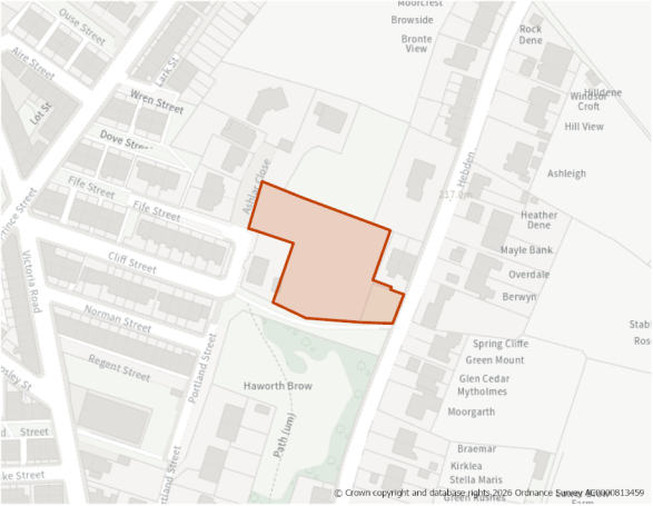
Site Size (ha) Gross: 0.29
Proposed Land Use: Housing
Minimum Development Capacity (Dwellings): 10
Site Type: Greenfield
Ward: Worth Valley
Settlement: Haworth
Ownership: Private
Delivery Timescale: Medium 2030-2035 (6-10)
Site Specific Requirements:
Design Principles
- Development should provide at least 10 dwellings as part of a high-quality built environment in line with Policies ST4 and DS1, at a net density of 35 dph. This should include affordable housing (in line with Policy HO4) and an appropriate mix of dwellings (in line with Policy HO3) and having due regard relevant housing needs evidence and the character of the area.
- Due to the site's topography, a sensitive site design will be required to mitigate any impact on the surrounding landscape and areas of green infrastructure. The footpath to the south of the site should be retained and protected.
- Development should also be in line with the requirements of the design and other relevant policies within the made (adopted) Haworth, Cross Roads and Stanbury Neighbourhood Development Plan.
Site Access, Highways and Transport
- The new access would lead to Hebden Road, where there are footways and streetlighting present.
Natural and Historic Environment
- The site lies within Zone B (Supporting Habitat/Functionally Linked Land). Development proposals must assess potential impacts on foraging habitat used by SPA qualifying species and provide ecological evidence where required, in accordance with the South Pennine Moors SPD and Policy NE3.
- The site is located in a designated Local Heritage Area (Haworth Brow) under Policy BHDD2/1 in the Haworth, Cross Roads and Stanbury Neighbourhood Development Plan.
Environmental Protection
- A small area of the western side of the site is located within the 150m buffer of a former landfill site, the rest of the site is in the 250m buffer. A Land Contamination Assessment – Phase 1 Report will be required as part of any planning application to determine any potential impacts. Impacts should be addressed in line with Policy CR2.
Open Space and Green / Blue Infrastructure
- Open space should be provided in line with Policy NE2, having regards to the standards set out in Appendix 11. The Open Space Assessment identifies a deficiency in playing field provision within Haworth and Cross Roads. Additional playing field space is required to meet current and future recreational needs and is considered a high priority.
- The site is within an area of moderate provision but high need for green and blue infrastructure. Development proposals should concentrate on the creation of new, and enhancement of existing green and blue infrastructure.
- The site is adjacent to a designated Local Green Space (Haworth Brow) to the south.
Landscape
- The site is located within the Worth Upland Wooded River Valleys Landscape Character area/type (C2), where the wealth of topographic diversity, time depth and cultural associations displayed in the area create a strong sense of place. The site is within the settlement and no landscape sensitivity assessment was undertaken for this site. Consideration should be given to the guidance set out in the Landscape Character Assessment SPD.
Infrastructure Requirements
- Proportionate contributions to community infrastructure will be required, where appropriate, in line with Policies ID1 and ID2, and having regard to the Local Infrastructure Plan.
H1576: Worstead Road, Cross Roads Comment
Site Boundary:
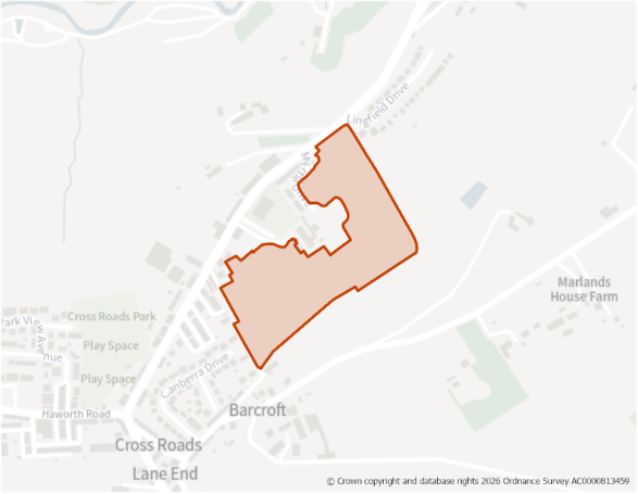
Site Size (ha) Gross: 5.37
Proposed Land Use: Housing
Minimum Development Capacity (Dwellings): 141
Site Type: Greenfield
Ward: Worth Valley
Settlement: Haworth
Ownership: Private
Delivery Timescale: Long 2035+ (11+)
Site Specific Requirements:
Design Principles
- Development should provide at least 141 dwellings as part of a high-quality built environment in line with Policies ST4 and DS1, at a net density of 35 dph. This should include affordable housing (in line with Policy HO4) and an appropriate mix of dwellings (in line with Policy HO3) and having due regard relevant housing needs evidence and the character of the area.
- Due to the site's topography some levelling or terracing may be required. A sensitive site design will be required to mitigate any impact on drainage, the surrounding landscape and nearby green infrastructure.
- Whilst not subject to TPOs, the mature trees within the site, along existing field boundaries should be retained. New tree planting should be located along the western boundary.
- As part of the landscaping scheme, dry stone walls should be retained where possible.
- The footpath which runs along the western boundary of the site should be retained and a sensitive design should be used, including housing orienation and boundary treatments for the safe use of the path.
- Development should also be in line with the requirements of the design and other relevant policies within the made (adopted) Haworth, Cross Roads and Stanbury Neighbourhood Development Plan.
Site Access, Highways and Transport
- A new access is required from Worstead Road. Some reconfiguration maybe necessary to provide acceptable visibility splays. The speed limit on Halifax Road may need to be reduced due to visibility.
Natural and Historic Environment
- The site lies within Zone C (Recreational Pressure) - Residential development resulting in a net increase in dwellings will be required to mitigate any recreational pressure on the SPA/SAC caused by such development in accordance with the South Pennine Moors SPD and Policy NE3.
- The northern part of the site is located within a bat alert area. An ecological survey will be required as part of any planning application to establish the extent/impacts as well as to identify appropriate mitigation.
- There is a belt of trees protected by a Tree Preservation Order, located along the northern boundary. The design and layout of any development should ensure these trees are preserved and enhanced in line with Policy NE6. An arboricutural study should be provided as part of any planning application.
- There are some Non-Designated Heritage Assets identified in the Neighbourhood Plan, which are located adjacent to the site.
Environmental Protection
- The southern portion of site is located within the 250m buffer of a former landfill site. Impacts should be addressed in line with Policy CR2.
- The western part of the site is classed as 3b on the Agricultural Land Classification (ALC).
Open Space and Green / Blue Infrastructure
- Open space should be provided in line with Policy NE2, having regards to the standards set out in Appendix 11. The Open Space Assessment identifies a deficiency in playing field provision within Haworth and Cross Roads. Additional playing field space is required to meet current and future recreational needs and is considered a high priority.
- The site is located in an area which has low provision and moderate need for green and blue infrastructure. Development proposals should focus on green and blue infrastructure creation, carefully designed to contribute towards site-specific issues e.g. flood mitigation, urban cooling etc.
Landscape
- The site is located within the Worth Upland Wooded River Valleys Landscape Character area/type (C2), where the wealth of topographic diversity, time depth and cultural associations displayed in the area create a strong sense of place.
- The Landscape Sesnsitivity Assessment was undertaken for the western half of the site, although the principals can be broadly translated to the while site. The assement rated the sensitivity as moderate and states that there is opportunity to integrate development sensitively into this partly enclosed site. Drystone walls should be retained were possible, particularly on the site periphery as should the existing mature trees. Tree planting, particularly on the western boundary of the site where there is existing woodland would help to integrate development into the landscape.
Other Constraints
- The site is situated within the boundary of the Haworth, Cross Roads and Stanbury Neighbourhood Development Plan (2019–2030). The western part of the site is identified in Policy H1: Worsted Road, Cross Roads of that plan and development should be in accordance with the requirements of that policy.
Green Belt (and Golden Rules)
- Site has been removed from the Green Belt. Development on the site should be consistent with the “Golden Rules” set out in the NPPF in relation to affordable housing, necessary improvements to infrastructure and accessible green space provision.
Infrastructure Requirements
- Proportionate contributions to community infrastructure will be required, where appropriate, in line with Policies ID1 and ID2, and having regard to the Local Infrastructure Plan.
POLICY OA1 – OAKWORTH Comment
Settlement Plan
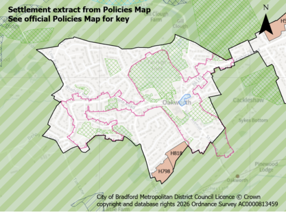
Settlement Hierarchy and Spatial Directions
- The village boundary is defined on the Policies Map. The focus for sustainable development of this medium village reflects its function and character balanced against heritage and environmental constraints.
Meeting Growth Needs
- Housing development includes a combination of development within the settlement boundary and land to be released from the Green Belt during the plan period and will:
- Deliver approximately 84 dwellings through a combination of sites under construction, planning permissions and new site allocations through the plan period as set out in Table OA1.1
- Deliver housing site allocations as shown on the policies map and section 5:
- H798: Providence Farm, Providence Lane
- H818: Pasture Avenue
Table OA1.1 - Oakworth : Under Construction
|
Under Construction |
Planning Permission |
Site Allocations |
|
|
Totals |
3 |
5 |
76 |
- Proposals for residential development within the settlement boundary on additional small sites, including the redevelopment of previously developed land, will be supported subject to meeting relevant Local Plan policies.
Local Services and Facilities
- Support the range and quality of uses within the designated Oakworth Local Centre as a key hub for the community to meet their day-to-day retail and leisure needs as well as the retention and improvement of local services and facilities.
- Protect and enhance designated open spaces such as Holden Park in compliance with Policy NE2 and support proposals which address deficiencies in open space provision as set out in the Open Spaces Study, seeking opportunities to increase the provision of outdoor sports space and play space where possible.
- Maintain and enhance sport and recreation facilities with support for widened community access.
Landscape
- Maintain and enhance the landscape setting of the settlement within the character areas of the Keighley Moorland Fringe and Worth Upland Wooded River Valley and key landscape features, fields and overall settlement pattern.
Historic and Natural Environment
- Protect and enhance strategic green and blue corridors and habitat networks to the north, south and east of the village, particularly around the Branshaw Plantation and River Worth to enhance biodiversity and recreation within and adjacent to the settlement as well as incorporating sufficient green space and connections within new developments. Consideration should be given to the Green and Blue Infrastructure Strategy.
- Where development is located within SPA/SAC Zone B (supporting habitat functionally linked land) residential development proposals must assess potential impacts on foraging habitat used by SPA qualifying species and provide ecological evidence where required, in accordance with the South Pennine Moors SPD and Policy NE3.
- Where development is located within SPA/SAC Zone C (recreational pressure) residential development resulting in a net increase in dwellings will be required to mitigate any recreational pressure on the SPA/SAC caused by such development in accordance with the South Pennine Moors SPD and Policy NE3.
- Ensure that future development conserves and enhances key heritage assets and their settings within and adjacent to the settlement including the Oakworth Conservation Area and various Listed Buildings as well as non-designated heritage assets.
Local Infrastructure
- Support improvements and access to public transport and active travel, including enhanced links to Keighley railway station and measures to reduce traffic congestion on routes from Oakworth to Keighley, along Keighley Road.
- Consider the opportunities to provide better connections between the village and Oakworth Station in order to continue to support the tourist attraction of the Keighley and Worth Valley Heritage Railway.
- Proportionate contributions to new or enhanced community infrastructure will be required, where appropriate, in line with Policies ID1 and ID2, and having regard to the Local Infrastructure Plan.
Oakworth: Site Allocations
H798: Providence Farm, Providence Lane, Oakworth Comment
Site Boundary:
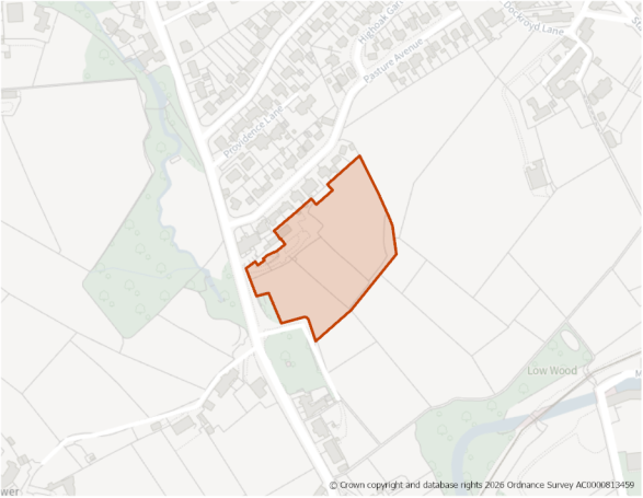
Site Size (ha) Gross: 1.35
Proposed Land Use: Housing
Minimum Development Capacity (Dwellings): 43
Site Type: Greenfield
Ward: Worth Valley
Settlement: Oakworth
Ownership: Private
Delivery Timescale: Long 2035+ (11+)
Site Specific Requirements:
Design Principles
- Development should provide at least 43 dwellings as part of a high quality built environment in line with Policies ST4 and DS1, at a net density of 35 dph. This should include affordable housing (in line with Policy HO4) and an appropriate mix of dwellings (in line with Policy HO3 and having due regard to relevant housing needs evidence and the character of the area).
- A sensitive design and layout will be required with consideration being given to the site's sloping topography and location on the edge of the settlement, as well as proximity to agricultural uses. Mitigation should be considered for any negative impacts on the surrounding landscape and to address areas of surface water floodrisk. Enhancements should be made to the surrounding Green Belt land including improvements to the adjacent public rights of way which may offer opportunities for residents to access the countryside.
Site Access, Highways and Transport
- A new access would be required to join Providence Lane. There are footways and streetlights present along this road. Consideration will need to be given to providing an access to the adjacent housing allocation site (H818) and these sites could be delivered together.
- The public right of way to the southwestern corner of site should be retained and improved.
Flooding, Water and Drainage
- A Level 2 Strategic Flood Risk Assesssment (SFRA) has been carried out on this site and indicates that in terms of fluvial flood risk almost the entire site is located within Flood Zone 1. There is a very small area along the western boundary of the site within Flood Zone 2 and therefore at medium risk. In terms of flooding from surface water the site is at predominantly very low risk. The SFRA indicates that it should be possible to develop this site for more vulnerable uses. Any FRA should consider surface water modelling of the site and consider safe access and escape routes.
Natural and Historic Environment
- The majority of site lies within Zone C Residential development resulting in a net increase in dwellings will be required to mitigate any recreational pressure on the SPA/SAC caused by such development in accordance with the South Pennine Moors SPD and Policy NE3. Small parts of the western boundary are within Zone B (Supporting Habitat/Functionally Linked Land). Development proposals must assess potential impacts on foraging habitat used by SPA qualifying species and provide ecological evidence where required, in accordance with the South Pennine Moors SPD and Policy NE3.
- There are trees protected by Tree Preservation Orders along the southwestern boundary of the site and must be retained and protected. The design and layout of any development should ensure these trees are preserved and enhanced in line with Policy NE6. An arboricutural study should be provided as part of any planning application.
- The site is located within a bat alert area. An ecological survey will be required as part of any planning application to establish the extent/impacts as well as to identify appropriate mitigation.
- The western site boundary is identified in Local Nature Recovery Strategy (LNRS) with preferred measure W4_M02 - Create new reedbeds, wet grasslands, floodplain meadows, open standing water and wet woodland around known areas of lowland raised bog. These will attract amphibians, invertebrates and birds.
Environmental Protection
- The majority of site is classed as Grade 3b on the Agricultural Land Classification (ALC).
Open Space and Green / Blue Infrastructure
- Open space should be provided in line with Policy NE2, having regards to the standards set out Appendix 11. The Open Space Assessment indicates that in Oakworth there is a need for increased provision of outdoor sports space and play provision for older children.
- Green and blue infrastructure should be provided in line with Policy NE1.
Landscape
- The site is located within the Worth Upland Wooded River Valleys Landscape Character area/type (C2), where the wealth of topographic diversity, time depth and cultural associations displayed in the area create a strong sense of place.
- The Landscape Sensitivity Assessment indicates that the site is an area of low-moderate landscape senstivity and that the site could be developed to provide a more integrated settlement edge with sensitive design enabling open views across the valley to be maintained. It benefits from being relatively well contained by existing vegetation within its wider context, with woodland to the south-west and to the south on the railway line. The site is at a lower level than existing housing and new development could be nestled into the lower slopes. Areas of tree planting on boundaries could be retained, strengthened, and connected to soften and integrate the new development and settlement edge.
Green Belt (and Golden Rules)
- Site has been removed from the Green Belt. Development on the site should be consistent with the “Golden Rules” set out in the NPPF in relation to affordable housing, necessary improvements to infrastructure and accessible green space provision
Infrastructure Requirements
- Proportionate contributions to community infrastructure will be required, where appropriate, in line with Policies ID1 and ID2, and having regard to the Local Infrastructure Plan.
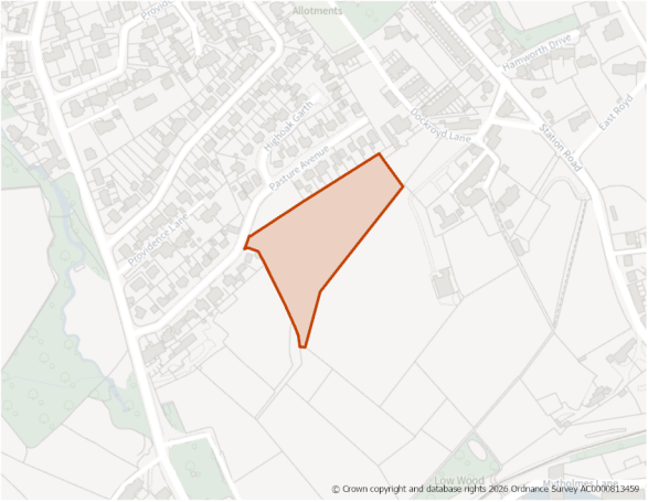
Site Size (ha) Gross: 1.06
Proposed Land Use: Housing
Minimum Development Capacity (Dwellings): 33
Site Type: Greenfield
Ward: Worth Valley
Settlement: Oakworth
Ownership: Private
Delivery Timescale: Long 2035+ (11+)
Site Specific Requirements:
Design Principles
- Development should provide at least 33 dwellings as part of a high quality built environment in line with Policies ST4 and DS1, at a net density of 35 dph. This should include affordable housing (in line with Policy HO4) and an appropriate mix of dwellings (in line with Policy HO3) and having due regard to relevant housing needs evidence and the character of the area.
- A sensitive design and layout should give consideration to the site's sloping topography, its proximity to, and impact on the adjacent conservation area (including consideration of the use of natural materials), and any relevant measures to mitigate impacts on drainage and the surrounding landscape. Enhancements should be made to the surrounding Green Belt land including improvements to any nearby public rights of way which may offer opportunities for residents to access the countryside.
Site Access, Highways and Transport
- A new access would be required at Pasture Avenue, where footways and streetlights are present. Visbility splays should be possible. Direct access off Pasture Avenue but would need to be improved to adoptable standards. Alternative access could be provided through the adjacent housing allocation H798 and consideration should be given to developing the sites together.
Flooding, Water and Drainage
- A nominal flood risk assessment has been carried out for this site. It indicates that the site is wholly located within Flood Zone 1 of the Environment Agency's (EA) Flood Map for Planning which indicates it as at low risk of flooding from rivers. Development should be possible at this site given the low fluvial and very low surface water flood risk to the site. The site is not modelled to be at significant additional fluvial or surface water risk as a result of climate change, however safe access and escape routes in the long term should be considered further. Any FRA should include for a drainage strategy which should investigate ground conditions for infiltration SuDS suitability.
Natural and Historic Environment
- The site lies within Zone C (Recreational Pressure) - Residential development resulting in a net increase in dwellings will be required to mitigate any recreational pressure on the SPA/SAC caused by such development in accordance with the South Pennine Moors SPD and Policy NE3.
- The site is located within a bat alert area. An ecological survey will be required as part of any planning application to establish the extent/impacts as well as to identify appropriate mitigation.
- The site is adjacent to the Oakworth Conservation Area. A Hertiage Impact Assessment (HIA) has been carried out for this site. It states that the site is at the rural fringe of Oakworth and beyond this, the landscape character changes to rural agricultural groupings and with long-range open views. While development will inevitably alter the rural setting, sensitive design may minimise harm across parts of the site.
- Development of the site will need to be informed by and respond to the surrounding high-quality development. Likely, the layout, design and scale of dwellings within the site should take design cues from the nearby traditional buildings and that this should also be reflected in the materials. Design and materials should be of a very high quality. Careful consideration of the landscape strategy, including retention of the existing mature trees, will be needed. The existing stone boundary wall along the boundary of the site should also be incorporated to ensure that this element of the rural character of the site is retained. The proposed buildings should not turn their backs to the Pasture Ave and should not be more than two storeys in height to avoid excessively dominating the existing buildings in the wider context.
- A landscaped buffer or area of open space is likely to be required around the buildings in the context of the site to enable views and to allow the buildings to be viewed in the context of open space and to allow an understanding of their function. This should be substantial enough to provide meaningful and effective separation between the development and the existing context buildings.
- The HIA concludes that new development can be accommodated on this site, although any development in the eastern section is likely to result in less than substantial harm of an unacceptable level. With a sensitive design and appropriate mitigation measures the remaining area of the site is likely to result in less than substantial harm of an acceptable level. It will be important for the development to carefully consider and investigate the mitgiation options to protect the landscape, views, and character of the wider setting.
Environmental Protection
- The majority of site is classed as Grade 3b on the Agricultural Land Classification (ALC).
Open Space and Green / Blue Infrastructure
- Open space should be provided in line with Policy NE2, having regards to the standards set out Appendix 11. The Open Space Assessment indicates that in Oakworth there is a need for increased provision of outdoor sports space and play provision for older children.
- Green and blue infrastructure should be provided in line with Policy NE1.
Landscape
- The site is located within the Worth Upland Wooded River Valleys Landscape Character area/type (C2), where the wealth of topographic diversity, time depth and cultural associations displayed in the area create a strong sense of place.
- The Landscape Sensitivity Assessment indicates that the site is an area of low-moderate landscape sensitivity. The site could be developed to provide a more integrated settlement edge with sensitive design enabling open views across the valley to be maintained. It benefits from being relatively well contained by existing vegetation within its wider context, with woodland to the south-west and to the south on the railway line. The site is at a lower level than existing housing and new development could be nestled into the lower slopes. Areas of tree planting on boundaries could be retained, strengthened, and connected to soften and integrate the new development and settlement edge.
Green Belt (and Golden Rules)
- Site has been removed from the Green Belt. Development on the site should be consistent with the “Golden Rules” set out in the NPPF in relation to affordable housing, necessary improvements to infrastructure and accessible green space provision.
Infrastructure Requirements
- Proportionate contributions to community infrastructure will be required, where appropriate, in line with Policies ID1 and ID2, and having regard to the Local Infrastructure Plan.
POLICY OX1 – OXENHOPE Comment
Settlement Plan
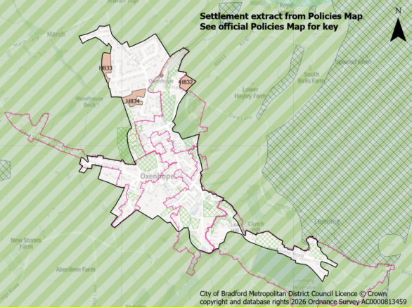
Settlement Hierarchy and Spatial Directions
- The village boundary is defined on the Policies Map. The village consists of the main settlement of Oxenhope and the separate, distinct hamlet of Leeming to the southeast. The focus for sustainable development of this small village reflects its function and character balanced against heritage and environmental constraints.
- The settlement features significant environmental constraints which focuses growth to its elongated settlement form.
- Development proposals should have regard to and be consistent with the made (adopted) Oxenhope Neighbourhood Development Plan and Design Guide where applicable.
Meeting Growth Needs
- Housing development includes a combination of development within the settlement boundary and land to be released from the Green Belt during the plan period and will:
- Deliver approximately 65 dwellings through a combination of sites under construction, planning permissions and new site allocations through the plan period as set out in Table OX1.1.
- Deliver housing site allocations as shown on the policies map and section 5:
- H832: Land on Harry Lane
- H833: Crossfield Road
- H834: Cross Lane
Table OX1.1 - Oxenhope:
|
Under Construction |
Planning Permission |
Site Allocations |
|
|
Totals |
9 |
5 |
51 |
- Proposals for new homes within the settlement boundary on additional small sites, including the redevelopment of previously developed land, will be supported subject to meeting relevant Local Plan and made (adopted) Neighbourhood Development Plan policies.
- Support initiatives for the sustainability and diversification of agricultural and rural enterprises.
- Support start-up and small businesses within creative and digital industries in line with Policy ED5 of the made (adopted) Oxenhope Neighbourhood Development Plan.
Local Services and Facilities
- This scale of development within this small village will help to sustain local services and facilities.
- Protect and enhance Local Green Spaces identified in Policy GS1 of the made (adopted) Neighbourhood Development Plan and designated open spaces in the Local Plan such as the Millennium Green, and playing fields around Shaw Lane in compliance with Policy NE2. Support proposals which address deficiencies in open space provision as set out in the Open Spaces Study, seeking opportunities to increase provision of outdoor sports spaces, parks and gardens and expand provision of play areas where possible.
- Maintain and enhance sporting and recreation facilities, including those identified in Policy GP3 of the made (adopted) Neighbourhood Development, whilst widened community access will be supported.
Landscape
- Maintain and enhance the landscape setting of the settlement within the character areas of the Worth Upland Wooded River Valleys and Cullingworth and Haworth Moorland Fringe, and key landscape features, fields and overall settlement pattern.
- Protect and enhance important views identified in Policy GP7 of the made (adopted) Neighbourhood Development Plan.
Historic and Natural Environment
- Protect and enhance strategic green and blue corridors and habitat networks particularly to the east of the village along the Leeming water corridor, and also to the south of the village in the moorland and wood valleys around Paul Clough and Nan Scar Beck. Enhance biodiversity and recreation within and adjacent to the settlement as well as incorporating sufficient green space and connections within new developments in line with Policy H4 of the made (adopted) Neighbourhood Development Plan. Consideration should be given to the Green and Blue Infrastructure Strategy
- Where development is located within SPA/SAC Zone B (supporting habitat functionally linked land) residential development proposals must assess potential impacts on foraging habitat used by SPA qualifying species and provide ecological evidence where required, in accordance with the South Pennine Moors SPD and Policy NE3.
- Where development is located within SPA/SAC Zone C (recreational pressure) residential development resulting in a net increase in dwellings will be required to mitigate any recreational pressure on the SPA/SAC caused by such development in accordance with the South Pennine Moors SPD and Policy NE3.
- Continue to protect the historic character of the village, ensuring new developments conserve and where appropriate, enhance the heritage significance and setting of relevant heritage assets and their settings within and adjacent to the settlement including the four Conservation Areas and variety of Listed Buildings as well as non-designated heritage assets identified within Policy GP2 of the made (adopted) Neighbourhood Development Plan.
- Promote sustainable tourism in the village in association with the Keighley and Worth Valley Heritage Railway and the wider links to the surrounding moorland associated with the Brontes.
Local Infrastructure
- Support improvements and access to public transport and active travel, including enhanced links to Keighley railway station.
- Proportionate contributions to new or enhanced community infrastructure will be required, where appropriate, in line with Policies ID1 and ID2, and having regard to the Local Infrastructure Plan.
Oxenhope: Site Allocations
H832: Land on Harry Lane, Oxenhope Comment
Site Boundary:
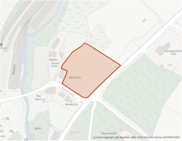
Site Size (ha) Gross: 0.54
Proposed Land Use: Housing
Minimum Development Capacity (Dwellings): 17
Site Type: Greenfield
Ward: Worth Valley
Settlement: Oxenhope
Ownership: Private
Delivery Timescale: Long 2035+ (11+)
Site Specific Requirements:
Design Principles
- Development should provide at least 17 dwellings as part of a high-quality built environment in line with Policies ST4 and DS1, at a net density of 35 dph in line with Policy HO2. This should include affordable housing (in line with Policy HO4), an appropriate mix of dwellings (in line with Policy HO3) and having due regard relevant housing needs evidence and the character of the area.
- A sensitive design and layout will be required taking into considertation the site's location as a gateway into the village and within the setting of the Oxenhope Station Road conservation area, as well as its edge of settlement position and relationship with the wider landscape. Enhancements should be made to the surrounding Green Belt land including improvements to public rights of way which may offer opportunities for residents to access the countryside.
- The design and layout should also reflect relevant policies within the made (adopted) Oxenhope Neighbourhood Development Plan and the Oxenhope Design Guide.
Site Access, Highways and Transport
- A new access would be required from Keighley Road or improvements made to the access off Harry Lane, then on to Keighley Road. There are footways and streetlights on Keighley Road.
Flooding, Water and Drainage
- The site is wholly located within Flood Zone 1 of the Environment Agency's (EA) Flood Map for Planning which indicates it as at low risk of flooding from rivers. There is a small area of surface water flood risk on the southern corner of the site. Development should be possible at this site given the low fluvial and very low surface water flood risk to the site. Any FRA should include a drainage strategy which looks at the surface water flow path as part of the site design and investigate ground conditions for infiltration SuDS suitability.
Natural and Historic Environment
- The site lies within Zone B (Supporting Habitat/Functionally Linked Land). Development proposals must assess potential impacts on foraging habitat used by SPA qualifying species and provide ecological evidence where required, in accordance with the South Pennine Moors SPD and Policy NE3.
- The site is located within a bat alert area and there is deciduous woodland priority habitat located across the road to the east and south. Development proposals should respond positively to these assets. An ecological survey will be required as part of any planning application to establish the extent/impacts as well as to identify appropriate mitigation.
- The site is identified in the LRNS with the preferred measure G3_M03 - Buffer and link existing neutral grasslands.
- The site is directly adjacent to the Oxenhope Station Road conservation areas. A Heritage Impact Assessment (HIA) has not been carried out for this site. The design of any development on the site should be in line with the requirements of Policy HE1.
Environmental Protection
- The eastern part of the site is crossed from north to south by a lower voltage electricity transmission cable. Development should include a strategy for responding to the Northern Powergrid equipment present within the site which demonstartes how the Northern Power Grid and HSE Guidance have been applied as part of the desgin and layout and how the impact of the assets has been reduced through good design. Enquiries should be made with Northern Powergrid.
Open Space and Green / Blue Infrastructure
- Open space should be provided in line with Policy NE2, having regards to the standards set out in Appendix 11. The Open Space Assessment indicates that in Oxenhope there is a need for increased provision of outdoor sports, parks and gardens, and play provision for older children.
- The site is located in an area with moderate to high provision, and moderate need, for existing green and blue infrastructure. Development proposals should focus on the protection and enhancement of these assets.
Landscape
- The site is located within the Worth Upland Wooded River Valleys LCA (C2), where the wealth of topographic diversity, time depth and cultural associations displayed in the area create a strong sense of place. No landscape sensitivity assessment was undertaken for this site. Consideration should be given to the guidance set out in the Landscape Character Assessment SPD.
Green Belt (and Golden Rules)
- Site has been removed from the Green Belt. Development on the site should be consistent with the “Golden Rules” set out in the NPPF in relation to affordable housing, necessary improvements to infrastructure and accessible green space provision.
Infrastructure Requirements
- Proportionate contributions to community infrastructure will be required, where appropriate, in line with Policies ID1 and ID2, and having regard to the Local Infrastructure Plan.
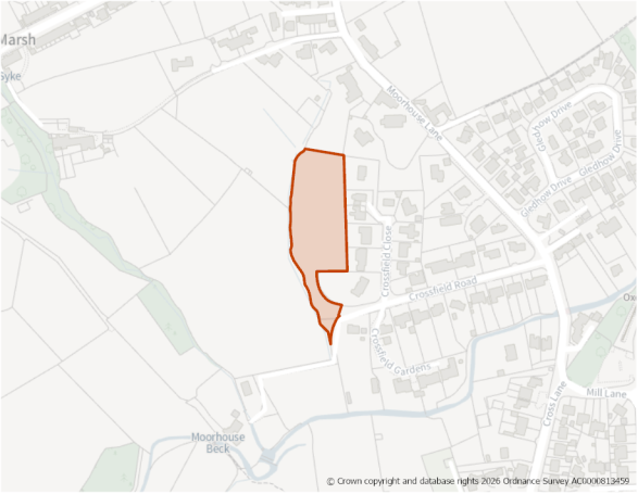
Site Size (ha) Gross: 0.69
Proposed Land Use: Housing
Minimum Development Capacity (Dwellings): 9
Site Type: Greenfield
Ward: Worth Valley
Settlement: Oxenhope
Ownership: Private
Delivery Timescale: Medium 2030-2035 (6-10)
Site Specific Requirements:
Design Principles
- Development should provide a high-quality built environment in line with Policies ST4 and DS1. This should include affordable housing (in line with Policy HO4), an appropriate mix of dwellings (in line with Policy HO3) and having due regard relevant housing needs evidence and the character of the area.
- A sensitive design and layout will be required taking into consideration the site's location on the edge of the settlement and its relationship to the surrounding rural landscape and existing residential development. Enhancements should be made to the surrounding Green Belt land including improvements to public rights of way which may offer opportunities for residents to access the countryside.
- Design and layout should also reflect relevant policies within the made (adopted) Oxenhope Neighbourhood Development Plan and the Oxenhope Design Guide.
Site Access, Highways and Transport
- A new access would need to be provided off Crossfield Road. There are footways and streetlights present along this road.
Flooding, Water and Drainage
- A Level 2 Strategic Flood Risk Assessment has been carried out for this site and indicates that development should avoid areas of the site modelled to be at surface water flood risk, as well as areas in the south of the site modelled to be at residual risk from reservoir failure. The unmodelled tributary should be modelled to ascertain current and future fluvial flood risk to this site. No development should take place over the top of a culvert nor within 8m either side of the culverted section of watercourse. Surface water management is required and will involve detailed surface water modelling based on layout plans and detailed design as well as full consultation with the LLFA on required runoff rates, likely to be greenfield or betterment. The use of infiltration SuDS should be investigated for suitability across the majority of the site. Any FRA for this site would need to be accompanied with a detailed drainage strategy informed by further pluvial modelling to help inform the identification of access and escape routes that are safe in all observed events.
Natural and Historic Environment
- The site lies within Zone B (Supporting Habitat/Functionally Linked Land). Development proposals must assess potential impacts on foraging habitat used by SPA qualifying species and provide ecological evidence where required, in accordance with the South Pennine Moors SPD and Policy NE3.
- Existing woodland along the northern boundary of the site is protected by a Tree Preservation Order and these trees should be protected and enhanced with additional planting.
- The site is located within a bat alert area. An ecological survey will be required as part of any planning application to establish the extent/impacts as well as to identify appropriate mitigation.
- Land directly to the west of the site is identified in the LRNS with the preferred measure T2_M04 - Extend and connect tree and woodland cover across the White Rose Forest.
- A Heritage Impact Assessment has been carried for this site and indicates that development of this site has potential to result in harm to the setting of designated and undesignated heritage assets. There would be some impacts on setting and loss of spatial significance in the context of the properties and their relationship to open landscape. Mitigation would acceptably reduce impact, especially through careful siting of development and effective landscaping, and it should be expected that any development would achieve an impact of Less than Substantial Harm (of an Acceptable Level).
Open Space and Green / Blue Infrastructure
- Open space should be provided in line with Policy NE2, having regards to the standards set out in Appendix 11. The Open Space Assessment indicates that in Oxenhope there is a need for increased provision of outdoor sports, parks and gardens, and play provision for older children.
- The site is located in an area with moderate to high provision, and moderate need, for existing green and blue infrastructure. Development proposals should focus on the protection and enhancement of these assets.
Landscape
- The site is located within the Worth Upland Wooded River Valleys LCA (C2). The Landscape Sensitivity Assessment reconises that the wealth of topographic diversity, time depth and cultural associations displayed in the area create a strong sense of place.
- The landscape sesnsitivity assessment was undertaken for the site, it rated the sensitivity as moderate and states that development should seek to retain mature trees and provide a buffer from the watercourse which is a valued characteristic of the landscape to the west. Tree planting on the boundary and within the development would provide integration.
Green Belt (and Golden Rules)
- Site has been removed from the Green Belt. Development on the site should be consistent with the “Golden Rules” set out in the NPPF in relation to affordable housing, necessary improvements to infrastructure and accessible green space provision.
Infrastructure Requirements
- Proportionate contributions to community infrastructure will be required, where appropriate, in line with Policies ID1 and ID2, and having regard to the Local Infrastructure Plan.
Planning Permission
- The majority of site benefits from planning permission for 9 dwellings (25/01814/PIP) granted on 30th April 2025. This was after 1 April 2025 (the base date for the Local Plan). Accordingly it has been identified as a site allocation.
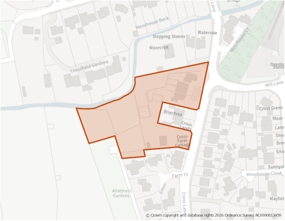
Site Size (ha) Gross: 0.78
Proposed Land Use: Housing
Minimum Development Capacity (Dwellings): 25
Site Type: Greenfield
Ward: Worth Valley
Settlement: Oxenhope
Ownership: Private
Delivery Timescale: Short 2025- 2030 (1-5)
Site Specific Requirements:
Design Principles
- Development should provide a high-quality built environment in line with Policies ST4 and DS1. This should include affordable housing (in line with Policy HO4), an appropriate mix of dwellings (in line with Policy HO3) and having due regard relevant housing needs evidence and the character of the area.
- A sensitive design and layout will be required taking account of the site's location between existing areas of housing and the countryside to the west.
- The design and layout for any future application for the allocated area should also reflect relevant policies within the made (adopted) Oxenhope Neighbourhood Development Plan and the Oxenhope Design Guide.
Site Access, Highways and Transport
- A new access would need to be provided off Cross Lane. Footways and streetlighting are present on the opposite side of this road.
Flooding, Water and Drainage
- A Level 2 Strategic Flood Risk Assessment has been carried out for this site and indicates that development be acceptable provided it can avoid the northwestern / northern boundary of the site at modelled fluvial and surface water risk. This area should be used as a blue green corridor. An update to the SFRA and/or any future FRA should provide updated information on existing and future flood risk from Moorhouse Beck before development can proceed.
- There is potential reservoir risk to the site, developers should consider: consulting with the local resilience forum for advice on emergency planning, consulting with relevant reservoir owners to understand the impact development may have on their reservoirs, and demonstrate that any proposed development will be safe throughout its lifetime. There is residual risk to the site from a blockage of the Moorhouse Beck culvert beneath Moorhouse Lane. The ongoing and future funding and maintenance arrangements for this asset also need to ascertained. Any FRA should produce a detailed drainage strategy which should include ground investigation for infiltration SuDS suitability.
Natural and Historic Environment
- The site lies within Zone B (Supporting Habitat/Functionally Linked Land). Development proposals must assess potential impacts on foraging habitat used by SPA qualifying species and provide ecological evidence where required, in accordance with the South Pennine Moors SPD and Policy NE3.
- Existing woodland along the northern boundary of the site protected by a Tree Preservation Order (TPO), these should be protected and enhanced with additional planting.
- The site is located within a bat alert area. An ecological survey will be required as part of any planning application to establish the extent/impacts as well as to identify appropriate mitigation.
- The site is partially identified in the LRNS with the preferred measure G2_M03 - Restore Magnesian Limestone quarries to limestone grasslands and, along Moorhouse Beck, W2_M02 - Restore or recreate lost wetlands.
- The site is adjacent to the Oxenhope Station Road conservation area. A Heritage Impact Assessment (HIA) has been carried out for this site and indicates that development of the site would present only a slight impact for the setting of the conservation area. With careful attention to design and appearance, it is concluded that development would not cause harm, and should result in an impact of Less than Substantial Harm (of an Acceptable Level).
Open Space and Green / Blue Infrastructure
- The site is part of an area of amenity open space and replacement provision or improvements should be made through new development. Open space should be provided in line with Policy NE2, having regards to the standards set out in Appendix 11. The Open Space Assessment indicates that in Oxenhope there is a need for increased provision of outdoor sports, parks and gardens, and play provision for older children.
- The site is located in an area with moderate to high provision, and moderate need, for existing green and blue infrastructure. Development proposals should focus on the protection and enhancement of these assets.
Landscape
- The site is located within the Worth Upland Wooded River Valleys LCA (C2), where the wealth of topographic diversity, time depth and cultural associations displayed in the area create a strong sense of place. The site is located within the settlement and no landscape sensitivity assessment was undertaken for this site. Consideration should be given to the guidance set out in the Landscape Character Assessment SPD.
Infrastructure Requirements
- Proportionate contributions to community infrastructure will be required, where appropriate, in line with Policies ID1 and ID2, and having regard to the Local Infrastructure Plan.
Planning Permission
- The eastern half of the site benefits from planning permission for 9 dwellings (24/04561/REM) granted July 2025. This was after 1 April 2025 (the base date for the Local Plan). Accordingly it has been identified as a site allocation.
POLICY QB1 – QUEENSBURY Comment
Settlement Plan
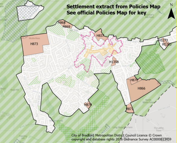
Settlement Hierarchy and Spatial Directions
- The town boundary is defined on the policies map and includes Queensbury and Mountain. The focus for sustainable development of this small town reflects its function and character balanced against heritage and environmental constraints.
- The close proximity of open moorland to Queensbury, the significance of heritage assets and viewpoints mean that development in this settlement must be of high quality and sensitively managed.
Meeting Growth Needs
- Housing development includes a combination of development within the settlement boundary and land to be released from the Green Belt during the plan period and will:
- Deliver approximately 838 dwellings through a combination of sites under construction, planning permissions and new site allocations as set out in Table QB1.1
- Deliver housing site allocations as shown on the policies map and section 5:
- H837: Sharket Close
- H866: Queensbury Golf Course
- H868: Albert Road/Denholme Road (west)
- H869: Albert Road/Denholme Road (east)
- H870: Brighouse Road
- H871: Jackson Hill Lane/Brighouse Road
- H873: Old Guy Road/Fleet Lane
- H874: Land south of Long Lane
- H1358: Old Mill Dam Lane
Table QB1.1 - Queensbury:
|
Under Construction |
Planning Permission |
Site Allocations |
|
|
Totals |
4 |
4 |
830 |
- Proposals for new homes within the settlement boundary on additional small sites, including the redevelopment of previously developed land, will be supported subject to meeting meeting relevant Local Plan policies.
- Good public transport links with Bradford City Centre and Halifax Town centre provide the opportunity to access a wider range of employment prospects.
Local Services and Facilities
- Support the range and quality of uses within the designated Queensbury District Centre as a key hub for the community to meet their day-to-day retail and leisure needs as well as the retention and improvement of local services and facilities.
- Protect and enhance designated open spaces in compliance with Policy NE1 and support proposals which address deficiencies in open space provision as set out on the Open Spaces Study, seeking to increase provision of amenity greenspace, allotments and play areas.
- Maintain and enhance sport and recreation facilities with support for widened community access.
Landscape
- Maintain and enhance the landscape setting of the settlement within the character areas of the Thornton, Queensbury and Wilsden Mixed Upland Pasture Landscape Character Area.
Historic and Natural Environment
- Ensure that future development conserves and enhances key heritage assets and their settings within and adjacent to the settlement including Queensbury’s historic core particularly within the Conservation Area and Listed Buildings as well as non-designated heritage assets.
- Support the reuse and restoration of key heritage assets such as the Black Dyke Mills complex and Victoria Hall, recognising the importance of these buildings to the historic development of Queensbury and to the local community.
- Protect and enhance strategic green and blue networks and corridors within and adjacent to the settlement as well as incorporating sufficient green space and connections within new developments.
- Protect and enhance the designated Local Nature Reserve (Littlemoor Park) and Local Wildlife Sites as well as habitat networks and priority habitats within and adjacent to the settlement.
- Where development is located within SPA/SAC Zone C (recreational pressure) residential development resulting in a net increase in dwellings will be required to mitigate any recreational pressure on the SPA/SAC caused by such development in accordance with the South Pennine Moors SPD and Policy NE3.
Local Infrastructure
- Support improvements and access to public transport and safe active travel routes to services and facilities and connections to the Great Northern Railway Trail.
- Proportionate contributions to new or enhanced community infrastructure will be required, where appropriate, in line with Policies ID1 and ID2, and having regard to the Local Infrastructure Plan.
Queensbury: Site Allocations
H837: Sharket Close, Queensbury Comment
Site Boundary:
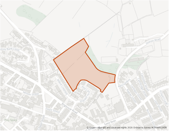
Site Size (ha) Gross: 2.03
Proposed Land Use: Housing
Minimum Development Capacity (Dwellings): 53
Site Type: Greenfield
Ward: Queensbury
Settlement: Queensbury
Ownership: Private
Delivery Timescale: Medium 2030-2035 (6-10)
Site Specific Requirements:
Design Principles
- Development should provide at least 53 dwellings and should form part of a high-quality built environment in line with Policies ST4 and DS1, at a net density of 35 dph in line with Policy HO2. This should include affordable housing (in line with Policy HO4) and an appropriate mix of dwellings (in line with Policy HO3 and having due regard to relevant housing needs evidence and the character of the area).
- A sensitive design and layout will be required taking into consideration the site's location within the setting of the Queensbury conservation area and a number of listed buildings, as well as its edge of settlement position and relationship with the wider landscape. Enhancements should be made to the surrounding Green Belt land including improvements to the adjacent public rights of way which may offer opportunities for residents to access the countryside.
Site Access, Highways and Transport
- Existing access off Station Road. There are footways and streetlights to the right of the existing access. There is also potential for a secondary access off Sharket Head Close.
Flooding, Water and Drainage
- The site was included in the Level 1 Strategic Flood Risk Assessment, however no further risk assessment has been carried out. The site is wholly located within Flood Zone 1 of the Environment Agency's (EA) Flood Map for Planning which indicates it is at low risk of flooding from rivers. Development should be possible at this site given the low fluvial and very low surface water flood risk to the site.
Natural and Historic Environment
- The site lies within Zone C (Recreational Pressure) - Residential development resulting in a net increase in dwellings will be required to mitigate any recreational pressure on the SPA/SAC caused by such development in accordance with the South Pennine Moors SPD and Policy NE3.
- The site is not identified in the LNRS as a priority area for nature recovery.
- There are trees which are protected by Tree Preservation Orders located along the northeastern and eastern boundaries of the site. The design and layout of any development should ensure these trees are preserved and enhanced in line with Policy NE6. An arboricultural survey should be provided as part of any planning application.
- A Heritage Impact Assessment has been prepared for this site and indicates that its development is likely to result in some harm to the setting of Queensbury Conservation Area. This harm is likely to be less than substantial and must be weighed against the public benefits of development. It may be possible to mitigate some of the harm through careful consideration of design, scale and layout as well as incorporating well thought out landscaping within the site.
- Development of the site will need to be informed by and respond to nearby built form. It is likely that the layout, design and scale of dwellings within the site should take design cues from the nearby traditional and/or high quality buildings and that this should also be reflected in the materials. The height of development should not exceed two or possibly three storeys. Careful consideration of the landscape strategy including retention of the existing trees will be needed. It is also suggested that well placed additional landscaping be used around the north-western boundaries of the site to filter views from within the conservation area, across the site.
Environmental Protection
- The site contains a former landfill site. A Land Contamination Assessment – Phase 1 Report will be required as part of any planning application to determine any potential impacts. Impacts should be addressed in line with Policy CR2. Land stability issues should also be identified and appropriately addressed.
- The majority of the site is classed as Grade 4 on the Agricultural Land Classification (ALC).
- The site is within a Mineral Safeguarding Area (MSA) for coal and partly in a MSA for sandstone. A mineral resource assessment will be required as part of any planning application to determine the extent and availability of any coal or sandstone resource.
Open Space and Green / Blue Infrastructure
- Open space should be provided in line with Policy NE2, having regards to the standards set out in Appendix 11. The Open Space Assessment indicates that in Queensbury there is a need for increased provision of amenity greenspace, allotments, and play provision for both young and older children.
- The site is located within an area of low provision and high need for green and blue infrastructure. Development proposals should focus on the creation of carefully designed green and blue infrastructure to contribute towards site specific issues e.g. flood risk mitigation, urban cooling etc.
Landscape
- The site is within the Thornton, Queensbury and Wilsden Mixed Upland Pasture Landscape Character area/type (E1) where, despite the presence of local undulations which provide a sense of enclosure, the overwhelming perception of this landscape is one of elevation and exposure.
- The Landscape Sensitivity Assessment states that the most sensitive element of the site is its proximity to the Queensbury Conservation Area. The shelter belt of trees at the eastern and northern boundaries of the site should be retained to maintain existing screening from the adjacent Queensbury Conservation Area, and in longer distance views to the north. Additional planting could also be utilised to integrate the western edge of the development with the existing broadleaved shelterbelt (including in views from the adjacent PRoW). The historic drystone wall boundary should be retained, and restored where in degraded condition. Built form should use local materials, e.g. light sandstone to ensure it adheres with the wider character.
Other Constraints
- Consultation maybe required with Yorkshire Water in relation to water and waste water infrastructure which is present on part of the site.
Green Belt (and Golden Rules)
- This site has been removed from the Green Belt. Development on the site should be consistent with the “Golden Rules” set out in the NPPF in relation to affordable housing, necessary improvements to infrastructure and accessible green space provision.
Infrastructure Requirements
- Proportionate contributions to community infrastructure will be required, where appropriate, in line with Policies ID1 and ID2, and having regard to the Local Infrastructure Plan.
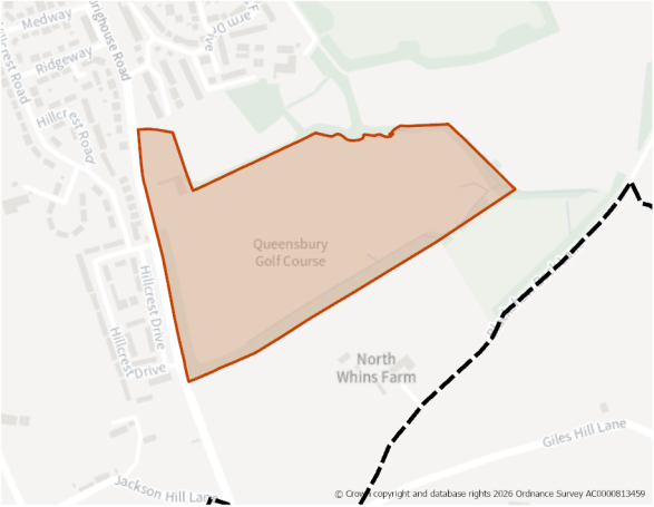
Site Size (ha) Gross: 10.76
Proposed Land Use: Housing
Minimum Development Capacity (Dwellings): 282
Site Type: Greenfield
Ward: Queensbury
Settlement: Queensbury
Ownership: Private
Delivery Timescale: Long 2035+ (11+)
Site Specific Requirements:
Design Principles
- Development should provide at least 282 dwellings and should form part of a high-quality built environment in line with Policies ST4 and DS1, at a net density of 35 dph in line with Policy HO2. This should include affordable housing (in line with Policy HO4) and an appropriate mix of dwellings (in line with Policy HO3 and having due regard to relevant housing needs evidence and the character of the area).
- A sensitive design and layout will be required taking into consideration the site's location on the edge of the settlement and proximity to agricultural uses. It will need to integrate existing green and blue infrastructure assets within the design, retaining trees and hedgerows. Enhancements should be made to the surrounding Green Belt land including improvements to the adjacent public rights of way which may offer opportunities for residents to access the countryside.
Site Access, Highways and Transport
- There is existing site access from Brighouse Road. Footways and street lights are present along the western side of this road. Given the proposed capacity of the site, a secondary access point will need to be provided.
Flooding, Water and Drainage
- A nominal flood risk assessment has been prepared for this site and shows that it indicates that development should be possible at this site given the low fluvial and very low surface water flood risk to the site. However, potential fluvial risk from Blackshaw Beck must be confirmed. Updated National Flood Risk mapping indicates that there are very small areas of Flood Zones 2, 3 and 3b along the northeastern and eastern part of the site following the path of Blackshaw Beck. The majority of the site is located in Flood Zone 1 of the Environment Agency's (EA) Flood Map for Planning which indicates it as at low risk of flooding from rivers. There should be no development within the existing area of functional floodplain present on site and the area of Flood Zone 2 and 3 should also be avoided unless it can pass the exception test.
- The site is not modelled to be at significant additional fluvial or surface water risk as a result of climate change. However, potential fluvial risk from Blackshaw Beck must be confirmed.
- Given the change in use and therefore vulnerability of the site, the FRA must show that the development can be designed to be safe and that there is adequate emergency planning provision (para 014 FRCC-PPG).
- Any FRA should include for a drainage strategy which includes the flow path in site design and investigate ground conditions for infiltration SuDS suitability.
Natural and Historic Environment
- The site lies within Zone C (Recreational Pressure) - Residential development resulting in a net increase in dwellings will be required to mitigate any recreational pressure on the SPA/SAC caused by such development in accordance with the South Pennine Moors SPD and Policy NE3.
- There are a number of trees which are protected by Tree Preservation Orders located along all the site boundaries. The design and layout of any development should ensure these trees are preserved and enhanced in line with Policy NE6. An arboricutural survey should be provided as part of any planning application.
- The site is located within a bat alert area and also includes areas of grassland and woodland which are part of the Bradford Habitat Network. Development proposals should respond positively to the assets which make up the networks, including the retention of trees which bound the site. An ecological survey will be required as part of any planning application to establish the extent/impacts as well as to identify appropriate mitigation.
- Littlemoor Local Nature Reserve is in close proximity to the site, with development providing opportunities to contribute to its enhancement.
- The site is identified in the LNRS with preferred measure B4_M02: Significantly boost biodiversity wherever possible where there are existing habitats alongside transport infrastructure.
Environmental Protection
- Part of the southern extent of the site is within the 250m buffer of a former landfill site. Impacts should be addressed in line with Policy CR2.
- The site is within a Mineral Safeguarding Area (MSA) for coal and partly in a MSA for sandstone. A mineral resource assessment will be required as part of any planning application to determine the extent and availability of any coal or sandstone resource.
Open Space and Green / Blue Infrastructure
- This site currently comprises of Queensbury Golf Course. The redevelopment of the site would result in the loss of this recreation open space. Replacement provision, or enhancement to other facilities within the District should be made to mitigate its loss. Open space should be provided on-site in line with Policy NE2, having regards to the standards set out in Appendix 11. The Open Space Assessment indicates that in Queensbury there is a need for increased provision of amenity greenspace, allotments, and play provision for both young and older children.
- The site is identified as being within an area of low provision and low need for green and blue infrastructure. However, development in this location may increase the need going forward, therefore development proposals should focus on creation of new green and blue infrastructure. There is opportunity in this location to improve existing assets which are located close by.
Landscape
- The site is within the Thornton, Queensbury and Wilsden Mixed Upland Pasture Landscape Character area/type (E1) where, despite the presence of local undulations which provide a sense of enclosure, the overwhelming perception of this landscape is one of elevation and exposure.
- The Landscape Sensitivity Assessment states that mature broadleaved trees along the site boundaries and in its interior provide a soft green edge to the settlement and in combination with Foster Park to the north, provide a parkland setting to this corner of the settlement. This tree cover should be retained to help integrate any new development into the landscape. Concentrate new development within the western section of the site, maintaining distance from and a buffer to the more sensitive Littlemoor Park (Foster Park) to the north.
Green Belt (and Golden Rules)
- This site has been removed from the Green Belt. Development on the site should be consistent with the “Golden Rules” set out in the NPPF in relation to affordable housing, necessary improvements to infrastructure and accessible green space provision.
Infrastructure Requirements
- Proportionate contributions to community infrastructure will be required, where appropriate, in line with Policies ID1 and ID2, and having regard to the Local Infrastructure Plan.
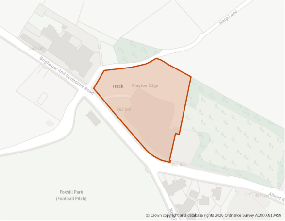
Site Size (ha) Gross: 0.70
Proposed Land Use: Housing
Minimum Development Capacity (Dwellings): 22
Site Type: Greenfield
Ward: Queensbury
Settlement: Queensbury
Ownership: Private
Delivery Timescale: Long 2035+ (11+)
Site Specific Requirements:
Design Principles
- Development should provide at least 22 dwellings and should form part of a high-quality built environment in line with Policies ST4 and DS1, at a net density of 35 dph in line with Policy HO2. This should include affordable housing (in line with Policy HO4) and an appropriate mix of dwellings (in line with Policy HO3 and having due regard to relevant housing needs evidence and the character of the area).
- A sensitive design and layout will be required which responds to the site's location on the edge of the settlement, its elevated position and its relationship with the wider landscape. This should include appropriate landscaping, incorporating trees to reinforce the settlement edge. Enhancements should be made to the surrounding Green Belt land including improvements to the adjacent public rights of way which may offer opportunities for residents to access the countryside.
Site Access, Highways and Transport
- A new access will be required. This would be from Albert Road, where footways and street lighting are present. Consideration should be given as to whether the site could be developed together with the adjacent allocation H869 and whether a shared access could be secured.
Flooding, Water and Drainage
- The site was included in the Level 1 Strategic Flood Risk Assessment, however no further risk assessment has been carried out. The site is wholly located within Flood Zone 1 of the Environment Agency's (EA) Flood Map for Planning which indicates it is at low risk of flooding from rivers. Development should be possible at this site given the low fluvial and very low surface water flood risk to the site.
Natural and Historic Environment
- The site lies within Zone C (Recreational Pressure) - Residential development resulting in a net increase in dwellings will be required to mitigate any recreational pressure on the SPA/SAC caused by such development in accordance with the South Pennine Moors SPD and Policy NE3.
- The site is identified in the LNRS with preferred measure T2_M04: Extend and connect tree and woodland cover across the White Rose Forest area in West Yorkshire.
Environmental Protection
- The site is within 150m of a former landfill site. A Land Contamination Assessment – Phase 1 Report will be required as part of any planning application to determine any potential impacts. Impacts should be addressed in line with Policy CR2.
- The majority of the site is classed as Grade 4 on the Agricultural Land Classification (ALC).
Open Space and Green / Blue Infrastructure
- Open space should be provided in line with Policy NE2, having regards to the standards set out in Appendix 11. The Open Space Assessment indicates that in Queensbury there is a need for increased provision of parks and gardens, outdoor sports space and play provision for both young and older children.
- The site is partly within an area of low provision and low need for green and blue infrastructure. However, development in this location may increase the need going forward, therefore development proposals should focus on creation of new green and blue infrastructure.
Landscape
- The site is within the Thornton, Queensbury and Wilsden Mixed Upland Pasture Landscape Character area/type (E1) where, despite the presence of local undulations which provide a sense of enclosure, the overwhelming perception of this landscape is one of elevation and exposure.
- The Landscape Sensitivity Assessment states that existing hedgerows should be maintained, and boundary tree planting reinforced to filter views from the adjacent bridleway on Harp Lane.
Green Belt (and Golden Rules)
- The site has been removed from the Green Belt. Development on the site should be consistent with the “Golden Rules” set out in the NPPF in relation to affordable housing, necessary improvements to infrastructure and accessible green space provision.
Infrastructure Requirements
- Proportionate contributions to community infrastructure will be required, where appropriate, in line with Policies ID1 and ID2, and having regard to the Local Infrastructure Plan.
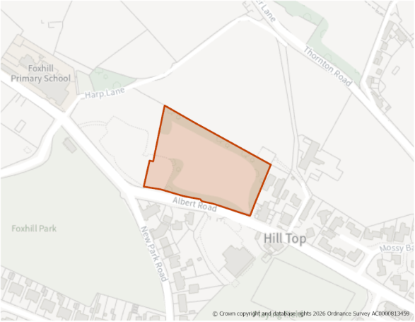
Site Size (ha) Gross: 0.97
Proposed Land Use: Housing
Minimum Development Capacity (Dwellings): 47
Site Type: PDL
Ward: Queensbury
Settlement: Queensbury
Ownership: Private
Delivery Timescale: Medium 2030-2035 (6-10)
Site Specific Requirements:
Design Principles
- Development should provide at least 47 dwellings and should form part of a high-quality built environment in line with Policies ST4 and DS1. This should include affordable housing (in line with Policy HO4) and an appropriate mix of dwellings (in line with Policy HO3 and having due regard to relevant housing needs evidence and the character of the area).
- A sensitive design and layout will be required reflecting the location of the site on the edge of the settlement and its interactions with the wider landscape to the north.
Site Access, Highways and Transport
- A new access could be created in the centre of the frontage of the site on Albert Road. There are footways and streetlighting present on this street. Consideration should be given as to whether the site could be developed together with the adjacent allocation H868 and whether a shared access could be secured.
Flooding, Water and Drainage
- The site was included in the Level 1 Strategic Flood Risk Assessment, however no further risk assessment has been carried out. The site is wholly located within Flood Zone 1 of the Environment Agency's (EA) Flood Map for Planning which indicates it is at low risk of flooding from rivers. Development should be possible at this site given the low fluvial and very low surface water flood risk to the site.
Natural and Historic Environment
- The site lies within Zone C (Recreational Pressure) - Residential development resulting in a net increase in dwellings will be required to mitigate any recreational pressure on the SPA/SAC caused by such development in accordance with the South Pennine Moors SPD and Policy NE3.
- The site is identified in the LNRS with preferred measure B4_M02: Significantly boost biodiversity wherever possible where there are existing habitats alongside transport infrastructure.
Environmental Protection
- The northeastern half of the site contains a former landfill site and the remainder is within 150m. The site was also formerly occupied by a car repair and sales garage. A Land Contamination Assessment – Phase 1 Report will be required as part of any planning application to determine any potential impacts. Impacts should be addressed in line with Policy CR2. Land stability issues should also be identified and appropriately addressed.
- The majority of the site is classed as Grade 4 on the Agricultural Land Classification (ALC).
Open Space and Green / Blue Infrastructure
- Open space should be provided in line with Policy NE2, having regards to the standards set out in Appendix 11. The Open Space Assessment indicates that in Queensbury there is a need for increased provision of amenity greenspace, allotments, and play provision for both young and older children.
- The site is partly within an area of low provision and low need for green and blue infrastructure. However, development in this location may increase the need going forward, therefore development proposals should focus on creation of new green and blue infrastructure.
Landscape
- The site is within the Thornton, Queensbury and Wilsden Mixed Upland Pasture Landscape Character area/type (E1) where, despite the presence of local undulations which provide a sense of enclosure, the overwhelming perception of this landscape is one of elevation and exposure. The site is within the settlement and no landscape sensitivity assessment was undertaken for this site. Consideration should be given to the guidance set out in the Landscape Character Assessment SPD.
Infrastructure Requirements
- Proportionate contributions to community infrastructure will be required, where appropriate, in line with Policies ID1 and ID2, and having regard to the Local Infrastructure Plan.
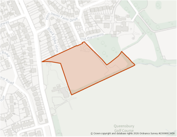
Site Size (ha) Gross: 1.43
Proposed Land Use: Housing
Minimum Development Capacity (Dwellings): 45
Site Type: Greenfield
Ward: Queensbury
Settlement: Queensbury
Ownership: Private
Delivery Timescale: Medium 2030-2035 (6-10)
Site Specific Requirements:
Design Principles
- Development should provide at least 45 dwellings as part of a high-quality built environment in line with Policies ST4 and DS1, at a net density of 35 dph in line with Policy HO2. This should include affordable housing (in line with Policy HO4) and an appropriate mix of dwellings (in line with Policy HO3 and having due regard to relevant housing need evidence and the character of the area).
- A sensitive design and layout will be required taking into consideration the key constraints of the adjacent protected trees and wider wildlife habitat network. A landscaping scheme will need to be provided, integrating important on-site and adjacent environmental assets. Enhancements to the surrounding Green Belt land should be made, including improving connections to offer opportunities for residents to access the countryside.
Site Access, Highways and Transport
- A new access will need to be provided off Harrowins Farm Drive / The Harrowins. There are footways and streetlights present on these roads. Conisderation should also be given to accessing the site from the adjacent housing allocation (Site H866) where there may be opportunity to provide an alternative access point.
Flooding, Water and Drainage
- A nominal flood risk assessment has been prepared for this site and shows that it is wholly located within Flood Zone 1 of the Environment Agency's (EA) Flood Map for Planning which indicates it is at low risk of flooding from rivers. Development should be possible at this site given the low fluvial and very low surface water flood risk to the site.
- Given the change in use and therefore vulnerability of the site, the FRA must show that the development can be designed to be safe and that there is adequate emergency planning provision.
- Any FRA should include a drainage strategy which should investigate ground conditions for infiltration SuDS suitability.
Natural and Historic Environment
- The site lies within Zone C (Recreational Pressure) - Residential development resulting in a net increase in dwellings will be required to mitigate any recreational pressure on the SPA/SAC caused by such development in accordance with the South Pennine Moors SPD and Policy NE3.
- The site is identified in the LNRS with preferred measure B4_M02: Significantly boost biodiversity wherever possible where there are existing habitats alongside transport infrastructure.
- The site is surrounded on three sides by substantial trees which are protected by Tree Preservation Orders. The design and layout of any development should ensure these trees are preserved and enhanced in line with Policy NE6. An arboricutural survey should be provided as part of any planning application.
- The site is located within a bat alert area and also within the grassland and woodland Wildlife Habitat Networks. Development proposals should respond positively to the assets which make up the networks, including the retention of trees which bound the site. An ecological survey will be required as part of any planning application to establish the extent/impacts as well as to identify appropriate mitigation.
Environmental Protection
- The site is within a Mineral Safeguarding Area (MSA) for coal and partly in a MSA for sandstone. A mineral resource assessment will be required as part of any planning application to determine the extent and availability of any coal or sandstone resource.
Open Space and Green / Blue Infrastructure
- Open space should be provided in line with Policy NE2, having regards to the standards set out in Appendix 11. The Open Space Assessment indicates that in Queensbury there is a need for increased provision of amenity greenspace, allotments, and play provision for both young and older children.
- The site is identified as being within an area of low provision and low need for green and blue infrastructure. However, development in this location may increase the need going forward, therefore development proposals should focus on creation of new green and blue infrastructure. There is opportunity in this location to improve existing assets which are located close by.
Landscape
- The site is within the Thornton, Queensbury and Wilsden Mixed Upland Pasture Landscape Character area/type (E1) where, despite the presence of local undulations which provide a sense of enclosure, the overwhelming perception of this landscape is one of elevation and exposure. The site is directly adjacent to the settlement, well enclosed by existing development and trees. No landscape sensitivity assessment was undertaken for this site. Consideration should be given to the guidance set out in the Landscape Character Assessment SPD.
Green Belt (and Golden Rules)
- The site has been removed from the Green Belt. Development on the site should be consistent with the “Golden Rules” set out in the NPPF in relation to affordable housing, necessary improvements to infrastructure and accessible green space provision.
Infrastructure Requirements
- Proportionate contributions to community infrastructure will be required, where appropriate, in line with Policies ID1 and ID2, and having regard to the Local Infrastructure Plan.
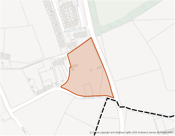
Site Size (ha) Gross: 1.29
Proposed Land Use: Housing
Minimum Development Capacity (Dwellings): 41
Site Type: Greenfield
Ward: Queensbury
Settlement: Queensbury
Ownership: Private
Delivery Timescale: Long 2035+ (11+)
Site Specific Requirements:
Design Principles
- Development should provide at least 41 dwellings as part of a high-quality built environment in line with Policies ST4 and DS1, at a net density of 35 dph in line with Policy HO2. This should include affordable housing (in line with Policy HO4) and an appropriate mix of dwellings (in line with Policy HO3 and having due regard to relevant housing need evidence and the character of the area).
- A sensitive design and layout will be required taking into consideration the site's location on the edge of the settlemennt as well as the proximity to agricultural uses. The site provides a gateway into Queensbury and its development present an opportunity to enhance the initial impression of the town. It will be important to given careful consideration to the positioning of buildings along the road frontage and use of natural materials which reflect the historic nature of the town. Enhancements should be made to the surrounding Green Belt land including improvements to the adjacent public rights of way which may offer opportunities for residents to access the countryside.
Site Access, Highways and Transport
- A new access would need to be created off Brighouse Road. There are footways and street lights along the frontage of this site on Brighouse Road.
Flooding, Water and Drainage
- The site was included in the Level 1 Strategic Flood Risk Assessment, however no further risk assessment has been carried out. The site is wholly located within Flood Zone 1 of the Environment Agency's (EA) Flood Map for Planning which indicates it is at low risk of flooding from rivers. Development should be possible at this site given the low fluvial and very low surface water flood risk to the site.
Natural and Historic Environment
- The site lies within Zone C (Recreational Pressure) - Residential development resulting in a net increase in dwellings will be required to mitigate any recreational pressure on the SPA/SAC caused by such development in accordance with the South Pennine Moors SPD and Policy NE3.
- The site is located within a bat alert area and adjacent to the grassland Wildlife Habitat Network. An ecological survey will be required as part of any planning application to establish the extent/impacts as well as to identify appropriate mitigation.
- Parts of the site are identified in the LNRS with the following preferred measures B2_M01: Create and maintain habitat corridors and stepping stones to connect and extend existing blue and green places; and U1_M01: Fully restore the hydrology of all peatlands.
Environmental Protection
- Telecommunication cables pass through the centre of the site from east to west.
- The site is within a Mineral Safeguarding Area (MSA) for coal and partly in a MSA for sandstone. A mineral resource assessment will be required as part of any planning application to determine the exten and availability of any coal or sandstone resource.
- The majority of the site is classed as Grade 4 on the Agricultural Land Classification (ALC).
Open Space and Green / Blue Infrastructure
- Open space should be provided in line with Policy NE2, having regards to the standards set out in Appendix 11. The Open Space Assessment indicates that in Queensbury there is a need for increased provision of amenity greenspace, allotments, and play provision for both young and older children.
- The site is within an area of moderate provision and low need for green and blue infrastructure. However, development in this location may increase the need going forward, therefore development proposals should focus on enhancing and improving existing assets as well as the creation of new green and blue infrastructure.
Landscape
- The site is within the Thornton, Queensbury and Wilsden Mixed Upland Pasture Landscape Character area/type (E1) where, despite the presence of local undulations which provide a sense of enclosure, the overwhelming perception of this landscape is one of elevation and exposure. The site is directly adjacent to the settlement and provides a gateway which transistions from a more rural landscape to the urban area. No landscape sensitivity assessment was undertaken for this site.
Green Belt (and Golden Rules)
- The site has been removed from the Green Belt. Development on the site should be consistent with the “Golden Rules” set out in the NPPF in relation to affordable housing, necessary improvements to infrastructure and accessible green space provision.
Infrastructure Requirements
- Proportionate contributions to community infrastructure will be required, where appropriate, in line with Policies ID1 and ID2, and having regard to the Local Infrastructure Plan.
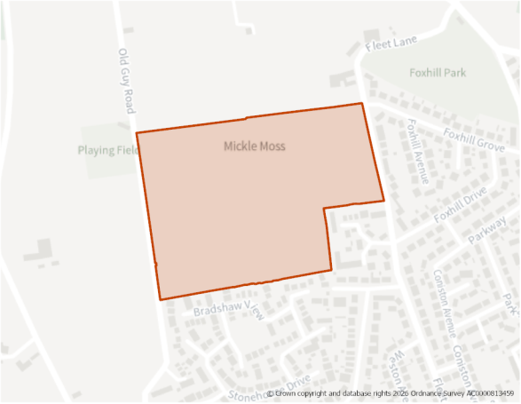
Site Size (ha) Gross: 11.00
Proposed Land Use: Housing
Minimum Development Capacity (Dwellings): 295
Site Type: Greenfield
Ward: Queensbury
Settlement: Queensbury
Ownership: Private
Delivery Timescale: Short 2025- 2030 (1-5)
Site Specific Requirements:
Design Principles
- Development should provide at least 295 dwellings as part of a high-quality built environment in line with Policies ST4 and DS1, at a net density of 35 dph in line with Policy HO2. This should include affordable housing (in line with Policy HO4) and an appropriate mix of dwellings (in line with Policy HO3 and having due regard to relevant housing need evidence and the character of the area).
- A sensitive design and layout will be required taking into consideration the site's location on the edge of the settlement, proximity to agricultural uses and its elevated position in the landcape.
- Enhancements should be made to the surrounding Green Belt land including improvements to the adjacent public rights of way which may offer opportunities for residents to access the countryside.
Site Access, Highways and Transport
- A new access is required off Old Guy Road and Fleet Lane.
Flooding, Water and Drainage
- A nominal flood risk assessment has been prepared for this site and shows that it is wholly located within Flood Zone 1 of the Environment Agency's (EA) Flood Map for Planning which indicates it as at low risk of flooding from rivers. The proposed development would see a change in the risk classification from less vulnerable to more vulnerable, according to the NPPF. Given the change in use and therefore vulnerability of the site, the FRA must show that the development can be designed to be safe and that there is adequate emergency planning provision (para 014 FRCC-PPG).
- Development should be possible at this site given the low fluvial and very low surface water flood risk to the site. The site is not modelled to be at significant additional fluvial or surface water risk as a result of climate change. Any FRA should include for a drainage strategy which includes the ponded areas and flow path in site design.
Natural and Historic Environment
- The site lies within Zone C (Recreational Pressure) - Residential development resulting in a net increase in dwellings will be required to mitigate any recreational pressure on the SPA/SAC caused by such development in accordance with the South Pennine Moors SPD and Policy NE3.
- A small part of the site is identified in the LNRS with the preferred measure U1_M01: Fully restore the hydrology of all peatlands.
Environmental Protection
- Records indicate that the site contains a former landfill site. A Land Contamination Assessment – Phase 1 Report will be required as part of any planning application to determine any potential impacts. Impacts should be addressed in line with Policy CR2.
- The majority of the site is classed as Grade 4 on the Agricultural Land Classification (ALC).
- The site is within a Mineral Safeguarding Area (MSA) for coal and partly in a MSA for sandstone. A mineral resource assessment will be required as part of any planning application to determine the extent and availability of any coal or sandstone resource.
Open Space and Green / Blue Infrastructure
- Open space should be provided in line with Policy NE2, having regards to the standards set out in Appendix 11. The Open Space Assessment indicates that in Queensbury there is a need for increased provision of amenity greenspace, allotments, and play provision for both young and older children.
- The site is within an area of low provision and low need for green and blue infrastructure. However, development in this location may increase the need going forward, therefore development proposals should focus on creation of new green and blue infrastructure. There is opportunity in this location to improve existing assets which are located close by.
Landscape
- The site is within the Thornton, Queensbury and Wilsden Mixed Upland Pasture Landscape Character area/type (E1) where, despite the presence of local undulations which provide a sense of enclosure, the overwhelming perception of this landscape is one of elevation and exposure.
- The Landscape Sensitivity Assessment states that sensitive elements of the site include the distinctive rectilinear field pattern and the presence of PRoW. Retain existing drystone walls where possible. In this exposed plateau location woodland could be perceived as out of character and should therefore not be used in the location to soften development. It is recommended that any new development be limited to the to the southern extent of the site to retain the undeveloped gap between Queensbury and Mountain and avoid impinging on the PRoW network.
Green Belt (and Golden Rules)
- The site has been removed from the Green Belt. Development on the site should be consistent with the “Golden Rules” set out in the NPPF in relation to affordable housing, necessary improvements to infrastructure and accessible green space provision.
Infrastructure Requirements
- Proportionate contributions to community infrastructure will be required, where appropriate, in line with Policies ID1 and ID2, and having regard to the Local Infrastructure Plan.
Planning Permission
- This site benefits from planning permission for the construction of 295 dwellings, open space, landscaping, and associated infrastructure (25/00842/MAF). This permission was granted after 1 April 2025 (the base date for the Local Plan). Accordingly, it has been identified as a site allocation.
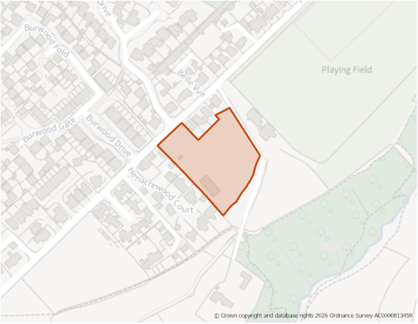
Site Size (ha) Gross: 0.69
Proposed Land Use: Housing
Minimum Development Capacity (Dwellings): 22
Site Type: Greenfield
Ward: Queensbury
Settlement: Queensbury
Ownership: Private
Delivery Timescale: Medium 2030-2035 (6-10)
Site Specific Requirements:
Design Principles
- Development should provide at least 22 dwellings and should form part of a high-quality built environment in lime with Policies ST4 and DS1, at a net density of 35 dph in line with Policy HO2. This should include affordable housing (in line with Policy HO4) and an appropriate mix of dwellings (in line with Policy HO3 and having due regard to relevant housing needs evidence and the character of the area).
- A sensitive design and layout will be required taking into consideration the site's location on the edge of the settlement, its proximity to the nearby by argicultural uses and wider countryside. This should include an appropriate landscaping scheme to create a defined edge to the settlement. Enhancements should be made to the surrounding Green Belt land including improvements to the adjacent public rights of way which may offer opportunities for residents to access the countryside.
Site Access, Highways and Transport
- A new access will need to be created off Long Lane. There are footways and streetlights present on this highway.
Flooding, Water and Drainage
- A nominal flood risk assessment has been prepared for this site and shows that it is wholly located within Flood Zone 1 of the Environment Agency's (EA) Flood Map for Planning which indicates it as at low risk of flooding from rivers. Development should be possible at this site given the low fluvial and very low surface water flood risk to the site.
- The proposed development would see a change in the risk classification from less vulnerable to more vulnerable, according to the NPPF. Given the change in use and therefore vulnerability of the site, the FRA must show that the development can be designed to be safe and that there is adequate emergency planning provision.
- The site is not modelled to be at significant additional fluvial or surface water risk as a result of climate change, however the flow path through the centre of the site in the long term should be maintained within site design. Any FRA should include for a drainage strategy which includes the flow path in site design and investigate ground conditions for infiltration SuDS suitability.
Natural and Historic Environment
- The site lies within Zone C (Recreational Pressure) of the South Pennine Moors SPA/SAC - Residential development resulting in a net increase in dwellings will be required to mitigate any recreational pressure on the SPA/SAC caused by such development in accordance with the South Pennine Moors SPD and Policy NE3.
- The site is located within a bat alert area, is adjacent to the Shibden Head Local Wildlife Site, and the grassland Wildlife Habitat Network. Development proposals should respond positively to these assets. An ecological survey will be required as part of any planning application to establish the extent/impacts as well as to identify appropriate mitigation.
- The site is not identified in the LNRS as a priority area for nature recovery.
Environmental Protection
- The site contains a former landfill site and there are records of quarrying activity. A Land Contamination Assessment – Phase 1 Report will be required as part of any planning application to determine any potential impacts. Impacts should be addressed in line with Policy CR2. Land stability issues should also be identified and appropriately addressed.
Open Space and Green / Blue Infrastructure
- Open space should be provided in line with Policy NE2, having regards to the standards set out in Appendix 11. The Open Space Assessment indicates that in Queensbury there is a need for increased provision of amenity greenspace, allotments, and play provision for both young and older children.
- The site is located in an area with moderate to high provision, and moderate need, for green and blue infrastructure. Development proposals should focus on the protection and enhancement of these assets.
Landscape
- The site is within the Thornton, Queensbury and Wilsden Mixed Upland Pasture Landscape Character area/type (E1) where, despite the presence of local undulations which provide a sense of enclosure, the overwhelming perception of this landscape is one of elevation and exposure.
- The Landscape Sensitivity Assessment states that the most sensitive elements of the site are its elevated location above Shibden Dale and the adjacent PRoW which provide access into this wooded valley from Queensbury. Tree planting could be utilised to help soften the settlement edge in longer distance views from the south-east (as per adjacent development) and mitigate impacts on recreational users of the PRoW.
Green Belt (and Golden Rules)
- The site has been removed from the Green Belt. Development on the site should be consistent with the "Golden Rules" set out in the NPPF in relation to affordable housing, necessary improvements to infrastructure and accessible gree space provision.
Infrastructure Requirements
- Proportionate contributions to community infrastructure will be required, where appropriate, in line with Policies ID1 and ID2, and having regard to the Local Infrastructure Plan.
H1358: Old Mill Dam Lane, Queensbury Comment
Site Boundary:
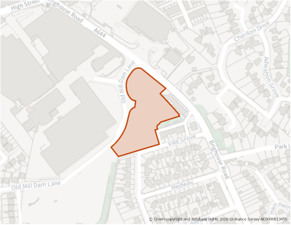
Site Size (ha) Gross: 0.74
Proposed Land Use: Housing
Minimum Development Capacity (Dwellings): 23
Site Type: Greenfield
Ward: Queensbury
Settlement: Queensbury
Ownership: Private
Delivery Timescale: Medium 2030-2035 (6-10)
Site Specific Requirements:
Design Principles
- Development should aim to provide at least 23 dwellings taking account of the heritage constraints adjacent to the site. The development should form part of a high-quality built environment in line with Policies ST4 and DS1, at a net density of 35 dph in line with Policy HO2. This should include affordable housing (in line with Policy HO4) and an appropriate mix of dwellings (in line with Policy HO3 and having due regard to relevant housing needs evidence and the charaacter of the area).
- This site is particularly sensitive as it forms part of the setting of the Grade II Listed Black Dyke Mills. The design of any new development will need to use appropriate materials and ensure a suitable landscaped buffer is provided in the northwest part of the site to protect and enhance the views of the important heritage asset. Depending on the design of the scheme a reduced capacity may be necessary.
Site Access, Highways and Transport
- There is an existing access off Old Mill Dam Lane, there are footways and streetlights present on this road.
Flooding, Water and Drainage
- A nominal flood risk assessment has been prepared for this site and shows that it is wholly located within Flood Zone 1 of the Environment Agency's (EA) Flood Map for Planning which indicates it as at low risk of flooding from rivers. Development should be possible at this site given the low fluvial and very low surface water flood risk to the site. Any FRA should include a drainage strategy which looks at the surface water flow path as part of the site design and investigate ground conditions for infiltration SuDS suitability.
Natural and Historic Environment
- The site lies within Zone C (Recreational Pressure) of the South Pennine Moors SPA/SAC - Residential development resulting in a net increase in dwellings will be required to mitigate any recreational pressure on the SPA/SAC caused by such development in accordance with the South Pennine Moors SPD and Policy NE3.
- There are trees protected by Tree Preservation Orders on the northern and eastern boundaries of the site. The design and layout of any development should ensure these trees are preserved and enhanced in line with Policy NE6. An arboricutural study should be provided as part of any planning application.
- The site is located within a bat alert area. An ecological survey will be required as part of any planning application to establish the extent/impacts as well as to identify appropriate mitigation.
- The site is identified in the LNRS with preferred measureG1_M03: Significantly enhance the biodiversity of remaining unimproved and species-rich semi-improved grasslands.
- The site is located adjacent to the Grade II Listed Black Dyke Mills. A Heritage Impact Assessment (HIA) has been carried out for this site and indicates that its development would result in harm of an unacceptable level as there is limited opportunity to effectively mitigate the resulting impact of development on the designated heritage asset.
- However, the wider public and sustainability benefits provided by the sensitive re-development of the site are such that its allocation in the plan is considered a necessary part of the development strategy for the settlement. A more detailed HIA for the specific proposed scheme will need to be carried out at the planning application stage, working closely with the Council’s Heritage team to develop appropriate mitigation measures to reduce the harm as much as is possible.
- It is considered that there is some opportunity within the site for development provided that it is located in the eastern part of the site and a sufficient buffer is provided to enable the setting of the Grade II Listed Black Dyke Mills to be protected and appreciated from Brighouse Road. However, the views from the elevated ground at Vale Grove are also important, and the land levels would need to be regraded to ensure the resulting development would not obscure these views. Views across to the mill buildings should be protected with careful consideration being given to the position, scale and size of the new dwellings.
Environmental Protection
- The site includes a series of earth mounds, partially formed from previous development works. A regrading of the land may be required to create suitable development platforms.
- There are records of part of the site being part of a former landfill site, with the remainder being within 150m of the site landfill site. A Land Contamination Assessment – Phase 1 Report will be required as part of any planning application to determine any potential impacts. Impacts should be addressed in line with Policy CR2.
Open Space and Green / Blue Infrastructure
- The site is part of an area of amenity open space and replacement provision or improvements should be made through new development. Open space should be provided in line with Policy NE2, having regards to the standards set out in Appendix 11. The Open Space Assessment indicates that in Queensbury there is a need for increased provision of amenity greenspace, allotments, and play provision for both young and older children.
- The site is partly within an area of low provision and high need for green and blue infrastructure. Development proposals should focus on the creation of carefully designed green and blue infrastructure to contribute towards site specific issues e.g. flood risk mitigation, urban cooling, etc.
Landscape
- The site is within the Thornton, Queensbury and Wilsden Mixed Upland Pasture Landscape Character area/type (E1) where, despite the presence of local undulations which provide a sense of enclosure, the overwhelming perception of this landscape is one of elevation and exposure. The site is within the settlement and no landscape sensitivity assessment was undertaken for this site. Consideration should be given to the guidance set out in the Landscape Character Assessment SPD.
Infrastructure Requirements
- Proportionate contributions to community infrastructure will be required, where appropriate, in line with Policies ID1 and ID2, and having regard to the Local Infrastructure Plan.
POLICY TH1 – THORNTON Comment
Settlement Plan
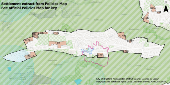
Settlement Hierarchy and Spatial Directions
- The village boundary is defined on the policies map. The focus for sustainable development of this large, linear village reflects its function and character balanced against heritage and environmental constraints, as well as its proximity to the Regional City of Bradford.
Meeting Growth Needs
- Housing development includes a combination of development within the settlement boundary and land to be released from the Green Belt during the plan period and will:
- Deliver approximately 621 dwellings through a combination of sites under construction, planning permissions and new site allocations as set out in Table TH1.1.
- Deliver housing site allocations as shown on the policies map and section 5:
- H1297: Old Road, Thornton
- H1301: North Cliffe Lane, Thornton
- H1316: Land north of Close Head Lane, Thornton
- H1317: Hill Top Road (east), Thornton
- H1318: Hill Top Road (west), Thornton
- H1320: Thornton Road (2)
- H1321: Land south of Hill Top Road, Thornton
- H1323: Site of Dole and Prospect Mills, Thornton Road, Thornton
- H1324: Close Head Drive, Thornton
- H1351: Land north of Thornton Road, Thornton
Table TH1.1 - Thornton :
|
Under Construction |
Planning Permission |
Site Allocations |
|
|
Totals |
165 |
27 |
429 |
- Proposals for new homes within the settlement boundary on additional small sites, including the redevelopment of previously developed land, will be supported subject to meeting relevant Local Plan policies.
- Employment uses will continue to be supported at the Fireclay Business Park to the west of the settlement and within the village centre.
Local Services and Facilities
- Support the range and quality of uses within the designated Thornton Local Centre as a key hub for the community to meet their day-to-day retail and leisure needs, including the South Square Centre. Support the retention and improvement of local services and facilities.
- Protect and enhance designated open spaces and compliance with Policy NE2 and support proposals which address deficiencies in open space provision as set out on the Open Spaces Study, seeking to increase provision of amenity greenspace, allotments, and play areas.
- Maintain and enhance sport and recreation facilities with support for widened community access.
Landscape
- Maintain and enhance the landscape setting of the settlement within the character areas of Thornton, Queensbury and Wilsden Mixed Upland Pasture and Clayton Urban Edge Wooded Valleys and Slopes, and key landscape features, fields and overall settlement pattern.
Historic and Natural Environment
- Protect and enhance strategic green and blue networks and corridors including the Pitty & Clayton Becks Corridor to enhance biodiversity and recreation within and adjacent to the settlement as well as incorporating sufficient green space and connections within new developments.
- Protect and enhance the designated Local Wildlife Sites as well as habitat networks and priority habitats within and adjacent to the settlement. Development proposals should also pay particular attention to avoiding impact on the route of the Great Northern Trail including the viaduct, which includes priority habitats and is part of the wider habitat network.
- Where development is located within SPA/SAC Zone B (supporting habitat functionally linked land) residential development proposals must assess potential impacts on foraging habitat used by SPA qualifying species and provide ecological evidence where required, in accordance with the South Pennine Moors SPD and Policy NE3.
- Where development is located within SPA/SAC Zone C (recreational pressure) residential development resulting in a net increase in dwellings will be required to mitigate any recreational pressure on the SPA/SAC caused by such development in accordance with the South Pennine Moors SPD and Policy NE3.
- Ensure that future development conserves and enhances key heritage assets and their settings within and adjacent to the settlement including the Conservation Area and significant number (256) of Listed Buildings and Structures, including two Grade II* Listed buildings (74 Market Street, the birthplace of the Bronte Sisters and Thornton Hall), the Grade II Listed Thornton Viaduct and a wealth of non-designated heritage assets.
Local Infrastructure
- Support improvements and access to public transport and active travel, including enhanced links to Bradford and measures to reduce traffic congestion on Thornton Road.
- Proportionate contributions to new or enhanced community infrastructure will be required, where appropriate, in line with Policies ID1 and ID2, as well as having regard to the Local Infrastructure Plan.
Thornton: Site Allocations
H1297: Old Road, Thornton Comment
Site Boundary:
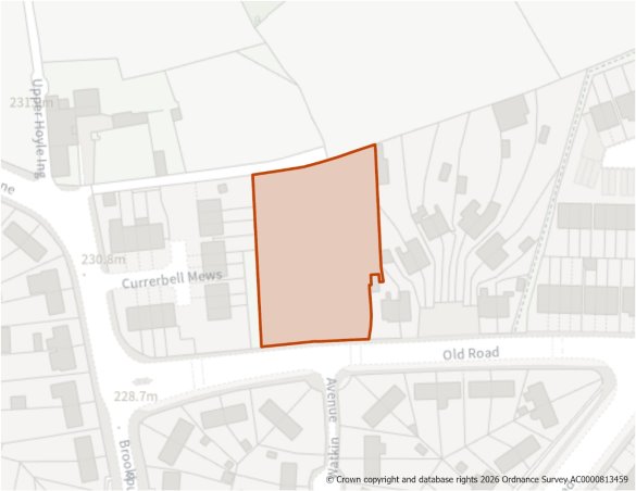
Site Size (ha) Gross: 0.29
Proposed Land Use: Housing
Minimum Development Capacity (Dwellings): 12
Site Type: PDL
Ward: Thornton & Allerton
Settlement: Thornton
Ownership: Private
Delivery Timescale: Short 2025- 2030 (1-5)
Site Specific Requirements:
Design Principles
- Development of this site should take place in line with the planning permission (23/02144/MAR).
Site Access, Highways and Transport
- There is an existing access from Old Road.
Natural and Historic Environment
- The site lies within Zone C (Recreational Pressure) - Residential development resulting in a net increase in dwellings will be required to mitigate any recreational pressure on the SPA/SAC caused by such development in accordance with the South Pennine Moors SPD and Policy NE3.
- The site is not identified in the LNRS as a priority area for nature recovery.
Open Space and Green / Blue Infrastructure
- Open space should be provided in line with Policy NE2, having regards to the standards set out in Appendix 11. The Open Space Assessment identifies a need to secure the provision of Amenity Greenspace within new developments, particularly where such provision can connect with existing open spaces and contribute to the wider Green Infrastructure network. The Assessment also highlights deficiencies in the provision of allotments and children's play areas within the settlement, which should be taken into account when considering opportunities for new open space provision.
- The site is located in an area which has low provision and moderate need for green and blue infrastructure. Development proposals should focus on green and blue infrastructure creation, carefully designed to contribute towards site-specific issues e.g. flood mitigation, urban cooling etc.
Landscape
- The site is located within the Thornton, Queensbury and Wilsden Mixed Upland Pasture Landscape Character area/type (E1), where despite the presence of local undulations which provide a sense of enclosure, the overwhelming perception of this landscape is one of elevation and exposure. The site is within the settlement and no landscape sensitivity assessment was undertaken for this site. Consideration should be given to the guidance set out in the Landscape Character Assessment SPD.
Infrastructure Requirements
- Proportionate contributions to community infrastructure will be required, where appropriate, in line with Policies ID1 and ID2, and having regard to the Local Infrastructure Plan.
Planning Permission
- The site benefits from planning permission for 12 dwellings with associated access and landscaping (23/02144/MAR) granted in May 2026. This was after 1 April 2025 (the base date for the Local Plan). Accordingly it has been identified as a site allocation.
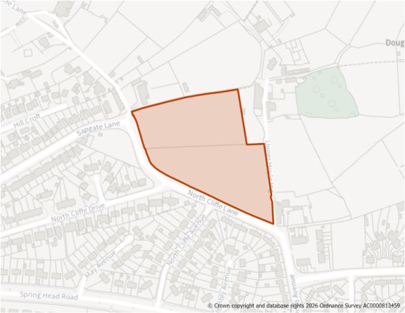
Site Size (ha) Gross: 1.97
Proposed Land Use: Housing
Minimum Development Capacity (Dwellings): 62
Site Type: Greenfield
Ward: Thornton & Allerton
Settlement: Thornton
Ownership: Private
Delivery Timescale: Medium 2030-2035 (6-10)
Site Specific Requirements:
Design Principles
- Development should provide at least 62 dwellings as part of a high-quality built environment in line with Policies ST4 and DS1, at a net density of 35 dph. This should include affordable housing (in line with Policy HO4) and an appropriate mix of dwellings (in line with Policy HO3) and having due regard relevant housing needs evidence and the character of the area.
- Development should be located within the western portion of the site, with an appropriate landscaped buffer provided to screen the development from the Grade II Listed Buildings (Grandage Gate Farm) adjacent to the eastern boundary.
- Trees within the south-eastern corner of the site should be retained and supplemented with additional planting. Given the site's topography, a sensitive design approach will be required to minimise impacts on drainage, the surrounding landscape, and green infrastructure assets. Enhancements should be made to the surrounding Green Belt land including improvements to the adjacent public rights of way which may offer opportunities for residents to access the countryside.
Site Access, Highways and Transport
- A new access will be required from North Cliffe Lane, where a footway and streetlights are present.
Flooding, Water and Drainage
- Across the east of the site (and an area to the west), groundwater levels are between 0.025m and 0.5m below the ground surface. There may be a risk of groundwater flooding to both surface and subsurface assets. There is the possibility of groundwater emerging at the surface locally.
Natural and Historic Environment
- The site lies within Zone C (Recreational Pressure) - Residential development resulting in a net increase in dwellings will be required to mitigate any recreational pressure on the SPA/SAC caused by such development in accordance with the South Pennine Moors SPD and Policy NE3.
- There are two trees on the southern tip of the site that are protected by Tree Preservation Orders (TPOs). The design and layout of any development should ensure these trees are preserved and enhanced in line with Policy NE6. An arboricutural survey should be provided as part of any planning application.
- The site is not identified in the LNRS as a priority area for nature recovery.
- A Heritage Impact Assessment has been carried out for this site and indicates that there is potential for the new development to be accommodated on the site however, any development to the eastern section closer to the listed buildings (Grandage Gate Farm and Hoyle Ing House) is likely to result in less than substantial harm (unacceptable). If sufficient mitigation measures are employed on the site, then the site except the eastern section of the site is likely to result in less than substantial harm (acceptable).
- The strengthening of landscaping along the boundaries to the east of the site (proximity to Grandage Gate Farm and Hoyle Ing House) with trees and buffer space, will help to generate a sense of separation and visual distinction from the designated assets and their setting. the development of the site will need to be informed by and respond to the surrounding high-quality development. Likely, the layout, design and scale of dwellings within the site should take design cues from the nearby traditional buildings and this should also be reflected in the materials. Design and materials should be of a very high quality. Careful consideration of the landscape strategy including retention of the existing trees will be needed. The existing stone boundary wall along the boundary with North Cliffe Lane and Upper Hoyle Ing should also be incorporated to ensure that this element of the rural character of the site is retained.
Environmental Protection
- The site is partially within a Mineral Safeguarding Area (MSA) for coal. A mineral resource assessment will be required as part of any planning application to determine the extent and availability of any coal resource.
- The majority of the site is classed as Grade 3b on the Agricultural Land Classification (ALC).
Open Space and Green / Blue Infrastructure
- Open space should be provided in line with Policy NE2, having regards to the standards set out in Appendix 11. The Open Space Assessment identifies a need to secure the provision of amenity greenspace within new developments, particularly where such provision can connect with existing open spaces and contribute to the wider Green Infrastructure network. The Assessment also highlights deficiencies in the provision of allotments and children's play areas within the settlement, which should be taken into account when considering opportunities for new open space provision.
- The site is located in an area which has low provision and moderate need for green and blue infrastructure. Development proposals should focus on green and blue infrastructure creation, carefully designed to contribute towards site-specific issues e.g. flood mitigation, urban cooling etc.
Landscape
- The site is located within the Thornton, Queensbury and Wilsden Mixed Upland Pasture Landscape Character area/type (E1), where despite the presence of local undulations which provide a sense of enclosure, the overwhelming perception of this landscape is one of elevation and exposure.
- The Landscape Sensitivity Assessment states that any development should be limited to the western extents of the site adjacent to North Cliffe Lane and existing development at Sapgate Lane/Cliffe Lane. This would help to maintain the gap between the settlement edge and the Grade II Listed Grandage Gate Farm and Upper Hoyle Ing Farm and minimise the extension of development into the rural hinterland of the Pitty Beck valley.
Green Belt (and Golden Rules)
- Site has been removed from the Green Belt. Development on the site should be consistent with the “Golden Rules” set out in the NPPF in relation to affordable housing, necessary improvements to infrastructure and accessible green space provision.
Infrastructure Requirements
- Proportionate contributions to community infrastructure will be required, where appropriate, in line with Policies ID1 and ID2, and having regard to the Local Infrastructure Plan.
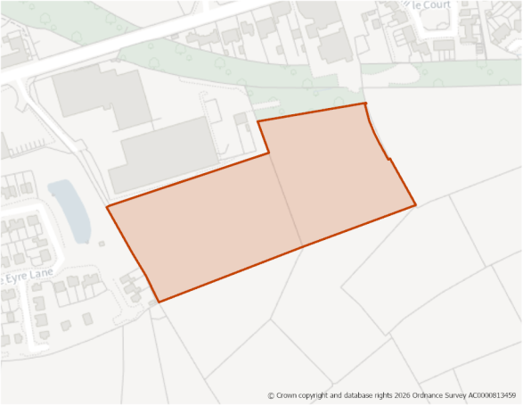
Site Size (ha) Gross: 2.41
Proposed Land Use: Housing
Minimum Development Capacity (Dwellings): 63
Site Type: Greenfield
Ward: Thornton & Allerton
Settlement: Thornton
Ownership: Private
Delivery Timescale: Long 2035+ (11+)
Site Specific Requirements:
Design Principles
- Development should provide at least 63 dwellings as part of a high-quality built environment in line with Policies ST4 and DS1, at a net density of 35 dph. This should include affordable housing (in line with Policy HO4) and an appropriate mix of dwellings (in line with Policy HO3) and having due regard relevant housing needs evidence and the character of the area.
- Enhancements should be made to the surrounding Green Belt land including improvements to the adjacent public rights of way which may offer opportunities for residents to access the countryside.
Site Access, Highways and Transport
- The site access is to be taken from Thornton Road.
Flooding, Water and Drainage
- A nominal flood risk assessment has been prepared for this site and shows that it is wholly located within Flood Zone 1 of the Environment Agency's (EA) Flood Map for Planning which indicates it as at low risk of flooding from rivers. Development should be possible at this site given the low fluvial and very low surface water flood risk to the site.
- The site is not modelled to be at significant additional fluvial or surface water risk as a result of climate change. Safe access and escape routes should be investigated further as part of a site-specific FRA. Routes may need to be raised above the existing surface water flow path along the northern boundary to allow surface water to flow naturally. Any FRA should include for a drainage strategy which includes the flow path in site design and investigate ground conditions for infiltration SuDS suitability.
Natural and Historic Environment
- The site lies within Zone B (Supporting Habitat/Functionally Linked Land) – Development proposals must assess potential impacts on foraging habitat used by SPA qualifying species and provide ecological evidence where required, in accordance with the South Pennine Moors SPD and Policy NE3.
- The site is located within a bat alert area. An ecological survey will be required as part of any planning application to establish the extent/impacts as well as to identify appropriate mitigation.
- The site is not identified in the LNRS as a priority area for nature recovery.
Environmental Protection
- The site located within the 150m buffer of a former landfill site. A Land Contamination Assessment – Phase 1 Report will be required as part of any planning application to determine any potential impacts. Impacts should be addressed in line with Policy CR2.
- The site is partially within a Mineral Safeguarding Area (MSA) for coal. A mineral resource assessment will be required as part of any planning application to determine the extent and availability of any coal resource.
- The majority of the site is classed as Grade 3b on the Agricultural Land Classification (ALC).
Open Space and Green / Blue Infrastructure
- Open space should be provided in line with Policy NE2, having regards to the standards set out in Appendix 11. The Open Space Assessment identifies a need to secure the provision of Amenity Greenspace within new developments, particularly where such provision can connect with existing open spaces and contribute to the wider Green Infrastructure network. The Assessment also highlights deficiencies in the provision of allotments and children's play areas within the settlement, which should be taken into account when considering opportunities for new open space provision.
- Green and blue infrastructure should be provided in line with Policy NE1.
Landscape
- The site is located within the Thornton, Queensbury and Wilsden Mixed Upland Pasture Landscape Character area/type (E1), where despite the presence of local undulations which provide a sense of enclosure, the overwhelming perception of this landscape is one of elevation and exposure. No landscape sensitivity assessment was undertaken for this site. Consideration should be given to the guidance set out in the Landscape Character Assessment SPD.
Green Belt (and Golden Rules)
- Site has been removed from the Green Belt. Development on the site should be consistent with the “Golden Rules” set out in the NPPF in relation to affordable housing, necessary improvements to infrastructure and accessible green space provision.
Infrastructure Requirements
- Proportionate contributions to community infrastructure will be required, where appropriate, in line with Policies ID1 and ID2, and having regard to the Local Infrastructure Plan.
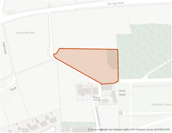
Site Size (ha) Gross: 0.52
Proposed Land Use: Housing
Minimum Development Capacity (Dwellings): 16
Site Type: Greenfield
Ward: Thornton & Allerton
Settlement: Thornton
Ownership: Public
Delivery Timescale: Long 2035+ (11+)
Site Specific Requirements:
Design Principles
- Development should provide at least 16 dwellings as part of a high-quality built environment in line with Policies ST4 and DS1, at a net density of 35 dph. This should include affordable housing (in line with Policy HO4) and an appropriate mix of dwellings (in line with Policy HO3) and having due regard relevant housing needs evidence and the character of the area.
- Given the site's topography, a sensitive design will be required to minimise impacts on the surrounding landscape, and nearby green infrastructure assets. The footpath to the south of the site should be retained and protected through sensitive design and boundary treatments as it forms part of the Bronte Way promoted route.
Site Access, Highways and Transport
- A new access into the will be required through an upgrade to the existing track from Hill Top Lane. Consideration should be given to alternative access through adjacent housing allocation site H1318.
Flooding, Water and Drainage
- Across the south part of the site, groundwater levels are between 0.025m and 0.5m below the ground surface. Within this zone there is a risk of groundwater flooding to both surface and subsurface assets. There is the possibility of groundwater emerging at the surface locally. In the centre of the site the levels are between 0.5 and 5m, where there is a risk of flooding to subsurface assets but surface manifestation of groundwater is unlikely.
- Due to the site topography and existing constraints, additional detailed work in relation to the drainage infrastructure for the site should be undertaken in a comprehensive manner across the other adjacnet development sites to plan suitable drainage routes, connections and new drainage infrastructure provision.
Natural and Historic Environment
- The site lies within Zone B (Supporting Habitat/Functionally Linked Land). Development proposals must assess potential impacts on foraging habitat used by SPA qualifying species and provide ecological evidence where required, in accordance with the South Pennine Moors SPD and Policy NE3.
- The southern part of the site is adjacent to an area which contain trees protected by Tree Preservation Orders (TPOs). The design and layout of any development should ensure these trees are preserved and enhanced in line with Policy NE6. An arboricutural survey should be provided as part of any planning application where appropriate.
- The site is not identified in the LNRS as a priority area for nature recovery.
Environmental Protection
- The site is located within the 250m buffer of a former landfill site. Impacts should be addressed in line with Policy CR2.
- The majority of the site is classed as Grade 4 on the Agricultural Land Classification (ALC).
Open Space and Green / Blue Infrastructure
- Open space should be provided in line with Policy NE2, having regards to the standards set out in Appendix 11. The Open Space Assessment identifies a need to secure the provision of Amenity Greenspace within new developments, particularly where such provision can connect with existing open spaces and contribute to the wider Green Infrastructure network. The Assessment also highlights deficiencies in the provision of allotments and children's play areas within the settlement, which should be taken into account when considering opportunities for new open space provision.
- The site is within an area of moderate provision and low need for green and blue infrastructure. However, development in this location may increase the need going forward, therefore development proposals should focus on enhancing and improving existing assets as well as the creation of new green and blue infrastructure.
Landscape
- The site is located within the Thornton, Queensbury and Wilsden Mixed Upland Pasture Landscape Character area/type (E1), where despite the presence of local undulations which provide a sense of enclosure, the overwhelming perception of this landscape is one of elevation and exposure.
- The Landscape Sensitivity Assessment states that any development should seek to respond to the existing linear form of development along Hill Top Road, which would also maintain some distance from the Brontë Way and Thornton Cemetery to the south. Historic drystone walls and boundary trees should be retained and enhanced.
Green Belt (and Golden Rules)
- Site has been removed from the Green Belt. Development on the site should be consistent with the “Golden Rules” set out in the NPPF in relation to affordable housing, necessary improvements to infrastructure and accessible green space provision.
Infrastructure Requirements
- Proportionate contributions to community infrastructure will be required, where appropriate, in line with Policies ID1 and ID2, and having regard to the Local Infrastructure Plan.
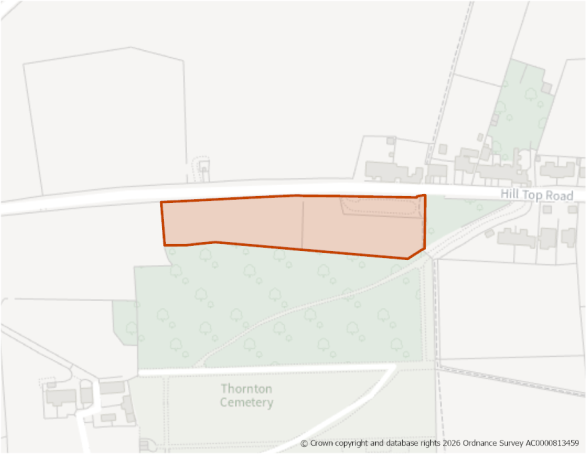
Site Size (ha) Gross: 0.86
Proposed Land Use: Housing
Minimum Development Capacity (Dwellings): 27
Site Type: Greenfield
Ward: Thornton & Allerton
Settlement: Thornton
Ownership: Public
Delivery Timescale: Long 2035+ (11+)
Site Specific Requirements:
Design Principles
- Development should provide at least 27 dwellings as part of a high-quality built environment in line with Policies ST4 and DS1, at a net density of 35 dph. This should include affordable housing (in line with Policy HO4) and an appropriate mix of dwellings (in line with Policy HO3) and having due regard relevant housing needs evidence and the character of the area.
- The design of the scheme should take account of the hill top, gateway location into Thornton, the trees situated to the south and wider rural landscape.
Site Access, Highways and Transport
- A new access would need to be provided on to Hill Top Road. There are no footways at this point on the road, but streetlights are present.
Flooding, Water and Drainage
- Across the site, groundwater levels are between 0.5m and 5m below the ground surface, where there is a risk of flooding to subsurface assets but surface manifestation of groundwater is unlikely.
Natural and Historic Environment
- Residential development resulting in a net increase in dwellings will be required to mitigate any recreational pressure on the SPA/SAC caused by such development in accordance with the South Pennine Moors SPD and Policy NE3.
- North-east corner of the site is identified in the LNRS with the prefered measure B2_M01: Create and maintain habitat corridors and stepping stones to connect and extend existing blue and green places.
Environmental Protection
- The site is located predonimantly within the 150m buffer of a former landfill site. A Land Contamination Assessment – Phase 1 Report will be required as part of any planning application to determine any potential impacts. Impacts should be addressed in line with Policy CR2.
- The majority of the site is classed as Grade 4 on the Agricultural Land Classification (ALC).
Open Space and Green / Blue Infrastructure
- The site is part of an area of amenity open space and replacement provision or improvements should be made through new development. Open space should be provided in line with Policy NE2, having regards to the standards set out in Appendix 11. The Open Space Assessment identifies a need to secure the provision of amenity greenspace within new developments, particularly where such provision can connect with existing open spaces and contribute to the wider green infrastructure network. The Assessment also highlights deficiencies in the provision of allotments and children's play areas within the settlement, which should be taken into account when considering opportunities for new open space provision.
- The site is within an area of moderate provision and low need for green and blue infrastructure. However, development in this location may increase the need going forward, therefore development proposals should focus on enhancing and improving existing assets as well as the creation of new green and blue infrastructure.
Landscape
- The site is located within the Thornton, Queensbury and Wilsden Mixed Upland Pasture Landscape Character area/type (E1), where despite the presence of local undulations which provide a sense of enclosure, the overwhelming perception of this landscape is one of elevation and exposure.
- The Landscape Sensitivity Assessment states that any development should seek to respond to the existing linear form of development along Hill Top Road, which would also maintain some distance from the Brontë Way and Thornton Cemetery to the south. Historic drystone walls and boundary trees should be retained and enhanced.
Infrastructure Requirements
- Proportionate contributions to community infrastructure will be required, where appropriate, in line with Policies ID1 and ID2, and having regard to the Local Infrastructure Plan.
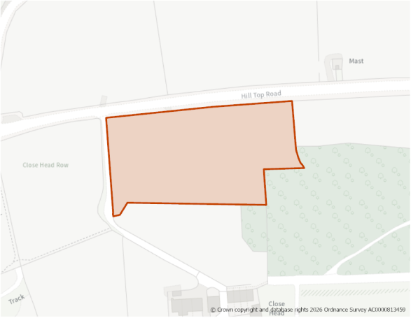
Site Size (ha) Gross: 0.96
Proposed Land Use: Housing
Minimum Development Capacity (Dwellings): 30
Site Type: Greenfield
Ward: Thornton & Allerton
Settlement: Thornton
Ownership: Public
Delivery Timescale: Medium 2030-2035 (6-10)
Site Specific Requirements:
Design Principles
- Development should provide at least 30 dwellings as part of a high-quality built environment in line with Policies ST4 and DS1, at a net density of 35 dph. This should include affordable housing (in line with Policy HO4) and an appropriate mix of dwellings (in line with Policy HO3) and having due regard relevant housing needs evidence and the character of the area.
- The design of the scheme should take account of the hill top, gateway location into Thornton and wider rural landscape setting. The footpath to the west of the site should be retained and protected through sensitive design and boundary treatments as it adjoins the Bronte Way promoted route. Enhancements should be made to the surrounding Green Belt land including improvements to the adjacent public rights of way which may offer opportunities for residents to access the countryside.
Site Access, Highways and Transport
- A new access needs to be provided from Hill Top Road. There are no footways at this point on the road, but streetlights are present.
Flooding, Water and Drainage
- Across the north of the site, groundwater levels are between 0.5m and 5m below the ground surface, where there is a risk of flooding to subsurface assets but surface manifestation of groundwater is unlikely.
Natural and Historic Environment
- The site lies within Zone B (Supporting Habitat/Functionally Linked Land). Development proposals must assess potential impacts on foraging habitat used by SPA qualifying species and provide ecological evidence where required, in accordance with the South Pennine Moors SPD and Policy NE3.
- South-east corner of the site is identified in the LNRS with the prefered measure B2_M01: Create and maintain habitat corridors and stepping stones to connect and extend existing blue and green places.
Environmental Protection
- The site is located predonimantly within the 150m buffer of a former landfill site. A Land Contamination Assessment – Phase 1 Report will be required as part of any planning application to determine any potential impacts. Impacts should be addressed in line with Policy CR2.
- The majority of the site is classed as Grade 4 on the Agricultural Land Classification (ALC).
Open Space and Green / Blue Infrastructure
- Open space should be provided in line with Policy NE2, having regards to the standards set out in Appendix 11. The Open Space Assessment identifies a need to secure the provision of amenity greenspace within new developments, particularly where such provision can connect with existing open spaces and contribute to the wider green infrastructure network. The Assessment also highlights deficiencies in the provision of allotments and children's play areas within the settlement, which should be taken into account when considering opportunities for new open space provision.
- The site is within an area of moderate provision and low need for green and blue infrastructure. However, development in this location may increase the need going forward, therefore development proposals should focus on enhancing and improving existing assets as well as the creation of new green and blue infrastructure.
Landscape
- The site is located within the Thornton, Queensbury and Wilsden Mixed Upland Pasture Landscape Character area/type (E1), where despite the presence of local undulations which provide a sense of enclosure, the overwhelming perception of this landscape is one of elevation and exposure.
- The Landscape Sensitivity Assessment states that any development should seek to respond to the existing linear form of development along Hill Top Road, which would also maintain some distance from the Brontë Way and Thornton Cemetery to the south. Historic drystone walls and boundary trees should be retained and enhanced.
Green Belt (and Golden Rules)
- Site has been removed from the Green Belt. Development on the site should be consistent with the “Golden Rules” set out in the NPPF in relation to affordable housing, necessary improvements to infrastructure and accessible green space provision.
Infrastructure Requirements
- Proportionate contributions to community infrastructure will be required, where appropriate, in line with Policies ID1 and ID2, and having regard to the Local Infrastructure Plan.
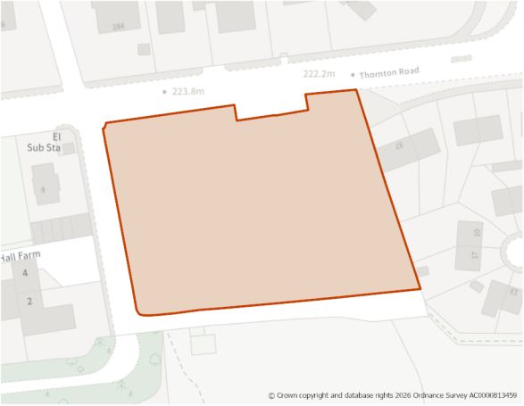
Site Size (ha) Gross: 0.47
Proposed Land Use: Housing
Minimum Development Capacity (Dwellings): 15
Site Type: Greenfield
Ward: Thornton & Allerton
Settlement: Thornton
Ownership: Private
Delivery Timescale: Long 2035+ (11+)
Site Specific Requirements:
Design Principles
- Development should provide at least 15 dwellings as part of a high-quality built environment in line with Policies ST4 and DS1, at a net density of 35 dph. This should include affordable housing (in line with Policy HO4) and an appropriate mix of dwellings (in line with Policy HO3) and having due regard relevant housing needs evidence and the character of the area.
- A sensitive design and layout is required on this site, respecting the designated heritage assets located to the west. Tree planting should be used to screen the development. The design of the properties should not exceed two storeys. The footpath to the west and south of the site should be retained and protected. Enhancements should be made to the surrounding Green Belt land including improvements to the adjacent public rights of way which may offer opportunities for residents to access the countryside.
Site Access, Highways and Transport
- A new access will be required from Thornton Road and this may involve the relocation of the adjacent bus stop.
Flooding, Water and Drainage
- Across a small part of the south of the site, groundwater levels are either at or very near to the ground surface. Within this zone there is a risk of groundwater flooding to both surface and subsurface assets. Groundwater may emerge at significant rates and has the capacity to flow overland and/or pond within any topographic low spots.
Natural and Historic Environment
- Residential development resulting in a net increase in dwellings will be required to mitigate any recreational pressure on the SPA/SAC caused by such development in accordance with the South Pennine Moors SPD and Policy NE3.
- The site is not identified in the LNRS as a priority area for nature recovery.
- A Heritage Impact Assessment (HIA) has been carried out for this site and identifies that the main impacts of development would be on the character and appearance of the approach to Thornton Hall and Thornton Hall Farm. Any development should be carefully designed and positioned to reflect the area's local character, with buildings facing the access road, limited to two storeys in height, and set back sufficiently from the road to preserve views towards the existing historic buildings.
- Development should use natural local materials, incorporate high-quality responsive design, and include landscaping along the southern boundary to soften the transition to the open countryside. No additional enhancement or mitigation measures are anticipated beyond these design requirements.
Open Space and Green / Blue Infrastructure
- Open space should be provided in line with Policy NE2, having regards to the standards set out in Appendix 11. The Open Space Assessment identifies a need to secure the provision of amenity greenspace within new developments, particularly where such provision can connect with existing open spaces and contribute to the wider green infrastructure network. The Assessment also highlights deficiencies in the provision of allotments and children's play areas within the settlement, which should be taken into account when considering opportunities for new open space provision.
- The site is located in an area which has low provision and moderate need for green and blue infrastructure. Development proposals should focus on green and blue infrastructure creation, carefully designed to contribute towards site-specific issues e.g. flood mitigation, urban cooling etc.
Landscape
- The site is within the Clayton Urban Edge Wooded Valleys and Slopes Landscape Character area/type (H2), where the enclosed and partly wooded nature of this area, in conjunction with characteristic drystone walls and long distance views from the elevated valley sides, creates a distinct sense of place very different from the urban area to the east or the open plateau to the west. No landscape sensitivity assessment was undertaken for this site. Consideration should be given to the guidance set out in the Landscape Character Assessment SPD.
Green Belt (and Golden Rules)
- Site has been removed from the Green Belt. Development on the site should be consistent with the “Golden Rules” set out in the NPPF in relation to affordable housing, necessary improvements to infrastructure and accessible green space provision.
Infrastructure Requirements
- Proportionate contributions to community infrastructure will be required, where appropriate, in line with Policies ID1 and ID2, and having regard to the Local Infrastructure Plan.
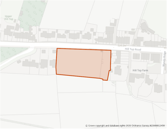
Site Size (ha) Gross: 0.51
Proposed Land Use: Housing
Minimum Development Capacity (Dwellings): 16
Site Type: Greenfield
Ward: Thornton & Allerton
Settlement: Thornton
Ownership: Private
Delivery Timescale: Long 2035+ (11+)
Site Specific Requirements:
Design Principles
- Development should provide at least 16 dwellings as part of a high-quality built environment in line with Policies ST4 and DS1, at a net density of 35 dph. This should include affordable housing (in line with Policy HO4) and an appropriate mix of dwellings (in line with Policy HO3) and having due regard relevant housing needs evidence and the character of the area.
- A sensitive design and layout will be required taking into account the site's elevated position and the heritage assets located to the east and north.
Site Access, Highways and Transport
- A new access point will be required from Hill Top Road. There are footways and streetlighting present on the opposite side of the road.
Flooding, Water and Drainage
- Across the north of the site, groundwater levels are between 0.5m and 5m below the ground surface, where there is a risk of flooding to subsurface assets but surface manifestation of groundwater is unlikely.
Natural and Historic Environment
- Residential development resulting in a net increase in dwellings will be required to mitigate any recreational pressure on the SPA/SAC caused by such development in accordance with the South Pennine Moors SPD and Policy NE3.
- The site is not identified in the LNRS as a priority area for nature recovery.
- A Heritage Impact Assessment (HIA) has been carried out for this site. It indicates that there is potential for the new development to be accommodated on the site however, any development to the top north-eastern section (towards the Hill Top Road), closer to the listed buildings, is likely to result in less than substantial harm of an unacceptable level. If sufficient design and appropriate mitigation measures are employed on the site, then the rest of the site (except the top north-eastern section) is likely to result in less than substantial harm of and acceptable level.
- The strengthening of landscaping along the boundaries to the east of the site (in close proximity to designated heritage assets) with trees and buffer space, will help to generate a sense of separation and visual distinction from the designated assets and their setting.
- The development of the site must be informed by and respond to its surroundings with high-quality development. To respect the local distinctiveness here, the layout, scale, orientation, style, and siting of any built form within the proposed site should take design cues from the nearby traditional buildings, and this should also be reflected in the materials with careful consideration. Both design and materials should be of very high quality, including the use of natural local materials and elements. Careful consideration of the landscape strategy, including the retention of existing trees, will be necessary. The existing stone boundary wall along the north and west boundary should also be incorporated to ensure that this element of the site’s rural character is retained. The proposed buildings should not turn their backs to the Hill Top Road and should not be more than two-storeys in height to excessively dominate the existing buildings in the wider context.
Environmental Protection
- The site is located predonimantly within the 150m buffer of a former landfill site. A Land Contamination Assessment – Phase 1 Report will be required as part of any planning application to determine any potential impacts. Impacts should be addressed in line with Policy CR2.
Open Space and Green / Blue Infrastructure
- Open space should be provided in line with Policy NE2, having regards to the standards set out in Appendix 11. The Open Space Assessment identifies a need to secure the provision of Amenity Greenspace within new developments, particularly where such provision can connect with existing open spaces and contribute to the wider Green Infrastructure network. The Assessment also highlights deficiencies in the provision of allotments and children's play areas within the settlement, which should be taken into account when considering opportunities for new open space provision.
- The site is within an area of moderate provision and low need for green and blue infrastructure. However, development in this location may increase the need going forward, therefore development proposals should focus on enhancing and improving existing assets as well as the creation of new green and blue infrastructure.
Landscape
- The site is located within the Thornton, Queensbury and Wilsden Mixed Upland Pasture Landscape Character area/type (E1), where despite the presence of local undulations which provide a sense of enclosure, the overwhelming perception of this landscape is one of elevation and exposure.
- The Landscape Sensitivity Assessment advises that drystone walls should be retained wherever possible. Existing woodland and mature trees within the site should be preserved, and additional tree planting should be incorporated along the southern boundary to protect and enhance the wooded character of the settlement. Any development should carefully consider the site's proximity to a number of Listed Buildings along Hill Top Road, and the use of vernacular architectural styles and materials should be encouraged to ensure development responds positively to local character. Development should be sensitively planned and designed to avoid drawing attention to the site or detracting from views from Thornton Viaduct.
Infrastructure Requirements
- Proportionate contributions to community infrastructure will be required, where appropriate, in line with Policies ID1 and ID2, and having regard to the Local Infrastructure Plan.
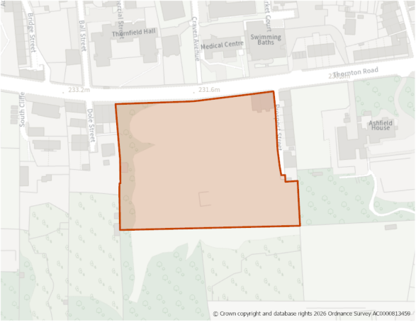
Site Size (ha) Gross: 1.19
Proposed Land Use: Housing
Minimum Development Capacity (Dwellings): 37
Site Type: PDL
Ward: Thornton & Allerton
Settlement: Thornton
Ownership: Private
Delivery Timescale: Long 2035+ (11+)
Site Specific Requirements:
Design Principles
- Development should provide at least 37 dwellings as part of a high-quality built environment in line with Policies ST4 and DS1, at a net density of 35 dph. This should include affordable housing (in line with Policy HO4) and an appropriate mix of dwellings (in line with Policy HO3) and having due regard relevant housing needs evidence and the character of the area.
- A sensitive design and layout will be required to reflect the historic nature of the site in the centre of the Thornton conservation area. The design should take cues from the former mill buildings that previously occupied the site and the surrounding heritage assets.
Site Access, Highways and Transport
- The site can be access off Thornton Road. There are footways and streetlights on this road.
Flooding, Water and Drainage
- A nominal flood risk assessment has been carried out for this site. It indicates that the site is wholly located within Flood Zone 1 of the Environment Agency's (EA) Flood Map for Planning which indicates it as at low risk of flooding from rivers. Development should be possible at this site given the low fluvial and very low surface water flood risk to the site.
- The site is not modelled to be at significant additional fluvial or surface water risk as a result of climate change. Any FRA should include for a drainage strategy which includes the ponded area and flow path in site design and investigate ground conditions for infiltration SuDS suitability
- Across the northern half of the site, groundwater levels are either at or very near to the ground surface. Within this zone there is a risk of groundwater flooding to both surface and subsurface assets. Groundwater may emerge at significant rates and has the capacity to flow overland and/or pond within any topographic low spots.
Natural and Historic Environment
- Residential development resulting in a net increase in dwellings will be required to mitigate any recreational pressure on the SPA/SAC caused by such development in accordance with the South Pennine Moors SPD and Policy NE3.
- The site is partly located within a bat alert area. The western and southern parts of the site are classed as semi-improved acid grassland, scattered scrub in the Bradford Habitat Network. An ecological survey will be required as part of any planning application to establish the extent/impacts as well as to identify appropriate mitigation.
- Land adjacent to the east contain trees which are protected by Tree Preservation Orders (TPOs) and must be protected.
- The site is identified in the LNRS with the prefered measure G1_M03: Restore and enhance existing species-rich grasslands.
- A Heritage Impact Assessment (HIA) has been carried out for this site. It indicates that development of the site should strive to have an impact of less than substantial harm of an acceptable level with the potenial to improve the settings of the listed buildings and an expectation to enhance the character of the conservation area.
- Appropriately designed development would be expected to enhance the Thornton Conservation Area and the settings of the affected listed buildings. It could be that high density built form reflecting the massing and scale of elements of the former mill might be appropriate, and more complementary than a generic residential layout. A design statement illustrating how the design responded to character and achieved positive impacts would be expected to accompany any development proposal.
- The use of materials and appearance responding to local distinctiveness would be essential. the scale, layout and form of development would be crucial especially in proximity to the listed buildings at Prospect Street and Thornton Road. Careful attention would be required to the southern edge of any development where it abuts the open countryside and is widely visible. An overtly suburban layout or appearance here would be incongruous and undesirable.
Environmental Protection
- The site consists of a former mill complex, remdiation of the previous uses may be necessary. A Land Contamination Assessment – Phase 1 Report may be required as part of any planning application to determine any potential impacts. Impacts should be addressed in line with Policy CR2.
- The southern half of the site is within a Development High Risk Area for former coal mining, indicating that it contains one or more recorded former related features at surface or shallow depth. A Coal Mining Risk Assessment (CMRA) will be required as part of any planning application.
- The site is partially within a Mineral Safeguarding Area (MSA) for coal. A mineral resource assessment will be required as part of any planning application to determine the extent and availability of any coal resource.
Open Space and Green / Blue Infrastructure
- Open space should be provided in line with Policy NE2, having regards to the standards set out in Appendix 11. The Open Space Assessment identifies a need to secure the provision of amenity greenspace within new developments, particularly where such provision can connect with existing open spaces and contribute to the wider green infrastructure network. The Assessment also highlights deficiencies in the provision of allotments and children's play areas within the settlement, which should be taken into account when considering opportunities for new open space provision.
- The site is within an area of moderate provision but high need for green and blue infrastructure. Development proposals should concentrate on the creation of new, and enhancement of existing green and blue infrastructure.
Landscape
- The north of the site is located within the Thornton, Queensbury and Wilsden Mixed Upland Pasture Landscape Character area/type (E1), where despite the presence of local undulations which provide a sense of enclosure, the overwhelming perception of this landscape is one of elevation and exposure. The southern half is within the Clayton Urban Edge Wooded Valleys and Slopes Landscape Character area/type (H2), where the enclosed and partly wooded nature of this area, in conjunction with characteristic drystone walls and long distance views from the elevated valley sides, creates a distinct sense of place very different from the urban area to the east or the open plateau to the west. The site is within the settlement and no landscape sensitivity assessment was undertaken for this site. Consideration should be given to the guidance set out in the Landscape Character Assessment SPD.
Infrastructure Requirements
- Proportionate contributions to community infrastructure will be required, where appropriate, in line with Policies ID1 and ID2, and having regard to the Local Infrastructure Plan.
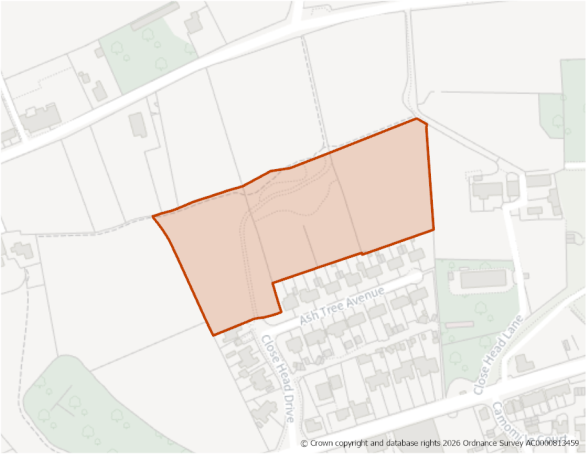
Site Size (ha) Gross: 1.89
Proposed Land Use: Housing
Minimum Development Capacity (Dwellings): 60
Site Type: Greenfield
Ward: Thornton & Allerton
Settlement: Thornton
Ownership: Private
Delivery Timescale: Long 2035+ (11+)
Site Specific Requirements:
Design Principles
- Development should provide at least 60 dwellings as part of a high-quality built environment in line with Policies ST4 and DS1, at a net density of 35 dph. This should include affordable housing (in line with Policy HO4) and an appropriate mix of dwellings (in line with Policy HO3) and having due regard relevant housing needs evidence and the character of the area.
- The design and layout of the site should take into consideration the hillside location and proximity to agricutural uses. The footpath to the north of the site should be retained and protected through sensitive design and boundary treatments as it forms part of the Bronte Way promoted route.
Site Access, Highways and Transport
- The site should be accessed via Close Head Drive. A alternative, additional access may be possible from the north as part of the wider development of housing site allocations H1316 and H1318.
Flooding, Water and Drainage
- Across the centre of the site, groundwater levels are between 0.025m and 0.5m below the ground surface. Within this zone there is a risk of groundwater flooding to both surface and subsurface assets. There is the possibility of groundwater emerging at the surface locally.
Natural and Historic Environment
- The site lies within Zone B (Supporting Habitat/Functionally Linked Land). Development proposals must assess potential impacts on foraging habitat used by SPA qualifying species and provide ecological evidence where required, in accordance with the South Pennine Moors SPD and Policy NE3.
- The site is partly located within a bat alert area. An ecological survey will be required as part of any planning application to establish the extent/impacts as well as to identify appropriate mitigation.
Environmental Protection
- The site is located predonimantly within the 250m buffer of a former landfill site. Impacts should be addressed in line with Policy CR2.
- Site is partially within a Mineral Safeguarding Area (MSA) for coal. A mineral resource assessment will be required as part of any planning application to determine the extent and availability of any coal resource.
- The majority of the site is classed as Grade 4 on the Agricultural Land Classification (ALC).
Open Space and Green / Blue Infrastructure
- Open space should be provided in line with Policy NE2, having regards to the standards set out in Appendix 11. The Open Space Assessment identifies a need to secure the provision of Amenity Greenspace within new developments, particularly where such provision can connect with existing open spaces and contribute to the wider Green Infrastructure network. The Assessment also highlights deficiencies in the provision of allotments and children's play areas within the settlement, which should be taken into account when considering opportunities for new open space provision.
- The site is partly within an area of moderate provision and low need for green and blue infrastructure. However, development in this location may increase the need going forward, therefore development proposals should focus on enhancing and improving existing assets as well as the creation of new green and blue infrastructure.
Landscape
- The site is located within the Thornton, Queensbury and Wilsden Mixed Upland Pasture Landscape Character area/type (E1), where despite the presence of local undulations which provide a sense of enclosure, the overwhelming perception of this landscape is one of elevation and exposure.
- The Landscape Sensitivity Assessment states that any development should seek to respond to the existing linear form of development along Hill Top Road, which would also maintain some distance from the Brontë Way and Thornton Cemetery to the south. Historic drystone walls and boundary trees should be retained and enhanced.
Green Belt (and Golden Rules)
- Eastern half of the site has been removed from the Green Belt. Development on the site should be consistent with the “Golden Rules” set out in the NPPF in relation to affordable housing, necessary improvements to infrastructure and accessible green space provision.
Infrastructure Requirements
- Proportionate contributions to community infrastructure will be required, where appropriate, in line with Policies ID1 and ID2, and having regard to the Local Infrastructure Plan.
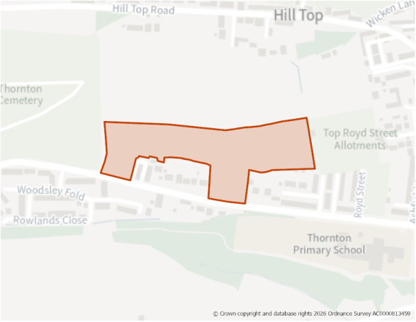
Site Size (ha) Gross: 3.46
Proposed Land Use: Housing
Minimum Development Capacity (Dwellings): 91
Site Type: Greenfield
Ward: Thornton & Allerton
Settlement: Thornton
Ownership: Mixed
Delivery Timescale: Long 2035+ (11+)
Site Specific Requirements:
Design Principles
- Development should provide at least 91 dwellings as part of a high-quality built environment in line with Policies ST4 and DS1, at a net density of 35 dph. This should include affordable housing (in line with Policy HO4) and an appropriate mix of dwellings (in line with Policy HO3) and having due regard relevant housing needs evidence and the character of the area.
- A sensitive design and layout will be required taking account of the position of the site in a tranistionary location between the urban and rural areas. The scheme should reflect the pastoral landscape. The footpaths to the west and east of the site should be retained and protected through sensitive design and boundary treatments. Particular attention should be paid to preserving the route of the Bronte Way, ensuring views from the footpath across to the wider countryside are retained.
Site Access, Highways and Transport
- A new access point will be required from Thornton Road. Significant engineering works may be required to form the access due to the level changes from Thornton Road into the site which may be challenging. Significant visibility splays will be required. The site currently has a large retaining wall along the southern boundary which should be retained where possible.
Flooding, Water and Drainage
- For the majority of the site, groundwater levels are between 0.025m and 0.5m below the ground surface. Within this zone there is a risk of groundwater flooding to both surface and subsurface assets. There is the possibility of groundwater emerging at the surface locally.
Natural and Historic Environment
- Residential development resulting in a net increase in dwellings will be required to mitigate any recreational pressure on the SPA/SAC caused by such development in accordance with the South Pennine Moors SPD and Policy NE3.
- The site is located within a bat alert area. An ecological survey will be required as part of any planning application to establish the extent/impacts as well as to identify appropriate mitigation.
- The western part of the site and a small part to the centre (adjoining Thornton Road) is identified in the LNRS with the preferred measureT2_M04: Extend and connect tree and woodland cover across the White Rose Forest area in West Yorkshire.
Environmental Protection
- The site is located predonimantly within the 150m buffer of a former landfill site. A Land Contamination Assessment – Phase 1 Report will be required as part of any planning application to determine any potential impacts. Impacts should be addressed in line with Policy CR2.
- The site is partially within a Mineral Safeguarding Area (MSA) for coal. A mineral resource assessment will be required as part of any planning application to determine the extent and availability of any coal resource.
- The majority of the site is classed as Grade 3b on the Agricultural Land Classification (ALC).
Open Space and Green / Blue Infrastructure
- Open space should be provided in line with Policy NE2, having regards to the standards set out in Appendix 11. The Open Space Assessment identifies a need to secure the provision of amenity greenspace within new developments, particularly where such provision can connect with existing open spaces and contribute to the wider green infrastructure network. The Assessment also highlights deficiencies in the provision of allotments and children's play areas within the settlement, which should be taken into account when considering opportunities for new open space provision.
- The site is within an area of moderate provision and low need for green and blue infrastructure. However, development in this location may increase the need going forward, therefore development proposals should focus on enhancing and improving existing assets as well as the creation of new green and blue infrastructure.
Landscape
- The site is located within Thornton, Queensbury and Wilsden Mixed Upland Pasture Landscape Character area/type (E1), where despite the presence of local undulations which provide a sense of enclosure, the overwhelming perception of this landscape is one of elevation and exposure.
- The Landscape Sensitivity Assessment was carried out on a large iteration of this site. As a result the site boundary has been amended to reflect landscape sensitivity considerations. Existing field boundary trees and external drystone walls should be retained wherever possible. Development should be designed to maintain views of Thornton Viaduct from the Brontë Way and preserve the rural character of the remaining open land.
Other Constraints
- The site is located adjacent to Thornton Cemetery. Consideration should be given to any potential impacts on this open space.
Infrastructure Requirements
- Proportionate contributions to community infrastructure will be required, where appropriate, in line with Policies ID1 and ID2, and having regard to the Local Infrastructure Plan.
POLICY WI1 – WILSDEN Comment
Settlement Plan
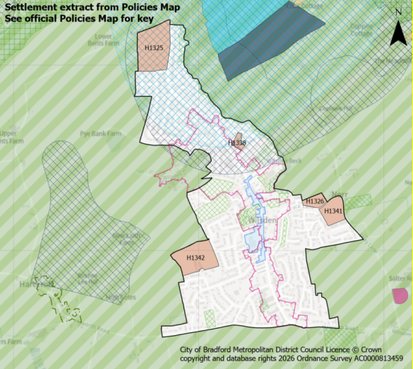
Settlement Hierarchy and Spatial Directions
- The village boundary is defined on the Policies Map. The village is formed of the main settlement of Wilsden and is constrained by the B6144 to the south and Bents Lane to the north. The focus for sustainable development of this medium village reflects its proximity to the Regional City of Bradford as well as its function and character balanced against heritage and environmental constraints.
- The settlement is surrounded and constrained by a number of environmental assets to the north such as Crag Wood and Bilberry Bank.
- Development proposals should have regard to and be consistent with the made (adopted) Wilsden Neighbourhood Development Plan and Wilsden Design Code where applicable.
Meeting Growth Needs
- Housing development includes a combination of development within the settlement boundary and land to be released from the Green Belt during the plan period and will:
- Deliver approximately 311 dwellings through a combination of sites under construction, planning permissions and new site allocations as set out in Table WI1.1.
- Deliver housing site allocations as shown on the policies map and section 5:
- H1325: Bents Lane (100 dwellings)
- H1326: Crack lane north (21 dwellings)
- H1338: Manor House Road (12 dwellings)
- H1341: Crack Lane south (47 dwellings)
- H1342: Moorside Farm (80 dwellings)
Table WI1.1 - Wilsden:
|
Under Construction |
Planning Permission |
Site Allocations |
|
|
Totals |
4 |
47 |
260 |
- Proposals for new homes within the settlement boundary on additional small sites, including the redevelopment of previously developed land, will be supported subject to meeting relevant Local Plan and made (adopted) Neighbourhood Development Plan policies.
- Support Wilsden’s Local Centre and its diversification where appropriate to help retain employment opportunities within the settlement and ensure its long-term sustainability.
Local Services and Facilities
- Support the range and quality of uses within the designated Wilsden Local Centre as a key hub for the community to meet their day-to-day retail and leisure needs as well as the retention and improvement of local services and facilities.
- Protect and enhance designated Local Green Spaces identified in Policy W/NE1 of the made (adopted) Neighbourhood Development Plan and open spaces in compliance with Policy NE2 such as Wilsden Park, Wilsden Recreation Ground, Wilsden Cricket Ground and Main Street Allotments. Support proposals which address deficiencies in open space provision as set out on the Open Spaces Study including seeking to increase provision of parks and gardens, outdoor sports, play space and allotments.
- Maintain and enhance sporting and recreation facilities, including those identified in Policy W/CF3 of the made (adopted) Neighbourhood Development. Also spport proposals to widen community access to sporting facilities.
Landscape
- Maintain and enhance the landscape setting of the settlement within the character areas of the Thornton, Queensbury and Wilsden Mixed Upland Pasture and Harden Upland Wooded River Valleys, and key landscape features, fields and overall settlement pattern.
- Development should have regard to impacts on the key views identified in Policy W/NE5 of the made (adopted) Neighbourhood Development Plan.
Historic and Natural Environment
- Protect and enhance strategic green and blue networks and corridors to enhance biodiversity and recreation within and adjacent to the settlement as well as incorporating sufficient green space and connections within new developments. Consideration should be given had to the Green and Blue Infrastructure Strategy.
- Protect and enhance the designated Wilsden habitat networks and priority habitats along the northeastern edge of the settlement and the Wilsden Beck corridor.
- Where development is located within SPA/SAC Zone C (recreational pressure) residential development resulting in a net increase in dwellings will be required to mitigate any recreational pressure on the SPA/SAC caused by such development in accordance with the South Pennine Moors SPD and Policy NE3.
- Ensure that future development conserves and enhances key heritage assets and their settings within and adjacent to the settlement including the Wilsden Conservation Area and Listed Buildings as well as non-designated heritage assets Policy W/BH1 of the made (adopted) Neighbourhood Development Plan.
Local Infrastructure
- Support improvements and access to public transport and active travel, including enhanced links to Bingley railway station and measures to reduce traffic congestion on routes along Main Street.
- Proportionate contributions to new or enhanced community infrastructure will be required, where appropriate, in line with Policies ID1 and ID2, and having regard to the Local Infrastructure Plan.
Wilsden: Site Allocations
H1325: Bents Lane, Wilsden Comment
Site Boundary:
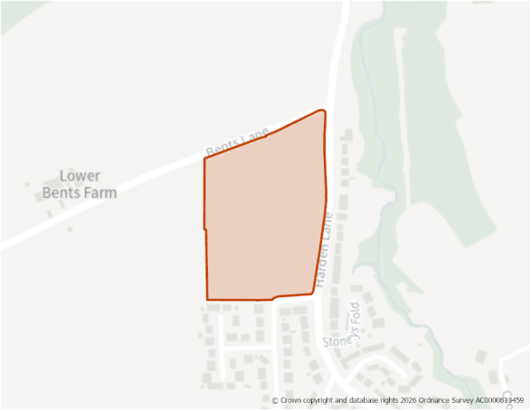
Site Size (ha) Gross: 4.07
Proposed Land Use: Housing
Minimum Development Capacity (Dwellings): 100
Site Type: Greenfield
Ward: Bingley West
Settlement: Wilsden
Ownership: Private
Delivery Timescale: Short 2025-2030 (1-5)
Site Specific Requirements:
Design Principles
- Development should provide at least 100 dwellings as part of a high quality built environment in line with Policies ST4 and DS1, at a net density of 35 dph. This should include affordable housing (in line with Policy HO4) and an appropriate mix of dwellings (in line with Policy HO3) and having due regard to relevant housing needs evidence and the character of the area)
- A sensitive design and layout will be required taking account of the gateway location of the site and wider rural landscape. Enhancements should be made to the surrounding Green Belt land including improvements to the adjacent public rights of way which may offer opportunities for residents to access the countryside.
- Development should be in keeping with the landscape character of the area and in line with design policies within the made (adopted) Wilsden Neighbourhood Development Plan and associated Design Code.
Site Access, Highways and Transport
- The new access would lead onto Harden Lane, where there are footways and streetlights present.
- A Public Right of Way (bridleway) across the southern boundary of the site should be retained.
Flooding, Water and Drainage
- A nominal flood risk assessment has been carried out for this site and indicates the site is wholly located within Flood Zone 1 of the Environment Agency's (EA) Flood Map for Planning which indicates it as at low risk of flooding from rivers. Development should be possible at this site given the low fluvial and very low surface water flood risk to the site.
- The site is not modelled to be at significant additional fluvial or surface water risk as a result of climate change. Any FRA should include for a drainage strategy which includes the flow path in site design and investigate ground conditions for infiltration SuDS suitability.
Natural and Historic Environment
- The site lies within Zone C (Recreational Pressure) - Residential development resulting in a net increase in dwellings will be required to mitigate any recreational pressure on the SPA/SAC caused by such development in accordance with the South Pennine Moors SPD and Policy NE3.
- The site is located within a bat alert area. An ecological survey will be required as part of any planning application to establish the extent/impacts as well as to identify appropriate mitigation.
- The far eastern corner of the site and northeastern corner of the site are identified in the Local Nature Recovery Strategy (LNRS) with a preferred measure of T2_M05: Help more red squirrels to move back into West Yorkshire. The southeastern boundary of the site is identified in the LNRS with preferred measure B4_ M02: Significantly boost biodiversity wherever possible where there are existing habitats alongside transport infrastructure. The northern site boundary is identified in the LNRS with preferred measures G1_M03: Restore Magnesian Limestone quarries to limestone grasslands.
Environmental Protection
- Part of the site is classed as Grade 3b in the Agricultural Land Classification (ALC).
Open Space and Green / Blue Infrastructure
- Open space should be provided in line with Policy NE2, having regards to the standards set out in Appendix 11. The Open Space Assessment indicates that in Wilsden there is a need for increased provision of amenity greenspace, allotments, and play provision for both young and older children.
- Green and blue infrastructure should be provided in line with Policy NE1.
Landscape
- The site is located within the Harden Upland Wooded River Valleys Landscape Character area/type (C3), which is recognised as a diverse landscape of parkland, pasture and wooded valleys linked by a strong network of public rights of way, together with the sense of time depth displayed in the area creates a strong sense of place.
- The Landscape Sensitivity Assessment indicates that the site is in an area of moderate landscape sensitivity. Development of the site could help to better integrate the existing settlement edge with the wider landscape and the sensitive introduction of vegetation could be used to soften this. The existing isolated trees should be retained where possible, as well
as the more intact drystone walls.
Green Belt (and Golden Rules)
- Site has been removed from the Green Belt. Development on the site should be consistent with the “Golden Rules” set out in the NPPF in relation to affordable housing, necessary improvements to infrastructure and accessible green space provision.
Infrastructure Requirements
- Proportionate contributions to community infrastructure will be required, where appropriate, in line with Policies ID1 and ID2, and having regard to the Local Infrastructure Plan.
Planning Permission
- The Council has resolved to grant outline planning permission at the site for residential development (26/00109/MAO). This was after 1 April 2025 (the base date for the Local Plan). Accordingly, it has been identified as a site allocation.
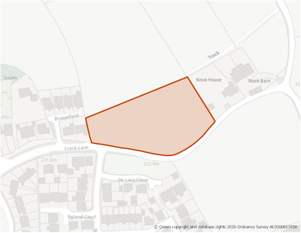
Site Size (ha) Gross: 0.67
Proposed Land Use: Housing
Minimum Development Capacity (Dwellings): 21
Site Type: Greenfield
Ward: Bingley West
Settlement: Wilsden
Ownership: Private
Delivery Timescale: Medium 2030-2035 (6-10)
Site Specific Requirements:
Design Principles
- Development should provide at least 21 dwellings as part of a high quality built environment in line with Policies ST4 and DS1, at a net density of 35 dph. This should include affordable housing (in line with Policy HO4) and an appropriate mix of dwellings (in line with Policy HO3) and having due regard to relevant housing needs evidence and the character of the area.
- A sensitive design and layout will be required taking into consideration the site's location on the edge of the settlement. Enhancements to the surrounding Green Belt land should be made, including improving connections to offer opportunities for residents to access the countryside. Development should be in keeping with the landscape character of the area and in line with design policies within the made (adopted) Wilsden Neighbourhood Development Plan and associated Design Code.
Site Access, Highways and Transport
- The new access would lead onto Crack Lane, where there is a footway and streetlights are present. Crack Lane may need to be widened or a new route created through housing allocation site H1341 with a new junction on to Shay Lane.
Flooding, Water and Drainage
- A nominal flood risk assessment has been carried out for this site. It indicates that the site is wholly located within Flood Zone 1 of the Environment Agency's (EA) Flood Map for Planning which indicates it as at low risk of flooding from rivers. Development should be possible at this site given the low fluvial and very low surface water flood risk to the site.
- Safe access and escape routes should be investigated further as part of a site-specific FRA. Routes may need to be raised above the existing surface water flow path along the northern boundary to allow surface water to flow naturally. Any FRA should include for a drainage strategy which should investigate ground conditions for infiltration SuDS suitability.
Natural and Historic Environment
- The site lies within Zone C (Recreational Pressure) - Residential development resulting in a net increase in dwellings will be required to mitigate any recreational pressure on the SPA/SAC caused by such development in accordance with the South Pennine Moors SPD and Policy NE3.
- The site is partly located within a bat alert area. An ecological survey will be required as part of any planning application to establish the extent/impacts as well as to identify appropriate mitigation.
- The eastern site boundary is identified in the Local Nature Recovery Strategy (LNRS) with the preferred measure of T2_M05: Help more red squirrels to move back into West Yorkshire.
- The site is within the wider setting of the Wilsden conservation area. Consideration should be given to any potential impacts on the heritage asset. The use of materials, local distinctiveness and boundary treatments should all form part of a well-designed scheme for the site. Consultation with the Council's Heritage Team may be required to understand the potential for any impacts.
Environmental Protection
- The western part of the site is within a 250m landfill buffer and the remainder of the site is within a 150m buffer. A Land Contamination Assessment – Phase 1 Report will be required as part of any planning application to identify any potential risk and appropriate mitigation measures. Impacts should be addressed in line with Policy CR2.
- Part of the site is classed as Grade 3b in the Agricultural Land Classification (ALC).
Open Space and Green / Blue Infrastructure
- Open space should be provided in line with Policy NE2, having regards to the standards set out in Appendix 11. The Open Space Assessment indicates that in Wilsden there is a need for increased provision of amenity greenspace, allotments, and play provision for both young and older children.
- The site is within an area of low provision and low need for green and blue infrastructure. However, development in this location may increase the need going forward, therefore development proposals should focus on creation of new green and blue infrastructure.
Landscape
- The site is within the Thornton, Queensbury and Wilsden Mixed Upland Pasture Landscape Character area/type (E1), where despite the presence of local undulations which provide a sense of enclosure, the overwhelming perception of this landscape is one of elevation and exposure.
- The Landscape Sensitivity Assessment indicates that the site is in an area of low-moderate landscape sensitivity. Retain dry stone walls and utilise tree planting to soften the settlement edge. Consider potential visibility of development from PRoW that converge on Norr Hill to the east. This site is more highly sensitive. Retain some sense of separation between the settlement and outlying property and seek to maintain some open views to the north.
Green Belt (and Golden Rules)
- Site has been removed from the Green Belt. Development on the site should be consistent with the “Golden Rules” set out in the NPPF in relation to affordable housing, necessary improvements to infrastructure and accessible green space provision
Infrastructure Requirements
- Proportionate contributions to community infrastructure will be required, where appropriate, in line with Policies ID1 and ID2, and having regard to the Local Infrastructure Plan.
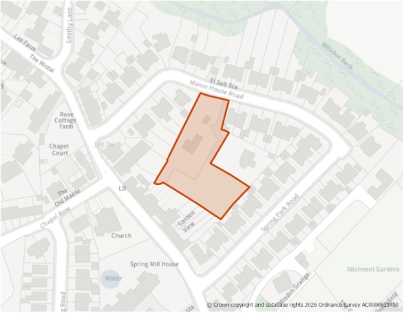
Site Size (ha) Gross: 0.33
Proposed Land Use: Housing
Minimum Development Capacity (Dwellings): 12
Site Type: PDL
Ward: Bingley West
Settlement: Wilsden
Ownership: Private
Delivery Timescale: Long 2035+ (11+)
Site Specific Requirements:
Design Principles
- Development should provide at least 12 dwellings as part of a high quality built environment in line with Policies ST4 and DS1, at a net density of 35 dph. This should include affordable housing (in line with Policy HO4) and an appropriate mix of dwellings (in line with Policy HO3) and having due regard to relevant housing needs evidence and the character of the area.
- Development should be in keeping with the landscape character of the area and in line with design policies within the made (adopted) Wilsden Neighbourhood Development Plan and associated Design Code.
Site Access, Highways and Transport
- A new access would lead onto Manor House Road, where there are footways and streetlights present.
Natural and Historic Environment
- The site lies within Zone C (Recreational Pressure) - Residential development resulting in a net increase in dwellings will be required to mitigate any recreational pressure on the SPA/SAC caused by such development in accordance with the South Pennine Moors SPD and Policy NE3.
- The site is located within a bat alert area. An ecological survey will be required as part of any planning application to establish the extent/impacts as well as to identify appropriate mitigation.
- There are a number of trees within and adjacent to the site which are protected by Tree Preservation Orders (TPOs). The design and layout of any development should ensure these trees are preserved and enhanced in line with Policy NE6. An arboricutural study should be provided as part of any planning application.
- The site is identified in the Local Nature Recovery Strategy (LNRS) with the preferred measure of T2_M05: Help more red squirrels to move back into West Yorkshire.
- The site is adjacent to Grade II Listed Old Manor House and Spring Mill House. The site is also adjacent to the Wilsden conservation area. The layout, design and scale of dwellings should have regard to the proximity of these designated heritage assets as well as the character of the surrounding area. A Heritage Impact Assessment will be required to determine the potential impact of development on the significance of these heritage assets and ensure any identified harm can be adeuqately mitigated.
Environmental Protection
- The northern part of the site is located within the 150m buffer of a landfill site, and the southern part of the site is within the 250m buffer. A Land Contamination Assessment – Phase 1 Report will be required as part of any planning application to identify any potential risk and appropriate mitigation measures. Impacts should be addressed in line with Policy CR2.
Open Space and Green / Blue Infrastructure
- Open space should be provided in line with Policy NE2, having regards to the standards set out in Appendix 11. The Open Space Assessment indicates that in Wilsden there is a need for increased provision of amenity greenspace, allotments, and play provision for both young and older children.
- The site is located in an area where there is is good provision and a low need for green and blue infrastructure. Development proposals should look to enhance existing green and blue infrastructure assets.
Landscape
- The site is within the Thornton, Queensbury and Wilsden Mixed Upland Pasture Landscape Character area/type (E1), where despite the presence of local undulations which provide a sense of enclosure, the overwhelming perception of this landscape is one of elevation and exposure. The site is within the settlement and no landscape sensitivity assessment was undertaken for this site. Consideration should be given to the guidance set out in the Landscape Character Assessment SPD.
Infrastructure Requirements
- Proportionate contributions to community infrastructure will be required, where appropriate, in line with Policies ID1 and ID2, and having regard to the Local Infrastructure Plan.
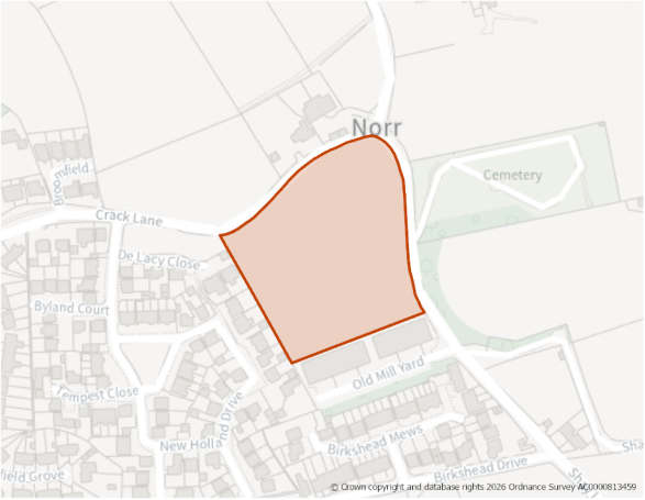
Site Size (ha) Gross: 1.48
Proposed Land Use: Housing
Minimum Development Capacity (Dwellings): 47
Site Type: Greenfield
Ward: Bingley West
Settlement: Wilsden
Ownership: Private
Delivery Timescale: Long 2035+ (11+)
Site Specific Requirements:
Design Principles
- Development should provide at least 47 dwellings as part of a high quality built environment in line with Policies ST4 and DS1, at a net density of 35 dph. This should include affordable housing (in line with Policy HO4) and an appropriate mix of dwellings (in line with Policy HO3) and having due regard to relevant housing needs evidence and the character of the area.
- A sensitive design and layout will be required taking account of the rural setting and undulating nature of the site and its proximity to the non-designated heritage assets of Nook House and Barn. The large mature tree on the site's northern boundary should be retained and protected. Enhancements should be made to the surrounding Green Belt land including improvements to the adjacent public rights of way which may offer opportunities for residents to access the countryside.
- Development should be in keeping with the landscape character of the area and in line with design policies within the made (adopted) Wilsden Neighbourhood Development Plan and associated Design Code.
Site Access, Highways and Transport
- The new access would lead onto Shay Lane, where there is a footway and streetlights are present. A further access point may be needed off Crack Lane and could serve the opposite housing allocation site H1326. Both Crack Lane and Shay Lane require improvements.
Flooding, Water and Drainage
- A nominal flood risk assessment has been carried out for this site. It indicates that the site is wholly located within Flood Zone 1 of the Environment Agency's (EA) Flood Map for Planning which indicates it as at low risk of flooding from rivers. Development should be possible at this site given the low fluvial and very low surface water flood risk to the site.
- The site is not modelled to be at significant additional fluvial or surface water risk as a result of climate change. Any FRA should include a drainage strategy which includes the flow path in site design and investigate ground conditions for infiltration SuDS suitability.
Natural and Historic Environment
- The site lies within Zone C (Recreational Pressure) - Residential development resulting in a net increase in dwellings will be required to mitigate any recreational pressure on the SPA/SAC caused by such development in accordance with the South Pennine Moors SPD and Policy NE3.
- The north eastern corner of the site and the eastern boundary are adjacent to the preferred measure from the Local Nature Recovery Strategy (LNRS) T2_M05 – help more red squirrels to move back into West Yorkshire.
- The site is located to the East of Wilsden conservation area and forms part of the agricultural setting of the village. Consideration should be given to the impact on the setting of the conservation areas and the long distance views across to the historic core of the village. A Heritage Impact Assessment (HIA) has been carried out for this site. It indicates that the development of the site will have less than substantial harm of an acceptable level on the Wilsden conservation area. Provided suitable mitigation is put in place, development of the site would be acceptable. To the east of the site is Wilsden Cemetery. Development of the site has the potential to impact upon its setting. Any future development proposals should incorporate green landscape screening towards the Shay Lane boundary in order to minimise the development impact on the cemetery site.
Environmental Protection
- The southeastern corner of the site is within a Development at High Risk Area for coal mining, indicating that it contains one or more recorded former related features at surface or shallow depth. A Coal Mining Risk Assessment (CMRA) will be required as part of any planning application.
- The site is within the 150m buffer of a landfill site, and the south-western corner of the site is within the 250m buffer. A Land Contamination Assessment – Phase 1 Report will be required as part of any planning application to identify any potential risk and appropriate mitigation measures. Impacts should be addressed in line with Policy CR2.
- The site is within a Mineral Safeguarding Area (MSA) for coal. A mineral resource assessment will be required as part of any planning application to determine the extent and availability of any coal resource.
- Part of the site is classed as Grade 3b in the Agricultural Land Classification (ALC).
Open Space and Green / Blue Infrastructure
- Open space should be provided in line with Policy NE2, having regards to the standards set out in Appendix 11. The Open Space Assessment indicates that in Wilsden there is a need for increased provision of amenity greenspace, allotments, and play provision for both young and older children.
- The site is within an area of low provision and low need for green and blue infrastructure. However, development in this location may increase the need going forward, therefore development proposals should focus on creation of new green and blue infrastructure.
Landscape
- The site is within the Thornton, Queensbury and Wilsden Mixed Upland Pasture Landscape Character area/type (E1), where despite the presence of local undulations which provide a sense of enclosure, the overwhelming perception of this landscape is one of elevation and exposure.
- The Landscape Sensitivity Assessment indicates that the site is part of an area of a low-moderate landscape sensitivity. Retain dry stone walls and utilise tree planting to soften the settlement edge. Ensure that the mature boundary tree on the northeast corner of the site is retained and appropriately protected during development. Retain some sense of separation between the settlement and outlying property and seek to maintain some open views to the north.
Other Constraints
- Consideration should be given to the impact of development at this site on the adjacent cemetery.
Green Belt (and Golden Rules)
- Site has been removed from the Green Belt. Development on the site should be consistent with the “Golden Rules” set out in the NPPF in relation to affordable housing, necessary improvements to infrastructure and accessible green space provision
Infrastructure Requirements
- Proportionate contributions to community infrastructure will be required, where appropriate, in line with Policies ID1 and ID2, and having regard to the Local Infrastructure Plan.
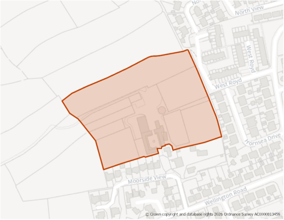
Site Size (ha) Gross: 3.05
Proposed Land Use: Housing
Minimum Development Capacity (Dwellings): 80
Site Type: Mixed
Ward: Bingley West
Settlement: Wilsden
Ownership: Private
Delivery Timescale: Long 2035+ (11+)
Site Specific Requirements:
Design Principles
- Development should provide at least 80 dwellings as part of a high quality built environment in line with Policies ST4 and DS1, at a net density of 35 dph. This should include affordable housing (in line with Policy HO4) and an appropriate mix of dwellings (in line with Policy HO3 and having due regard to relevant housing needs evidence and the character of the area).
- A senstively designed scheme should be provided which takes account of the surrounding rural character. Enhancements should be made to the surrounding Green Belt land including improvements to the adjacent public rights of way which may offer opportunities for residents to access the countryside.
- Development should be in keeping with the landscape character of the area and in line with design policies in the made (adopted) Wilsden Neighbourhood Development Plan and associated Design Code.
Site Access, Highways and Transport
- A new access would need to be created off West Royd, where there is a footway and streetlights are present.
- There is a public right of way which runs along the eastern boundary should be retained and enhanced as part of improvement works to facilitate the new access to the site.
Flooding, Water and Drainage
- A nominal flood risk assessment has been carried out for this site. It indicates that the site is wholly located within Flood Zone 1 of the Environment Agency's (EA) Flood Map for Planning which indicates it as at low risk of flooding from rivers. Development should be possible at this site given the low fluvial and very low surface water flood risk to the site.
- The site is not modelled to be at significant additional fluvial or surface water risk as a result of climate change. Any FRA should include for a drainage strategy which includes the flow path in site design and investigate ground conditions for infiltration SuDS suitability.
Natural and Historic Environment
- The site lies within Zone C (Recreational Pressure) - Residential development resulting in a net increase in dwellings will be required to mitigate any recreational pressure on the SPA/SAC caused by such development in accordance with the South Pennine Moors SPD and Policy NE3.
- The site is not identified in the LNRS as a priority area for nature recovery.
- A Heritage Impact Assessment (HIA) has been carried out for this site. It indicates that development must be informed by its surrounding residential context in terms of scale and materials. The housing development to the south has incorporated green landscaping to soften its impact on the rural fringe. Similar landscaping strategies should be employed for the development of this site. The HIA concludes that development of the site will have a less than substantial impact of an accptable level on the Wilsden Conservation Area. Existing development to the west of the conservation area means that development can take place at the site without overtly impacting on the heritage asset.
Environmental Protection
- The site is within a Mineral Safeguarding Area (MSA) for sandstone. A mineral resource assessment will be required as part of any planning application to determine the extent and availability of any sandstone resource.
- The site is crossed from south to north on the western side by a lower voltage electricity transmission line. Development should include a strategy for responding to the Northern Powergrid equipment present within the site which demonstrates how the Northern Powergrid and HSE Guidance have been applied as part of the design and layout and how the impact of the assets has been reduced through good design. Enquiries should be made with Northern Powergrid.
- Part of the site is classed as Grade 3b in the Agricultural Land Classification (ALC).
Open Space and Green / Blue Infrastructure
- Open space should be provided in line with Policy NE2, having regards to the standards set out in Appendix 11. The Open Space Assessment indicates that in Wilsden there is a need for increased provision of amenity greenspace, allotments, and play provision for both young and older children.
- The site is within an area of low provision and low need for green and blue infrastructure. However, development in this location may increase the need going forward, therefore development proposals should focus on creation of new green and blue infrastructure.
Landscape
- The site is within the Thornton, Queensbury and Wilsden Mixed Upland Pasture Landscape Character area/type (E1), where despite the presence of local undulations which provide a sense of enclosure, the overwhelming perception of this landscape is one of elevation and exposure.
- The Landscape Sensitivity Assessment indicates that the site is part of an area of a low-moderate landscape sensitivity. Retain drystone walls where possible, particularly along the site boundaries. Utilise carefully positioned tree planting to soften the settlement edge in views from the nearby PRoW network.
Green Belt (and Golden Rules)
- Site has been removed from the Green Belt. Development on the site should be consistent with the “Golden Rules” set out in the NPPF in relation to affordable housing, necessary improvements to infrastructure and accessible green space provision
Infrastructure Requirements
- Proportionate contributions to community infrastructure will be required, where appropriate, in line with Policies ID1 and ID2, and having regard to the Local Infrastructure Plan.
[1] The identified site capacity is shown as 58 dwellings. This relates to the pending planning application currently under consideration and equates to a net site density of circa 35 dwellings per hectare. The developable part of this site is located in the northern section.
