

Bradford District Local Plan - Publication Draft (Regulation 19) (October 2026)
Section 5: Settlement Policies & Site Allocations for Airedale
POLICY BA1 – BAILDON Comment
Settlement Plan
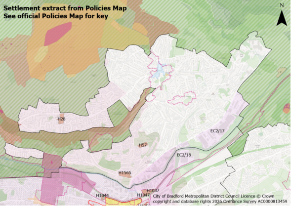
Settlement Hierarchy and Spatial Directions
- The town boundary is defined on the Policies Map and consists of Baildon and Lower Baildon, located between the River Aire to the south and the edge of Baildon Moor to the north.
- The focus for sustainable development of this medium town reflects its function and character, balanced against heritage and environmental constraints.
- The settlement features significant environmental and physical constraints which focuses growth within its linear settlement form and boundary.
Meeting Growth Needs
- Housing development is concentrated within the settlement boundary during the plan period and will:
- Deliver approximately 190 dwellings through a combination of sites under construction, planning permissions and new site allocations as set out in Table BA1.1
Table BA1.1
|
Under Construction |
Planning Permission |
Site Allocations |
|
|
Totals |
105 |
6 |
79 |
- Deliver housing site allocations as shown on the Policies Map and section 5:
- H28: South of West Lane
- H57: Land north of Richard Whiteley Drive
- H1565: Green Lane / Southdown Road
- Proposals for new homes within the settlement boundary on additional small sites, including the redevelopment of previously developed land, will be supported subject to meeting relevant Local Plan policies.
- Employment uses will continue to be concentrated within the Lower Baildon area of the town to the south of Otley Road and identified in Policies EC2/17 (Otley Road) and EC2/18 (Otley Road/Thackley Old Road Employment Zone).
Local Services and Facilities
- Support the range and quality of uses within the designated Baildon Local Centre as a key hub for the community to meet their day-to-day retail and leisure needs as well as the retention and improvement of local services and facilities.
- Protect and enhance designated open spaces in compliance with Policy NE2 and support proposals which address deficiencies in open space provision as set out on the Open Spaces Study.
- Maintain and enhance sport and recreation facilities with support for widened community access.
Landscape
- Maintain and enhance Baildon’s landscape setting reflecting its mix of landscape types and character areas (the Moorland Fringe, the Bingley and Baildon steep valley sides and the Central Airedale Settled Valley Floor), landscape features, fields and overall settlement pattern. Reference should be made to the Landscape Character Assessment Supplementary Planning Document
Historic and Natural Environment
- Protect and enhance the green and blue networks and corridors including the River Aire Corridor, Baildon Bank, Baildon Moor and urban fringe to enhance biodiversity and recreation within and adjacent to the settlement as well as incorporating sufficient green space and connections within new developments.
- Consideration should be given to the Green and Blue Infrastructure Strategy and the opportunities identified for enhancement within the Keighley – Shipley – Bingley Corridor.
- Protect and enhance the designated Local Wildlife Sites (Baildon Bank, Baildon Moor, Fairbank Wood, Shipley Glen, Tong Park with Hawksworth Spring Wood) and Local Geological Sites (Baildon Bank and Baildon Green Quarries, Baildon Moor, Shipley Glen) as well as habitat networks and priority habitats within and adjacent to the settlement.
- Development proposals should also pay particular attention to avoiding impact on the Trench Meadows Site of Special Scientific Interest towards the south-western edge of the settlement and Bradford Pennine Gateway National Nature Reserve (NNR).
- Where development is located within SPA/SAC Zone C (Recreational Pressure) residential development resulting in a net increase in dwellings will be required to mitigate any recreational pressure on the SPA/SAC caused by such development in accordance with the South Pennine Moors SPD and Policy NE3.
- Ensure that future development conserves and enhances key heritage assets and their settings within and adjacent to the settlement including the Baildon, Baildon Green, Saltaire and Station Road Conservation Areas and Listed Buildings, Scheduled Monuments as well as non-designated heritage assets.
- Development in the western part of the settlement within the Saltaire World Heritage Site (WHS) Buffer Zone should comply with Policy HE1 and conserve those elements which contribute towards its Outstanding Universal Value (OUV), including its setting and key views.
Local Infrastructure
- Support improvements and access to public transport and active travel, including enhanced links to Saltaire and Baildon railway stations and measures to reduce traffic congestion on routes from Lower Baildon to Baildon Local Centre, along Otley Road and the junction of Green Lane / Otley Road / Baildon Bridge.
- Proportionate contributions to new or enhanced community infrastructure will be required, where appropriate, in line with Policies ID1 and ID2 as well as having regard to the Local Infrastructure Plan.
Baildon (including Lower Baildon): Site Allocations
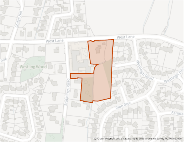
Site Size (ha) Gross: 1.02
Proposed Land Use: Housing
Minimum Development Capacity (Dwellings): 11
Site Type: Greenfield
Ward: Baildon
Settlement: Baildon
Ownership: Private
Delivery Timescale: Medium 2030-2035 (6-10)
Site Specific Requirements:
Planning Permission
- Site benefits from planning permission for 11 dwellings with associated access and landscaping (23/01010/MAF) granted in December 2025. This was after 1 April 2025 (the base date for the Local Plan). Accordingly it has been identified as a site allocation.
- Development of this site should take place in line with the approved planning permission. Should this permission not be implemented within the required timescales and/or a further application comes forward on the site, it will be determined against the policies set out in this Plan.
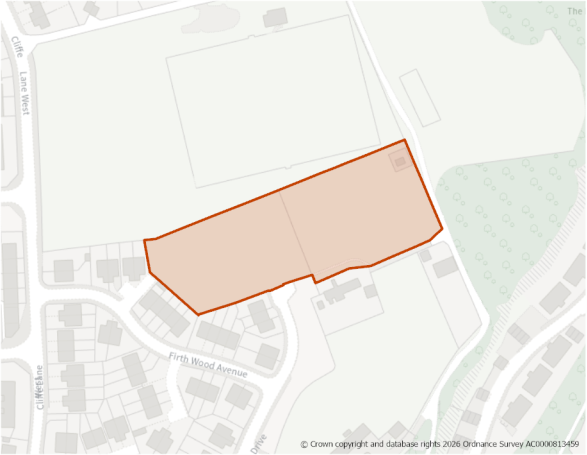
Site Size (ha) Gross: 0.73
Proposed Land Use: Housing
Minimum Development Capacity (Dwellings): 29
Site Type: Greenfield
Ward: Baildon
Settlement: Baildon
Ownership: Private
Delivery Timescale: Short 2025- 2030 (1-5)
Site Specific Requirements:
Design Principles
- Development should provide at least 29 dwellings as part of a high quality built environment in line with Policies ST4 and DS1. This should include affordable housing (in line with Policy HO4) and an appropriate mix of dwellings (in line with Policy HO3 and having due regard to relevant housing needs evidence and the character of the area).
Site Access, Highways and Transport
- A new site access is required and should be taken from Richard Whiteley Drive, where there are footpaths and streetlighting present.
- A Public Right of Way (bridleway) runs along the track adjacent to the eastern boundary of the site. Consideration should be given to providing a pedestrian and cycle link to it as part of any future development layout. This should be well-designed and overlooked by surrounding dwellings.
Natural and Historic Environment
- The site lies within Zone C (Recreational Pressure) - Residential development resulting in a net increase in dwellings will be required to mitigate any recreational pressure on the SPA/SAC caused by such development in accordance with the South Pennine Moors SPD and Policy NE3.
- The site is adjacent to an area of priority habitat (deciduous woodland) and within a bat alert area. An ecological survey will be required as part of any planning application to establish the extent/impacts as well as to identify appropriate mitigation.
- The site is identifed in the West Yorkshire Local Nature Recovery Strategy with the preferred measures B1_MO1: Plant and maintain new resilient mosaics of habitats in urban areas, B1_MO2: Significantly boost the biodiversity and resilience of existing urban wooded areas, and B2_MO1: Expand and enhance existing mapped priority habitats or create new wetlands on suitable anchor institution land
- The site is adjacent to area of TPO woodland and contains several trees. It is also bounded to the north by a hedgerow. Development should be informed by an arboricultural assessment
- The site is within the Saltaire World Heritage Site Buffer Zone, and within proximity to a designated heritage asset (Grade II Listed Building – Ferniehurst Farm). The Heritage Impact Assessment shows that there would be no impact on these identified designated heritage assets.
Environmental Protection
- Site is within 150m buffer of a former landfill site. A Land Contamination Assessment – Phase 1 Report will required as part of any planning application.
- The site was historically used as a training ground / quarry, giving rise for potential land contamination. A Land Contamination Assessment – Phase 1 Report will be required as part of any planning application. Impacts should be addressed in line with Policy CR2.
Open Space and Green / Blue Infrastructure
- Site was allocated as a playing field within the Bradford Replacement Unitary Development Plan (RUDP), associated with its former use as a school.
- Open space should be provided in line with Policy NE2, having regard to the standards set out Appendix 11.
- The site lies with the Keighley – Bingley – Shipley opportunity area, as identified in the Green and Blue Infrastructure Strategy (GBIS). The strategy should be consulted to identify opportunities for incorporating measures within the development that enhances the quality of, and connectivity to the green and blue infrastructure network, in line with Policies ST6 and NE1
Landscape
- The site is located within the Bingley and Baildon Steep Valley Sides Landscape Character area/type (D1). No landscape sensitivity assessment was undertaken for this site. Consideration should be given to the guidance set out in the Landscape Character Assessment SPD.
Infrastructure Requirements
- Proportionate contributions to community infrastructure will be required, where appropriate, in line with Policies ID1 and ID2, and having regard to the Local Infrastructure Plan.
Planning Permission
- A detailed planning application is currently pending on this site for 29 dwellings which may be determined before the Local Plan is adopted.
H1565: Green Lane/Southdown Road, Baildon Comment
Site Boundary:
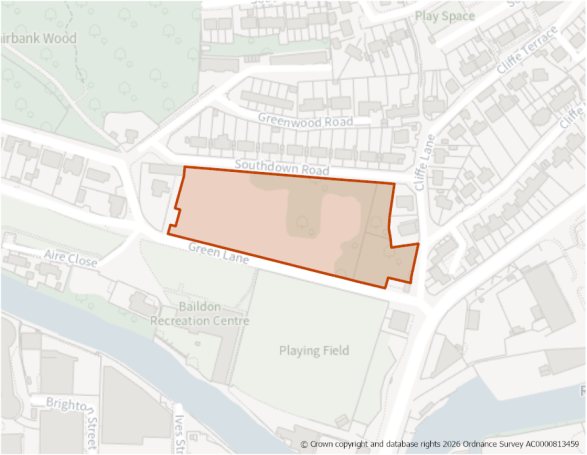
Site Size (ha) Gross: 1.23
Proposed Land Use: Housing
Minimum Development Capacity (Dwellings): 39
Site Type: Greenfield
Ward: Baildon
Settlement: Baildon
Ownership: Mixed
Delivery Timescale: Medium 2030-2035 (6-10)
Site Specific Requirements:
Design Principles
- Development should provide at least 39 dwellings as part of a high quality built environment in line with Policies ST4 and DS1, at a net density of 35 dph. This should include affordable housing (in line with Policy HO4) and an appropriate mix of dwellings (in line with Policy HO3 and having due regard to relevant housing needs evidence and the character of the area).
- The design and layout of any future development should respond positively to the green and blue infrastructure networks within/adjacent to the site and the adjacent Wildlife Habitat Network, flood risk constraints and its location within theSaltaire World Heritage Site (WHS) buffer zone.
Site Access, Highways and Transport
- A new site access is required and should be taken from Green Lane where footpaths and streetlighting are present.
- Consideration should be given to the impact on the junction between Green Lane, Otley Road and Cliffe Lane.
Flooding, Water and Drainage
- Part of the south eastern corner of the site is located within the function floodplain (Flood Zone 3b) as well as Flood Zones 2 and 3. No development should take place within the existing area of functional floodplain and directed away from areas modelled to be at risk of fluvial and surface water flooding. A Flood Risk Assessment should be provided as part of any planning application.
Natural and Historic Environment
- The site lies within SPA/SAC Zone C (Recreational Pressure) - residential development resulting in a net increase in dwellings will be required to mitigate any recreational pressure on the SPA/SAC caused by such development in accordance with the South Pennine Moores SPD and Policy NE3.
- The site is located within a bat alert area. An ecological survey will be required as part of any planning application to establish the extent/impacts as well as to identify appropriate mitigation.
- The site is located adjacent to an identified Wildife Habitat Network. Development proposals should respond positively to its presence, whilst existing mature trees along the Green Lane southern boundary of the site, should be retained.
- The site is identified in the West Yorkshire Local Nature Recovery Strategy with the preferred measure W4_MO2: Create new reedbeds, wet grasslands, floodplain meadows, open standing water and wet woodland around known areas of lowland raised bog
- The site is located within the Saltaire World Heritage Site (WHS) Buffer Zone, whilst Green Lane is identified as an important gateway to the WHS. Development should be informed by the local context and tree line boundaries, which are aethetically pleasant part of the street scene to be retained. It should also not become an overtly prominent feature of the approach gateway. Regard should be had to the WHS Management Plan.
Environmental Protection
- Site located within 150m buffer of former landfill site. A Land Contamination Assessment – Phase 1 Report will required as part of any planning application due, determining any potential impacts. Impacts should be addressed in line with Policy CR2.
Open Space and Green / Blue Infrastructure
- Open space should be provided in line with Policy NE2, having regard to the standards set out Appendix 11.
- The site lies with the Keighley – Bingley – Shipley opportunity area, as identified in the Green and Blue Infrastructure Strategy (GBIS). The strategy should be consulted to identify opportunities for incorporating measures within the development that enhances the quality of, and connectivity to the green and blue infrastructure network, in with Policy ST6 and NE1.
Landscape
- The site is located within the Central Airedale Settled Valley Floor Landscape Character area/type (G2). No landscape sensitivity assessment was undertaken for this site. Consideration should be given to the guidance set out in the Landscape Character Assessment SPD.
Infrastructure Requirements
- Proportionate contributions to community infrastructure will be required, where appropriate, in line with Policies ID1 and ID2, and having regard to the Local Infrastructure Plan
POLICY BI1 – BINGLEY Comment
Settlement Plan
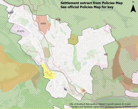
Settlement Hierarchy and Spatial Directions
- The town boundary is defined on the Policies Map and consists of built-up area of Bingley including the Eldwick, Gilstead and Crossflatts areas of the town.
- The focus for sustainable development of this medium town reflects its sustainable location with good highway and public transport connections including a railway station and regular bus services to nearby communities, as well as the services and facilities it provides. This is balanced against the importance of its historic centre with designated heritage assets and wider environmental and physical constraints.
- Development proposals should have regard to, and be consistent with, the made (adopted) Bingley Neighbourhood Development Plan.
Meeting Growth Needs
- Housing development includes a combination of development within the settlement boundary and land to be released from the Green Belt during the plan period and will:
- Deliver approximately 817 dwellings through a combination of sites under construction, planning permissions and new site allocations as set out in Table BI1.1.
- Deliver housing site allocations as shown on the policies map and the site proformas within section 5:
- H77: Laurel Bank, Sheriff Lane, Eldwick
- H105: Sty Lane, Crossflatts
- H106: Greenhill Barn, Lady Lane
Table BI1.1 - Bingley:
|
Under Construction |
Planning Permission |
Site Allocations |
|
|
Totals |
332 |
37 |
448 |
- Proposals for new homes within the settlement boundary on additional small sites, including the redevelopment of previously developed land, will be supported subject to meeting relevant policies and made (adopted) Neighbourhood Development Plan policies.
- Employment uses will continue to be concentrated within the town including the Castlefields Industrial Estate (identified under Policy EC2/15). The plan will deliver the employment allocation shown on the Policies Map and section 5:
- E8: John Escritt Road (0.5 hectares)
Local Services and Facilities
- Support the range and quality of uses within the designated Bingley Town Centre (as shown on the Policies Map) as a key hub for the town and surrounding communities to meet their day-to-day retail and leisure needs as well as the retention and improvement of local services and facilities.
- Support a diverse mix of retail, commercial, leisure and cultural uses and a strong independent business sector and improve visitor attractions together whilst ensuring a high-quality built environment, public realm, and distinctive character. Residential development will also be supported, where appropriate. Regard should be given to Policy BING3 of the made (adopted) Neighbourhood Development together its supporting documentation - the Bingley Town Centre and Local Centres Design Code and Neighbourhood Plan Masterplan
- Protect and enhance designated Local Green Spaces, identified in Policy BING8 of the made (adopted) Neighbourhood Development Plan, and open spaces in compliance with Policy NE2. Proposals that address deficiencies in open space provision identified in the Open Space Study, will be supported.
- Maintain and enhance sport and recreation facilities with support for widened community access.
Landscape
- Maintain and enhance Bingley’s landscape setting reflecting its mix of landscape types and character areas (the moorland fringe, the Baildon and Bingley, and the Thwaites Brow steep valley sides and the Central Airedale settled valley floor), landscape features, fields and overall settlement pattern. Reference should be made to the Landscape Character Assessment Supplementary Planning Document.
- Development should have regard to potential impacts on the Distinctive Local Views and Vistas identified in Policy BING12 of the made (adopted) Neighbourhood Development Plan.
Historic and Natural Environment
- Protect and enhance green and blue networks and corridors within and adjacent to the settlement including the River Aire Corridor, the Leeds Liverpool Canal corridor, Shipley Glen, Morton Beck and the corridors identified in Policy BING9 of the made (adopted) Neighbourhood Development Plan. The aim is to enhance biodiversity and recreation opportunities within and adjacent to the settlement as well as incorporating sufficient green space and connections within new developments.
- Consideration should be given to the Green and Blue Infrastructure Strategy and the opportunities identified for enhancement within the Keighley – Shipley – Bingley Corridor, as well as the green infrastructure principles set out in Policy BING9 of the made (adopted) Neighbourhood Development Plan.
- Protect and enhance the designated Bingley South Bog SSSI, Bradford Pennine Gateway National Nature Reserve, Local Wildlife Sites (Bingley North Bog, Gilstead Moor Edge and Prince of Wales Park, Hollin Plantation, Leeds Liverpool Canal, Milnerfields Traditional Orchard, Milnerfields Woods, Shipley Glen, St. Ives Estate) and Local Geological Sites (Shipley Glen) as well as habitat networks and priority habitats within and adjacent to the settlement. Development proposals should also pay particular attention to avoiding impacts upon these designated assets.
- The northern section of the settlement is located within SPA/SAC Zone B (2.5km) (supporting habitat functionally linked land, recreational pressure), whilst the southern section is within SPA/SAC Zone C (7km) (recreational pressure). Development proposals must assess potential impacts on foraging habitat used by SPA qualifying species and provide ecological evidence where required, as well as mitigate any recreational pressure on the SPA/SAC caused by such development in accordance with the South Pennine Moors SPD and Policy NE3.
- Ensure that future development conserves and enhances key heritage assets and their settings within and adjacent to the settlement including the Bingley, Eldwick Beck, Leeds Liverpool Canal and Micklethwaite Conservation Areas and Listed Buildings as well as non-designated heritage assets identified in Policy BING10 of the made (adopted) Neighbourhood Development Plan.
- Development on the eastern part of the settlement is within the Saltaire World Heritage Site (WHS) Buffer Zone and should comply with Policy HE1 and conserve those elements which contribute towards its Outstanding Universal Value (OUV), including its setting and key views.
Local Infrastructure
- Support improvements and access to public transport and active travel, including enhanced links to Bingley Grammar School, Beckfoot Hazelbeck School and Bingley and Crossflatts railway stations. Consideration should be given to the walking and cycling improvements set out in Policy BING7 of the made (adopted) Neighbourhood Development Plan
- Support proposals which strengthen the routes between Main Street, the Leeds and Liverpool Canal and Five Rise Locks, including improved signage, pedestrian routes and cycling connections
- Consideration should be given to reducing traffic congestion on routes through the settlement, along Keighley Road and Main Street and the junctions connecting with the Aire Valley trunk road.
- Proportionate contributions to new or enhanced community infrastructure will be required, where appropriate, in line with Policies ID1 and ID2.
Bingley: Site Allocations
H77: Laurel Bank, Sheriff Lane, Eldwick Comment
Site Boundary:
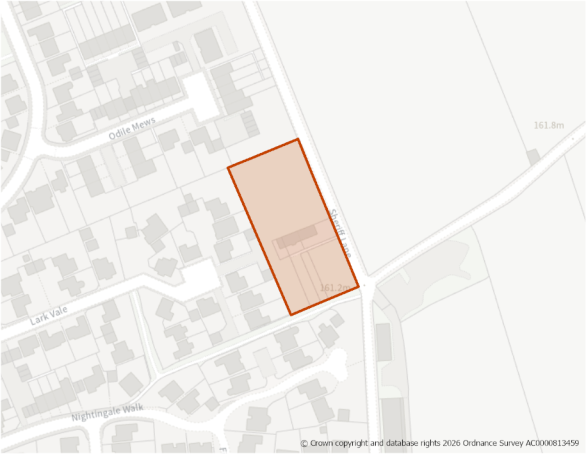
Site Size (ha) Gross: 0.33
Proposed Land Use: Housing
Minimum Development Capacity (Dwellings): 3
Site Type: Greenfield
Ward: Bingley East
Settlement: Bingley
Ownership: Private
Delivery Timescale: Short 2025-2030 (1-5)
Site Specific Requirements:
Design Principles
- Development should provide at least 3 dwellings as part of a high quality built environment in line with Policies ST4 and DS1.
- Sensitive design and layout is required having regard to the presence of existing dwellings within the wider site and the restricted site access as well as the TPO trees and TPO woodland to the north.
- Design and layout should also reflect relevant policies within the “made” Bingley Neighourhood Development Plan.
Site Access, Highways and Transport
- A new site access is required and should be taken from Lark Vale. No access should be taken from Sheriff Lane.
- Sheriff Lane and the adjoinging Public Right of Way running along the southern boundary are identified in Policy BING7 of the “made” (adopted) Neighbourhood Development Plan as a walking and cycling route between Eldwick and Crossflatts/Micklethwaite that should enhanced.
Natural and Historic Environment
- The site lies within the Special Protection Area / Special Area of Conservation, (SPA/ SAC), Zone B (Supporting Habitat/Functionally Linked Land; recreational pressure). Development proposals must assess potential impacts on foraging habitat used by SPA qualifying species and provide ecological evidence where required, as well as mitigate any recreational pressure on the SPA/SAC caused in accordance with the South Pennine Moors SPD and Policy NE3.
- The site’s northern boundary is immediately adjacent to a number of TPO trees and an area of TPO Woodland that are of a high amenity value. These trees should be retained and protected by ensuring that any construction takes place outside the root protection area. Careful consideration should be given to the siting of any dwellings in relation to these trees.
Environmental Protection
- The site is located within the 150m and 250m buffers of a former landfill site. A Land Contamination Assessment – Phase 1 Report will required as part of any planning application to identify any potential risk and appropriate mitigation measures. Impacts should be addressed in line with Policy CR2.
Open Space and Green / Blue Infrastructure
- Open space should be provided in line with Policy NE2, having regard to the standards set out Appendix 11.
Landscape
- The site is located within the Bingley and Baildon Steep Valley Sides Landscape Character area/type (D1). No landscape sensitivity assessment was undertaken for this site. Consideration should be given to the guidance set out in the Landscape Character Assessment SPD.
Infrastructure Requirements
- Proportionate contributions to community infrastructure will be required, where appropriate, in line with Policies ID1 and ID2, and having regard to the Local Infrastructure Plan.
H105: Sty Lane, Bingley Comment
Site Boundary:
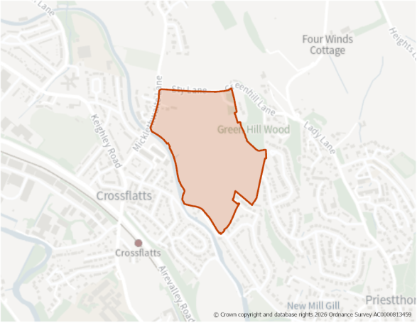
Site Size (ha) Gross: 16.57
Proposed Land Use: Housing
Minimum Development Capacity (Dwellings): 420
Site Type: Greenfield
Ward: Bingley East
Settlement: Bingley
Ownership: Private
Delivery Timescale: Medium 2030-2035 (6-10)
Site Specific Requirements:
Design Principles
- Development should provide at least 420 dwellings as part of a high quality built environment in line with Policies ST4 and DS1. This should include affordable housing (in line with Policy HO4) and an appropriate mix of dwellings (in line with Policy HO3 and having due regard to relevant housing needs evidence and the character of the area).
- A high quality development should be provided based on the outline masterplan as approved (14/002893/MAO).
- Design and layout should also reflect relevant policies within the “made” Bingley Neighourhood Development Plan.
Site Access, Highways and Transport
- New/improved site access will be required from Micklethwaite Lane and Sty Lane.
Flooding, Water and Drainage
- The site is located within Flood Zone 1, however areas of surface water flooding risk are located within and adjacent to the site. A Flood Risk Assessment will be required to determine the nature of any risk and to identify suitable mitigation measures. A drainage stategy will also be required.
Natural and Historic Environment
- The site lies within the Special Protection Area / Special Area of Conservation, (SPA/ SAC), Zone B (Supporting Habitat/Functionally Linked Land; recreational pressure). Development proposals must assess potential impacts on foraging habitat used by SPA qualifying species and provide ecological evidence where required, as well as mitigate any recreational pressure on the SPA/SAC caused in accordance with the South Pennine Moors SPD and Policy NE3.
- The site is located within a bat alert area. An ecological survey will be required as part of any planning application to establish the extent/impacts as well as to identify appropriate mitigation.
- The site lies within a SSSI Impact Risk Zone. Based on the level of development proposed, there is a potential for it to impact upon a SSSI. Consultation will be required with Natural England to seek advice on how impacts might be avoided or mitigated.
- The site is immediately adajcent to the Leeds and Liverpool Canal Local Wildlife Site. The layout and design of any development include an appropriate buffer area along its southern boundary. An ecological survey will be required as part of any planning application to establish the extent/impacts as well as to identify appropriate mitigation
- The site is identified in the West Yorkshire Local Nature Recovery Strategy with the preferred measures B4M02: Significantly boost biodiversity wherever possible where there are existing habitats alongside transport infrastructure, Q2_M01: Significantly enhance the quality of the habitats in existing Local Wildlife Sites, T1_M01: Through natural processes and planting, create biodiverse, site-suitable, and adaptable woodland habitats to buffer and connect existing ancient woodlands and ancient/veteran trees, and T2_M04: Extend and connect tree and woodland cover across the White Rose Forest area in West Yorkshire.
- The sites contains and is adjacent to areas of TPO woodland as well as hedgerows that form part of long standing field boundaries. Such features should be retained and protected as part of the design and layout of any development. An arboricultural assessment will be required as part of any planning application.
- The site contains and is within proximity to three designated heritage assets (Grade II Listed Buildings – Laythorpe Farm and Laythorpe Farm Barn, and Green Hill Gate), and is adjacent to and partially located within the Leeds Liverpool Canal Conservation Area.
- The site contains two non-designated heritage assets, as identified in Policy BING10 of the “made” Bingley Neighbourhood Development Plan – Prehistoric carved cup and ring rock, and hedging, drystone wall boundaries and gateposts (both of which are listed as being within the Greenhill Fields). It is also adjacent to a further non-designated heritage asset – lime kilns adjacent to the Leeds Liverpool Canal at Micklethwaite Bridge.
Environmental Protection
- The site shows evidence of potential instability with streams and field drains running through the northern/north western sections towards the canal. Ground conditions are also boggy in places, whilst consideration should be given to the canal bank, which is partially eroded in places. Engagement should take place with the Canal and River Trust.
- The site is crossed from south east to north by a lower voltage electricity transmission underground cable. The eastern section is also crossed by a lower voltage electricity transmission line. Development should include a strategy for responding to the Northern Powergrid equipment present within the site, which demonstrates how the Northern Powergrid and HSE Guidance have been applied as part of the design and layout and how the impact of the assets has been reduced through good design. Enquiries should be made with Northern Powergrid.
Open Space and Green / Blue Infrastructure
- Open space should be provided in line with Policy NE2, having regard to the standards set out in Appendix 11.
- The site lies within the Keighley – Bingley – Shipley opportunity area, as identified in the Green and Blue Infrastructure Strategy (GBIS). The strategy should be consulted to identify opportunities for incorporating measures within the development that enhances the quality of, and connectivity to the green and blue infrastructure network, in line with Policies ST6 and NE1
Landscape
- The site is located partially within the Bingley and Baildon Steep Valley Sides Landscape Character area/type (D1) and partially within the Central Airedale Settled Valley Floor Character area/type (G2).
- No landscape sensitivity assessment was undertaken for this site. Consideration should be given to the guidance set out in the Landscape Character Assessment SPD.
Infrastructure Requirements
- Proportionate contributions to community infrastructure will be required, where appropriate, in line with Policies ID1 and ID2, and having regard to the Local Infrastructure Plan.
Planning Permission
- Site benefits from a hybrid planning permission, granted in September 2016. This includes an outline planning permission for 420 to 440 dwellings. A Reserved Matters application is currently pending on this site for 420 dwellings which may be determined before the Local Plan is adopted.
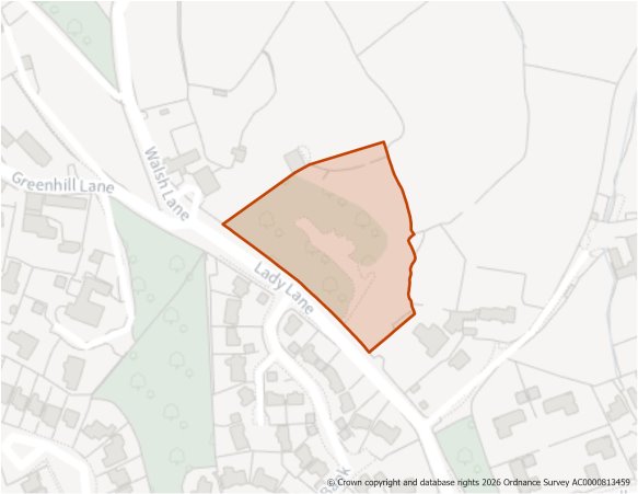
Site Size (ha) Gross: 0.78
Proposed Land Use: Housing
Minimum Development Capacity (Dwellings): 25
Site Type: Greenfield
Ward: Bingley East
Settlement: Bingley
Ownership: Private
Delivery Timescale: Medium 2030-2035 (6-10)
Site Specific Requirements:
Design Principles
- Development should provide at least 25 dwellings as part of a high quality built environment in line with Policies ST4 and DS1, at a net density of 35 dph. This should include affordable housing (in line with Policy HO4) and an appropriate mix of dwellings (in line with Policy HO3 and having due regard to relevant housing needs evidence and the character of the area).
- Sensitive design and layout will require taking into consideration the site’s elevated position, sloping topography and location on the edge of the settlement as well as its proximity to designated heritage assets.
- Design and layout should also reflect relevant policies within the “made” Bingley Neighbourhood Development Plan.
Site Access, Highways and Transport
- A new site access is required and should be taken from Lady Lane, which has footways and streetlighting present.
- Lady Lane is identified in the “made” Bingley Neighbourhood Development Plan under Policy BING7 as a walking and cycling route between Eldwick and Crossflatts/Micklethwaite that should be enhanced.
Natural and Historic Environment
- The site lies within the Special Protection Area / Special Area of Conservation, (SPA/ SAC), Zone B (Supporting Habitat/Functionally Linked Land; recreational pressure). Development proposals must assess potential impacts on foraging habitat used by SPA qualifying species and provide ecological evidence where required, as well as mitigate any recreational pressure on the SPA/SAC caused in accordance with the South Pennine Moors SPD and Policy NE3.
- The site is partially located in a broad corridor centred on Prince of Wales Park identified in Policy BING9 of the “made” (adopted) Neighbourhood Development Plan as an area where proposals for strategic nature recovery and biodiversity net gain will be supported.
- The site is identified in the West Yorkshire Local Nature Recovery Strategy with the preferred measures B4_M02: Significantly boost the biodiversity and resilience of existing urban wooded areas and G1_M03: Restore and enhance existing species-rich grasslands.
- The site is a planted conifer woodland and is adjacent to an area of TPO woodland. These should be, where possible, retained and protected as part of the design and layout of any development in line with Policy NE6. An arboricultural assessment will be required as part of any planning application.
- The site is within close proximity of two designated heritage assets (Grade II Listed Buildings – Greenhill Grange and Greenhill Crag Farm). A Heritage Impact Assessment (HIA) has been carried out for this site and indicates that its development would result in harm of an unacceptable level as there is limited opportunity to effectively mitigate the resulting impact of development on the designated heritage asset(s).
- However, the wider public and sustainability benefits provided by the sensitive development of the site are such that its allocation in the plan is considered a necessary part of the development strategy for the settlement. A more detailed HIA, for the specific proposed scheme will need to be carried out at the planning application stage working closely with the Council’s Heritage team, to develop appropriate mitigation measures to reduce the harm as much as is possible.
Environmental Protection
- The site is partly within a Mineral Safeguarding Area for Sandstone. However, due to the site area (below 1ha) a mineral resource assessment is not required in line with Policy MIN3.
- The site is crossed from east to west by a low voltage electricity transmission line. Development should include a strategy for responding to the Northern Powergrid equipment present within the site, which demonstrates how the Northern Powergrid and HSE Guidance have been applied as part of the design and layout and how the impact of the assets has been reduced through good design. Enquiries should be made with Northern Powergrid
- The site is crossed from north to south by an underground water aqueduct. Engagement should take place with Yorkshire Water to determine whether development will have any impact.
Open Space and Green / Blue Infrastructure
- Open space should be provided in line with Policy NE2, having regard to the standards set out in Appendix 11.
Landscape
- The site is located within the Bingley and Baildon Steep Valley Sides Landscape Character area/type (D1).
- The site has a low-moderate landscape sensitivity. Development should be sensitively designed to respond to the existing nature of the settlement boundary by limiting built form at the higher elevations of the site.
Green Belt (and Golden Rules)
- The site has been removed from the Green Belt. Development on the site should be consistent with the “Golden Rules” set out in the NPPF in relation to affordable housing, necessary improvements to infrastructure and accessible green space provision.
Infrastructure Requirements
- Proportionate contributions to community infrastructure will be required, where appropriate, in line with Policies ID1 and ID2, and having regard to the Local Infrastructure Plan.
E8: John Escritt Road: Site Boundary Comment
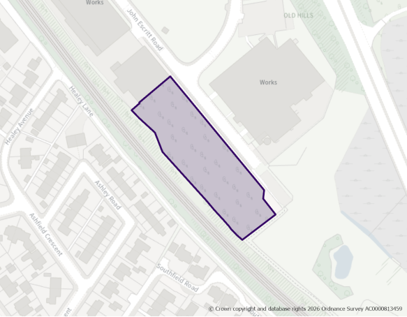
Site Size (ha) Gross: 0.50
Net Developable Area (ha): 0.50
Proposed Land Use: Employment (E(g)(i), B2 and B8)
Site Type: Greenfield
Ward: Bingley East
Settlement: Bingley
Ownership: Private
Delivery Timescale: 2030-2035
Site Specific Requirements:
Site Access, Highways and Transport
- A new access to John Escritt Road is required.
Natural and Historic Environment
- The site lies within the Special Protection Area / Special Area of Conservation (SPA/SAC) Zone C (Recreational Pressure) - Residential development resulting in a net increase in dwellings will be required to mitigate any recreational pressure on the SPA/SAC caused by such development in accordance with the South Pennine Moors SPD and Policy NE3.
- Bingley South Bog SSSI immediately to the south together with hedgerow protection
- Site is adjacent to an identified Wildlife Habitat Network (Grassland) and partially within a bat alert area. An ecology survey may be required at the planning application stage. Early engagement with the Council's Biodiversity Officer is recommended.
- The site is identified in the LNRS with preferred measure T2_M05: Help more red squirrels to move back into West Yorkshire.
Environmental Protection
- Site is within a Mineral Safeguarding Area (MSA) for sandstone. A mineral resource assessment will be required as part of any planning application to determine the extent and availability of any sandstone resource.
Open Space and Green / Blue Infrastructure
- The site lies within the Keighley- Bingley – Shipley CorridorOpportunity Area, as identified in the Green and Blue Infrastructure Strategy (GBIS). The strategy should be consulted to identify opportunities for incorporating measures within the development that enhance the quality of, and connectivity to, the green and blue infrastructure network in this area.
- Site is partially within an area of high provision and high need for green and blue infrastructure. Development proposals should focus on carefully designed green and blue infrastructure to contribute towards site specific issues e.g. flood mitigation, urban cooling etc.
- Where appropriate, the site should seek to provide on-site open space in line with Policy NE2.
Landscape
- The site is located within the Central Airedale Settled Valley Floor Landscape Character area/type (G2). No landscape sensitivity assessment was undertaken for this site. Consideration should be given to the guidance set out in the Landscape Character Assessment SPD.
Other Constraints
- The eastern section of the site may require remediation due to previous works.
Infrastructure Requirements
- Proportionate contributions to community infrastructure will be required, where appropriate, in line with Policies ID1 and ID2, and having regard to the Local Infrastructure Plan.
POLICY CO1 – COTTINGLEY Comment
Settlement Plan
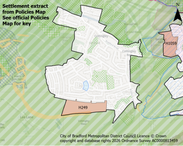
Settlement Hierarchy and Spatial Directions
- The village boundary is defined on the Policies Map and consists of the built-up area of Cottingley located between the River Aire to the north, the edge of Cottingley Moor to the south and Cottingley New Road/Bradford Old Road to the east.
- The focus for sustainable development of this large village reflects the level of functions and services it provides, and its character. This is balanced against its wider environmental and physical constraints.
- Development proposals should have regard to, and be consistent with, the made (adopted) Bingley Neighbourhood Development Plan, which covers the Cottingley area.
Meeting Growth Needs
- Housing development includes a combination of development within the settlement boundary and land to be released from the Green Belt during the plan period and will:
- Deliver approximately 170 dwellings through a combination of sites under construction, planning permissions and new site allocations as set out in Table CO1.1
- Deliver housing site allocation as shown on the Policies Map and Section 5:
- H249: March Cote Lane
- Proposals for new homes within the settlement boundary on additional small sites, including the redevelopment of previously developed land, will be supported subject to meeting relevant Local Plan and made (adopted) Neighbourhood Development Plan policies.
Table CO1.1 - Cottingley:
|
Under Construction |
Planning Permission |
Site Allocations |
|
|
Totals |
11 |
4 | 155 |
Local Services and Facilities
- Support the range and quality of uses within the designated Cottingley Local Centre as a key hub for the community to meet their day-to-day shopping and leisure needs as well as the retention and enhancement of local services and facilities.
- Protect and enhance designated Local Green Spaces, identified in Policy BING8 of the made (adopted) Neighbourhood Development Plan and open spaces in compliance with Policy NE2. Proposals which address deficiencies in open space provision as set out on the Open Spaces Study will be supported.
- Maintain and enhance sport and recreation facilities with support for widened community access including opportunities to increase provision of Outdoor Sports Spaces, Parks and Play areas through new development.
Landscape
- Maintain and enhance the landscape setting with its mix of landscape types and character areas (the Thornton, Queensbury and Wilsden Mixed Upland Pasture, the Cottingley Urban Edge Wooded Valleys and Slopes and the Central Airedale Settled Valley Floor), landscape features, fields and overall settlement pattern. Reference should be made to the Landscape Character Assessment Supplementary Planning Document.
- Development should have regard to potential impacts on the Distinctive Local Views and Vistas identified in Policy BING12 of the made (adopted) Neighbourhood Development Plan.
Historic and Natural Environment
- Protect and enhance green and blue networks and corridors including River Aire Corridor, Cottingley Beck, Hazel Beck, other watercourses and settlement fringe as well as the corridors identified in Policy BING9 of the made (adopted) Neighbourhood Development Plan. The aim is to enhance biodiversity and recreation within and adjacent to the settlement as well as incorporating sufficient green space and connections within new developments.
- Consideration should be given to the Green and Blue Infrastructure Strategy and the opportunities identified for enhancement within the Keighley – Shipley – Bingley Corridor, as well as the green infrastructure principles set out in Policy BING9 of the made (adopted) Neighbourhood Development Plan.
- Protect and enhance the designated Local Wildlife Sites (Cottingley Woods – Black Hills, Hazel Beck, Rye Loaf Hill), Ancient Woodland as well as habitat networks and priority habitats within and adjacent to the settlement. Development proposals should also pay particular attention to avoiding impact on the Bingley South Bog Site of Special Scientific Interest, located in Bingley, on the northern side of the settlement.
- Where development is located within SPA/SAC Zone C (Recreational Pressure) residential development resulting in a net increase in dwellings will be required to mitigate any recreational pressure on the SPA/SAC caused by such development in accordance with the South Pennine Moors SPD and Policy NE3.
- Ensure that future development conserves and enhances key heritage assets and their settings within and adjacent to the settlement including Listed Buildings as well as non-designated heritage assets as identified in Policy BING10 of the made (adopted) Neighbourhood Development Plan.
Local Infrastructure
- Proportionate contributions to community infrastructure will be required, where appropriate, in line with Policies ID1 and ID2, and having regard to the Local Infrastructure Plan
Cottingley: Site Allocations
H249: Marchcote Lane, Cottingley Comment
Site Boundary:
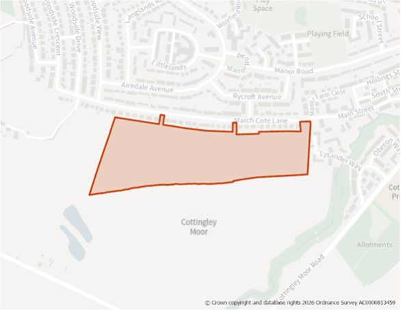
Site Size (ha) Gross: 8.46
Proposed Land Use: Housing
Minimum Development Capacity (Dwellings): 155
Site Type: Greenfield
Ward: Bingley West
Settlement: Cottingley
Ownership: Private
Delivery Timescale: Medium 2030-2035 (6-10)
Site Specific Requirements:
Design Principles
- The site should provide at least 155 dwellings as part of a high-quality built environment in line with Policies ST4 and DS1. This should include affordable housing (in line with Policy HO4 and an appropriate mix of dwellings (in line with Policy HO3 and having due regard to relevant housing needs evidence and the character of the area).
- A sensitive design and layout will be required taking into consideration the site’s location on the edge of the settlement. This should include appropriate landscaping and seek to avoid areas that are at risk of surface water flooding.
- Design and layout should also reflect relevant policies within the “made” Bingley Neighbourhood Development Plan.
Site Access, Highways and Transport
- New access required. Potential access points from March Cote Lane (to the north) and Lysander Way (to the east). Consideration should be given to determine the most appropriate point of vehicular and pedestrian access as well as impacts on the wider highway network.
- A Public Right of Way, Bingley 36, runs across the site from north to south. This should be retained and incorporated within the design and layout of any development.
Flooding, Water and Drainage
- Northern edge of the site is partially within groundwater levels (between 0.5m and 5m below the ground surface). Potential surface water flooding and pooling has been identified at eastern edge of site.
- The site is more than 1ha in size. A Flood Risk Assessment (FRA) and Drainage Assessment should be provided to identify any potential flood risk and appropriate measures for managing it.
Natural and Historic Environment
- The site lies within the Special Protection Area / Special Area of Conservation, SPA/SAC Zone C (Recreational Pressure) - Residential development resulting in a net increase in dwellings will be required to mitigate any recreational pressure on the SPA/SAC caused by such development in accordance with the South Pennine Moors SPD and Policy NE3.
- The site is located within a bat alert area. An ecological survey will be required as part of any planning application to establish the extent/impacts as well as to identify appropriate mitigation.
- The site is identified in the West Yorkshire Local Nature Recovery Strategy with preferred measure T2_M05: Help more red squirrels to move back into West Yorkshire.
- The site contains a site of archaeological potential (Class II). Archaeology assessment will be required.
- Potential impact on setting of a Listed Building (Grade II) adjacent to the northeast corner of the site, partially within 50m buffer of Listed Buildings (Grade II- Manor Farm). Stock-A-Close Farmhouse & Barn, both Grade II Listed Buildings, are located 230 meters to the west of the site.
- The site is within an area identified by the Saltaire World Heritage Site (WHS) Management Plan 2014 as important to its setting.
- A Heritage Impact Assessment will be required at the planning application stage to assess potential impact on the WHS and its setting. Discussion with the Council's Landscape, Design and Conservation section is recommended.
Environmental Protection
- Site is partially within sandstone and coal Minerals Safeguarding Areas (MSAs). A mineral resource assessment will be required as part of any planning application to determine the extent and availability of any sandstone and coal mineral resources.
- The eastern section of the site is crossed underground by an aqueduct (Nidd Aqueduct) from north to south close to the eastern boundary. Engagement should take place with Yorkshire Water.
- The site is crossed from west to east by a lower voltage electricity transmission line (possibly 11kV) close to the northern boundary. Development should include a strategy, for responding to the Northern Powergrid equipment present within the site, which demonstrates how the Northern Powergrid and HSE Guidance have been applied as part of the design and layout, and how the impact of the assets has been reduced through good design. Enquiries should be made with Northern Powergrid.
Open Space and Green / Blue Infrastructure
- Open space should be provided in line with Policy NE2, having regards to the standards set out in Appendix 11.
- The site is within an area of low provision and high need for green and blue infrastructure. Development proposals should focus on carefully designed green and blue infrastructure to contribute towards site specific issues.
Landscape
- The site is located within the Thornton, Queensbury, and Wilsden Mixed Upland Pasture Landscape Character Area/type (E1).
- A sensitive design and layout will be required, including consideration of topography, building heights and appropriate screening to mitigate any impacts on the landscape. If development were to occur, it should be restricted to the lower, northern extends of the site. Drystone walls should be retained where possible and existing tree belts should be maintained and enhanced to screen views from the PRoW network and nearby Listed Building, including Stock-A-Close farmhouse.
- A landscape impact assessment will be required to access the impact of the development on the wider landscape.
Other Constraints
- The site is located on sloping terrain on the edge of Cottingley Moor, on the southern side of the Aire Valley. The landform slopes uniformly south-west to north-east.
Green Belt (and Golden Rules)
- Site has been removed from the Green Belt. Development on the site should be consistent with the “Golden Rules” set out in the NPPF in relation to affordable housing, necessary improvements to infrastructure and accessible green space provision.
Infrastructure Requirements
- Proportionate contributions to community infrastructure will be required, where appropriate, in line with Policies ID1 and ID2, and having regard to the Local Infrastructure Plan.
Planning Permission
- An outline planning application is currently pending on this site for 155 homes which may be determined before the Local Plan is adopted (19/03599/MAO).
POLICY EM1 – EAST MORTON: Settlement Plan Comment
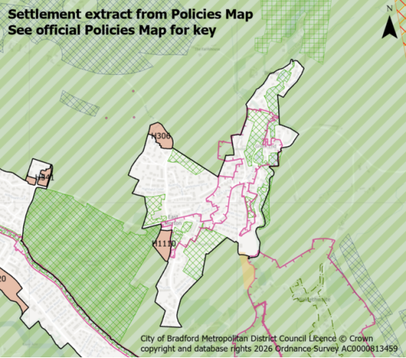
Settlement Hierarchy and Spatial Directions
- The village boundary is defined on the Policies Map and consists of the existing built-up area of East Morton located on the slopes of the Aire Valley and straddling Morton Beck.
- The focus for sustainable development of this Small Village reflects its function and character balanced against heritage and environmental constraints.
- The settlement features significant environment constraints which focuses growth within its rural settlement form and boundary.
Meeting Growth Needs
- Housing development includes development within the settlement boundary and land to be released from the Green Belt during the plan period and will:
- Deliver approximately 38 dwellings through a combination of existing planning permissions and new site allocations through the plan period as set out in table EM1.1.
- Deliver housing site allocations as shown on the Policies Map and in section 5:
- H306 High Stead, Street Lane
- H1110 Carr Lane
- Proposals for new homes within the settlement boundary on additional small sites, including the redevelopment of previously developed land, will be supported subject to meeting relevant Local Plan policies.
Table EM1.1 - East Morton:
|
Under Construction |
Planning Permission |
Site Allocations |
|
|
Totals |
- |
3 |
35 |
Local Services and Facilities
- Support the retention and improvement of any local services and facilities.
- Protect and enhance designated and open spaces in compliance with Policy NE2 and support proposals which address deficiencies in open space provision as set out on the Open Spaces Study.
- Maintain and enhance sport and recreation facilities with support for widened community access.
Landscape
- Maintain and enhance East Morton’s landscape setting with its varied landscape types and character areas (steep valley sides and moorland fringe), landscape features, fields and overall settlement pattern. Reference should be made to the Landscape Character Assessment Supplementary Planning Document.
Historic and Natural Environment
- Protect and enhance green and blue networks and corridors including the River Aire Corridor, Morton Beck and village fringe to enhance biodiversity and recreation within and adjacent to the settlement as well as incorporating sufficient green space and connections within new developments.
- Consideration should be given to the Green and Blue Infrastructure Strategy and the opportunities identified for enhancement within the Keighley – Shipley – Bingley Corridor.
- Protect and enhance designated Local Wildlife Sites (Leeds Liverpool Canal, Sunnydale) and habitat networks and priority habitats within and adjacent to the settlement.
- East Morton is located within SPA/SAC Zone B (supporting habitat, recreational impacts) proposals will be required to consider whether the land proposed for development affects foraging habitat for qualifying species. Planning applications must be supported by such ecological evidence or survey work as is reasonably required to determine impacts, in accordance with the South Pennine Moors SPD and Policy NE3.
- Ensure that future development conserves and enhances key heritage assets and their settings within and adjacent to the settlement including East Morton and Micklethwaite Conservation Areas and Listed Buildings as well as non-designated heritage assets.
Local Infrastructure
- Proportionate contributions to new or enhanced community infrastructure will be required, where appropriate, in line with Policies ID1 and ID2, as well as having regard to the Local Infrastructure Plan.
East Morton: Site Allocations
H306: High Stead, Street Lane, East Morton Comment
Site Boundary:
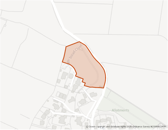
Site Size (ha) Gross: 0.88
Proposed Land Use: Housing
Minimum Development Capacity (Dwellings): 7
Site Type: Greenfield
Ward: Keighley East
Settlement: East Morton
Ownership: Private
Delivery Timescale: Medium 2030-2035 (6-10)
Site Specific Requirements:
Design Principles
- Development should provide at least 7 dwellings as part of a high quality built environment in line with Policies ST4 and DS1. This should include an appropriate mix of dwellings (in line with Policy HO3 and having due regard to relevant housing needs evidence and the character of the area).
- A sensitive design and layout will be required, giving appropriate consideration to topography, building heights and appropriate screening to reflect the site’s location on the northern edge of the settlement as well as to mitigate any impacts on the landscape.
Site Access, Highways and Transport
- An existing site access is available from Street Lane, however no footways or streetlighting are present.
- Consideration should be given to providing an appropriate pedestrian and cycle access to/from the site.
Natural and Historic Environment
- The site lies within Zone B (Supporting Habitat/Functionally Linked Land; recreational pressure). Development proposals must assess potential impacts on foraging habitat used by SPA qualifying species and provide ecological evidence where required, as well as mitigate any recreational pressure on the SPA/SAC caused, in accordance with the South Pennine Moors SPD and Policy NE3.
- Site is within the vicinity of a designated heritage asset – a Scheduled Monument. The design and layout of any development should ensure that it takes into consideration this heritage asset and its setting.
Environmental Protection
- Site located within 250m buffer of a former landfill site. A Land Contamination Assessment – Phase 1 Report will required as part of any planning application.
- Site is partially located within the outer consultation zone for a high pressure gas pipeline. Design and layout of any development should ensure that appropriate clearances and guidance are taken into consideration. Consultation should take place with Northern Gas Networks, as appropriate.
Open Space and Green / Blue Infrastructure
- Open space should be provided in line with Policy NE2, having regards to the standards set out in Appendix 11.
- Site is located within a Green Infrastructure corridor related to the River Aire. The design and layout of any development should ensure that due consideration is given to Green Infrastructure connectivity and enhancement in line with Policies ST6 and NE1.
Landscape
- The site is located within the Bingley and Baildon Steep Valley Sides Landscape Character area/type (D1).
- The key sensitivity of this site is the general landscape character to the north, which the site does not form a part of, but development within the site would influence slightly. Strengthening the existing vegetation on the site periphery and dedicated management of the young hedgerow would screen development from view and create a more natural settlement boundary over time.
Green Belt (and Golden Rules)
- Site has been removed from the Green Belt. However, the level of development proposed is below the threshold for the Golden Rules to apply.
Infrastructure Requirements
- Proportionate contributions to community infrastructure will be required, where appropriate, in line with Policies ID1 and ID2, and having regard to the Local Infrastructure Plan.
Planning Permission
- A detailed planning application is currently pending on this site for 7 dwellings which may be determined before the Local Plan is adopted.
H1110: Morton Lane, East Morton Comment
Site Boundary:
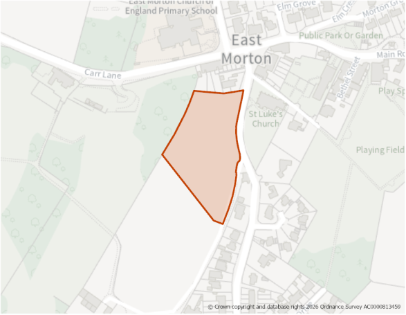
Site Size (ha) Gross: 0.88
Proposed Land Use: Housing
Minimum Development Capacity (Dwellings): 28
Site Type: Greenfield
Ward: Keighley East
Settlement: East Morton
Ownership: Private
Delivery Timescale: Long 2035+ (11+)
Site Specific Requirements:
Design Principles
- Development should provide at least 28 dwellings as part of a high quality built environment in line with Policies ST4 and DS1, at a net density of 35 dph. This should include affordable housing (in line with Policy HO4) and an appropriate mix of dwellings (in line with Policy HO3 and having due regard to relevant housing needs evidence and the character of the area).
- A sensitive design and layout will be required taking into consideration the site’s location on the edge of the settlement and overlooking the valley of the River Aire as well as its proximity to designated heritage assets. Appropriate screening should be provided along the southern boundary.
Site Access, Highways and Transport
- A new site access is required and should taken from Morton Lane, where footways and streetlighting is present.
Natural and Historic Environment
- The site lies within Zone B (Supporting Habitat/Functionally Linked Land; recreational pressure). Development proposals must assess potential impacts on foraging habitat used by SPA qualifying species and provide ecological evidence where required, as well as mitigate any recreational pressure on the SPA/SAC caused in accordance with the South Pennine Moors SPD and Policy NE3.
- Site is within a bat alert area. An ecological survey will be required as part of any planning application to establish the extent/impacts as well as to identify appropriate mitigation
- Site contains a large mature tree within its southern boundary and is adjacent to an area TPO woodland. The design and layout of any development should ensure these trees are preserved and enhanced in line with Policy NE6. An arboricutural study should be provided as part of any planning application.
- Site is adjacent to East Morton Conservation Area and within proximity to East Morton Congregational Church (a Grade II Listed Building). The layout, design and scale of dwellings should have regard to the proximity of these designated heritage assets as well as the character of the surrounding area, taking into account the site’s topography, position in the landscape, and views into and out of the Conservation Area. Careful consideration of the landscape strategy will be needed.
Environmental Protection
- The site’s southern boundary is crossed from south east to west by a lower voltage electricity transmission line. Development should include a strategy for responding to the Northern Powergrid equipment present within/adjacent to the site which demonstrates how the Northern Powergrid and HSE Guidance have been applied as part of the design and layout and how the impact of the assets has been reduced through good design. Enquiries should be made with Northern Powergrid.
Open Space and Green / Blue Infrastructure
- Open space should be provided in line with Policy NE2, having regard to the standards set out Appendix 11.
- The site lies with the Keighley – Bingley – Shipley opportunity area, as identified in the Green and Blue Infrastructure Strategy (GBIS). The strategy should be consulted to identify opportunities for incorporating measures within the development that enhances the quality of, and connectivity to the green and blue infrastructure network, in line with Policies ST6 and NE1
Landscape
- The site is located within the Bingley and Baildon Steep Valley Sides Landscape Character area/type (D1).
- Site is part of an area of moderate landscape sensitivity. Woodland buffers in the south of the site would integrate development better in the landscape and screen views from the canal. There should be careful consideration of design and layout, including buffer zone and softening through planting to minimise harm to the setting of the East Morton and Leeds and Liverpool Canal conservation areas.
Green Belt (and Golden Rules)
- Site has been removed from the Green Belt. Development on the site should be consistent with the “Golden Rules” set out in the NPPF in relation to affordable housing, necessary improvements to infrastructure and accessible green space provision.
Infrastructure Requirements
- Proportionate contributions to community infrastructure will be required, where appropriate, in line with Policies ID1 and ID2, and having regard to the Local Infrastructure Plan.
Policy KY1: Keighley
Keighley is the second largest settlement within the Bradford District and the largest within the Airedale sub-area. The town and its setting is defined by the valleys of three watercourses – the River Aire, the River Worth and North Beck. Its northern boundary is formed by the edge of Riddlesden with southern limit being the Bracken Bank and Damems areas. To the west, the town advances uphill towards the suburb of Braithwaite and it extends eastwards towards the residential neighbourhoods of Long Lee and Thwaites Brow.
The Local Plan settlement hierarchy identifies Keighley as one of Bradford district’s large towns. It will be a main local focus growth for housing, employment, shopping, leisure, education, health and cultural activities and facilities. The key aim is to transform its economic, environmental, physical and social conditions to support its long-term regeneration.
Keighley Town Centre is the main retail and service centre serving the wider area including the rural hinterlands and has a large employment base. It benefits from a good labour pool as well as its accessibility to surrounding areas including Bradford, Halifax, Wharfedale, Lancashire and North Yorkshire. The main employment areas are located along the A650 corridor and Dalton Lane, the town centre and along the valley of the River Worth as well as the A629 corridor running southwards from the town.
The Town has excellent transport connections with the A650 and A629 providing main road links to/from Bradford, Shipley and Bingley, as well as to settlements to the north of the District (Steeton with Eastburn and Silsden) and beyond into North Yorkshire and East Lancashire. The A629 also provides a key link along the Worth Valley towards Haworth as well as Denholme and Halifax. There are good public transport links with frequent train services on the electrified Airedale Line serving Skipton, Bingley, Shipley, Bradford and Leeds. There are less frequent services to Carlisle (via the Settle and Carlisle line) and Lancaster (via the Bentham line), as well as a daily return service to London Kings Cross (via Leeds).
Keighley Town Council acts as an administrative body for the parish area, who are in the process of preparing a Neighbourhood Development Plan for their area. This will form part of the Development Plan for the area, when it is made (adopted).
Keighley has an established strategic, long-term non-statutory Development Framework which sets an overarching vision and principles for the town’s growth and regeneration. It also seeks to identify future opportunities for transformation and development and help to create conditions to support inward investment.
Part of the vision is based on supporting economic growth and expansion within the town’s business sector including encouraging innovation across key sectors and attracting new businesses to the area. The other part involves the regeneration to the town centre as key hub for the community and wider area, including creating a more diverse range of mix uses, enhancing the public realm and built environment and making use of development opportunities. One element of creating a diverse mix of uses involves supporting new housing, particularly within the town centre. Specific interventions are proposed within each of the seven character zones identified within the framework.
The Keighley Regeneration Area (RA10) identified in the Local Plan generally follows the town centre area and parts of the River Worth Linear Park, the Victoria Park Residential Zone and the Worth Valley character zones.
The framework builds on a number of successful funding announcements for Keighley over recent years such as the Towns Fund vision and programme, Levelling Up Funding, and the Long Term Plan for Town. Since the publication of the Development Framework, further regeneration funding has been announced for Keighley including the Plan for Neighbourhoods Funding and Pride in Place funding.
Vision for Keighley
Keighley will continue to pride itself as a making town – celebrating the success of manufacturing and textiles and inspiring the people of Keighley to make, create and innovate. Innovation will be encouraged within key high-growth sectors including advanced manufacturing, engineering and technology, bringing together industry and research, attracting new businesses within the town and supporting the expansion of existing businesses.
The town centre will be regenerated to provide a mix of uses, combining a new health and leisure offer, and encouraging new food & beverage outlets as part of a market/food hall within a re-purposed Airedale Shopping Centre. : (Keighley Development Framework – June 2024)
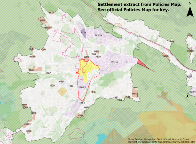
Settlement Hierarchy and Spatial Directions
- The settlement boundary for Keighley is defined on the Policies Map and consists of the main built-up area of the town and area defined by the valleys of the River Aire, River Worth and North Beck. Its northern extent consists of the developed slopes of Riddlesden with its southern limit being the Bracken Bank and Damems areas. The western extent is defined by the Braithwaite and Blackhill suburbs with Long Lee and Thwaites Brow in the east.
- Housing growth will be focused upon maximising opportunities for delivery of new housing via prioritising the development of previously development land within the settlement boundary, including within Keighley Town Centre regeneration area, followed by greenfield sites within the settlement and a limited number releases from the Green Belt.
- Deliver a thriving, sustainable and diverse town centre, with excellent public transport connectivity while supporting businesses to grow and delivering new high-quality housing as making the most of its strategic location as an attractive gateway to Bronte Country.
- Broaden the diversity, tenure and quality of housing within Keighley with opportunities to attract new residents benefiting from its transport connectivity, an enhanced town centre and high-quality environment.
- A range of housing types, sizes and tenures will be encouraged in Keighley to provide a mix of dwellings to meet the need of the existing and future residents. This could include mid to-high density apartment buildings and mid to-lower density townhouse terraces, together with the conversion of existing buildings including residential uses within the upper level of commercial buildings.
- Continue to support local businesses and key economic sectors including advanced manufacturing, engineering and technology, alongside attracting new businesses. The focus on new and expanded employment development will be within the Hard Ings/Beechcliffe, Eastwood/Worth Village and Worth Valley Employment Zones (identified under Policies EC2/14, EC2/16 and EC2/24).
Meeting Growth Needs
- Housing development includes a combination of development within the settlement boundary and land to be released from the Green Belt during the plan period and will:
- Housing development in Keighley will deliver approximately 2,245 dwellings through a combination of sites under construction, planning permissions, new site allocations and a regeneration area allowance (RAA) during the plan period as set out in Table KY.1.1
- Deliver the site allocations as shown on the Policies Map and within the site proformas in section 5:
- H388: Hollins Lane (North), Utley
- H393: Shann Lane
- H420: Bradford Road, Riddlesden
- H508: Aire Valley Business Centre, Lawkholme Lane
- H522: Land north of Skipton Road, Utley
- H528: Marlborough Street
- H533: Holmewood Residential, Fell Lane, Exley Head
- H538: Keighley Road, Exley Head
- H539: Keighley Road, Bogthorn
- H541: Carr Bank, Riddlesden
- H543: Moss Carr Road, Long Lee
- H544: Moss Carr Road, Long Lee
- H545: Black Hill Lane, Braithwaite
- H546: Parkwood Rise
- H550: Hainworth Road
- H551: Hainworth Wood Road
- H554: Woodhouse Road
- H555: Whinfield Drive, Braithwaite
- H559: Former Branshaw School, Nashville Street
- H560: Long Lee Lane, Long Lee
- H563: North Dean Road/Broster Avenue, Guard House
- H564: The Bungalow, Harden Road, Long Lee
- H565: Grange Street
- H566: Parson Street
- H567: Land south of North Dean Road, Guard House
- H568: New Wheathead Farm, Occupation Lane
- H569: Higher Wheathead Farm, Exley Head
- H570: Former Bronte School Playing Fields
- H1354: Hollins Lane (South), Utley
Table KY1.1 – Keighley Housing Delivery: Under Construction
|
Under Construction |
Planning Permission |
Allocations |
Regeneration Area | |
|
Totals |
295 |
116 |
1,334 |
500 |
- To help meet employment needs 2.6ha of employment land is allocated for B2, B8 Eg(i) and Eg (iii) uses. The following site allocations as shown on the Policies Map and within the site proformas in section 5 will be delivered:
- E96: Allotment Gardens, Kensington Street
- E118: Beechcliffe
- E119: Bradford
- Approach to delivery:
- Market-led approach to delivery of development on housing site allocations – working with developers and registered providers to secure quality housing schemes.
- Market-led approach to employment site development and intensification of employment opportunities within the Employment Zone.
- Regeneration focused growth within the Keighley Town Centre Regeneration Area (RA10) – centred on creating a more diverse range of mix uses, enhancing the public realm and built environment and making use of development opportunities. This includes introduced housing into the area.
Local Services and Facilities
- Support a positive approach towards the vitality and viability of the designated Keighley Town Centre (and Primary Shopping Area) as defined on the Policies Map as a key hub for retail, employment, cultural, leisure and tourism development as well as service provision within the District, including surrounding communities.
- Support the regeneration of the town centre to strengthen and diversify the mix of uses present to improve its offer, increase footfall and usage and increase activity during the day time and the evening. This includes the introduction of a mix of housing types and sizes to meet the needs of existing and future residents.
- Support the vitality and viability of the Fell Lane/Oakworth Road and Riddlesden Local Centres as important hubs for the community to meet its day-to-day shopping and service needs.
- Protect and enhance existing open spaces within the town and its neighbourhoods in compliance with Policy NE2. Proposals that address deficiencies in open space provision identified within the Open Space Study, will be supported.
- New developments will provide accessible multifunctional open space for existing and new communities within the area. These should help to create a network of green corridors to connect habitats and improve ecology both within the urban area and wider corridors.
- Maintain and enhance sport and recreation facilities with support for widened community access.
Townscape and Landscape
- Improve connectivity and permeability between the town centre and surrounding neighbourhoods with public realm enhancements and green/blue Infrastructure corridors including the valleys of the River Aire, River Worth and North Beck that connect the urban area with the surrounding countryside.
- Retain local distinctiveness and townscape features through the sensitive use and reuse of industrial architecture and historic buildings.
- Maintain and enhance Keighley’s landscape setting with its mix of landscape types and character areas (the Moorland Fringes, the Steep Valley Sides, Upland Wooded River Valleys, Settled Valley Floor and Moorland Plateau), landscape features, fields and overall settlement pattern. Reference should be made the Landscape Character Assessment Supplementary Planning Document.
Historic and Natural Environment
- Protect and enhance green and blue infrastructure networks within and adjacent to the settlement including the valleys of the River Aire and River Worth as well as North Beck, the Leeds and Liverpool Canal corridor as well as key open spaces, areas of woodland and open land on the upper slopes of the valleys. The aim is to enhance biodiversity and recreation opportunities within and adjacent to the settlement as well as incorporating sufficient green space and connections within new development, particularly where there is low provision and high need.
- Consideration should be given to the Green and Blue Infrastructure Strategy and the opportunities identified for enhancement within the Keighley opportunity area and the Keighley – Shipley – Bingley Corridor.
- Protected and enhance the designated nature sites within and adjacent to the settlement include the Park Wood Local Nature Reserve and twelve Local Wildlife Sites (Beechcliffe Ings, Beechcliffe Ox-Bow, Elam Wood, Hainworth Wood, Hawkcliffe Wood, Holme House Wood and Grasslands, How Beck Wood, Leeds Liverpool Canal, Owlhill Wood, Park Wood, Stockbridge Nature Reserve, Whins Wood) as well as habitat networks and priority habitats.
- The northern section of settlement is located within SPA/SAC Zone B (2.5km) supporting habitat functionally linked land, recreational pressure), whilst the central and southern sections are within SPA/SAC Zone C (7km) (recreational pressure). Development proposals must assess potential impacts on foraging habitat used by SPA qualifying species and provide ecological evidence where required, as well as mitigate any recreational pressure on the SPA/SAC caused by such development in accordance with the South Pennine Moors SPD and Policy EN3.
- Continue to ensure that future development conserves and enhances key heritage assets and their settings within and adjacent to the settlement including its five Conservation Areas (Braithwaite; Devonshire Park and Cliffe Castle; Keighley Town Centre; Leeds Liverpool Canal ) and large number of Listed Buildings, including three Grade I Listed Buildings (West Riddlesden Hall, East Riddlesden Hall, and a Barn circa 80 Metres to North-east of East Riddlesden Hall), five Grade II* buildings, seven Scheduled Monuments surrounding the settlement; two Grade II Registered Parsk and Gardens (Lund Park and Whinburn), as well as non-designated heritage assets.
Local Infrastructure
- Proposals that created improved and enhanced connectivity between key nodes within Keighley, in particular through cycling and walking, will be supported. This includes links between the railway station, bus station and town centre.
- Proportionate contributions to new or enhanced community infrastructure will be required, where appropriate, in line with Policies ID1 and ID2.
Evidence:
- Keighley Development Framework (2024)
- Landscape Character Assessment SPD (2026)
- Landscape Sensitivity Study (2026)
- Local Infrastructure Plan (LIP)
- Retail and Leisure Study (2026)
- Settlement Study (2026)
- South Pennine Moors SPD (2022)
- Sports Assessment (2026)
- Transport Assessment (2026)
Keighley: Site Allocations
H388: Hollins Lane (north), Utley Comment
Site Boundary:
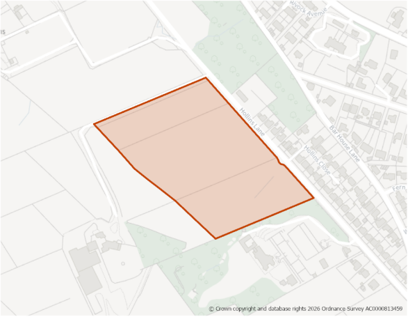
Site Size (ha) Gross: 4.06
Proposed Land Use: Housing
Minimum Development Capacity (Dwellings): 107
Site Type: Greenfield
Ward: Keighley Central
Settlement: Keighley
Ownership: Private
Delivery Timescale: Long 2035+ (11+)
Site Specific Requirements:
Design Principles
- Development should provide at least 107 dwellings as part of a high-quality built environment in line with Policies ST4 and DS1, at a net density of 35 dph in line with Policy HO2. This should include affordable housing (in line with Policy HO4) and an appropriate mix of dwellings (in line with Policy HO3 and having due regard to relevant housing needs evidence and the character of the area).
- A sensitive design and layout will be required taking into consideration the site’s location on the edge of the settlement as well as its proximity to the historic listed property Whinburn Hall. This should include appropriate landscaping and retention of existing mature trees on the site’s boundary.
Site Access, Highways and Transport
- A new site access will be required. This should be taken from Hollins Lane, where footways and streetlighting are present on the south eastern boundary of the site. Appropriate highway works will be required to achieve this access.
Flooding, Water and Drainage
- The site is located in Flood Zone 1. There is a risk of surface water flooding in the centre of the southern section. A flood risk assessment should be provided as part of any planning application and should include a drainage strategy which includes the ponded area in the site design and investigate ground conditions for infiltration SuDS suitability.
Natural and Historic Environment
- The site is located adjacent to Whinburn and its gardens, a Grade II Listed Building and Registered Park/Garden. A Heritage Impact Assessment (HIA) has been carried out, it considers that the impact of development on the setting of the listed structures at Whinburn is likely to increase in close proximity and also with the rising topography of the site.
- The HIA indicates that development of the southern section of the site is likely to be unacceptable due to impact on the listed structures. It is unlikely that the impact of a large residential development in close proximity to the heritage assets could be successfully mitigated to an acceptable degree.
- It is suggested that development is likely only to be acceptable within the northern section of the site and on the provision of a landscaped buffer to protect the setting of Whinburn and its gardens, with the southern seciton being left undeveloped. This is likely to have a more limited impact which may be acceptable in terms of the level of harm to the setting and significance of the heritage assets.
- A more detailed HIA, for the specific proposed scheme will need to be carried out at the planning application stage working closely with the Council’s Heritage team, to develop appropriate mitigation measures to reduce the harm as much as is possible
- The site lies within the Special Protection Area / Special Area of Conservation (SPA/SAC) Zone C (Recreational Pressure) - Residential development resulting in a net increase in dwellings will be required to mitigate any recreational pressure on the SPA/SAC caused by such development in accordance with the South Pennine Moors SPD and Policy NE3.
- Part of the site is identified in the West Yorkshire Local Nature Recovery Strategy with the preferred measures T2_M04 - Significantly boost biodiversity wherever possible where there are existing habitats alongside transport infrastructure.
- The site contains areas of TPO woodland and mature trees along the eastern and southern boundaries. These should be retained and protected as part of the design and layout of any development in line with Policy NE6. An arboricultural assessment will be required as part any planning application.
Open Space and Green / Blue Infrastructure
- Open space should be provided in line with Policy NE2, having regards to the standards set out in Appendix 11
- The site lies within the Keighley – Bingley - Shipley Opportunity Area, as identified in the Green and Blue Infrastructure Strategy (GBIS) and an area of low provision and high need for green and blue infrastructure. The strategy should be consulted to identify opportunities for incorporating measures within the development that enhance the quality of, and connectivity to, the green and blue infrastructure network in this area. Development proposals should focus on carefully designed green and blue infrastructure to contribute towards site specific issues.
Landscape
- The site is located within the Hollins Bank Steep Valley Sides Landscape Character area/type (D3).
- The site is assessed as having a moderate-high landscape senstivity. To mitigate impacts is considered that historic drystone walls and gateways should be retained and, where necessary, repaired and integrated into new development. Trees and tree belts should be included to help integrate the development into the landscape, prioritising native trees and those along Hollins Lane. This should be designed to provide connectivity to the woodland. If possible, some sight lines to the steeper slopes should be retained. Development should respect the historic and valued adjacent Registered Park and Garden and a buffer from this asset should be considered.
Green Belt (and Golden Rules)
- The Site has been removed from the Green Belt. Development on the site should be consistent with the “Golden Rules” set out in the NPPF in relation to affordable housing, necessary improvements to infrastructure and accessible green space provision.
Infrastructure Requirements
- Proportionate contributions to community infrastructure will be required, where appropriate, in line with Policies ID1 and ID2, and having regard to the Local Infrastructure Plan.
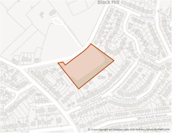
Site Size (ha) Gross: 0.83
Proposed Land Use: Housing
Minimum Development Capacity (Dwellings): 26
Site Type: Greenfield
Ward: Keighley Central
Settlement: Keighley
Ownership: Private
Delivery Timescale: Long 2035+ (11+)
Site Specific Requirements:
Design Principles
- Development should provide at least 26 dwellings as part of a high-quality built environment in line with Policies ST4 and DS1, at a net density of 35 dph in line with Policy HO2. This should include affordable housing (in line with Policy HO4) and an appropriate mix of dwellings (in line with Policy HO3 and having due regard to relevant housing needs evidence and the character of the area).
- A sensitive design and layout will be required taking into consideration the site’s location within the settlement as well as the amenity of adjoining residential properties.
Site Access, Highways and Transport
- A new site access will be required. This should be taken from Shann Lane, where footways and streetlighting are present. Appropriate highway works will be required to achieve this access.
Flooding, Water and Drainage
- The site is located in Flood Zone 1. There is a risk of surface water flooding (ponding) in the centre of the site. A flood risk assessment should be provided as part of any planning and should include a drainage strategy which includes the ponded area in site design and investigate ground conditions for infiltration SuDS suitability.
Natural and Historic Environment
- The site lies within the Special Protection Area / Special Area of Conservation (SPA/SAC) Zone C (Recreational Pressure) - Residential development resulting in a net increase in dwellings will be required to mitigate any recreational pressure on the SPA/SAC caused by such development in accordance with the South Pennine Moors SPD and Policy NE3.
- The site is identified in the West Yorkshire Local Nature Recovery Strategy with the preferred measures B2_M01 – Expand and enhance existing mapped priority habitats or create new wetlands on suitable anchor institution land and B2_M04 - Significantly boost biodiversity wherever possible where there are existing habitats alongside transport infrastructure.
- The site contains a belt of mature trees running along the southern, eastern and north eastern boundaries. These should be retained and protected as part of the design and layout of any development in line with Policy NE6. An arboricultural assessment will be required as part any planning application.
Environmental Protection
- The site was historically used as a reservoir. Consideration should be given to potential impacts from this former use and addressed in line with Policy CR2.
Open Space and Green / Blue Infrastructure
- Open space should be provided in line with Policy NE2, having regard to the standards set out in Appendix 11
- The site lies within the Keighley Opportunity Area, as identified in the Green and Blue Infrastructure Strategy (GBIS) and partly within an area of low provision and high need for green and blue infrastructure. The strategy should be consulted to identify opportunities for incorporating measures within the development that enhance the quality of, and connectivity to, the green and blue infrastructure network in this area. Development proposals should focus on carefully designed green and blue infrastructure to contribute towards site specific issues.
Landscape
- The site is located within the Keighley Moorland Fringe Landscape Character area/type (B1). No landscape sensitivity assessment was undertaken for this site. Consideration should be given to the guidance set out in the Landscape Character Assessment SPD.
Infrastructure Requirements
- Proportionate contributions to community infrastructure will be required, where appropriate, in line with Policies ID1 and ID2, and having regard to the Local Infrastructure Plan.
H420: Bradford Road, Riddlesden Comment
Site Boundary:
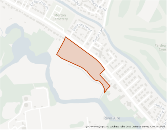
Site Size (ha) Gross: 2.78
Proposed Land Use: Housing
Minimum Development Capacity (Dwellings): 73
Site Type: Greenfield
Ward: Keighley East
Settlement: Keighley
Ownership: Private
Delivery Timescale: Long 2035+ (11+)
Site Specific Requirements:
Design Principles
- Development should provide at least 73 dwellings as part of a high-quality built environment in line with Policies ST4 and DS1, at a net density of 35 dph in line with Policy HO2. This should include affordable housing (in line with Policy HO4) and an appropriate mix of dwellings (in line with Policy HO3 and having due regard to relevant housing needs evidence and the character of the area).
- A sensitive design and layout will be required taking into consideration the site’s location on the edge of the settlement and its position over looking the valley of the River Aire. This should include appropriate landscaping and seek to avoid areas that are at risk of fluvial flooding. Consideration should also be given to the amenity of adjoining residential properties.
Site Access, Highways and Transport
- A new site access will be required. This should be taken from Bradford Road, where footways and streetlighting are present. Appropriate highway works will be required to achieve this access. Consideration should be given to the difference in levels between Skipton Road and the site, as well as the junction between Bradford Road and Swine Lane.
Flooding, Water and Drainage
- Part of the site, within the southern boundary is located in Flood Zone 3b (functional flood plain) whilst the majority of the southern section is within Flood Zone 2. No development should take place within the area of functional flood plain with it being left as open greenspace.
- Any devleopment within Flood Zone 2 should be accompanied by emergency plans, Property Flood Resilience measures, whilst flood alerts should remain in place.
- The site is predominately at very low risk of surface water flooding, although there are areas within its southern and northern corners.
- A flood risk assessment should be provided as part of any planning application to determine potential flood risk. It should also consider the safe access and escape routes to the site.
Natural and Historic Environment
- The site lies within the Special Protection Area / Special Area of Conservation (SPA/SAC) Zone B (Supporting Habitat/Functionally Linked Land; recreational impacts) - Development proposals must assess potential impacts on foraging habitat used by SPA qualifying species and provide ecological evidence where required as well as mitigate any recreational pressure on the SPA/SAC, in accordance with the South Pennine Moors SPD and Policy NE3.
- The site is partially within an identified wildlife habitat network (grassland) and adjacent to a priority habitat at its south east corner (decidious woodland). It is also within a bat alert area. An ecological survey will be required as part of any planning application.
- The south eastern corner of the site is within proximity of the Airedale Heiffer (a Grade II Listed Building). The layout, design and scale of dwellings should have regard to the proximity of this designated heritage asset and its setting.
Environmental Protection
- The site is partly within the 150m and 250m buffers of a former landfill site. A Land Contamination Assessment – Phase 1 Report will be required as part of any planning application. Impacts should be addresed in line with Policy CR2.
- Site is partially within a Mineral Safeguarding Area (MSA) for sandstone. A mineral resource assessment will be required as part of any planning application to determine the extent and availability of any sandstone resource in line with Policy MIN3.
- The site is crossed from north to south by a lower voltage electricity transmission line. Development should include a strategy for responding to the Northern Powergrid equipment present within the site which demonstrates how the Northern Powergrid and HSE Guidance have been applied as part of the design and layout and how the impact of the assets has been reduced through good design. Enquiries should be made with Northern Powergrid.
Open Space and Green / Blue Infrastructure
- Open space should be provided in line with Policy NE2, having regard to the standards set out In Appendix 11
- The site lies within the Keighley – Bingley - Shipley Opportunity Area, as identified in the Green and Blue Infrastructure Strategy (GBIS). The strategy should be consulted to identify opportunities for incorporating measures within the development that enhance the quality of, and connectivity to, the green and blue infrastructure network in this area. Development proposals should focus on carefully designed green and blue infrastructure to contribute towards site specific issues.
Landscape
- The site is located within the Central Airedale Settled Valley Floor Landscape Character area/type (G2). No landscape sensitivity assessment was undertaken for this site. Consideration should be given to the guidance set out in the Landscape Character Assessment SPD.
Green Belt (and Golden Rules)
- The site has been removed from the Green Belt. Development on the site should be consistent with the “Golden Rules” set out in the NPPF in relation to affordable housing, necessary improvements to infrastructure and accessible green space provision.
Infrastructure Requirements
- Proportionate contributions to community infrastructure will be required, where appropriate, in line with Policies ID1 and ID2, and having regard to the Local Infrastructure Plan.
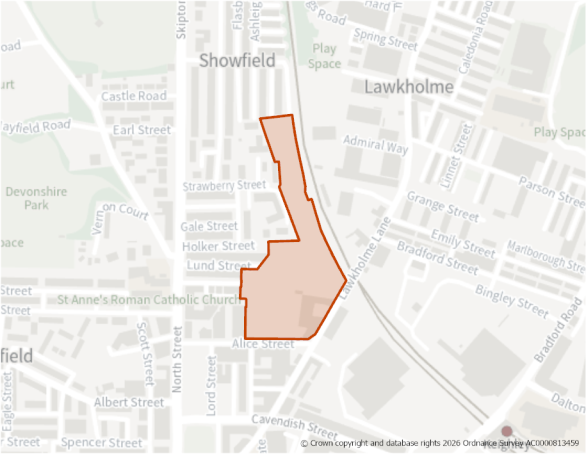
Site Size (ha) Gross: 2.85
Proposed Land Use: Housing
Minimum Development Capacity (Dwellings): 160
Site Type: Previously Developed Land
Ward: Keighley Central
Settlement: Keighley
Ownership: Private
Delivery Timescale: Medium 2030-2035 (6-10)
Site Specific Requirements:
Design Principles
- Development should provide at least 160 dwellings as part of a high-quality built environment in line with Policies ST4 and DS1, at a net density of 75 dph in line with Policy HO2. This should include affordable housing (in line with Policy HO4) and an appropriate mix of dwellings (in line with Policy HO3 and having due regard to relevant housing needs evidence and the character of the area).
- A sensitive design and layout will be required taking into consideration the site’s location within the settlement as well as its proximity to the Keighley Town Centre Conservation Area, Drill Hall and Keighley Town Centre. This should include appropriate landscaping and open space. Further consideration should be given to mitigating the impacts of the adjacent railway line.
Site Access, Highways and Transport
- An existing access is available from Lawkholme Lane, where there are footways and streetlighting present. Appropriate highway works will be required to improve this access.
- Consideration should be given to the provision of an additional access to/from Alice Street.
Flooding, Water and Drainage
- The site contains areas at risk of surface water flooding (high, medium and low risk) within the northern and southern sections of the site. A flood risk assessment will be required as part of any planning application.
Natural and Historic Environment
- The site lies within the Special Protection Area / Special Area of Conservation (SPA/SAC) Zone C (Recreational Pressure) - Residential development resulting in a net increase in dwellings will be required to mitigate any recreational pressure on the SPA/SAC caused by such development in accordance with the South Pennine Moors SPD and Policy NE3.
- The site is partly within a bat alert area. An ecological survey will be required as part of any future planning application.
- The site is identified in the West Yorkshire Local Nature Recovery Strategywith the preferred measure T2_M04 - Extend and connect tree and woodland cover across the White Rose Forest area in West Yorkshire.
- Site is adjacent to the Keighley Town Centre Conservation Area and within proximity to the Drill Hall (a Grade II Listed Building). The layout, design and scale of dwellings should have regard to the proximity of these designated heritage assets and their setting as well as the character of the surrounding area.
Environmental Protection
- The site was formerly occupied by a textiles and footwear manufacturer and has a longer history as an engineering works, giving rise to potential for land contamination. A Land Contamination Assessment – Phase 1 Report will be required as part of any planning application. Impacts should be addressed in line with Policy CR2.
- The site is adjacent to the Leeds/Bradford to Skipton railway line, giving rise to potential impacts from noise. The design and layout of any development should include appropriate measures to reduce these impacts in line with Policy CR2.
- The site is within a Mineral Safeguarding Area (MSA) for sand and gravel. A mineral resource assessment will be required as part of any planning application to determine the extent and availability of any sand and gravel resource in line with Policy MIN3.
Open Space and Green / Blue Infrastructure
- Open space should be provided in line with Policy NE2, having regard to the standards set out In Appendix 11
- The site lies within the Keighley Opportunity Area, as identified in the Green and Blue Infrastructure Strategy (GBIS) and is partly within an area of low provision and high need for green and blue infrastructure. The strategy should be consulted to identify opportunities for incorporating measures within the development that enhance the quality of, and connectivity to, the green and blue infrastructure network in this area. Development proposals should focus on carefully designed green and blue infrastructure to contribute towards site specific issues.
Landscape
- The site is located within the Central Airedale Settled Valley Floor Landscape Character area/type (G2). No landscape sensitivity assessment was undertaken for this site. Consideration should be given to the guidance set out in the Landscape Character Assessment SPD.
Infrastructure Requirements
- Proportionate contributions to community infrastructure will be required, where appropriate, in line with Policies ID1 and ID2, and having regard to the Local Infrastructure Plan.
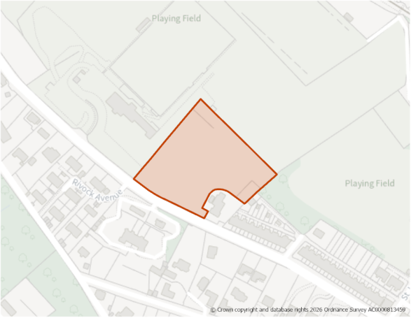
Site Size (ha) Gross: 1.08
Proposed Land Use: Housing
Minimum Development Capacity (Dwellings): 34
Site Type: Greenfield
Ward: Keighley Central
Settlement: Keighley
Ownership: Private
Delivery Timescale: Long 2035+ (11+)
Site Specific Requirements:
Design Principles
- Development should provide at least 34 dwellings as part of a high-quality built environment in line with Policies ST4 and DS1, at a net density of 35 dph in line with Policy HO2. This should include affordable housing (in line with Policy HO4) and an appropriate mix of dwellings (in line with Policy HO3 and having due regard to relevant housing needs evidence and the character of the area).
- A sensitive design and layout will be required taking into consideration the site’s location adjoining the outer edge of the settlement as well as its proximity to the rugby club. This should include appropriate landscaping.
Site Access, Highways and Transport
- A new site access will be required. This should be taken from Skipton Road, where footways and streetlighting are present. Appropriate highway works will be required to achieve this access. Consideration should be given to the difference in levels between Skipton Road and the site.
Flooding, Water and Drainage
- The site is located in Flood Zone 1 and at low risk of fluvial flooding. It is also predominately at very low risk of surface water. However, there is a element of surface water flooding (medium risk) within the southern section of the site. A flood risk assessment should be provided to show that any development would be safe, and contain a drainage strategy which includes the surface waste flow paths in the site design.
Natural and Historic Environment
- The site lies within the Special Protection Area / Special Area of Conservation (SPA/SAC) Zone C (Recreational Pressure) - Residential development resulting in a net increase in dwellings will be required to mitigate any recreational pressure on the SPA/SAC caused by such development in accordance with the South Pennine Moors SPD and Policy NE3.
- The site contains TPO trees along all boundaries and a TPO woodland within the northern boundary. These should be retained and protected as part of the design and layout of any development in line with Policy NE6. An arboricultural assessment will be required as part of any planning application.
Environmental Protection
- Site is within 150m buffer of a former landfill site. A Land Contamination Assessment – Phase 1 Report will be required as part of any planning application. Impacts should be addressed in line with Policy CR2.
Open Space and Green / Blue Infrastructure
- Open space should be provided in line with Policy NE2, having regard to the standards set out in Appendix 11.
- The site lies within the Keighley – Bingley - Shipley Opportunity Area, as identified in the Green and Blue Infrastructure Strategy (GBIS) and partly within an area of low provision and high need for green and blue infrastructure. The strategy should be consulted to identify opportunities for incorporating measures within the development that enhance the quality of, and connectivity to, the green and blue infrastructure network in this area. Development proposals should focus on carefully designed green and blue infrastructure to contribute towards site specific issues.
Landscape
- The site is located within the Upper Airedale Settled Valley Floor Landscape Character area/type (G1). No landscape sensitivity assessment was undertaken for this site. Consideration should be given to the guidance set out in the Landscape Character Assessment SPD.
Other Constraints
- The site is located adjacent to Keighley Rugby Union Football Club. Consideration should be given to potential impacts from noise and floodlighting.
Green Belt (and Golden Rules)
- The site has been removed from the Green Belt. Development on the site should be consistent with the “Golden Rules” set out in the NPPF in relation to affordable housing, necessary improvements to infrastructure and accessible green space provision.
Infrastructure Requirements
- Proportionate contributions to community infrastructure will be required, where appropriate, in line with Policies ID1 and ID2, and having regard to the Local Infrastructure Plan.
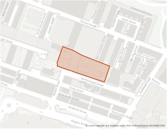
Site Size (ha) Gross: 0.32
Proposed Land Use: Housing
Minimum Development Capacity (Dwellings): 24
Site Type: PDL
Ward: Keighley Central
Settlement: Keighley
Ownership: Private
Delivery Timescale: Long 2035+ (11+)
Site Specific Requirements:
Design Principles
- Development should provide at least 24 dwellings as part of a high-quality built environment in line with Policies ST4 and DS1, at a net density of 75 dph in line with Policy HO2. This should include affordable housing (in line with Policy HO4) and an appropriate mix of dwellings (in line with Policy HO3 and having due regard to relevant housing needs evidence and the character of the area).
- A sensitive design and layout will be required taking into consideration the site’s location within the settlement as well as its proximity to surrounding industrial and commercial uses. This should include appropriate landscaping.
Site Access, Highways and Transport
- An existing access is available from Marlborough Street, where there are footways and streetlighting present. Appropriate highway works, including realignment of the existing kerbs, will be required to achieve this access.
Natural and Historic Environment
- The site lies within the Special Protection Area / Special Area of Conservation (SPA/SAC) Zone C (Recreational Pressure) - Residential development resulting in a net increase in dwellings will be required to mitigate any recreational pressure on the SPA/SAC caused by such development in accordance with the South Pennine Moors SPD and Policy NE3.
Environmental Protection
- The site is adjacent to employment and commercial uses, giving rise to potential impacts from noise and traffic movement. Relevant assessments should be provided to determine the nature and extent of any impacts together with appropriate mitigation measure as part of any planning application.
- The design and layout of development should not compromise the operation of existing employment uses and ensure that the amenity of future occupiers is protected.
Open Space and Green / Blue Infrastructure
- Open space should be provided in line with Policy NE2, having regard to the standards set out In Appendix 11
- The site lies within theKeighley Focus Area, as identified in the Green and Blue Infrastructure Strategy (GBIS). The strategy should be consulted to identify opportunities for incorporating measures within the development that enhance the quality of, and connectivity to, the green and blue infrastructure network in this area.
Landscape
- The site is located within the Central Airedale Settled Valley Floor Landscape Character area/type (G2). No landscape sensitivity assessment was undertaken for this site. Consideration should be given to the guidance set out in the Landscape Character Assessment SPD.
Infrastructure Requirements
- Proportionate contributions to community infrastructure will be required, where appropriate, in line with Policies ID1 and ID2, and having regard to the Local Infrastructure Plan.
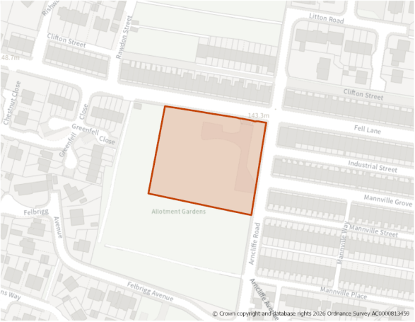
Site Size (ha) Gross: 0.53
Proposed Land Use: Housing
Minimum Development Capacity (Dwellings): 43
Site Type: PDL
Ward: Keighley West
Settlement: Keighley
Ownership: Private
Delivery Timescale: Short 2025- 2030 (1-5)
Site Specific Requirements:
Design Principles
- Development should provide at least 43 dwellings as part of a high-quality built environment in line with Policies ST4 and DS1, at a net density of 50 dph in line with Policy HO2. This should include affordable housing (in line with Policy HO4) and an appropriate mix of dwellings (in line with Policy HO3 and having due regard to relevant housing needs evidence and the character of the area).
- A sensitive design and layout will be required taking into consideration the site’s location within the settlement, its proximity to the adjacent allotment gardens and the amenity of adjoining residential properties. This should include appropriate landscaping and open space.
Site Access, Highways and Transport
- A new site access will be required. This should be taken from Oakworth Road, where footways and streetlighting are present. Appropriate highway works will be required to achieve this access.
Flooding, Water and Drainage
- The site is located within Flood Zone 1 and is at low risk of fluvial flooding. It is also predominately at very low risk of surface water flooding. However, there is evidence of ponding in the centre of the site, with a small flow path on Fell Lane, to the north. A flood risk assessment will be required to determine the risk of flooding in relation to development layout plans. It is suggested that surface water should be retained on site and that the use of infiltration SuDS should be investigated for suitability across the majority of the site.
- Additionally, groundwater conditions must be investigated further through the flood risk assessment to ascertain groundwater levels and conditions.
Natural and Historic Environment
- The site lies within the Special Protection Area / Special Area of Conservation (SPA/SAC) Zone C (Recreational Pressure) - Residential development resulting in a net increase in dwellings will be required to mitigate any recreational pressure on the SPA/SAC caused by such development in accordance with the South Pennine Moors SPD and Policy NE3.
- The site is located within a bat alert area. An ecological survey will be required as part of any planning application to establish the extent/impacts as well as to identify appropriate mitigation.
Environmental Protection
- Site is located within the 250m Buffer of former landfill site. Any potential impacts should be addressed in line with Policy CR2.
Open Space and Green / Blue Infrastructure
- Open space should be provided in line with Policy NE2, having regard to the standards set out in Appendix 11
- The site lies within the Keighley Opportunity Area, as identified in the Green and Blue Infrastructure Strategy (GBIS) and partly within an area of low provision and high need for green and blue infrastructure. The strategy should be consulted to identify opportunities for incorporating measures within the development that enhance the quality of, and connectivity to, the green and blue infrastructure network in this area. Development proposals should focus on carefully designed green and blue infrastructure to contribute towards site specific issues.
Landscape
- The site is located within the Central Airedale Settled Valley Floor Landscape Character area/type (G2). No landscape sensitivity assessment was undertaken for this site. Consideration should be given to the guidance set out in the Landscape Character Assessment SPD.
Infrastructure Requirements
- Proportionate contributions to community infrastructure will be required, where appropriate, in line with Policies ID1 and ID2, and having regard to the Local Infrastructure Plan.
Planning Permission
- The site benefits from planning permission for a 78-bedroom care home (Use Class C2) with associated car parking, landscape and ancillary accommodation (25/03558/MAF) granted in September 2025. This was after 1 April 2025 (the base date for the Local Plan). Accordingly, it has been identified as a site allocation.
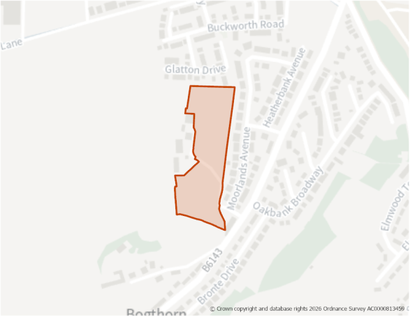
Site Size (ha) Gross: 1.93
Proposed Land Use: Housing
Minimum Development Capacity (Dwellings): 61
Site Type: Greenfield
Ward: Keighley West
Settlement: Keighley
Ownership: Private
Delivery Timescale: Medium 2030-2035 (6-10)
Site Specific Requirements:
Design Principles
- Development should provide at least 61 dwellings as part of a high-quality built environment in line with Policies ST4 and DS1, at a net density of 35 dph in line with Policy HO2. This should include affordable housing (in line with Policy HO4) and an appropriate mix of dwellings (in line with Policy HO3 and having due regard to relevant housing needs evidence and the character of the area).
- A sensitive design and layout will be required taking into consideration the site’s location on the edge of the settlement and the amenity of adjoining residential properties to the north, east and west.
Site Access, Highways and Transport
- An existing access is available via Brown Spings Lane via Moorlands Avenue, where there are footways and streetlighting present. Highway works will be required to upgrade and widen this access to provide a suitable route into the site.
- A Public Right of Way (PRoW) runs within the eastern boundary of the site, linking Brown Springs Lane with Oakworth Road and Occupation Lane. The design and layout of any development should retain this footpath.
Flooding, Water and Drainage
- The site is located in Flood Zone 1 and at low risk of fluvial flooding, It is also predominately at very low risk of surface water flooding, althought there is an area of ponding (medium risk) within a topgraphic low point in the central section.
- A flood risk assessment will be required and should demonstrate that development can be designed to be safe. It should also contain a drainage strategy which includes the ponded area and flow path in site design and investigate ground conditions for infiltration SuDS suitability.
Natural and Historic Environment
- The site lies within the Special Protection Area / Special Area of Conservation (SPA/SAC) Zone C (Recreational Pressure) - Residential development resulting in a net increase in dwellings will be required to mitigate any recreational pressure on the SPA/SAC caused by such development in accordance with the South Pennine Moors SPD and Policy NE3.
Environmental Protection
- Site is within a Mineral Safeguarding Area (MSA) for sandstone. A mineral resource assessment will be required as part of any planning application to determine the extent and availability of any sandstone resource in line with Policy MIN3.
- Site is partly within the 150m and 250m buffers of a former landfill site. A Land Contamination Assessment – Phase 1 Report will be required as part of any planning application. Impacts should be addressed in line with Policy CR2.
Open Space and Green / Blue Infrastructure
- Open space should be provided in line with Policy NE2, having regard to the standards set out In Appendix 11.
- Green and blue infrastructure should be provided in line with Policy NE1.
Landscape
- The site is located within the Keighley Moorland Fringe Landscape Character area/type (B1).
- The site has a low-moderate landscape sensitivity. To address this, new development, if sited appropriately into the slope and integrated with vegetation, could help to soften and better integrate the existing abrupt urban edges to the site. Dry stone walls should be retained and integrated into the design of new development.
Other Constraints
- The site is located adjacent to a former quarry (Bogthorn Quarry), which is listed as a village green.
Infrastructure Requirements
- Proportionate contributions to community infrastructure will be required, where appropriate, in line with Policies ID1 and ID2, and having regard to the Local Infrastructure Plan.
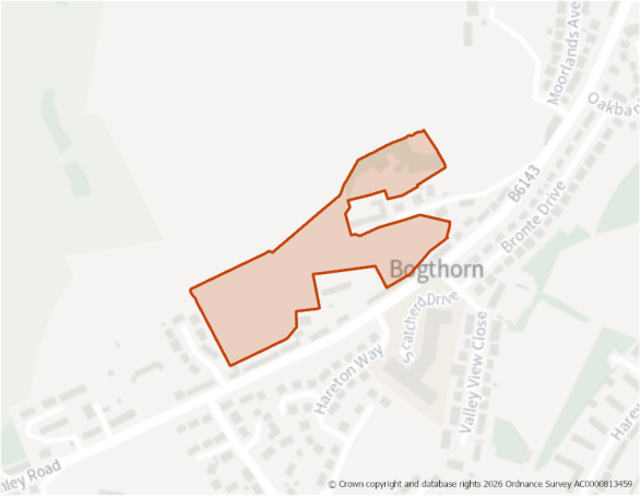
Site Size (ha) Gross: 3.03
Proposed Land Use: Housing
Minimum Development Capacity (Dwellings): 79
Site Type: Greenfield
Ward: Keighley West
Settlement: Keighley
Ownership: Private
Delivery Timescale: Long 2035+ (11+)
Site Specific Requirements:
Design Principles
- Development should provide at least 79 dwellings as part of a high-quality built environment in line with Policies ST4 and DS1, at a net density of 35 dph in line with Policy HO2. This should include affordable housing (in line with Policy HO4) and an appropriate mix of dwellings (in line with Policy HO3 and having due regard to relevant housing needs evidence and the character of the area).
- A sensitive design and layout will be required taking into consideration the site’s location on the edge of the settlement adjoining the countryside as well as its varying topography and the amenity of adjoining residential properties. This should include appropriate landscaping and open space
Site Access, Highways and Transport
- A new site access will be required. This should be taken from Oakworth Road, where footways and streetlighting are present. Appropriate highway works will be required to achieve this access.
Flooding, Water and Drainage
- The site is located in Flood Zone 1 and at low risk of fluvial flooding, It is also predominately at very low risk of surface water flooding, althought there is an area of ponding (medium risk) within the north east section.
- A flood risk assessment will be required and should demonstrate that development can be designed to be safe. It should also contain a drainage strategy which includes the ponded area in site design and investigate ground conditions for infiltration SuDS suitability.
Natural and Historic Environment
- The site lies within the Special Protection Area / Special Area of Conservation (SPA/SAC) Zone C (Recreational Pressure) - Residential development resulting in a net increase in dwellings will be required to mitigate any recreational pressure on the SPA/SAC caused by such development in accordance with the South Pennine Moors SPD and Policy NE3.
Environmental Protection
- The northern eastern section of the site contains a former landfill site, whilst the remainder is within the 150m and 250m buffers. A Land Contamination Assessment – Phase 1 Report will be required as part of any planning application. Impacts should be addressed in line with Policy CR2.
- Site is partially within a Mineral Safeguarding Area (MSA) for sandstone. A mineral resource assessment will be required as part of any planning application to determine the extent and availability of any sandstone resource in line with Policy MIN3.
Open Space and Green / Blue Infrastructure
- Open space should be provided in line with Policy NE2, having regard to the standards set out In Appendix 11.
- Green and blue infrastructure should be provided in line with Policy NE1.
Landscape
- The site is located within the Keighley Moorland Fringe Landscape Character area/type (B1)
- The site has a low-moderate landscape sensitivity. To address this, new development, if sited appropriately into the slope and integrated with vegetation, could help to soften and better integrate the existing abrupt urban edges to the site. Dry stone walls should be retained and integrated into the design of new development.
Other Constraints
- The north eastern section of the site includes part of former quarry (Bogthorn Quarry).
Infrastructure Requirements
- Proportionate contributions to community infrastructure will be required, where appropriate, in line with Policies ID1 and ID2, and having regard to the Local Infrastructure Plan.
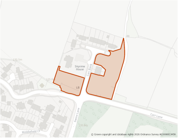
Site Size (ha) Gross: 0.51
Proposed Land Use: Housing
Minimum Development Capacity (Dwellings): 18
Site Type: Greenfield
Ward: Keighley East
Settlement: Keighley
Ownership: Private
Delivery Timescale: Short 2025-2030 (1-5)
Site Specific Requirements:
Design Principles
- Development should provide at least 18 dwellings as part of a high-quality built environment in line with Policies ST4 and DS1. This should include affordable housing (in line with Policy HO4) and an appropriate mix of dwellings (in line with Policy HO3 and having due regard to relevant housing needs evidence and the character of the area).
- A sensitive design and layout will be required taking into consideration the site’s location on the edge of the settlement, the amenity of adjoining residential properties and the proximity to the children’s home.
Site Access, Highways and Transport
- An existing access is available via Carr Bank, where there are footways and streetlighting present.
- A Public Right of Way (PRoW) runs along the south western boundary of the site.
Natural and Historic Environment
- The site lies within the Special Protection Area / Special Area of Conservation (SPA/SAC) Zone B (Supporting Habitat/Functionally Linked Land; recreational impacts). Development proposals must assess potential impacts on foraging habitat used by SPA qualifying species and provide ecological evidence where required, as well as mitigate any recreational pressure on the SPA/SAC, in accordance with the South Pennine Moors SPD and Policy NE3.
Open Space and Green / Blue Infrastructure
- Open space should be provided in line with Policy NE2, having regard to the standards set out In Appendix 11.
- The site lies within the Keighley – Bingley - Shipley Corridor , as identified in the Green and Blue Infrastructure Strategy (GBIS). The strategy should be consulted to identify opportunities for incorporating measures within the development that enhance the quality of, and connectivity to, the green and blue infrastructure network in this area.
Landscape
- The site is located within the Bingley and Baildon Steep Valley Sides Landscape Character area/type (D1). No landscape sensitivity assessment was undertaken for this site. Consideration should be given to the guidance set out in the Landscape Character Assessment SPD.
Infrastructure Requirements
- Proportionate contributions to community infrastructure will be required, where appropriate, in line with Policies ID1 and ID2, and having regard to the Local Infrastructure Plan.
Planning Permission
- A detailed planning application is currently pending on the site for 18 dwellings which may be determined before the Local Plan is adopted.
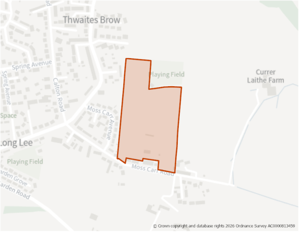
Site Size (ha) Gross: 4.94
Proposed Land Use: Housing
Minimum Development Capacity (Dwellings): 103
Site Type: Greenfield
Ward: Keighley East
Settlement: Keighley
Ownership: Private
Delivery Timescale: Short 2025-2030 (1-5)
Site Specific Requirements:
Design Principles
- Development should provide at least 103 dwellings as part of a high-quality built environment in line with Policies ST4 and DS1. This should include affordable housing (in line with Policy HO4) and an appropriate mix of dwellings (in line with Policy HO3 and having due regard to relevant housing needs evidence and the character of the area).
- A sensitive design and layout will be required taking into consideration the site’s location on the edge of the settlement adjacent to the countryside, the proximity of the cricket club and the amenity of adjoining residential properties . This should include appropriate landscaping and screening.
Site Access, Highways and Transport
- A new site access will be required. This should be taken from Moss Carr Road, where footways and streetlighting are present. Appropriate highway works will be required to achieve this access.
- Consideration should be given to impacts on the junction of Moss Carr Road, Thwaites Brow Road, Carlton Road and Long Lee Lane.
- Consideration should be given to the provision of a pedestrian/cycle links to/from the adjoining footpath and road networks.
Flooding, Water and Drainage
- The site is located within Flood Zone 1 and is at low risk of fluvial flooding. However, it is at low risk of surface water flooding in the central section. A drainage assessment should be provided as part of any planning application to assess the risk and determine potential mitigation measures. Consideration should be given the use of SuDS.
Natural and Historic Environment
- The site lies within the Special Protection Area / Special Area of Conservation (SPA/SAC) Zone C (Recreational Pressure) - Residential development resulting in a net increase in dwellings will be required to mitigate any recreational pressure on the SPA/SAC caused by such development in accordance with the South Pennine Moors SPD and Policy NE3.
- Parts of the site is identified in the West Yorkshire Local Nature Recovery Strategywith the preferred measure T2_M04 - Extend and connect tree and woodland cover across the White Rose Forest area in West Yorkshire.
Environmental Protection
- Site is partially within a Development High Risk Area for coal mining, indicating that it contains one or more recorded former related features at surface or shallow depth. A Coal Mining Risk Assessment (CMRA) will be required as part of any planning application.
- Site is partially within a Mineral Safeguarding Area (MSA) for sandstone and coal. A mineral resource assessment will be required as part of any planning application to determine the extent and availability of any sandstone and coal resource in line with Policy MIN3.
Open Space and Green / Blue Infrastructure
- Open space should be provided in line with Policy NE2, having regard to the standards set out In Appendix 11.
- Green and blue infrastructure should be provided in line with Policy NE1.
Landscape
- The site is located within the Thwaites Brow Steep Valley Sides Landscape Character area/type (D2). No landscape sensitivity assessment was undertaken for this site. Consideration should be given to the guidance set out in the Landscape Character Assessment SPD.
Other Constraints
- The site is located adjacent to Long Lee Cricket Club. The design and layout of any development should not compromise the use of the cricket ground. Consideration should be given to potential impact of ball strike on any future development. A ball-strike assessment should be provided as part of any planning application to determine potential risk and mitigation measures.
Infrastructure Requirements
- Proportionate contributions to community infrastructure will be required, where appropriate, in line with Policies ID1 and ID2, and having regard to the Local Infrastructure Plan.
Planning Permission
- Site benefits from outline planning permission for residential development of land for up to 103 dwellings requesting consideration of access (19/04151/MAO) granted in July 2023. Accordingly, it remains identified as a site allocation.
- A Reserved Matters application requesting consideration of layout, scale, appearance and landscaping for 103 dwellings (pursuant to outline approval 19/04151/MAO) (25/04668/MAR) is pending decision. This may be determined before the Local Plan is adopted.
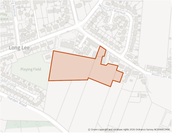
Site Size (ha) Gross: 1.25
Proposed Land Use: Housing
Minimum Development Capacity: (Dwellings): 40
Site Type: Greenfield
Ward: Keighley East
Settlement: Keighley
Ownership: Private
Delivery Timescale: Long 2035+ (11+)
Site Specific Requirements:
Design Principles
- Development should provide at least 40 dwellings as part of a high-quality built environment in line with Policies ST4 and DS1, at a net density of 35 dph in line with Policy HO2. This should include affordable housing (in line with Policy HO4) and an appropriate mix of dwellings (in line with Policy HO3 and having due regard to relevant housing needs evidence and the character of the area).
- A sensitive design and layout will be required taking into consideration the site’s location on the edge of the settlement and the amenity of adjoining residential properties as well as adajcent community centre, GP surgery and sports pitch.
Site Access, Highways and Transport
- A new site access will be required. This should be taken from Moss Carr Road, where footways and streetlighting are present. Appropriate highway works will be required to achieve this access.
- Consideration should be given to the site’s proximity to the junction of Moss Carr Road, Thwaites Brow Road and Long Lee Lane.
Flooding, Water and Drainage
- The site is located in Flood Zone 1 and is at low risk of fluvial flooding and predominately at very low risk of surface water flooding. However, there is some risk (low and medium risk) of surface water flooding affecting the north west corner.
- A Flood Risk Assessment will be required in order to assess the potential from a culverted watercourse and options for addressing it. Should a culvert be identified, no development should take place on top, and 8 metres either side of it, whilst opportunities for including it as part of site design should be explored as a blue/green corridor.
- Run-off from the site to adjacent land should be considered as part of a detailed drainage strategy and flood risk assessment. The drainage strategy should also ensure there is no increase in surface water flood risk elsewhere as a result of development. Consideration should be given to retaining the surface water flor path on site, whilst the suitability of using infiltration SuDS across the majoirty of the site should be investigated for suitability across the majority of the site.
Natural and Historic Environment
- The site lies within the Special Protection Area / Special Area of Conservation (SPA/SAC) Zone C (Recreational Pressure) - Residential development resulting in a net increase in dwellings will be required to mitigate any recreational pressure on the SPA/SAC caused by such development in accordance with the South Pennine Moors SPD and Policy NE3.
- The site is identified in the West Yorkshire Local Nature Recovery Strategywith the preferred measure G1_M03 - Restore and enhance species rich grassland.
Environmental Protection
- Site is partially within a Mineral Safeguarding Area (MSA) for sandstone and coal. A mineral resource assessment will be required as part of any planning application to determine the extent and availability of any sandstone and coal resource in line with Policy MIN3.
- Site is partly within the 150m and 250m buffers of a former landfill site. A Land Contamination Assessment – Phase 1 Report will be required as part of any planning application. Impacts should be addressed in line with Policy CR2.
Open Space and Green / Blue Infrastructure
- Open space should be provided in line with Policy NE2, having regard to the standards set out In Appendix 11
- Part of the site (western area) lies within theKeighley Focus Area, as identified in the Green and Blue Infrastructure Strategy (GBIS). The strategy should be consulted to identify opportunities for incorporating measures within the development that enhance the quality of, and connectivity to, the green and blue infrastructure network in this area.
Landscape
- The site is located within the Cullingworth and Haworth Moorland Fringe Landscape Character area/type (B2). No landscape sensitivity assessment was undertaken for this site. Consideration should be given to the guidance set out in the Landscape Character Assessment SPD.
Infrastructure Requirements
- Proportionate contributions to community infrastructure will be required, where appropriate, in line with Policies ID1 and ID2, and having regard to the Local Infrastructure Plan.
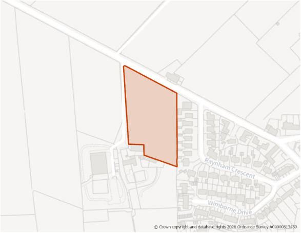
Site Size (ha) Gross: 0.92
Proposed Land Use: Housing
Minimum Development Capacity (Dwellings): 29
Site Type: Greenfield
Ward: Keighley West
Settlement: Keighley
Ownership: Private
Delivery Timescale: Long 2035+ (11+)
Site Specific Requirements:
Design Principles
- Development should provide at least 29 dwellings as part of a high-quality built environment in line with Policies ST4 and DS1, at a net density of 35 dph in line with Policy HO2. This should include affordable housing (in line with Policy HO4) and an appropriate mix of dwellings (in line with Policy HO3 and having due regard to relevant housing needs evidence and the character of the area).
- A sensitive design and layout will be required taking into consideration the site’s location on the edge of the settlement boundary as well as its proximity to agricultural uses and the amenity of adjoining residential properties. This should include appropriate landscaping and screening.
Site Access, Highways and Transport
- A new site access will be required. This should be taken from Black Hill Lane, which lacks footways and streetlighting. Appropriate highway works including the provision of footways and streetlighting will be required to achieve this access.
- Black Hill Lane will require infrastructure improvement. Off site highway works may also be required along the route to the town centre.
Natural and Historic Environment
- The site lies within the Special Protection Area / Special Area of Conservation (SPA/SAC) Zone C (Recreational Pressure) - Residential development resulting in a net increase in dwellings will be required to mitigate any recreational pressure on the SPA/SAC caused by such development in accordance with the South Pennine Moors SPD and Policy NE3.
Environmental Protection
- The site lies within the 250m buffer of former landfill site which is now used as a cemetery. Any potential impacts should be addressed in line with Policy CR2.
- The site is within a Mineral Safeguarding Area (MSA) for sandstone. As the site is under 1ha in size, a mineral resource assessment will not be required as part of any planning application to determine the extent and availability of any sandstone resource in line with Policy MIN3.
Open Space and Green / Blue Infrastructure
- Open space should be provided in line with Policy NE2, having regard to the standards set out In Appendix 11.
- Site is within an area of low provision and high need for green and blue infrastructure. Development proposals should focus on carefully designed green and blue infrastructure to contribute towards site specific issues.
Landscape
- The site is located within the Keighley Moorland Fringe Landscape Character area/type (B1)
- The site has a low-moderate landscape sensitivity. To address this, development should be oriented to reduce the appearance of an abrupt urban edge. Native trees should be included to integrate development and dry stone walls should be retained, to reflect the moorland fringe character. Planting trees along the western boundary of the site would extend the tree line created by the avenue approaching Prospect House extending from Black Hill Lane, creating a stronger boundary feature on the settlement edge.
Green Belt (and Golden Rules)
- Site has been removed from the Green Belt. Development on the site should be consistent with the “Golden Rules” set out in the NPPF in relation to affordable housing, necessary improvements to infrastructure and accessible green space provision.
Infrastructure Requirements
- Proportionate contributions to community infrastructure will be required, where appropriate, in line with Policies ID1 and ID2, and having regard to the Local Infrastructure Plan.
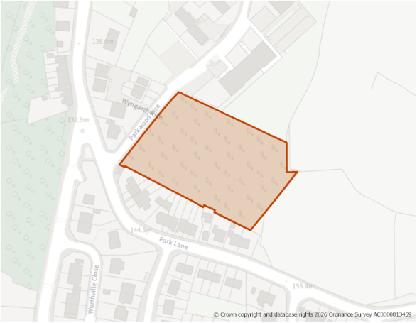
Site Size (ha) Gross: 0.73
Proposed Land Use: Housing
Minimum Development Capacity (Dwellings): 23
Site Type: Greenfield
Ward: Keighley East
Settlement: Keighley
Ownership: Private
Delivery Timescale: Short 2025-2030 (1-5)
Site Specific Requirements:
Design Principles
- Development should provide at least 23 dwellings as part of a high-quality built environment in line with Policies ST4 and DS1, at a net density of 35 dph in line with Policy HO2. This should include affordable housing (in line with Policy HO4) and an appropriate mix of dwellings (in line with Policy HO3) and having due regard to relevant housing needs evidence and the character of the area.
- A sensitive design and layout will be required taking into consideration the site’s location within the settlement as well as its sloping topography and the amenity of adjacent residential properties. This should include the provision of appropriate landscaping and screening.
Site Access, Highways and Transport
- A new site access will be required. This should be taken from Parkwood Rise, where there are footways and streetlighting present. Appropriate highway works will be required to achieve this access.
Natural and Historic Environment
- The site lies within the Special Protection Area / Special Area of Conservation (SPA/SAC) Zone C (Recreational Pressure) - Residential development resulting in a net increase in dwellings will be required to mitigate any recreational pressure on the SPA/SAC caused by such development in accordance with the South Pennine Moors SPD and Policy NE3.
- The site is located within a bat alert area. An ecological survey will be required as part of any planning application to establish the extent/impacts as well as to identify appropriate mitigation.
- The site contains several mature trees along its boundaries. The design and layout of any development should retain these trees in line with Policy NE6.
- The site is identified in the West Yorkshire Local Nature Recovery Strategywith the preferred measure T4_M04 - Extend and connect tree and woodland cover across the White Rose Forest area in West Yorkshire.
Environmental Protection
- The site was historically used as an allotment, giving rise to potential risk of contamination. A Land Contamination Assessment – Phase 1 Report will be required as part of any planning application. Impacts should be addressed in line with Policy CR2.
Open Space and Green / Blue Infrastructure
- Open space should be provided in line with Policy NE2, having regard to the standards set out In Appendix 11.
- The site lies within the Keighley Focus Area, as identified in the Green and Blue Infrastructure Strategy (GBIS). The strategy should be consulted to identify opportunities for incorporating measures within the development that enhance the quality of, and connectivity to, the green and blue infrastructure network in this area.
Landscape
- The site is located within the Thwaites Brow Steep Valley Sides Landscape Character area/type (D2). No landscape sensitivity assessment was undertaken for this site. Consideration should be given to the guidance set out in the Landscape Character Assessment SPD.
Infrastructure Requirements
- Proportionate contributions to community infrastructure will be required, where appropriate, in line with Policies ID1 and ID2, and having regard to the Local Infrastructure Plan.
Planning Permission
- Site benefits from outline planning permission for residential development of land with all matters reserved (23/00039/MAO) granted in June 2026. This was after 1 April 2025 (the base date for the Local Plan). Accordingly, it has been identified as a site allocation.
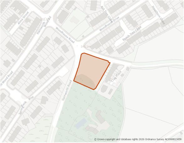
Site Size (ha) Gross: 0.23
Proposed Land Use: Housing
Minimum Development Capacity (Dwellings): 8
Site Type: Greenfield
Ward: Keighley East
Settlement: Keighley
Ownership: Private
Delivery Timescale: Medium 2030-2035 (6-10)
Site Specific Requirements:
Design Principles
- Development should provide at least 8 dwellings as part of a high-quality built environment in line with Policies ST4 and DS1, at a net density of 35 dph in line with Policy HO2. This should include an appropriate mix of dwellings (in line with Policy HO3 and having due regard to relevant housing needs evidence and the character of the area).
- A sensitive design and layout will be required taking into consideration the site’s location within the settlement and should include appropriate landscaping and having regard to the adjacent areas of TPO woodland.
Site Access, Highways and Transport
- A new site access will be required. This should be taken from Woodhouse Road, where there are footways and streetlighting present. Appropriate highway works will be required to achieve this access.
Natural and Historic Environment
- The site lies within the Special Protection Area / Special Area of Conservation (SPA/SAC) Zone C (Recreational Pressure) - Residential development resulting in a net increase in dwellings will be required to mitigate any recreational pressure on the SPA/SAC caused by such development in accordance with the South Pennine Moors SPD and Policy NE3.
- The site is identified as being a priority habitat (deciduous woodland) and is within a bat alert area. An ecological survey will be required as part of any planning applicaton to determine any impacts.
- The site contains, and is adjacent to, an area of TPO woodland. This feature should be retained and protected as part of the design and layout of any development in line with Policy NE6. An arboricultural assessment will be required as part any planning application.
- The site is identified in the West Yorkshire Local Nature Recovery Strategywith the preferred measure B4_M02 - Significantly boost biodiversity wherever possible where there are existing habitats alongside transport infrastructure.
Open Space and Green / Blue Infrastructure
- Open space should be provided in line with Policy NE2, having regard to the standards set out In Appendix 11.
- The site lies within the Keighley Opportunity Area, as identified in the Green and Blue Infrastructure Strategy (GBIS) and an area of low provision and high need for green and blue infrastructure. The strategy should be consulted to identify opportunities for incorporating measures within the development that enhance the quality of, and connectivity to, the green and blue infrastructure network in this area. Development proposals should focus on carefully designed green and blue infrastructure to contribute towards site specific issues.
Landscape
- The site is located within the Thwaites Brow Steep Valley Sides Landscape Character area/type (D2). No landscape sensitivity assessment was undertaken for this site. Consideration should be given to the guidance set out in the Landscape Character Assessment SPD.
Infrastructure Requirements
- Proportionate contributions to community infrastructure will be required, where appropriate, in line with Policies ID1 and ID2, and having regard to the Local Infrastructure Plan.
Planning Permission
- A Permission in Principle application is currently pending on this site for up to 9 dwellings which may be determined before the Local Plan is adopted.
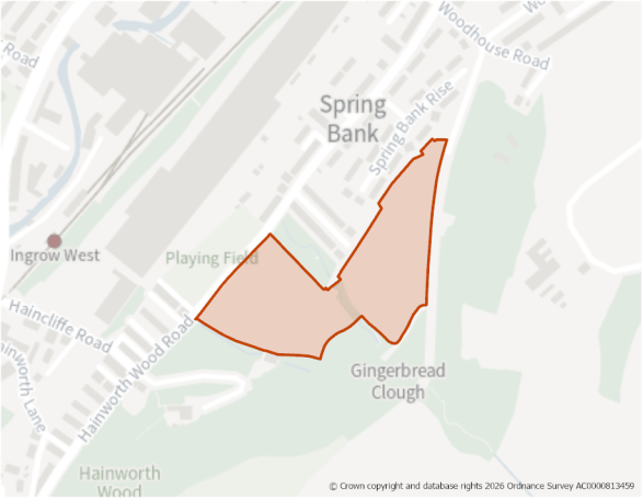
Site Size (ha) Gross: 3.23
Proposed Land Use: Housing
Minimum Development Capacity (Dwellings): 73
Site Type: Greenfield
Ward: Keighley East
Settlement: Keighley
Ownership: Public
Delivery Timescale: Long 2035+ (11+)
Site Specific Requirements:
Design Principles
- Development should provide at least 73 dwellings as part of a high-quality built environment in line with Policies ST4 and DS1, at a net density of 35 dph in line with Policy HO2. This should include affordable housing (in line with Policy HO4) and an appropriate mix of dwellings (in line with Policy HO3 and having due regard to relevant housing needs evidence and the character of the area).
- A sensitive design and layout will be required taking into consideration the site’s location within the settlement as well as its proximity to protected woodland, and designated Local Wildlife Site.
Site Access, Highways and Transport
- A new site access is required. This should be taken from Hainworth Wood Road, where there are footways and streetlighting presence. Appropriate highway works will be required to achieve this access. A crossing of Ginger Bread Clough will be required.
- An alternative access exists from Hainworth Road (to the north east), However, this consists of a track and would need to be made up to an adoptable standard if used to serve the site.
- A Public Right of Way (PRoW) runs adjacent to the north eastern boundary linking to Hainworth Road. Consideration should be given to providing a pedestrian and cycle link to it as part any future development layout. This should be well-designed and overlooked by surrounding dwellings
Flooding, Water and Drainage
- A watercourse (Gingerbread Clough) runs across the site from south east to north west.
- The site is located with Flood Zone 1 and is at low risk of fluvial and surface water flooding; however, a flood risk assessment is required to determined potential fluvial risk from Gingerbread Clough.
- The flood risk assessment should include for a drainage strategy which includes the existing channel in site design and investigate ground conditions for infiltration SuDS suitability.
Natural and Historic Environment
- The site lies within the Special Protection Area / Special Area of Conservation (SPA/SAC) Zone C (Recreational Pressure) - Residential development resulting in a net increase in dwellings will be required to mitigate any recreational pressure on the SPA/SAC caused by such development in accordance with the South Pennine Moors SPD and Policy NE3.
- Site is adjacent an area of priority habitat (Deciduous Woodland), part of which, adjacent to the southern boundary, is also classed as an area of Ancient Woodland. The design and layout of any development should ensure that the appropriate buffers are maintained.
- The site contains and is adajcent to a Local Wildlife Site (LWS) (Hainworth Wood) and is within a bat alert area. An ecological survey should be provided as part of any planning applications. The design and layout of any development should ensure that it avoids the designated LWS.
- The site contains and is adjacent to an area TPO woodland along and within the eastern and southern sections. Such features should be retained and protected as part of the design and layout of any development in line with Policy NE6. An arboricultural assessment will be required as part any planning application.
- The site is identified in the West Yorkshire Local Nature Recovery Strategywith the preferred measure T2_M04 - Extend and connect tree and woodland cover across the White Rose Forest area in West Yorkshire.
Environmental Protection
- Site is partly within the 150m and 250m buffers of a former landfill site. A Land Contamination Assessment – Phase 1 Report will be required as part of any planning application. Impacts should be addressed in line with Policy CR2.
Open Space and Green / Blue Infrastructure
- Open space should be provided in line with Policy NE2, having regards to the standards set out In Appendix 11.
- The site lies within the Keighley Opportunity Area, as identified in the Green and Blue Infrastructure Strategy (GBIS) and partly within an area of low provision and high need for green and blue infrastructure. The strategy should be consulted to identify opportunities for incorporating measures within the development that enhance the quality of, and connectivity to, the green and blue infrastructure network in this area. Development proposals should focus on carefully designed green and blue infrastructure to contribute towards site specific issues.
Landscape
- The site is located within the Thwaites Brow Steep Valley Sides Landscape Character area/type (D2).
- In relation to addressing landscape impacts, development should be avoided at the highest elevations to the south to retain some sense of the characteristic steep valley side landform and provide a buffer between the development and the ancient woodland. Natural Flood Management and SuDS should be incorporated, particularly close to Gingerbread Clough to enhance the wetland habitats and improve drainage across the site. Integrating the development with tree belts would soften the distant views towards the site and provide an element of connectivity with the adjoining woodland.
Infrastructure Requirements
- Proportionate contributions to community infrastructure will be required, where appropriate, in line with Policies ID1 and ID2, and having regard to the Local Infrastructure Plan.
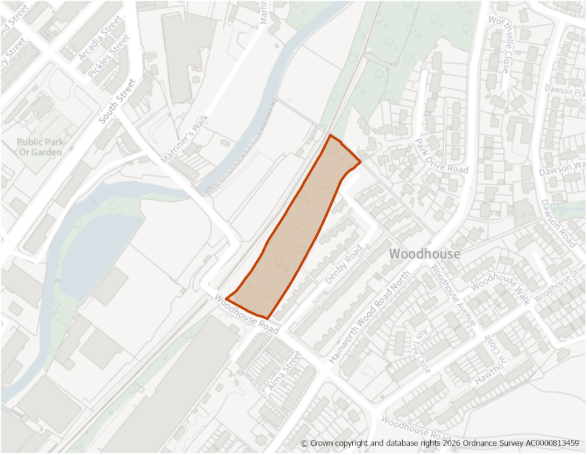
Site Size (ha) Gross: 0.80
Proposed Land Use: Housing
Minimum Development Capacity (Dwellings): 25
Site Type: Greenfield
Ward: Keighley East
Settlement: Keighley
Ownership: Private
Delivery Timescale: Medium 2030-2035 (6-10)
Site Specific Requirements:
Design Principles
- Development should provide at least 25 dwellings as part of a high-quality built environment in line with Policies ST4 and DS1, at a net density of 35 dph in line with Policy HO2. This should include affordable housing (in line with Policy HO4) and an appropriate mix of dwellings (in line with Policy HO3 and having due regard to relevant housing needs evidence and the character of the area).
- A sensitive design and layout will be required taking into consideration the site’s location within the settlement as well as its proximity to commerical/industrial uses and the Keighley and Worth Valley Railway. This should include appropriate landscaping, open space and links to the adjacent Public Rights of Way network.
Site Access, Highways and Transport
- A new site access will be required. This should be taken from Denby Road, where there are footways and streetlighting present. Appropriate highway works will be required to achieve this access.
- A Public Right of Way (PRoW) runs along the northern boundary of the site. Consideration should be given to providing a link to it as part any future development layout. This should be well-designed and overlooked by surrounding dwellings.
Flooding, Water and Drainage
- Site contains areas at risk of surface water flooding. This should be assessed and impacts addressed in with Policy CR4.
Natural and Historic Environment
- The site lies within the Special Protection Area / Special Area of Conservation (SPA/SAC) Zone C (Recreational Pressure) - Residential development resulting in a net increase in dwellings will be required to mitigate any recreational pressure on the SPA/SAC caused by such development in accordance with the South Pennine Moors SPD and Policy NE3.
- The site is located within a bat alert area. An ecological survey will be required as part of any planning application to establish the extent/impacts as well as to identify appropriate mitigation.
- The site contains a number of mature trees along the eastern and western boundaries. The design and layout of any development should retain these trees in line with Policy NE6.
- The site is identified in the West Yorkshire Local Nature Recovery Strategywith the preferred measure G3_M03 - Restore and enhance existing species-rich grassland.
Environmental Protection
- Site is partly within the 150m and 250m buffers of a former landfill site. A Land Contamination Assessment – Phase 1 Report will be required as part of any planning application. Impact should be addressed in line with Policy CR2.
- The site is adajcent to the Keighley and Worth Valley Railway line and within close proximity to several commerical/industrial uses. Impacts should be addressed in line with Policy CR2.
Open Space and Green / Blue Infrastructure
- Open space should be provided in line with Policy NE2, having regard to the standards set out In Appendix 11.
- The site lies within the Keighley Opportunity Area, as identified in the Green and Blue Infrastructure Strategy (GBIS)and partly within an area of low provision and high need for green and blue infrastructure. The strategy should be consulted to identify opportunities for incorporating measures within the development that enhance the quality of, and connectivity to, the green and blue infrastructure network in this area. Development proposals should focus on carefully designed green and blue infrastructure to contribute towards site specific issues.
Landscape
- The site is located within the Central Airedale Settled Valley Floor Landscape Character area/type (G2). No landscape sensitivity assessment was undertaken for this site. Consideration should be given to the guidance set out in the Landscape Character Assessment SPD.
Infrastructure Requirements
- Proportionate contributions to community infrastructure will be required, where appropriate, in line with Policies ID1 and ID2, and having regard to the Local Infrastructure Plan.
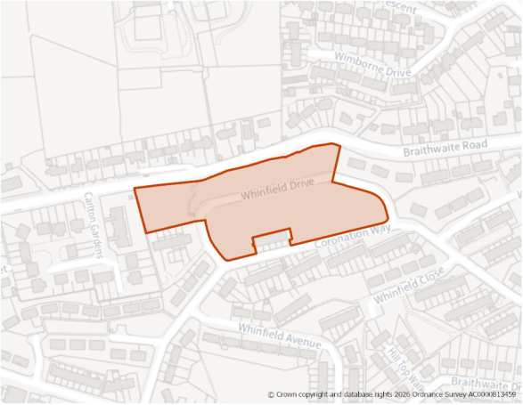
Site Size (ha) Gross: 1.23
Proposed Land Use: Housing
Minimum Development Capacity (Dwellings): 39
Site Type: Greenfield
Ward: Keighley West
Settlement: Keighley
Ownership: Private
Delivery Timescale: Medium 2030-2035 (6-10)
Site Specific Requirements:
Design Principles
- Development should provide at least 39 dwellings as part of a high-quality built environment in line with Policies ST4 and DS1, at a net density of 35 dph in line with Policy HO2. This should include affordable housing (in line with Policy HO4) and an appropriate mix of dwellings (in line with Policy HO3 and having due regard to relevant housing needs evidence and the character of the area).
- A sensitive design and layout will be required taking into consideration the site’s location within the settlement. This should include appropriate landscaping, open space, retaining existing mature trees and maintaining the existing Public Right of Way.
Site Access, Highways and Transport
- An existing access is available via Whinfield Drive, where there are footways and streetlighting present.
- A Public Right of Way (PRoW) runs across the western section of the site linking Whinfield Drive with Braithwaite Road. The design and layout of any development should retain this footpath.
Natural and Historic Environment
- The site lies within the Special Protection Area / Special Area of Conservation (SPA/SAC) Zone C (Recreational Pressure) - Residential development resulting in a net increase in dwellings will be required to mitigate any recreational pressure on the SPA/SAC caused by such development in accordance with the South Pennine Moors SPD and Policy NE3.
- The site includes a number of mature trees within the northern boundary. The design and layout of any development should retain these trees in line with Policy NE6.
- The site is identified in the West Yorkshire Local Nature Recovery Strategywith the preferred measure B3_M01 - Create and maintain habitat corridors and stepping stones to connect and extend existing blue and green places.
Environmental Protection
- The north west section of site is within 250m buffer of former landfill, any potential impacts should be addressed in line with Policy CR2.
- Site lies within a Mineral Safeguarding Area (MSA) for sandstone. A mineral resource assessment will be required as part of any planning application to determine the extent and availability of any sandstone resource in line with Policy MIN3.
Open Space and Green / Blue Infrastructure
- Open space should be provided in line with Policy NE2, having regard to the standards set out In Appendix 11.
- Site is partially within an area of low provision and high need for green and blue infrastructure. Development proposals should focus on carefully designed green and blue infrastructure to contribute towards site specific issues.
- Part of the south eastern section of the site lies within the Keighley Focus Area, as identified in the Green and Blue Infrastructure Strategy (GBIS). The strategy should be consulted to identify opportunities for incorporating measures within the development that enhance the quality of, and connectivity to, the green and blue infrastructure network in this area.
Landscape
- The site is located within the Keighley Moorland Fringe Landscape Character area/type (B1). No landscape sensitivity assessment was undertaken for this site. Consideration should be given to the guidance set out in the Landscape Character Assessment SPD.
Infrastructure Requirements
- Proportionate contributions to community infrastructure will be required, where appropriate, in line with Policies ID1 and ID2, and having regard to the Local Infrastructure Plan.
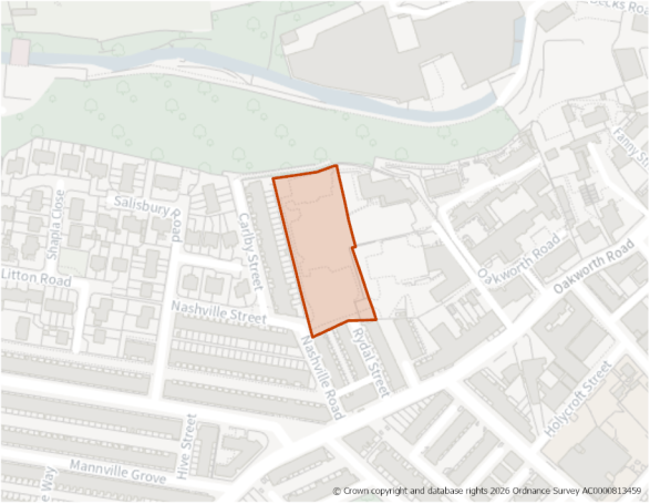
Site Size (ha) Gross: 0.51
Proposed Land Use: Housing
Minimum Development Capacity (Dwellings): 23
Site Type: PDL
Ward: Keighley West
Settlement: Keighley
Ownership: Private
Delivery Timescale: Medium 2030-2035 (6-10)
Site Specific Requirements:
Design Principles
- Development should provide at least 23 dwellings as part of a high-quality built environment in line with Policies ST4 and DS1, at a net density of 50 dph in line with Policy HO2. This should include affordable housing (in line with Policy HO4) and an appropriate mix of dwellings (in line with Policy HO3 and having due regard to relevant housing needs evidence and the character of the area).
- A sensitive design and layout will be required taking into consideration the site’s location within the settlement as well as its proximity to the woodland to the north and the amenity of adjoining residential properties. This should include appropriate landscaping and provision of green space.
Site Access, Highways and Transport
- An existing access is available from Nashville Road/Nashville Street, where there are footways and streetlighting present. This should be widened. Alternative access points from Rydal Street and Oxford Street may be possible but require further investigation.
Flooding, Water and Drainage
- The site is located in Flood Zone 1; however there is a risk of surface water flooding within and adjacent to the western boundary and the northern section of the site. An assessment will be required to determine the extent of any risk and appropriate mitigations measures.
Natural and Historic Environment
- The site lies within the Special Protection Area / Special Area of Conservation (SPA/SAC) Zone C (Recreational Pressure) - Residential development resulting in a net increase in dwellings will be required to mitigate any recreational pressure on the SPA/SAC caused by such development in accordance with the South Pennine Moors SPD and Policy NE3.
- The site is adjacent to an identified Wildlife Habitat Network (Woodland) and within a bat alert area. An ecological survey should be provided as part of any planning application.
- The site is adjacent to an area of TPO woodland. The design and layout of any development should ensure these trees are preserved and enhanced in line with Policy NE6. An arboricultural assessment should be provided as part of any planning application.
- The site is identified in the West Yorkshire Local Nature Recovery Strategywith the preferred measure B3_M01 - Create and maintain habitat corridors and stepping stones to connect and extend existing blue and green places.
Environmental Protection
- Site is partly within the 250m buffer of a former landfill site. Impacts should be addressed in line with Policy CR2.
Open Space and Green / Blue Infrastructure
- Open space should be provided in line with Policy NE2, having regard to the standards set out In Appendix 11.
- The site lies within the Keighley Focus Area, as identified in the Green and Blue Infrastructure Strategy (GBIS). The strategy should be consulted to identify opportunities for incorporating measures within the development that enhance the quality of, and connectivity to, the green and blue infrastructure network in this area.
Landscape
- The site is located within the Central Airedale Settled Valley Floor Landscape Character area/type (G2). No landscape sensitivity assessment was undertaken for this site. Consideration should be given to the guidance set out in the Landscape Character Assessment SPD.
Infrastructure Requirements
- Proportionate contributions to community infrastructure will be required, where appropriate, in line with Policies ID1 and ID2, and having regard to the Local Infrastructure Plan.
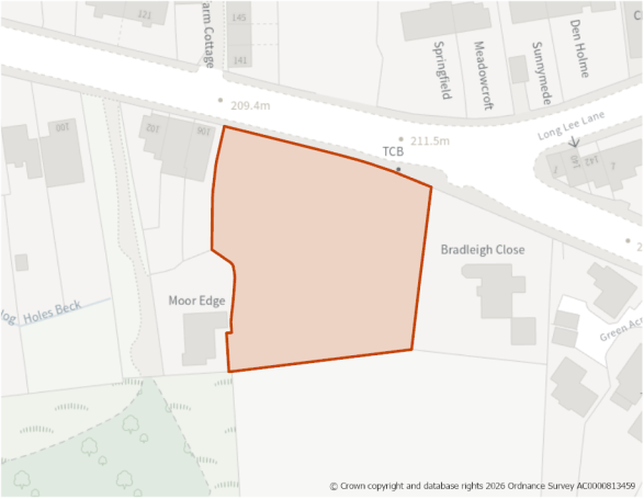
Site Size (ha) Gross: 0.24
Proposed Land Use: Housing
Minimum Development Capacity (Dwellings): 8
Site Type: Greenfield
Ward: Keighley East
Settlement: Keighley
Ownership: Private
Delivery Timescale: Medium 2030-2035 (6-10)
Site Specific Requirements:
Design Principles
- Development should provide at least 8 dwellings as part of a high-quality built environment in line with Policies ST4 and DS1, at a net density of 35 dph in line with Policy HO2. This should include an appropriate mix of dwellings in line with Policy HO3 and having due regard to relevant housing needs evidence and the character of the area.
- A sensitive design and layout will be required taking into consideration the site’s location on the edge of the settlement, adajcent to the countryside. This should include appropriate landscaping and screening.
Site Access, Highways and Transport
- A new site access will be required and should be taken from Long Lee Lane, where footpaths and streetlighting are present. Appropriate highway works will be required to achieve this access.
- Consideration should be given to the impact on the junction of Long Lee Lane and Harden Road, immediately adjacent to the site.
Flooding, Water and Drainage
- The site is located in Flood Zone 1; however, a flood risk assessment will be required to assess and investigate the potential presence of a culverted watercourse, and groundwater levels and conditions. Should a watercourse be present, the design and layout should ensure that no development takes place on top of it and within 8 metres either side. Opportunities to open up the culvert should be explored as part of site design as a blue/green corridor.
- Site has a potential risk surface water flooding affecting the central and western sections. Consideration could be given retaining surface water on the site and leaving the topographic low spot free from development, whilst the use of infiltration SuDS should be investigated.
Natural and Historic Environment
- The site lies within the Special Protection Area / Special Area of Conservation (SPA/SAC) Zone C (Recreational Pressure) - Residential development resulting in a net increase in dwellings will be required to mitigate any recreational pressure on the SPA/SAC caused by such development in accordance with the South Pennine Moors SPD and Policy NE3.
Environmental Protection
- Site is partly within the 250m buffer of former landfill site. Impacts should be addressed in line with Policy CR2.
Open Space and Green / Blue Infrastructure
- Open space should be provided in line with Policy NE2, having regard to the standards set out In Appendix 11.
- The site lies within the Keighley Focus Area, as identified in the Green and Blue Infrastructure Strategy (GBIS). The strategy should be consulted to identify opportunities for incorporating measures within the development that enhance the quality of, and connectivity to, the green and blue infrastructure network in this area.
Landcape
- The site is located within the Thwaites Brow Steep Valley Sides Landscape Character area/type (D2). No landscape sensitivity assessment was undertaken for this site. Consideration should be given to the guidance set out in the Landscape Character Assessment SPD.
Green Belt (and Golden Rules)
- Site has been removed from the Green Belt. However, the level of development proposed is below the threshold for the Golden Rules to apply.
Infrastructure Requirements
- Proportionate contributions to community infrastructure will be required, where appropriate, in line with Policies ID1 and ID2, and having regard to the Local Infrastructure Plan.
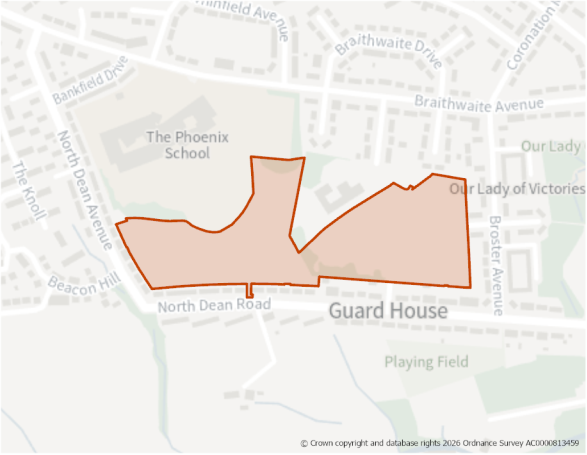
Site Size (ha) Gross: 4.79
Proposed Land Use: Housing
Minimum Development Capacity (Dwellings): 126
Site Type: PDL
Ward: Keighley West
Settlement: Keighley
Ownership: Public
Delivery Timescale: Medium 2030-2035 (6-10)
Site Specific Requirements:
Design Principles
- Development should provide at least 126 dwellings as part of a high-quality built environment in line with Policies ST4 and DS1, at a net density of 35 dph in line with Policy HO2. This should include affordable housing (in line with Policy HO4) and an appropriate mix of dwellings (in line with Policy HO3 and having due regard to relevant housing needs evidence and the character of the area).
- A sensitive design and layout will be required taking into consideration the site’s location within the settlement and amenity of adjoining residential properties as well as its proximity to the open space and education uses adjoining the north western boundary. This should include appropriate landscaping and screening.
Site Access, Highways and Transport
- An existing access leads to the site via School Road from Broster Avenue, where there are footways and streetlighting present. Alternative or additional vehicluar and pedestrian/cycle access points from North Dean Road could be investigated.
Flooding, Water and Drainage
- The site is located in Flood Zone 1 and is not at risk fluvial flooding and at very low risk of surface water flooding; however, a Flood Risk Assessment will be required to confirm that any development could be designed to be safe. Additionally, longer term safe access and escape routes should be considered further. The flood risk assessment should include a drainage strategy which includes the ponded area in site design and investigate ground conditions for infiltration SuDS suitability.
Natural and Historic Environment
- The site lies within the Special Protection Area / Special Area of Conservation (SPA/SAC) Zone C (Recreational Pressure) - Residential development resulting in a net increase in dwellings will be required to mitigate any recreational pressure on the SPA/SAC caused by such development in accordance with the South Pennine Moors SPD and Policy NE3.
- The site is located within a bat alert area. An ecological survey will be required as part of any planning application to establish the extent/impacts as well as to identify appropriate mitigation.
- The site is identified in the West Yorkshire Local Nature Recovery Strategywith the preferred measure B3_M02 - Enhance (rather than replace) existing habitats on some areas of brownfield.
Open Space and Green / Blue Infrastructure
- Open space should be provided in line with Policy NE2, having regard to the standards set out In Appendix 11.
- The site is adjacent to (south of) of areas of open space, classed as natural and semi-natural green space (Land north of North Dean Road) and outdoor sports facilities (Merlin Top Primary Academy). Design and layout of any development should consider maintain and enhance links to these areas of open space
- The site lies within the Keighley Opportunity Area, as identified in the Green and Blue Infrastructure Strategy (GBIS). The strategy should be consulted to identify opportunities for incorporating measures within the development that enhance the quality of, and connectivity to, the green and blue infrastructure network in this area. Development proposals should focus on carefully designed green and blue infrastructure to contribute towards site specific issues.
Landscape
- The site is located within the Hollins Bank Steep Valley Sides Landscape Character area/type (D3). No landscape sensitivity assessment was undertaken for this site. Consideration should be given to the guidance set out in the Landscape Character Assessment SPD.
Infrastructure Requirements
- Proportionate contributions to community infrastructure will be required, where appropriate, in line with Policies ID1 and ID2, and having regard to the Local Infrastructure Plan.
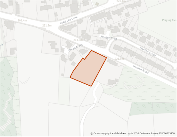
Site Size (ha) Gross: 0.21
Proposed Land Use: Housing
Minimum Development Capacity (Dwellings): 7
Site Type: Greenfield
Ward: Keighley East
Settlement: Keighley
Ownership: Private
Delivery Timescale: Medium 2030-2035 (6-10)
Site Specific Requirements:
Design Principles
- Development should provide at least 7 dwellings as part of a high-quality built environment in line with Policies ST4 and DS1, at a net density of 35 dph in line with Policy HO2. This should include an appropriate mix of dwellings (in line with Policy HO3 and having due regard to relevant housing needs evidence and the character of the area).
- A sensitive design and layout will be required taking into consideration the site’s location on the edge of the settlement adjacent to the countryside as well as the amenity of adjoining resdential properities. This should include appropriate landscaping and seeking to avoid development on the upper slopes within the southern section of the site.
Site Access, Highways and Transport
- A new site access will be required and should be taken from Harden Road, where footpaths and streetlighting is present. Appropriate highway works will be required to achieve this access.
Natural and Historic Environment
- The site lies within the Special Protection Area / Special Area of Conservation (SPA/SAC) Zone C (Recreational Pressure) - Residential development resulting in a net increase in dwellings will be required to mitigate any recreational pressure on the SPA/SAC caused by such development in accordance with the South Pennine Moors SPD and Policy NE3.
- The site is identified in the West Yorkshire Local Nature Recovery Strategywith the preferred measure G3_M01 - Create new botanically diverse, managed, species-rich grasslands.
Environmental Protection
- Site is within 150m buffer of a former landfill site. A Land Contamination Assessment – Phase 1 Report will be required as part of any planning application. Impacts should be addressed in line with Policy CR2.
- Site is crossed from north to south east by a lower voltage electicity transmission line. Development should include a strategy for responding to the Northern Powergrid equipment present within the site which demonstrates how the Northern Powergrid and HSE Guidance have been applied as part of the design and layout and how the impact of the assets has been reduced through good design. Enquiries should be made with Northern Powergrid.
Open Space and Green / Blue Infrastructure
- Open space should be provided in line with Policy NE2, having regard to the standards set out In Appendix 11.
- The site lies within the Keighley Focus Area, as identified in the Green and Blue Infrastructure Strategy (GBIS). The strategy should be consulted to identify opportunities for incorporating measures within the development that enhance the quality of, and connectivity to, the green and blue infrastructure network in this area.
Landscape
- The site is located within the Cullingworth and Haworth Moorland Fringe Landscape Character area/type (B2).
- Site is considered to have a low-moderate landscape impact. The design and layout of any development should address this by ensuring that the southern part of the site on its upper slopes should is retained due to its higher degree of sensitivity, as part of the wider pastoral landscape relating to the settlement setting.
- Development within the northern section on the lower slopes has the potential to be positively integrated into the existing settlement edge by tree cover and boundary improvements. If possible, views towards the prominent drystone walling along the skyline to the south should be maintained.
Green Belt (and Golden Rules)
- Site has been removed from the Green Belt. However, the level of development proposed is below the threshold for the Golden Rules to apply.
Infrastructure Requirements
- Proportionate contributions to community infrastructure will be required, where appropriate, in line with Policies ID1 and ID2, and having regard to the Local Infrastructure Plan.
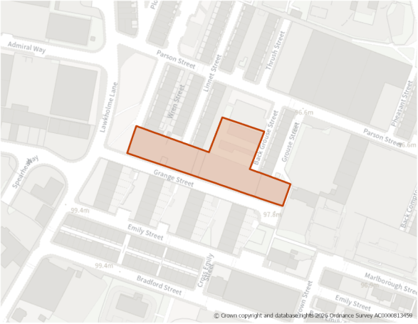
Site Size (ha) Gross: 0.33
Proposed Land Use: Housing
Minimum Development Capacity (Dwellings): 25
Site Type: PDL
Ward: Keighley Central
Settlement: Keighley
Ownership: Private
Delivery Timescale: Long 2035+ (11+)
Site Specific Requirements:
Design Principles
- Development should provide at least 25 dwellings as part of a high-quality built environment in line with Policies ST4 and DS1, at a net density of 75 dph in line with Policy HO2. This should include affordable housing (in line with Policy HO4) and an appropriate mix of dwellings (in line with Policy HO3 and having due regard to relevant housing needs evidence and the character of the area).
- A sensitive design and layout will be required taking into consideration the site’s location within the settlement as well as its proximity to industrial/commercial uses and the Parson Street playground adjoining the northern boundary. This should include appropriate landscaping.
Site Access, Highways and Transport
- A new site access will be required and should be taken from Grange Street, where footpaths and streetlighting is present. Appropriate highway works will be required to achieve this access.
- Consideration should be given to providing new or improved pedestrian and cycle access to Parson Street playground and the immediate surrounding area. Any routes should be well-designed and overlooked by surrounding dwellings.
Natural and Historic Environment
- The site lies within the Special Protection Area / Special Area of Conservation (SPA/SAC) Zone C (Recreational Pressure) - Residential development resulting in a net increase in dwellings will be required to mitigate any recreational pressure on the SPA/SAC caused by such development in accordance with the South Pennine Moors SPD and Policy NE3.
Environmental Protection
- Site is currently derelict and has historically accommodated a range of commercial uses giving rise for the potential risk of land contamination. A Land Contamination Assessment – Phase 1 Report will be required as part of any planning application. Impacts should be addressed in line with Policy CR2.
Open Space and Green / Blue Infrastructure
- Site is adjacent an area of designated open space classed as provision for children (Parson Street Play Areas). Design and layout of any development should consider maintaining and enhance links to this area of open space.
- Open space should be provided in line with Policy NE2, having regard to the standards set out In Appendix 11.
- The site lies within the Keighley Opportunity Area, as identified in the Green and Blue Infrastructure Strategy (GBIS) and an area of low provision and high need for green and blue infrastructure. The strategy should be consulted to identify opportunities for incorporating measures within the development that enhance the quality of, and connectivity to, the green and blue infrastructure network in this area. Development proposals should focus on carefully designed green and blue infrastructure to contribute towards site specific issues
Landscape
- The site is located within the Central Airedale Settled Valley Floor Landscape Character area/type (G2). No landscape sensitivity assessment was undertaken for this site. Consideration should be given to the guidance set out in the Landscape Character Assessment SPD.
Infrastructure Requirements
- Proportionate contributions to community infrastructure will be required, where appropriate, in line with Policies ID1 and ID2, and having regard to the Local Infrastructure Plan.
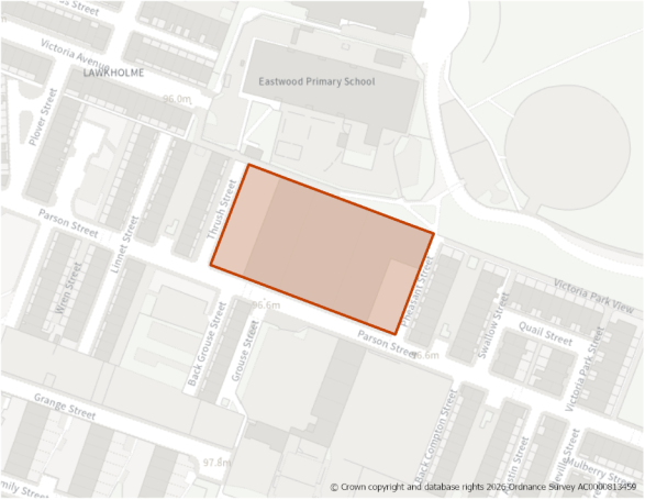
Site Size (ha) Gross: 0.49
Proposed Land Use: Housing
Minimum Development Capacity (Dwellings): 33
Site Type: PDL
Ward: Keighley Central
Settlement: Keighley
Ownership: Private
Delivery Timescale: Long 2035+ (11+)
Site Specific Requirements:
Design Principles
- Development should provide at least 33 dwellings as part of a high-quality built environment in line with Policies ST4 and DS1, at a net density of 75 dph in line with Policy HO2. This should include affordable housing (in line with Policy HO4) and an appropriate mix of dwellings (in line with Policy HO3 and having due regard to relevant housing needs evidence and the character of the area).
- A sensitive design and layout will be required taking into consideration the site’s location within the settlement as well as its proximity to a designated heritage asset (Victoria Hall) and Victoria Park.
Site Access, Highways and Transport
- A new site access will be required and should be taken from Parson Street, where footpaths and streetlighting are present. Appropriate highway works will be required to achieve this access.
- Consideration should be given to providing new or improved pedestrian and cycle access to Victoria Park.
Natural and Historic Environment
- The site lies partially within the Special Protection Area / Special Area of Conservation (SPA/SAC) Zone B (Supporting Habitat/Functionally Linked Land; recreational pressures). Development proposals must assess potential impacts on foraging habitat used by SPA qualifying species and provide ecological evidence where required in accordance with the South Pennine Moors SPD and Policy NE3.
- The remaining site lies within Zone C (Recreational Pressure) - Residential development resulting in a net increase in dwellings will be required to mitigate any recreational pressure on the SPA/SAC caused by such development in accordance with the South Pennine Moors SPD and Policy NE3.
- The site is identified in the West Yorkshire Local Nature Recovery Strategywith the preferred measure B3_M01 - Create and maintain habitat corridors and stepping stones to connect and extend existing blue and green places.
Environmental Protection
- Site is currently in business use and was historically an engineering works giving rise to a potential risk of land contamination. A Land Contamination Assessment – Phase 1 Report will be required as part of any planning application. Impacts should be addressed in line with Policy CR2.
- Site is adajcent (north of) the Atlas Business Park), which include a number of differnt businesses, giving rise to potential impacts. Impacts should be addressed in line with Policy CR2.
Open Space and Green / Blue Infrastructure
- Site is adjacent an area of designated open space classed as parks and gardens (Victoria Park). Design and layout of any development should consider maintaining and enhancing links to this area of open space.
- Open space should be provided in line with Policy NE2, having regard to the standards set out In Appendix 11.
- The site lies within the Keighley Focus Area, as identified in the Green and Blue Infrastructure Strategy (GBIS). The strategy should be consulted to identify opportunities for incorporating measures within the development that enhance the quality of, and connectivity to, the green and blue infrastructure network in this area.
Landscape
- The site is located within the Central Airedale Settled Valley Floor Landscape Character area/type (G2). No landscape sensitivity assessment was undertaken for this site. Consideration should be given to the guidance set out in the Landscape Character Assessment SPD.
Infrastructure Requirements
- Proportionate contributions to community infrastructure will be required, where appropriate, in line with Policies ID1 and ID2, and having regard to the Local Infrastructure Plan.
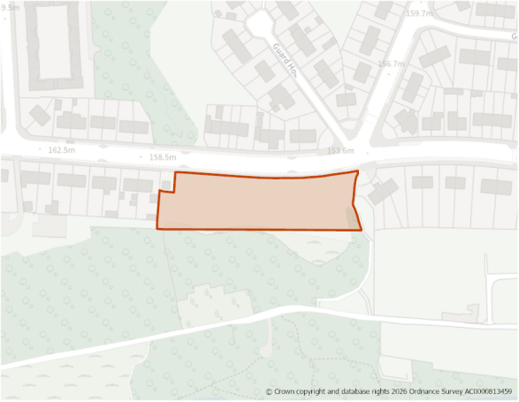
Site Size (ha) Gross: 0.37
Proposed Land Use: Housing
Minimum Development Capacity (Dwellings): 19
Site Type: Greenfield
Ward: Keighley West
Settlement: Keighley
Ownership: Public
Delivery Timescale: Long 2035+ (11+)
Site Specific Requirements:
Design Principles
- Development should provide at least 19 dwellings as part of a high-quality built environment in line with Policies ST4 and DS1, at a net density of 50 dph in line with Policy HO2. This should include affordable housing (in line with Policy HO4) and an appropriate mix of dwellings (in line with Policy HO3 and having due regard to to relevant housing needs evidence and the character of the area).
- A sensitive design and layout will be required taking into consideration the site’s location within the settlement, overlooking the valley of North Beck, as well as its proximity to open spaces to the south and east. This should include appropriate landscaping and screening.
Site Access, Highways and Transport
- A new site access is required and should be taken from North Dean Road, where footpaths and streetlighting are present. Appropriate highway works will be required to achieve this access.
- A Public Right of Way runs along the eastern boundary of the site. This should be retained as part of any development layout, with consideration given to enhancing it.
Flooding, Water and Drainage
- The site is located in Flood Zone 1 and at low risk of fluvial and surface water flooding; however, a Flood Risk Assessment will be required to confirm the potential fluvial risk from watercourse that flows through the site. Additionally, longer term safe access and escape routes should be considered further. The flood risk assessment should include a drainage strategy which includes the ponded area in site design and investigate ground conditions for infiltration SuDS suitability.
Natural and Historic Environment
- The site lies within the Special Protection Area / Special Area of Conservation (SPA/SAC) Zone C (Recreational Pressure) - Residential development resulting in a net increase in dwellings will be required to mitigate any recreational pressure on the SPA/SAC caused by such development in accordance with the South Pennine Moors SPD and Policy NE3.
- The site is located within a bat alert area. An ecological survey will be required as part of any planning application to establish the extent/impacts as well as to identify appropriate mitigation.
- The site is identified in the West Yorkshire Local Nature Recovery Strategywith the preferred measure T2_M04 - Extend and connect tree and woodland cover across the White Rose Forest area in West Yorkshire.
Environmental Protection
- Site is partly within 150m and wholy with the 250m buffer of a former landfill site. A Land Contamination Assessment – Phase 1 Report will be required as part of any planning application. Impacts should be addressed in line with Policy CR2.
- Site includes an electricty sub-station and is crossed by a lower voltage electricity transmission line close to its western boundary. Development should include a strategy for responding to the Northern Powergrid equipment present within the site which demonstrates how the Northern Powergrid and HSE Guidance have been applied as part of the design and layout and how the impact of the assets has been reduced through good design. Enquiries should be made with Northern Powergrid.
Open Space and Green / Blue Infrastructure
- Site is adjacent an area of designated open space classed as open land in settlements (Land south of North Dean Road). Design and layout of any development should consider maintain and enhance links to this area of open space.
- Open space should be provided in line with Policy NE2, having regard to the standards set out In Appendix 11.
- The site lies within the Keighley Focus Area, as identified in the Green and Blue Infrastructure Strategy (GBIS). The strategy should be consulted to identify opportunities for incorporating measures within the development that enhance the quality of, and connectivity to, the green and blue infrastructure network in this area.
Landscape
- The site is located within the Central Airedale Settled Valley Floor Landscape Character area/type (G2). No landscape sensitivity assessment was undertaken for this site. Consideration should be given to the guidance set out in the Landscape Character Assessment SPD.
Infrastructure Requirements
- Proportionate contributions to community infrastructure will be required, where appropriate, in line with Policies ID1 and ID2, and having regard to the Local Infrastructure Plan.
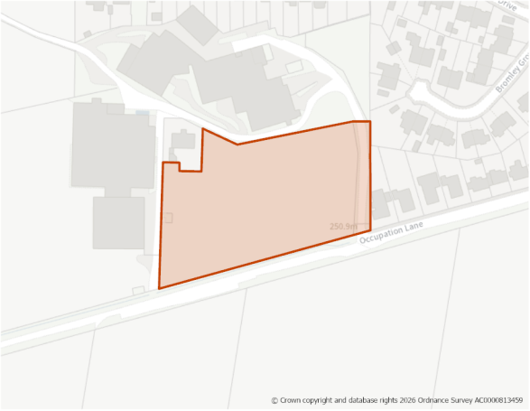
Site Size (ha) Gross: 0.86
Proposed Land Use: Housing
Minimum Development Capacity (Dwellings): 27
Site Type: Greenfield
Ward: Keighley West
Settlement: Keighley
Ownership: Private
Delivery Timescale: Long 2035+ (11+)
Site Specific Requirements:
Design Principles
- Development should provide at least 27 dwellings as part of a high-quality built environment in line with Policies ST4 and DS1, at a net density of 35 dph in line with Policy HO2. This should include affordable housing (in line with Policy HO4) and an appropriate mix of dwellings (in line with Policy HO3 and having due regard to relevant housing needs evidence and the character of the area).
- A sensitive design and layout will be required taking into consideration the site’s location on the edge of the settlement as well as its proximity to agricultural uses and the amenity of neighbourhing residential properties. This should include appropriate landscaping to soften the existing urban edge.
- Consideration should be given to developing the site in conjunction with site H569, located immediately to the north.
Site Access, Highways and Transport
- Access is via a farm track running from Occupation Lane (an unadopted highway), both will require upgrading to meet residential highway requirements. An alternative access point may be available from Steadings Way through site H569.
Flooding, Water and Drainage
- Site has a potential risk of surface water flooding affecting the north western section. A detailed drainage strategy will be required as part of any future planning application to ensure there is no increase elsewhere as result of new development. Consideration should be given to retaining surface water on-site, whilst the use of infiltration SuDS should be investigated
Natural and Historic Environment
- The site lies within the Special Protection Area / Special Area of Conservation (SPA/SAC) Zone C (Recreational Pressure) - Residential development resulting in a net increase in dwellings will be required to mitigate any recreational pressure on the SPA/SAC caused by such development in accordance with the South Pennine Moors SPD and Policy NE3.
Environmental Protection
- Site is immediately adjacent to a farm complex and is part of agricultural enterprise giving rise to a potential risk of land contamination. Land Contamination Assessment – Phase 1 Report will be required as part of any planning application. Impacts should be addressed in line with Policy CR2.
Open Space and Green / Blue Infrastructure
- Open space should be provided in line with Policy NE2, having regard to the standards set out In Appendix 11.
- Green and blue infrastructure should be provided in line with Policy NE1.
Landscape
- The site is located within the Keighley Moorland Fringe Landscape Character area/type (B1)
- Site has potential to impact on the landscape. The local topography should be used to integrate development into the landscape and soften the existing abrupt edges which form the urban edge of Keighley. Development should be avoided on the highest elevations, whilst drystone walls should be retained, where possible
Green Belt (and Golden Rules)
- Site has been removed from the Green Belt. Development on the site should be consistent with the “Golden Rules” set out in the NPPF in relation to affordable housing, necessary improvements to infrastructure and accessible green space provision.
Infrastructure Requirements
- Proportionate contributions to community infrastructure will be required, where appropriate, in line with Policies ID1 and ID2, and having regard to the Local Infrastructure Plan.
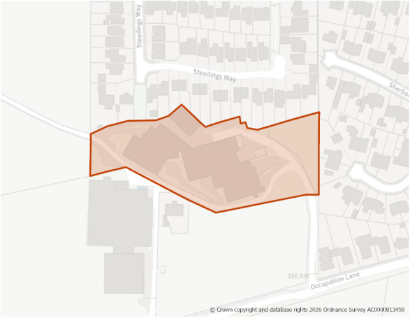
Site Size (ha) Gross: 0.94
Proposed Land Use: Housing
Minimum Development Capacity (Dwellings): 30
Site Type: Greenfield
Ward: Keighley West
Settlement: Keighley
Ownership: Private
Delivery Timescale: Medium 2030-2035 (6-10)
Site Specific Requirements:
Design Principles
- Development should provide at least 30 dwellings as part of a high-quality built environment in line with Policies ST4 and DS1, at a net density of 35 dph in line with Policy HO2. This should include affordable housing (in line with Policy HO4 and an appropriate mix of dwellings (in line with Policy HO3 and having due regard to relevant housing needs evidence and the character of the area).
- A sensitive design and layout will be required taking into consideration the site’s location on the edge of the settlement as well as its proximity to agricultural uses and the amenity of adjacent residential properties. This should include appropriate landscaping.
- Consideration should be given to developing the site in conjunction with site H568, located immediately to the south.
Site Access, Highways and Transport
- Access is via a farm track running from Occupation Lane (an unadopted highway), both will require upgrading to meet residential highway requirements. An alternative access point may be available from Steadings Way.
Flooding, Water and Drainage
- The site is located in Flood Zone 1, however a Flood Risk Assessment will be required to assess and investigate the potential presence of a culverted watercourse, and groundwater levels and conditions. Should a watercourse be present, the design and layout should ensure that no development takes place on top it nor within 8 metres either side.
- Site has a potential risk of surface water flooding affecting the centre and eastern sections. A detailed drainage strategy will be required as part of any future planning application to ensure there is no increase elsewhere as result of new development. Consideration should be given to retaining surface water on-site, whilst the use of infiltration SuDS should be investigated.
Natural and Historic Environment
- The site lies within the Special Protection Area / Special Area of Conservation (SPA/SAC) Zone C (Recreational Pressure) - Residential development resulting in a net increase in dwellings will be required to mitigate any recreational pressure on the SPA/SAC caused by such development in accordance with the South Pennine Moors SPD and Policy NE3.
Environmental Protection
- Site is occupied by a farm complex giving risk to a potential risk of land contamination. Land Contamination Assessment – Phase 1 Report will be required as part of any planning application. Impacts should be addressed in line with Policy CR2.
Open Space and Green / Blue Infrastructure
- Open space should be provided in line with Policy NE2, having regard to the standards set out In Appendix 11.
- Green and blue infrastructure should be provided in line with Policy NE1.
Landscape
- The site is located within the Keighley Moorland Fringe Landscape Character area/type (B1). No landscape sensitivity assessment was undertaken for this site. Consideration should be given to the guidance set out in the Landscape Character Assessment SPD.
Other Constraints
- This site is in use and fully developed with farm buildings which will require demolision and removal to allow for residential development to commence.
Infrastructure Requirements
- Proportionate contributions to community infrastructure will be required, where appropriate, in line with Policies ID1 and ID2, and having regard to the Local Infrastructure Plan.
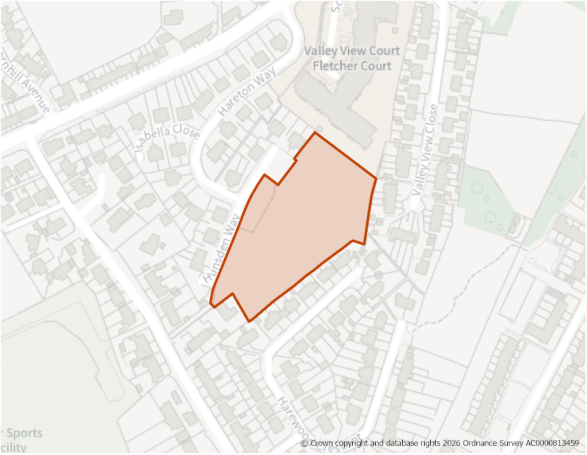
Site Size (ha) Gross: 1.00
Proposed Land Use: Housing
Minimum Development Capacity (Dwellings): 32
Site Type: Greenfield
Ward: Keighley West
Settlement: Keighley
Ownership: Public
Delivery Timescale: Medium 2030-2035 (6-10)
Site Specific Requirements:
Design Principles
- Development should provide at least 32 dwellings as part of a high-quality built environment in line with Policies ST4 and DS1, at a net density of 35 dph in line with Policy HO2. This should include affordable housing (in line with Policy HO4) and an appropriate mix of dwellings (in line with Policy HO3 and having due regard to relevant housing needs evidence and the character of the area).
- A sensitive design and layout will be required taking into consideration the site’s location within the settlement as well as the amenity of adjacent residential properties and nursing home. This should include appropriate landscaping and seeking to avoid areas that are at risk of surface water flooding.
Site Access, Highways and Transport
- A new site access will be required and should be taken from Hunsden Way/Earnshaw Way, where footways and streetlighting are present. Appropriate highway works will be required to achieve this access..
- Site is adjacent to a Public Right of Way, linking it to the surrounding area. Consideration should be given to providing a pedestrian and cycle link to it as part any future development layout. This should be well-designed and overlooked by surrounding dwellings.
Flooding, Water and Drainage
- The site is located within Flood Zone 1, and at low risk of fluvial flooding; however there is potential (low) risk of surface water flooding along the northern boundary. A Flood Risk Assessment should be providedd to show that any development can be designed to be safe include a drainage strategy which includes the flow path in site design and investigate ground conditions for infiltration SuDS suitability.
Natural and Historic Environment
- The site lies within the Special Protection Area / Special Area of Conservation (SPA/SAC) Zone C (Recreational Pressure) - Residential development resulting in a net increase in dwellings will be required to mitigate any recreational pressure on the SPA/SAC caused by such development in accordance with the South Pennine Moors SPD and Policy NE3.
- An area of TPO woodland is present along the western and southern boundaries of the site. The design and layout of any development should ensure these trees are preserved and enhanced in line with Policy NE6. An arboricultural assessment should be provided as part of any planning application.
Environmental Protection
- Part of northern corner of site lies within 250m buffer of former landfill. Any potential impacts should be addressed in line with Policy CR2.
Open Space and Green / Blue Infrastructure
- Open space should be provided in line with Policy NE2, having regard to the standards set out In Appendix 11.
- Site is partially within an area of low provision and high need for green and blue infrastructure. Development proposals should focus on carefully designed green and blue infrastructure to contribute towards site specific issues.
Landscape
- The site is located within the Central Airedale Settled Valley Floor Landscape Character area/type (G2). No landscape sensitivity assessment was undertaken for this site. Consideration should be given to the guidance set out in the Landscape Character Assessment SPD.
Infrastructure Requirements
- Proportionate contributions to community infrastructure will be required, where appropriate, in line with Policies ID1 and ID2, and having regard to the Local Infrastructure Plan.
H1354: Hollins Lane (south), Utley Comment
Site Boundary:
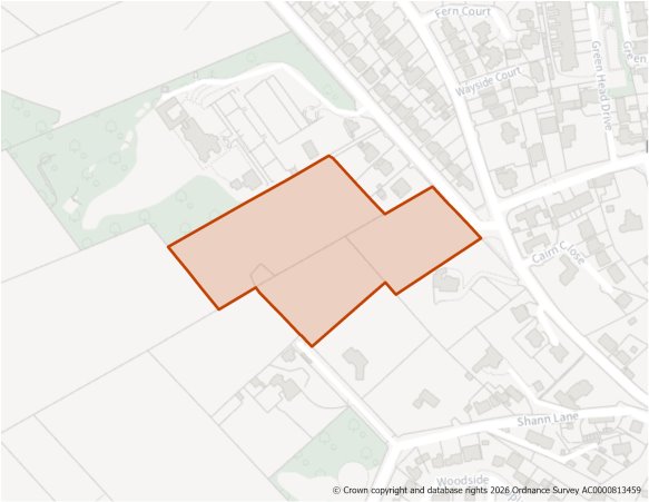
Site Size (ha) Gross: 2.04
Proposed Land Use: Housing
Minimum Development Capacity (Dwellings): 39
Site Type: Greenfield
Ward: Keighley Central
Settlement: Keighley
Ownership: Private
Delivery Timescale: Medium 2030-2035 (6-10)
Site Specific Requirements:
Design Principles
- Development should provide at least 39 dwellings as part of a high-quality built environment in line with Policies ST4 and DS1, at a net density of 35 dph in line with Policy HO2. This should include affordable housing (in line with Policy HO4) and an appropriate mix of dwellings (in line with Policy HO3 and having due regard to relevant housing needs evidence and the character of the area).
- A sensitive design and layout will be required taking into consideration the site’s location on the edge of the settlement and its steeply sloping topography as well as its proximity to the historic listed property - Whinburn Hall – and its gardens. This should include appropriate landscaping and seek to retain existing trees/woodland.
Site Access, Highways and Transport
- A new site access will be required. This should be taken from Hollins Lane, where footways and streetlighting are present. Appropriate highway works will be required to achieve this access.
- Consideration should be given to the impact on the junction (double mini roundabout) at Spring Gardens Lane/Green Head Lane.
Flooding, Water and Drainage
- The site is located with Flood Zone 1. There is a risk of surface water flooding in the northern of the southern section. A Flood Risk Assessment should be provided as part of any planning application and should include a drainage strategy which includes the ponded area in site design and investigate ground conditions for infiltration SuDS suitability.
Natural and Historic Environment
- The site is located adjacent to Whinburn and its gardens, a Grade II Listed Building and Registered Park/Garden. A Heritage Impact Assessment (HIA) has been carried out that considers the impact of development on the setting of the nearby listed structures and registered garden is likely to increase with the rising topography of the site and within close proximity to the southern boundary of the heritage assets.
- The HIA states that development is likley to only be acceptable on the provision of a significant landscaped buffer to protect the setting of Whinburn and the gardens and potentially development only on the lower sections of the site and the areas further away from the boundary of Whinburn, subject to further evaluation and potentially a landscape visual impact assessment.
- A more detailed HIA, for the specific proposed scheme will need to be carried out at the planning application stage working closely with the Council’s Heritage team, to develop appropriate mitigation measures to reduce the harm as much as is possible
- The site lies within the Special Protection Area / Special Area of Conservation (SPA/SAC) Zone C (Recreational Pressure) - Residential development resulting in a net increase in dwellings will be required to mitigate any recreational pressure on the SPA/SAC caused by such development in accordance with the South Pennine Moors SPD and Policy NE3.
- Part of the site is identified in the West Yorkshire Local Nature Recovery Strategy with the preferred measures T2_M04 - Significantly boost biodiversity wherever possible where there are existing habitats alongside transport infrastructure.
- The site contains areas of TPO woodland, as well as a number of mature trees, in the central section and along the eastern boundary. Other areas of TPO woodland and TPO trees are adjacent to the northern and southern boundaries. These should be retained and protected as part of the design and layout of any development in line with Policy NE6. An arboricultural assessment will be required as part any planning application.
Open Space and Green / Blue Infrastructure
- Open space should be provided in line with Policy NE2, having regard to the standards set out In Appendix 11.
- The site lies within the Keighley - Bingley - Shipley Opportunity Area, as identified in the Green and Blue Infrastructure Strategy (GBIS) and an area of low provision and high need for green and blue infrastructure. The strategy should be consulted to identify opportunities for incorporating measures within the development that enhance the quality of, and connectivity to, the green and blue infrastructure network in this area. Development proposals should focus on carefully designed green and blue infrastructure to contribute towards site specific issues.
Landscape
- The site is located within the Hollins Bank Steep Valley Sides Landscape Character area/type (D3).
- The orth eastern section of the site is assessed as having a moderate landscape sensitivity. To mitigate impacts it was suggested utilising tree planting to integrate development into the wider settlement. Where possible the existing drystone wall network should be retained and enhanced. If possible, a sight line should be maintained through the site towards the steeply rising slope to the west.
Infrastructure Requirements
- Proportionate contributions to community infrastructure will be required, where appropriate, in line with Policies ID1 and ID2, and having regard to the Local Infrastructure Plan.
E96: Allotment Gardens, Kensington Street Comment
Site Boundary:
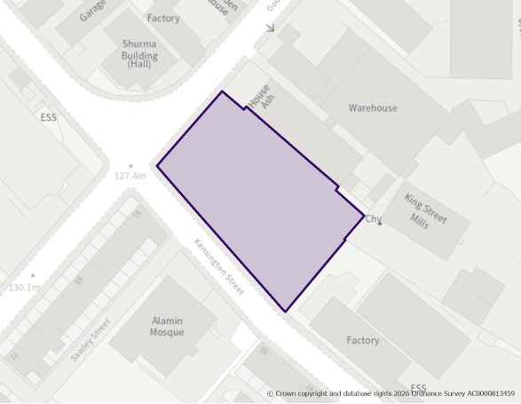
Site Size (ha) Gross: 0.20
Net Developable Area (ha): 0.20
Proposed Land Use: Employment (Eg(iii))
Site Type: Greenfield
Ward: Keighley Central
Settlement: Keighley
Ownership: Private
Delivery Timescale: 2030-2035
Site Specific Requirements:
Site Access, Highways and Transport
- A new access to Kensington Street is required.
Natural and Historic Environment
- The site lies within the Special Protection Area /Special Area of Conservation Zone C (Recreational Pressure) - Residential development resulting in a net increase in dwellings will be required to mitigate any recreational pressure on the SPA/SAC caused by such development in accordance with the South Pennine Moors SPD and Policy NE3.
- Site is within bat alert area. An ecology survey may be required at the planning application stage. Early engagement with the Council's Biodiversity Officer is recommended.
Environmental Protection
- The site was historically used as a timber works, giving rise for potential land contamination. A Land Contamination Assessment – Phase 1 Report will be required as part of any planning application. Impacts should be addressed in line with Policy CR2.
Open Space and Green / Blue Infrastructure
- The site lies within the KeighleyOpportunity Area, as identified in the Green and Blue Infrastructure Strategy (GBIS). The strategy should be consulted to identify opportunities for incorporating measures within the development that enhance the quality of, and connectivity to, the green and blue infrastructure network in this area.
- Site is partially within an area of high provision and high need for green and blue infrastructure. Development proposals should focus on carefully designed green and blue infrastructure to contribute towards site specific issues e.g. flood mitigation, urban cooling etc.
- Where appropriate, the site should seek to provide on-site open space in line with Policy NE2.
Landscape
- The site is located within the Central Airedale Settled Valley Floor Landscape Character area/type (G2). No landscape sensitivity assessment was undertaken for this site. Consideration should be given to the guidance set out in the Landscape Character Assessment SPD.
Infrastructure Requirements
- Proportionate contributions to community infrastructure will be required, where appropriate, in line with Policies ID1 and ID2, and having regard to the Local Infrastructure Plan.
E118: Beechcliffe Comment
Site Boundary:
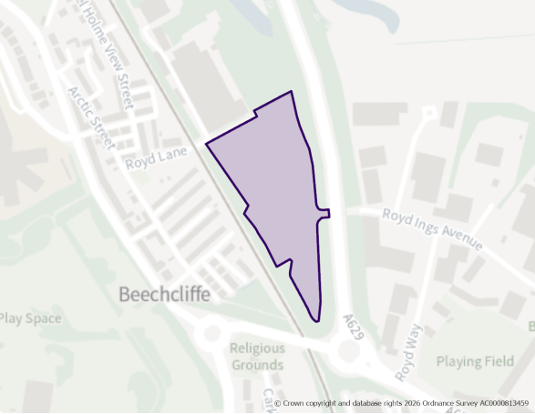
Site Size (ha) Gross: 3.30
Net Developable Area (ha): 1.65
Proposed Land Use: Employment (Eg(i), B2 and B8)
Site Type: Greenfield
Ward: Keighley Central
Settlement: Keighley
Ownership: Private
Delivery Timescale: 2030-2035
Site Specific Requirements:
Site Access, Highways and Transport
- An access connecting to Royd Ings Avenue will be required.
- Public Right of Way (PROW) Keighley 703 crosses the site.
Flooding, Water and Drainage
- It should be possible to develop this site for less vulnerable uses.
- Ideally, less vulnerable development would be directed to the area of the site within Flood Zone 1. Were development to proceed within Flood Zone 2, the site-specific Flood Risk Assessment (FRA) must show that appropriate evacuation procedures and flood response infrastructure are in place to manage the fluvial risk associated with the extreme flood event.
- The site is modelled to flood to significant depths and hazards during the medium risk plus climate change event. Topographic depressions and flow routes should be considered and included in site design and ideally left in place to flood naturally when required. Any regrading of land must include like for like volumes to ensure risk is contained safely onsite for the lifetime of development.
- Any FRA should further consider groundwater conditions within the south of the site and include for a detailed drainage strategy.
- Any FRA should consider whether there are any offsite works that could prevent flooding from the River Aire backing up into the site.
- Any FRA should be carried out in line with the latest versions of the NPPF; FRCC-PPG; EA guidance; the CBMDC Local Plan and national and local SuDS policy and guidelines.
- Throughout the FRA process, consultation should be carried out with the following, where applicable, the local planning authority; the lead local flood authority; emergency planning officers; the Environment Agency; Yorkshire Water; the highways authorities; and the emergency services.
Natural and Historic Environment
- The site lies within Zone B (Supporting Habitat/Functionally Linked Land) - Development proposals must assess potential impacts on foraging habitat used by Special Protection Area (SPA) qualifying species and provide ecological evidence where required, in accordance with the South Pennine Moors SPD and Policy NE3.
- Site contains Local Wildlife Site, is partially covered by a priority habitat (deciduous woodland), partially within an identified Wildlife Habitat Network (Grassland and Wetland) and within a bat alert area. An ecology survey may be required at the planning application stage. Early engagement with the Council's Biodiversity Officer is recommended.
- The site is identified in the LNRS with the preferred measure B4_M02: Significantly boost biodiversity wherever possible where there are existing habitats alongside transport infrastructure.
- The site is adjacent to a Historic Park & Garden (Utley Cemetery).
Environmental Protection
- Site is in a former landfill, which may pose contamination issues.
- The site was historically used as a textile mill & Metal works, giving rise for potential land contamination. A Land Contamination Assessment – Phase 1 Report will be required as part of any planning application. Impacts should be addressed in line with Policy CR2.
- Site is partially within a Mineral Safeguarding Area (MSA) for sand and gravel. A mineral resource assessment will be required as part of any planning application to determine the extent and availability of any sand and gravel resource.
Open Space and Green / Blue Infrastructure
- The site lies within the Keighley- Bingley – Shipley CorridorOpportunity Area, as identified in the Green and Blue Infrastructure Strategy (GBIS). The strategy should be consulted to identify opportunities for incorporating measures within the development that enhance the quality of, and connectivity to, the green and blue infrastructure network in this area.
- Site is partially within an area of medium provision and high need for green and blue infrastructure. Development proposals should focus on carefully designed green and blue infrastructure to contribute towards site specific issues e.g. flood mitigation, urban cooling etc.
- Where appropriate, the site should seek to provide on-site open space in line with Policy NE2.
Landscape
- The site is located within the Central Airedale Settled Valley Floor Landscape Character area/type (G2).
- The key sensitivities of this site are the wetland and woodland areas, particularly the area designated as a Local Wildlife Site, and effects on the biodiversity of these areas should be carefully considered and avoided.
- Any development should be sited on the more open fields to the north of the site, and the risk of flooding should be assessed and mitigated. Recreational access through the site should be maintained and enhanced.
- Development would consist of medium-sized commercial/industrial units – similar to the adjacent existing manufacturing unit and commercial development along Royd Ings Avenue. Due to the enclosed nature of the site, its location within a busy transport corridor and the proximity of similar structures, this scale of development is considered appropriate. Care should be taken to ensure new development is both of a similar scale to the existing development and is perceived as such from the surrounding area.
Infrastructure Requirements
- Proportionate contributions to community infrastructure will be required, where appropriate, in line with Policies ID1 and ID2, and having regard to the Local Infrastructure Plan.
E119: Bradford Road Comment
Site Boundary:
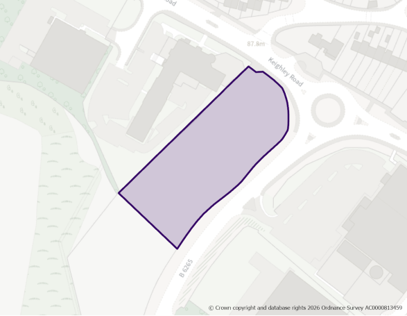
Site Size (ha) Gross: 0.80
Net Developable Area (ha): 0.80
Proposed Land Use: Employment (Eg(i), B2 and B8)
Site Type: Greenfield
Ward: Keighley East
Settlement: Keighley
Ownership: Private
Delivery Timescale: 2030-2035
Site Specific Requirements:
Site Access, Highways and Transport
- Site could be accessed from Bradford Road and the B6265, but a suitable access location requires further investigation.
Flooding, Water and Drainage
- The site technically lies within Flood Zone1 but immediately borders functional floodplain - More detailed flood risk assessments would likely be required for the site, and careful consideration given to the layout of the development.
Natural and Historic Environment
- The site lies within the Special Protection Area / Special Area of Conservation (SPA/SAC) Zone B (Supporting Habitat/Functionally Linked Land) - Development proposals must assess potential impacts on foraging habitat used by SPA qualifying species and provide ecological evidence where required, in accordance with the South Pennine Moors SPD and Policy NE3.
- Site is adjacent to an identified Wildlife Habitat Network (Wetland) and partially within a bat alert area. An ecology survey may be required at the planning application stage. Early engagement with the Council's Biodiversity Officer is recommended.
- The site is identified in the LNRS with the preferred measureT2_M04: Extend and connect tree and woodland cover across the White Rose Forest area in West Yorkshire.
Environmental Protection
- Site is in a former landfill, which may pose contamination issues.
- Site is adjacent to a high-pressure gas pipeline (owned/operated by National Gas or Northern Gas Networks). Design and layout of any development should ensure that appropriate clearances are taken into consideration. Consultation should take place with the Health and Safety Executive, National Gas and Northern Gas Networks, as appropriate.
Open Space and Green / Blue Infrastructure
- The site lies within the Keighley- Bingley – Shipley CorridorOpportunity Area, as identified in the Green and Blue Infrastructure Strategy (GBIS). The strategy should be consulted to identify opportunities for incorporating measures within the development that enhance the quality of, and connectivity to, the green and blue infrastructure network in this area.
- Site is within an area of low provision and medium need for green and blue infrastructure. Development proposals should focus on carefully designed green and blue infrastructure to contribute towards site specific issues e.g. flood mitigation, urban cooling etc.
- Where appropriate, the site should seek to provide on-site open space in line with Policy NE2.
Landscape
- The site is located within the Central Airedale Settled Valley Floor Landscape Character area/type (G2). No landscape sensitivity assessment was undertaken for this site. Consideration should be given to the guidance set out in the Landscape Character Assessment SPD.
Infrastructure Requirements
- Proportionate contributions to community infrastructure will be required, where appropriate, in line with Policies ID1 and ID2, and having regard to the Local Infrastructure Plan.
POLICY SI1 – SILSDEN Comment
Settlement Plan
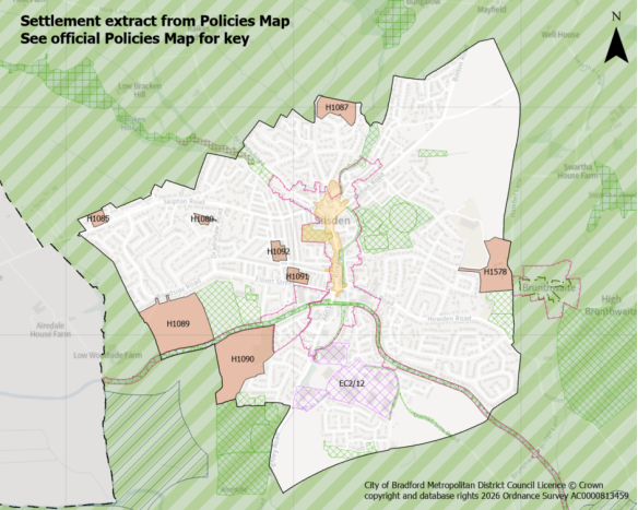
Settlement Hierarchy and Spatial Directions
- The town boundary is defined on the Policies Map and consists of the existing Silsden built up area located to the north of River Aire and its floodplain, straddling the Leeds Liverpool Canal and rising northwards towards the slopes of the rolling enclosed pasture surrounding the settlement to the north, east and west.
- The focus for sustainable development of this small town reflects its function including the level services and facilities it provides. This is balanced against the importance of its historic centre and the Leeds Liverpool Canal corridor with its designated heritage assets and wider environmental and physical constraints.
- Development proposals should have regard to, and be consistent with, the made (adopted) Steeton with Eastburn and Silsden Neighbourhood Development Plan.
Meeting Growth Needs
- Housing development is concentrated within the settlement boundary. No Green Belt release is proposed. It will:
- Deliver approximately 651 dwellings through a combination of sites under construction, planning permissions and new site allocations through the plan period as set out in table SI1.1.
- Deliver the following housing site allocations as shown on the Policies Map and section 5:
- H1080: Dradishaw Road
- H1085: Stone Lodge, 134 Skipton Road
- H1087: North Dene Road
- H1089: Woodside Road
- H1090: Sykes Lane
- H1091: Aire View Infants School, Elliot Street
- H1092: Hothfield Junior School, Norton Street
- H1578: Hawber Lane
Table SI1.1:
|
Under Construction |
Planning Permission |
Site Allocations |
|
|
Totals |
36 |
144 |
471 |
- Proposals for new homes within the settlement boundary on additional small sites, including the redevelopment of previously developed land, will be supported subject to meeting relevant Local Plan and made (adopted) Neighbourhood Development Plan policies.
- Employment uses should continue to be concentrated in the Keighley Road Employment Zone (identified under Policy EC2/12) and areas safeguarded under Policy SWES8 of the made (adopted) Neighbourhood Development Plan.
Local Services and Facilities
- Support the range and quality of uses within the designated Silsden District Centre as a key hub for the town and surrounding communities to meet their day-to-day retail and leisure needs as well as the retention and improvement of local services and facilities.
- Protect and enhance designated Local Green Spaces, identified in Policy SWES10 of the made (adopted) Neighbourhood Development Plan, and open spaces in compliance with Policy NE2. Proposals that address deficiencies in open space provision identified in the Open Space Study, will be supported.
- Maintain and enhance sporting and recreation facilities, including those identified in Policy SWES11 of the made (adopted) Neighbourhood Development, whilst widened community access will be supported.
Landscape
- Maintain and enhance Silsden’s landscape setting reflecting its mix of landscape types and character areas (the settled valley floor of the River Aire Valley and the Silsden Bowl rolling enclosed pasture), landscape features, fields and overall settlement pattern. Regard should be had to the Landscape Character Assessment Supplementary Planning Document.
- Protect and enhance important views identified in Policy SWES5 of the made (adopted) Neighbourhood Development Plan.
Historic and Natural Environment
- Protect and enhance green and blue networks and corridors including the River Aire, Leeds Liverpool Canal Corridor, Silsden Beck, Brackenhill Ghyll and settlement fringe to enhance biodiversity and recreation as well as incorporating sufficient green space and connections within new developments.
- Consideration should be given to the Green and Blue Infrastructure Strategy and the opportunities identified for enhancement within the Keighley – Shipley – Bingley Corridor.
- Protect and enhance designated Local Wildlife Sites (Brackenhill Ghyll, Hainsworth Hedges, Leeds Liverpool Canal, Silsden Reservoir Woodland, Swartha Wood) and Local Geological Site (Throstle Nest) as well as habitat networks and priority habitats within and adjacent to the settlement.
- The eastern section of the settlement is located within SPA/SAC Zone B (2.5km) (supporting habitat functionally linked land, recreational pressure), whilst the western section is within SPA/SAC Zone C (7km) (recreational pressure). Development proposals must assess potential impacts on foraging habitat used by SPA qualifying species and provide ecological evidence where required, as well as mitigate any recreational pressure on the SPA/SAC caused by such development in accordance with the South Pennine Moors SPD and Policy NE3.
- Ensure that future development conserves and enhances key heritage assets and their settings within and adjacent to the settlement including the Brunthwaite, Leeds Liverpool Canal and Silsden Conservation Areas and Listed Buildings as well as non-designated heritage assets identified in Policy SWES4 of the made (adopted) Neighbourhood Development Plan.
Local Infrastructure
- Support sustainable transport measures that reduce barriers to connections between Silsden and Steeton with Eastburn and improve access to the railway station.
- Proportionate contributions to new or enhanced community infrastructure will be required, where appropriate, in line with Policies ID1 and ID2, and Policy SWES7 of the made (adopted) Neighbourhood Development Plan as well as having regard to the Local Infrastructure Plan.
Silsden: Site Allocations
H1080: Dradishaw Road, Silsden Comment
Site Boundary:
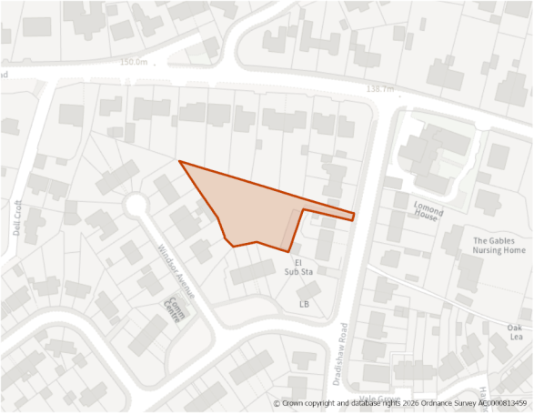
Site Size (ha) Gross: 0.21
Proposed Land Use: Housing
Minimum Development Capacity (Dwellings): 7
Site Type: PDL
Ward: Airedale
Settlement: Silsden
Ownership: Other
Delivery Timescale: Long 2035+ (11+)
Site Specific Requirements:
Design Principles
- Development should provide at least 7 dwellings as part of a high quality built environment in line with Policies ST4 and DS1, at a net density of 35 dph. This should include an appropriate mix of dwellings (in line with Policy HO3 and having due regard to relevant housing needs evidence and the character of the area).
- Sensitive site design and layout should be in keeping with the character of the surrounding area and take account of the adjacent protected trees.
- Design and layout should also reflect relevant policies within the “made” Steeton with Eastburn and Silsden Neighbourhood Development Plan.
Site Access, Highways and Transport
- Site access is available via an existing driveway from Dradishaw Road. This should be brought up to an appropriate standard.
Natural and Historic Environment
- The site lies within SPA/SAC Zone C (Recreational Pressure) - residential development resulting in a net increase in dwellings will be required to mitigate any recreational pressue on the SPA/SAC caused by such development in accordance with the South Pennine Moores SPD and Policy NE3.
- The site’s southern boundary adjoins an area of mature trees which are protected by a Tree Preservation Order. The design and layout of any development should ensure these trees are preserved and enhanced in line with Policy NE6. An arboricutural assessment should be provided as part of any planning application.
Landscape
- The site is located within the Silsden Bowl Rolling Enclosed Pasture Landscape Character area/type (F1). No landscape sensitivity assessment was undertaken for this site. Consideration should be given to the guidance set out in the Landscape Character Assessment SPD.
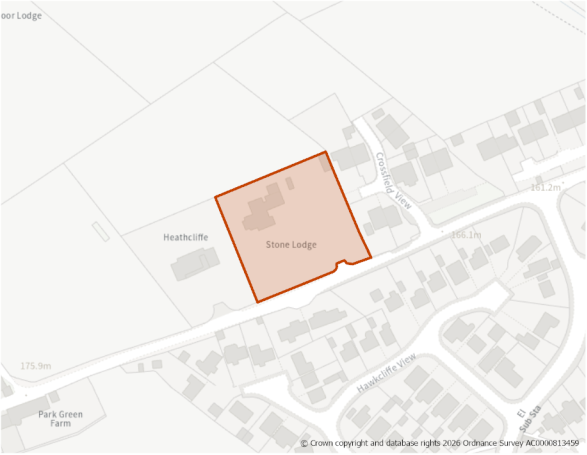
Site Size (ha) Gross: 0.38
Proposed Land Use: Housing
Minimum Development Capacity (Dwellings): 6
Site Type: PDL
Ward: Airedale
Settlement: Silsden
Ownership: Private
Delivery Timescale: Short 2025- 2030 (1-5)
Site Specific Requirements:
Planning Permission
- Site benefits from outline planning permission for residential development (22/00233/OUT) granted in August 2022 and a Reserved Matters for 7 dwellings pursant to the previous outline permission (25/02247/REM) granted in February 2026. The latter was granted after 1 April 2025 (the base date for the Local Plan). Accordingly, it has been identified as a site allocation.
- Development of this site should take place in line with the Reserved Matters. Should this permission not be implemented within the required timescales and/or a further application come forward on the site, it will be determined against the policies set out in this Plan.
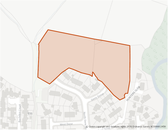
Site Size (ha) Gross: 1.35
Proposed Land Use: Housing
Minimum Development Capacity (Dwellings): 43
Site Type: Greenfield
Ward: Airedale
Settlement: Silsden
Ownership: Public
Delivery Timescale: Long 2035+ (11+)
Site Specific Requirements:
Design Principles
- Development should provide at least 43 dwellings as part of a high quality built environment in line with Policies ST4 and DS1, at a net density of 35 dph. This should include affordable housing (in line with Policy HO4 and an appropriate mix of dwellings (in line with Policy HO3 and having due regard to relevant housing needs evidence and the character of the area).
- A sensitive design and layout will be required taking into consideration the site’s location on the edge of the settlement, landscape impact and its sloping topography as well as the presence of protected trees and existing hedgerows.
- It should also be in line with design and other relevant policies within the “made” Steeton with Eastburn and Silsden Neighbourhood Development Plan.
Site Access, Highways and Transport
- A new site access is required and should be taken from North Dene Road. This road should be upgraded to an adoptable standard.
- Consideration should be given to the impact on the junction between Eliott Street, Kirkgate, Clog Bridge and Keighley Road.
Flooding, Water and Drainage
- Areas at risk of fluvial and surface water flooding are identified within and adjacent to the western boundary of the site. A detailed flood risk assessment will be required as part of any planning application. This will be expected to assess the extent and impacts of fluvial and surface water flooding, and identify appropriate mitigation measures. It should show development can be designed to be safe and that there is adequate emergency planning provision.
- The Flood Risk Assessment should also include a drainage strategy. It should include the flow path in site design and investigate ground conditions for inflitration SuDS suitability.
Natural and Historic Environment
- The site lies within Zone B (Supporting Habitat/Functionally Linked Land; recreational pressure). Development proposals must assess potential impacts on foraging habitat used by SPA qualifying species and provide ecological evidence where required, as well as mitigate any recreational pressue on the SPA/SAC, in accordance with the South Pennine Moors SPD and Policy NE3.
- The site is located within a bat alert area. An ecological survey will be required as part of any planning application to establish the extent/impacts as well as to identify appropriate mitigation.
- The site’s eastern boundary adjoins an area of mature trees which are protected by a Tree Preservation Order. The design and layout of any development should ensure these trees are preserved and enhanced in line with Policy NE6. An arboricutural assessment should be provided as part of any planning application.
- The site contains and is adjacent to hedgerows and trees. The design and layout of any development should, where possible, seek to retain these features.
Environmental Protection
- The site’s northern section is crossed by an electricity transmission line running from east to west. Development should include a strategy for responding to the Northern Powergrid equipment present within the site which demonstrates how the Northern Powergrid and HSE Guidance have been applied as part of the design and layout and how the impact of the assets has been reduced through good design. Enquiries should be made with Northern Powergrid.
Open Space and Green / Blue Infrastructure
- Open space should be provided in line with Policy NE2, having regard to the standards set out Appendix 11.
Landscape
- The site is located within the Silsden Bowl Rolling Enclosed Pasture Landscape Character area/type (F1).
- The site would have a moderate landscape sensitivity. Development should be located along the southern edge of the site, away from the more elevated and visually prominent extents to the north. Hedgerows and boundary trees should be maintained and strengthened to help integrate new development into the landscape.
Infrastructure Requirements
- Proportionate contributions to community infrastructure will be required, where appropriate, in line with Policies ID1 and ID2, and having regard to the Local Infrastructure Plan.
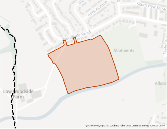
Site Size (ha) Gross: 5.55
Proposed Land Use: Housing
Minimum Development Capacity (Dwellings): 146
Site Type: Greenfield
Ward: Airedale
Settlement: Silsden
Ownership: Private
Delivery Timescale: Long 2035+ (11+)
Site Specific Requirements:
Design Principles
- Development should provide at least 146 dwellings as part of a high quality built environment in line with Policies ST4 and DS1, at a net density of 35 dph. This should include affordable housing (in line with Policy HO4) and an appropriate mix of dwellings (in line with Policy HO3 and having due regard to relevant housing needs evidence and the character of the area).
- A sensitive design and layout will be required, giving appropriate consideration to the sloping topography, building heights and appropriate screening to reflect the site’s location on the western edge of the settlement as well as to mitigate any impacts on the wider landscape and the Leeds and Liverpool Canal Conservation Area and Local Wildlife Site. Existing features such as trees, hedgerows and field boundaries should be retained. Dwellings should not exceed two storeys in height.
- It should also be in line with design and other relevant policies within the “made” Steeton with Eastburn and Silsden Neighbourhood Development Plan.
Site Access, Highways and Transport
- Site access is available from Woodside Road, where there are footways and streetlighting available.
- Consideration should be given to the impact on the junction between Eliott Street, Kirkgate, Clog Bridge and Keighley Road.
- A Public Right of Way (PRoW) runs along part of the northern boundary of the site. The design and layout of any development should protect it and consider linkages to the wider network.
- A farm access runs through the north west corner of the site. The design and layout of any development should ensure this is maintained to allow continued operation of the existing farm business.
Flooding, Water and Drainage
- Parts of the site’s southern boundary (adjoining the Canal) are located within Flood Zones 2 and 3. The layout and design of any proposed development should direct it away from areas at a higher risk of flooding in accordance with Policy CR4.
Natural and Historic Environment
- The site lies within SPA/SAC Zone C (Recreational Pressure) - Residential development resulting in a net increase in dwellings will be required to mitigate any recreational pressue on the SPA/SAC caused by such development in accordance with the South Pennine Moores SPD and Policy NE3.
- The site is immediately adajcent to the Leeds and Liverpool Canal Local Wildlife Site. The layout and design of any development include an appropriate buffer area along its southern boundary. An ecological survey will be required as part of any planning application to establish the extent/impacts as well as to identify appropriate mitigation.
- The site is located adjacent to two elements of the identified wildlife habitat network and within a bat alert area. An ecological survey will be required as part of any planning application to establish the extent/impacts as well as to identify appropriate mitigation.
- The site contains several trees and areas of woodland benefitting from Tree Preservation Orders as well as hedgerows that form part of historic field boundaries. Such features should be retained and protected as part of the design and layout of any development. An arboricultural assessment will be required as part any planning application.
- The site is identified in the West Yorkshire Local Nature Recovery Strategy with the preferred measure T2_M05: Help more red squirrels to move back into West Yorkshire: buffer, connect, improve and safeguard existing woodland and create new woodland in areas where red squirrels are expanding (or could do so).
- The site is located immediately adjacent to the Leeds and Liverpool Canal Conservation Area. A Heritage Impact Assessment (HIA) has been carried out for this site and indicates that its development would result in harm of an unacceptable level as there is limited opportunity to effectively mitigate the resulting impact of development on the designated heritage asset.
- However, the wider public and sustainability benefits provided by the sensitive development of the site are such that its allocation in the plan is considered a necessary part of the development strategy for the settlement. A more detailed HIA, for the specific proposed scheme will need to be carried out at the planning application stage working closely with the Council’s Heritage team, to develop appropriate mitigation measures to reduce the harm as much as is possible.
Environmental Protection
- The site is partly within the 150m and 250m buffers of former landfill site. A Land Contamination Assessment – Phase 1 Report will required as part of any planning application to identify any potential risk and appropriate mitigation measures.
- The site is immediately adjacent to the Leed and Liverpool Canal. It will be need to be demonstrated that any development will not impose adverse loading that could adversely impact land stability towards the canal. Engagement should take place with the Canal and River Trust.
- The north eastern and eastern sections of the site are crossed by an electricity transmission line running from north to south. Development should include a strategy for responding to the Northern Powergrid equipment present within the site which demonstrates how the Northern Powergrid and HSE Guidance have been applied as part of the design and layout and how the impact of the assets has been reduced through good design. Enquiries should be made with Northern Powergrid.
Open Space and Green / Blue Infrastructure
- Open space should be provided in line with Policy NE2, having regard to the standards set out Appendix 11.
Landscape
- The site is located within the Silsden Bowl Rolling Enclosed Pasture Landscape Character area/type (F1).
- The site is assessed as having a moderate landscape sensitivity. To mitigate impacts is recommended that development should be located in proximity to the existing settlement edge, as to reduce the perception of settlement creep further south into the floodplain. Consideration should be given to the setting of the historic Leeds and Liverpool Canal and provide an appropriate buffer and screening between any new development and the canal edge. Existing modern development on the canal edge have been constructed using building materials and styles that are sensitive to the historic context of the canal and this should also be applied at this site.
- Opportunities to soften the existing settlement edge, integrating development into the wider landscape with new planting should be taken. Hedgerows and boundary trees should be maintained and strengthened to help integrate new development into the landscape.
Infrastructure Requirements
- Proportionate contributions to community infrastructure will be required, where appropriate, in line with Policies ID1 and ID2, and having regard to the Local Infrastructure Plan.
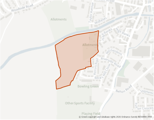
Site Size (ha) Gross: 5.59
Proposed Land Use: Housing
Minimum Development Capacity (Dwellings): 149
Site Type: Greenfield
Ward: Airedale
Settlement: Silsden
Ownership: Other
Delivery Timescale: Medium 2030-2035 (6-10)
Site Specific Requirements:
Design Principles
- Development should provide at least 149 dwellings as part of a high-quality built environment in line with Policies ST4 and DS1, at a net density of 35 dph. This should include affordable housing (in line with Policy HO4) and an appropriate mix of dwellings (in line with Policy HO3 and having due regard to relevant housing needs evidence and the character of the area).
- A sensitive design and layout will be required, giving appropriate consideration to the site's location on the south western edge of the settlement
- It should also be in line with design policies within the “made” Steeton with Eastburn and Silsden Neighbourhood Development Plan.
Site Access, Highways and Transport
- A new site access is required and should be taken from Riverside Road, which leads from A6034 Keighley Road.
- Sykes Lane is an important right of way and is identified in Policy SWES6 of the “made” (adopted) Neighbourhood Development Plan as an important route to be protected for its relative tranquility, green infrastructure and hedgerows. The design and layout of any development should maintain its rural nature.
Flooding, Water and Drainage
- The south western section of site is identified as being a risk of fluvial flooding (within Flood Zone 2). Development should be directed away from this area.
- A detailed Flood Risk Assessment should be provided having regard to the recommendations of the Level 2 Strategic Flood Risk Assessment relating to surface water flooding, drainage, proximity to the Leeds Liverpool Canal, reservoir flooding, groundwater levels/conditions and consideration of access and escape routes.
Natural and Historic Environment
- The site lies within SPA/SAC Zone C (Recreational Pressure) - residential development resulting in a net increase in dwellings will be required to mitigate any recreational pressure on the SPA/SAC caused by such development in accordance with the South Pennine Moors SPD and Policy NE3.
- The site is identified in the West Yorkshire Local Nature Recovery Strategy with the preferred measure W4_M01: Create new permanent and ephemeral wetlands to restore natural water cycle processes by providing flood and drought resilience.
- The site is immediately adajcent to the Leeds Liverpool Canal Local Wildlife Site. The layout and design of any development should include an appropriate buffer area along its northern boundary. An ecological survey will be required as part of any planning application to establish the extent/impacts as well as to identify appropriate mitigation.
- The site is located adjacent to an identified wildlife habitat network and within a bat alert area. An ecological survey will be required as part of any planning application to establish the extent/impacts as well as to identify appropriate mitigation.
- The site contains a number of mature trees and hedgerows, forming part of longstanding field boundaries. Such features should be retained and protected as part of the design and layout of any development. An arboricultural assessment will be required as part any planning application.
- The site is located adjacent to the Leeds and Liverpool Canal Conservation Area. A Heritage Impact Assessment (HIA) has been carried out for this site and indicates that its development of the majority of the site would result in harm of an unacceptable level as there is limited opportunity to effectively mitigate the resulting impact of development on the designated heritage asset.
- However, the wider public and sustainability benefits provided by the sensitive development of the site are such that its allocation in the plan is considered a necessary part of the development strategy for the settlement. A more detailed HIA, for the specific proposed scheme will need to be carried out at the planning application stage working closely with the Council’s Heritage team, to develop appropriate mitigation measures to reduce the harm as much as is possible
- The site is adjacent to Sykes Lane, identified in the made (adopted) Neighbourhood Development Plan as a non-designated heritage asset. Any development should seek to conserve and enhance this asset in line with Policy HE1 and Neighbourhood Development Plan Policy SWES4.
Environmental Protection
- The site is immediately adjacent to the Leeds Liverpool Canal. Changes in levels may have the potential to impact on the stability of the canal embankment. Development will need to demonstrate that it will not adversely impact the embankment supporting the canal, above the site. Engagement should take place with the Canal and River Trust.
- Site partially located within a Mineral Safeguarding Area for sand and gravel. A mineral resource assessment will be required as part of any planning application to determine the extent and availability of any sand and gravel resource, in line with Policy MIN3.
Open Space and Green / Blue Infrastructure
- Open space should be provided in line with Policy NE2, having regard to the standards set out Appendix 11.
Landscape:
- The site is located within the Upper Airedale Settled Valley Floor Landscape Character area/type (G1). No landscape sensitivity assessment was undertaken for this site. Consideration should be given to the guidance set out in the Landscape Character Assessment SPD.
Infrastructure Requirements
- Proportionate contributions to community infrastructure will be required, where appropriate, in line with Policies ID1 and ID2, and having regard to the Local Infrastructure Plan.
Planning Permission
- A detailed planning application is currently pending on this site for 149 dwellings which may be determined before the Local Plan is adopted.
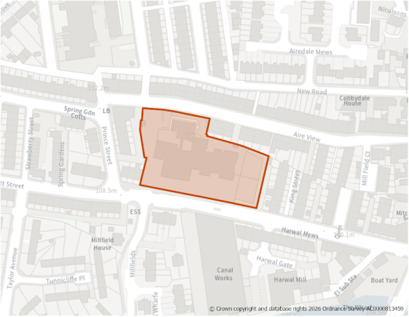
Site Size (ha) Gross: 0.49
Proposed Land Use: Housing
Minimum Development Capacity (Dwellings): 23
Site Type: PDL
Ward: Airedale
Settlement: Silsden
Ownership: Public
Delivery Timescale: Short 2025-2030 (1-5)
Site Specific Requirements:
Design Principles
- Development should provide at least 23 dwellings as part of a high quality built environment in line with Policies ST4 and DS1, at a net density of 50 dph. This should include affordable housing (in line with Policy HO4) and an appropriate mix of dwellings (in line with Policy HO3 and having due regard to relevant housing needs evidence and the character of the area).
- A sensitive design and layout will be required taking into consideration the site’s location within the settlement and its proximity to the Leeds Liverpool Canal Conservation Area.
- Design and layout should also reflect relevant policies within the “made” Steeton with Eastburn and Silsden Neighbourhood Development Plan .
Site Access, Highways and Transport
- A new site access is required and should be taken from Elliot Street and/or Aire View.
- Consideration should be given to the impact on the junction between Eliott Street, Kirkgate, Clog Bridge and Keighley Road.
Flooding, Water and Drainage
- The site has a low risk of flooding; however, a Flood Risk Assessment should be provided and contain a drainage strategy that includes an investigation into ground conditions for infiltration SuDS suitability. It should also show that the development can be designed to be safe and that there is adequate emergency planning provision.
Natural and Historic Environment
- The site lies within SPA/SAC Zone C (Recreational Pressure) - Residential development resulting in a net increase in dwellings will be required to mitigate any recreational pressure on the SPA/SAC caused by such development in accordance with the South Pennine Moors SPD and Policy NE3.
- The site is located within a bat alert area. An ecological survey will be required as part of any planning application to establish the extent/impacts as well as to identify appropriate mitigation.
- The site is identified in the West Yorkshire Local Nature Recovery Strategy with the preferred measure B3_M01: Encourage temporary (so-called ‘meanwhile-use’, in planning terms) nature-rich uses on undeveloped smaller non-phased brownfield sites (of more than 0.25 hectares) or on land being used for larger phased developments (more than five hectares).
Environmental Protection
- Potential for contamination to present due to nearby historic land uses and site’s previous use as a school. A Phase 1 Geo-Environmental Assessment should be provided to determine any potential contamination, with a Phase 2 site investigation being undertaken, if appropriate.
Open Space and Green / Blue Infrastructure
- Open space should be provided in line with Policy NE2, having regard to the standards set out Appendix 11.
Landscape:
- The site is located within the Silsden Bowl Rolling Enclosed Pasture Landscape Character area/type (F1). No landscape sensitivity assessment was undertaken for this site. Consideration should be given to the guidance set out in the Landscape Character Assessment SPD.
Infrastructure Requirements
- Proportionate contributions to community infrastructure will be required, where appropriate, in line with Policies ID1 and ID2, and having regard to the Local Infrastructure Plan.
Planning Permission
- An outline planning application is currently pending on this site for 22 dwellings which may be determined before the Local Plan is adopted.
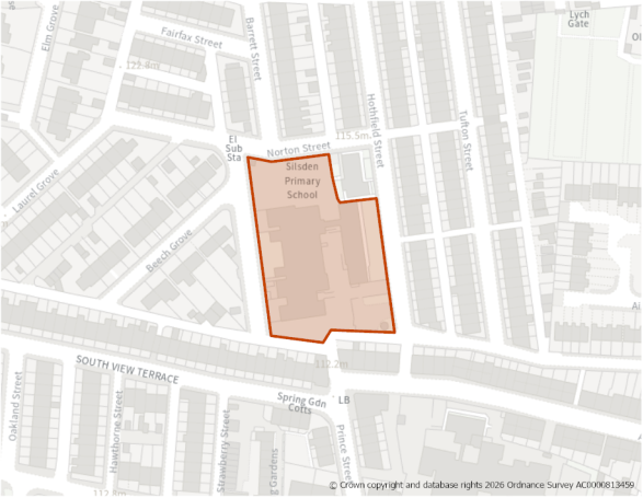
Site Size (ha) Gross: 0.47
Proposed Land Use: Housing
Minimum Development Capacity (Dwellings): 25
Site Type: PDL
Ward: Airedale
Settlement: Silsden
Ownership: Public
Delivery Timescale: Short 2025-2030 (1-5)
Site Specific Requirements:
Design Principles
- Development should provide at least 25 dwellings as part of a high quality built environment in line with Policies ST4 and DS1, at a net density of 50 dph. This should include affordable housing (in line with Policy HO4 and an appropriate mix of dwellings (in line with Policy HO3 and having due regard to relevant housing needs evidence and the character of the area).
- A sensitive design and layout will be required taking into consideration the site’s location within the settlement.
- Design and layout should also reflect relevant policies within the “made” Steeton with Eastburn and Silsden Neighbourhood Development Plan .
Site Access, Highways and Transport
- A new site access is required and should be taken from the adjoining highway network, subject to discussion with the Council’s Highway team.
- Consideration should be given to the impact on the junction between Eliott Street, Kirkgate, Clog Bridge and Keighley Road.
Flooding, Water and Drainage
- The Level 2 SFRA considers that it should be appropriate to develop this site given its location in Flood Zone 1. However, there is significant risk from surface water in the longer term. A detailed drainage strategy will be required to ensure there is no increase in surface water flood risk elsewhere as a result of new development.
- Surface water should be retained on site. This will require detailed surface water modelling based on layout plans and detailed design and full consultation with the Local Lead Flood Authority on required runoff rates, likely to be brownfield or betterment. The use of infiltration SuDS should be investigated.
Natural and Historic Environment
- The site lies within SPA/SAC Zone C (Recreational Pressure) - Residential development resulting in a net increase in dwellings will be required to mitigate any recreational pressure on the SPA/SAC caused by such development in accordance with the South Pennine Moors SPD and Policy NE3.
- The site is identified in the Local Nature Recovery Strategy with the preferred measure B3_M01: Encourage temporary (so-called ‘meanwhile-use’, in planning terms) nature-rich uses on undeveloped smaller non-phased brownfield sites (of more than 0.25 hectares) or on land being used for larger phased developments (more than five hectares).
Environmental Protection
- Potential for contamination to present due to nearby historic land uses and site’s previous use as a school. A Phase 1 Geo-Environmental Assessment should be provided to determine any potential contamination, with a Phase 2 site investigation being undertaken, if appropriate.
Open Space and Green / Blue Infrastructure
- Open space should be provided in line with Policy NE2, having regard to the standards set out Appendix 11.
Landscape:
- The site is located within the Silsden Bowl Rolling Enclosed Pasture Landscape Character area/type (F1). No landscape sensitivity assessment was undertaken for this site. Consideration should be given to the guidance set out in the Landscape Character Assessment SPD.
Infrastructure Requirements
- Proportionate contributions to community infrastructure will be required, where appropriate, in line with Policies ID1 and ID2, and having regard to the Local Infrastructure Plan.
Planning Permission
- An outline planning application is currently pending on this site for 25 dwellings which may be determined before the Local Plan is adopted.
H1578: Hawber Lane, Silsden Comment
Site Boundary:
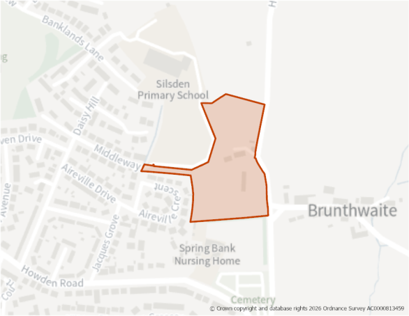
Site Size (ha) Gross: 2.53
Proposed Land Use: Housing
Minimum Development Capacity (Dwellings): 72
Site Type: Greenfield
Ward: Airedale
Settlement: Silsden
Ownership: Private
Delivery Timescale: Medium 2030-2035 (6 – 10)
Site Specific Requirements:
Design Principles
- Development should provide at least 72 dwellings as part of a high quality built environment in line with Policies ST4 and DS1. This should include affordable housing (in line with Policy HO4) and an appropriate mix of dwellings (in line with Policy HO3 and having due regard to relevant housing needs evidence and the character of the area).
- Sensitive site design and layout should be in keeping with the character of the surrounding area and take account of its proximity to the Brunthwaite Conservation Area.
- Design and layout should also reflect relevant policies within the “made” Steeton with Eastburn and Silsden Neighbourhood Development Plan .
Site Access, Highways and Transport
- A new site access is required and should be taken from Middleway where there are footways and streetlights present.
Flooding, Water and Drainage
- The site is more than 1ha in size. A Flood Risk and Drainage Assessment should be provided to identify any potential flood risk and appropriate measures for managing it.
Natural and Historic Environment
- The site lies within SPA/SAC Zone B (Supporting Habitat/Functionally Linked Land; recreational pressure). Development proposals must assess potential impacts on foraging habitat used by SPA qualifying species and provide ecological evidence where required, as well as mitigate any recreational pressure on the SPA/SAC in accordance with the South Pennine Moors SPD and Policy NE3.
- The site is located within a bat alert area. An ecological survey will be required as part of any planning application to establish the extent/impacts as well as to identify appropriate mitigation.
- The site is adjacent to the Brunthwaite Conservation Area and within close proximity to two Grade II Listed Buildings.
Environmental Protection
- The northern section of the site is crossed by low voltage electricity transmission line running from east to west. Development should include a strategy for responding to the Northern Powergrid equipment present within the site which demonstrates how the Northern Powergrid and HSE Guidance have been applied as part of the design and layout and how the impact of the assets has been reduced through good design. Enquiries should be made with Northern Powergrid.
Open Space and Green / Blue Infrastructure
- Open space should be provided in line with Policy NE2, having regard to the standards set out Appendix 11.
Landscape
- The site is located within the Silsden Bowl Rolling Enclosed Pasture Landscape Character area/type (F1).
- The western extents of the site in proximity to the existing settlement edge and where the slope is more gradual may be less sensitive to change. Opportunities to soften the existing settlement edge should be taken, integrating new development into the wider landscape with new planting and species appropriate trees. Historic drystone walls, hedgerows and boundary trees should be maintained and strengthened to help integrate new development into the landscape.
Green Belt (and Golden Rules)
- The north east section of the site is located within the Green Belt. The design and layout of any proposal should ensure that development is directed towards the non-Green Belt sections of the site. The area covered by Green Belt should remain open.
Infrastructure Requirements
- Proportionate contributions to community infrastructure will be required, where appropriate, in line with Policies ID1 and ID2, and having regard to the Local Infrastructure Plan.
Planning Permission
- A detailed planning application is currently pending on this site for 72 dwellings which may be determined before the Local Plan is adopted.
- The Council’s Regulatory and Appeals Committee (March 2026) resolved that planning permission be granted, subject to a s106 agreement being completed. This was after 1 April 2025 (the base date for the Local Plan). Accordingly, it has been identified as a site allocation.
POLICY SE1 – STEETON WITH EASTBURN Comment
Settlement Plan
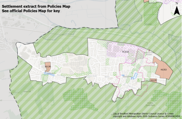
Settlement Hierarchy and Spatial Directions
- The village boundary is defined on the Policies Map and consists of the main body of the settlement located between the Leeds/Bradford to Skipton railway line and the wooded slopes to the south.
- The focus for sustainable development of this large village reflects its sustainable location with good highway and public transport connections including a railway station and regular bus services to nearby communities, as well as the services and facilities it provides. This is balanced against the importance of its historic centre with designated heritage assets and wider environmental and physical constraints including the presence of the River Aire flood plain and railway line to the north.
- Further development outside of the settlement boundaries to the west should be avoided to preserve its setting and character, and to avoid reducing the gap with neighbouring settlements (Cross Hills and Sutton in Craven).
- Development proposals should have regard to, and be consistent with, the made (adopted) Steeton with Eastburn and Silsden Neighbourhood Development Plan.
Meeting Growth Needs
- Housing development includes a combination of development within the settlement boundary and land to be released from the Green Belt during the plan period and will:
- Deliver approximately 234 dwellings through a combination of sites under construction, existing planning permissions and new site allocations as set out in Table SE1.1.
- Deliver housing site allocations as shown on the Policies Map and in Section 5:
- H1135: Aireburn Avenue
- H1136: West of Green Lane
- H1353: Summerhill Lane
Table SE1.1 - Steeton with Eastburn:
|
Under Construction |
Planning Permission |
Site Allocations |
|
|
Totals |
23 |
1 |
210 |
- Proposals for residential development within the settlement boundary on additional small sites, including the redevelopment of previously developed land, will be supported subject to meeting relevant Local Plan and made (adopted) Neighbourhood Development Plan policies.
- Employment uses will continue to be concentrated in the Steeton Grove Employment Zone (identified under Policy EC2/22) and areas safeguarded under Policy SWES8 of the made (adopted) Neighbourhood Development Plan.
Local Services and Facilities
- Support the designated Steeton with Eastburn Local Centre shown on the Policies Map as a key hub for the community to meet their day-to-day shopping needs as well as the retention and enhancement of local services and facilities.
- The roles of Airedale General Hospital and the Airedale Centre for Mental Health as key facilities for the District and beyond will be supported. Proposals for new or enhanced healthcare facilities should comply with relevant Local Plan policies, in particular Policies ST4 and SC4, and those of the made (adopted) Neighbourhood Development Plan.
- Protect and enhance designated Local Green Spaces, identified in Policy SWES10 of the made (adopted) Neighbourhood Development Plan, and open spaces in compliance with Policy NE2. Proposals that address deficiencies in open space provision identified in the Open Space Study, will be supported.
- Maintain and enhance sporting and recreation facilities, including those identified in Policy SWES11 of the made (adopted) Neighbourhood Development, whilst widened community access will be supported.
Landscape
- Maintain and enhance Steeton with Eastburn’s landscape setting reflecting the mix of landscape types and character areas (the settled valley floor of the River Aire Valley and the Hollins Bank steep valley side rising to the south), landscape features, fields and overall settlement pattern. Reference should be made to the Landscape Character Assessment Supplementary Planning Document.
- Development should have regard to potential impacts on the key views identified in Policy SWES5 of the made Neighbourhood Development Plan.
Historic and Natural Environment
- Protect and enhance green and blue infrastructure networks and corridors within and adjacent to the settlement including the River Aire Corridor, Steeton Beck and Eastburn Beck to enhance biodiversity and recreation, as well as incorporating sufficient green space and connections within new developments.
- Consideration should be given to the Green and Blue Infrastructure Strategy and the opportunities identified for enhancement within the Keighley – Shipley – Bingley Corridor.
- Protect and enhance designated Local Wildlife Sites (Currer Wood, Hawkcliffe Wood and Steeton Reservoir) as well as habitat networks and priority habitats within and adjacent to the settlement. Opportunities should be taken to deliver a net gain in biodiversity.
- Steeton with Eastburn is located within SPA/SAC Zone C. Residential development resulting in a net increase in dwellings will be required to mitigate any recreational pressure on the SPA/SAC caused by such development in accordance with the South Pennine Moors SPD and Policy NE3.
- Ensure that future development conserves and enhances key heritage assets and their settings within and adjacent to the settlement, including Steeton Conservation Area and Listed Buildings as well as non-designated heritage assets, identified in Policy SWES4 of the made (adopted) Neighbourhood Development Plan.
Local Infrastructure
- Support sustainable transport measures that reduce barriers to connections between Steeton and Eastburn and Silsden and improve access to the railway station.
- Consideration should be given to improving public transport and active travel measures connecting Airedale General Hospital and Steeton and Silsden railway station.
- Proportionate contributions to new or enhanced community infrastructure will be required, where appropriate, in line with Policies ID1 and ID2, and Policy SWES7 of the made (adopted) Neighbourhood Development Plan as well as having regard to the Local Infrastructure Plan.
Steeton with Eastburn: Site Allocations
H1135: Aireburn Avenue, Steeton with Eastburn Comment
Site Boundary:
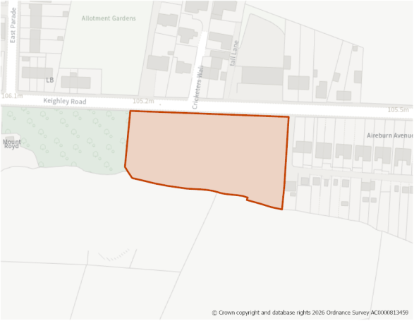
Site Size (ha) Gross: 0.70
Proposed Land Use: Housing
Minimum Development Capacity (Dwellings): 22
Site Type: Greenfield
Ward: Airedale
Settlement: Steeton
Ownership: Unregistered
Delivery Timescale: Long 2035+ (11+)
Site Specific Requirements:
Design Principles
- Development should provide at least 22 dwellings as part of a high quality built environment in line with Policies ST4 and DS1, at a net density of 35 dph. This should include affordable housing (in line with Policy HO4) and an appropriate mix of dwellings (in line with Policy HO3 and having due regard to relevant housing needs evidence and the character of the area).
- Sensitive design and layout will be required taking into consideration the proximity of the Conservation Area and the site’s sloping topography including the provision of appropriate landscaping. Layout, design and scale of new dwellings should take cues from nearby dwellings and should not exceed two storeys in height. Existing dry stone boundary walling should be retained.
- Design and layout should also reflect relevant policies within the “made” Steeton with Eastburn and Silsden Neighbourhood Development Plan .
Site Access, Highways and Transport
- A new site access is required and should be taken from Keighley Road, where there are footways and streetlighting present.
Flooding, Water and Drainage
- The site is at low risk of surface water flooding. A Flood Risk Assessment will be required as part of any planning application to establish the extent/impacts as well as to identify appropriate mitigation, where required.
Natural and Historic Environment
- The site lies within SPA/SAC Zone C (Recreational Pressure) - Residential development resulting in a net increase in dwellings will be required to mitigate any recreational pressue on the SPA/SAC caused by such development in accordance with the South Pennine Moores SPD and Policy NE3.
- The site is adjacent to identified habitat network (grassland to the south and woodland to the east) and partially located within a bat alert area. An ecological survey will be required to establish the extent/impacts and identify appropriate mitigation.
- Mature trees are present within site’s south western section and overhang the western boundary. The design and layout of any development should seek to retain these trees.
- The site is classified as being a mixture of Grade 2 and Grade 4 agricultural land with remainder being classed as “urban”.
- The site is around 150m from the Steeton Conservation Area. The layout, design and scale of dwellings should have regard to the character of the surrounding area, taking into accout the site’s topography and views into and out of the Conservation Area. Careful consideration of the landscape strategy will be needed.
Open Space and Green / Blue Infrastructure
- Open space should be provided in line with Policy NE2, having regard to the standards set out Appendix 11.
- Site is within an area of low provision and high need for green and blue infrastructure. Development proposals should focus on carefully designed green and blue infrastructure to contribute towards site specific issues.
- The site lies partially within the Keighley – Bingley – Shipley opportunity area, as identified in the Green and Blue Infrastrucutre Strategy (GBIS). This strategy should be consulted to identify opportunities for incorporating measures within the development that enhance the quality of, and connectivity to, the green and blue infrastructure network in this area.
Landscape
- The site is located within the Upper Airedale Settled Valley Floor Landscape Character area/type (G1). No landscape sensitivity assessment was undertaken for this site. Consideration should be given to the guidance set out in the Landscape Character Assessment SPD.
Infrastructure Requirements
- Proportionate contributions to community infrastructure will be required, where appropriate, in line with Policies ID1 and ID2, and having regard to the Local Infrastructure Plan.
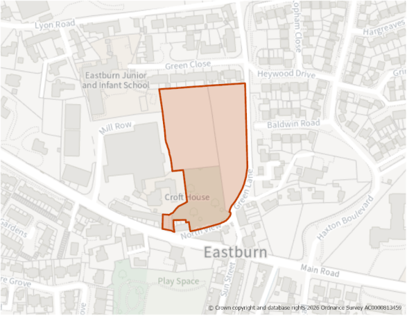
Site Size (ha) Gross: 1.31
Proposed Land Use: Housing
Minimum Development Capacity (Dwellings): 41
Site Type: Greenfield
Ward: Airedale
Settlement: Steeton
Ownership: Private
Delivery Timescale: Medium 2030-2035 (6-10)
Site Specific Requirements:
Design Principles
- Development should provide at least 41 dwellings as part of a high quality built environment in line with Policies ST4 and DS1, at a net density of 35 dph. This should include affordable housing (in line with Policy HO4) and an appropriate mix of dwellings (in line with Policy HO3 and having due regard to relevant housing needs evidence and the character of the area).
- A sensitive design and layout will be required taking into consideration the trees and areas of woodland benefitting from individual and group TPO designations as well as the site’s proximity to industrial/employment uses.
- Design and layout should also reflect relevant policies within the “made” Steeton with Eastburn and Silsden Neighbourhood Development Plan.
Site Access, Highways and Transport
- A new site access is required and should be taken from Main Road.
Flooding, Water and Drainage
- There is potential for surface water flooding adjacent to the site’s northern boundary. A Flood Risk Assessment should be provided as part of any future planning application determine potential risks and identify appropriate mitigation measures.
Natural and Historic Environment
- The site lies within SPA/SAC Zone C (Recreational Pressure) – Residential development resulting in a net increase in dwellings will be required to mitigate any recreational pressue on the SPA/SAC caused by such development in accordance with the South Pennine Moores SPD and Policy NE3.
- The site is partially within a bat alert area. An ecological survey will be required to establish the extent/impacts and identify appropriate mitigation.
- The site is identified in the West Yorkshire Local Nature Recovery Strategy (LNRS) with the preferred measure T2_M05: Help more red squirrels to move back into West Yorkshire: buffer, connect, improve and safeguard existing woodland and create new woodland in areas where red squirrels are expanding (or could do so).
- The site contains a number of TPO trees and TPO woodland areas. The design and layout of any development should seek, where possible, to retain and protect these trees. An arboricultural assessment will be required.
- The site is within proximity to a designated heritage asset (Listed Building – Grade II – Eastburn House). The design and layout of any development should ensure that it takes into consideration this heritage asset and its setting.
Environmental Protection
- The site is located adjacent to Eastburn Mills, an industrial estate giving rise to potential for contamination to be present due to nearby historic land uses. A Phase 1 Geo-Environmental Assessment should be provided to determine any potential contamination, with a Phase 2 site investigation being undertaken, if appropriate.
Open Space and Green / Blue Infrastructure
- Open space should be provided in line with Policy NE2, having regard to the standards set out Appendix 11.
Landscape
- The site is located within the Upper Airedale Settled Valley Floor Landscape Character area/type (G1). No landscape sensitivity assessment was undertaken for this site. Consideration should be given to the guidance set out in the Landscape Character Assessment SPD.
Infrastructure Requirements
- Proportionate contributions to community infrastructure will be required, where appropriate, in line with Policies ID1 and ID2 and having regard to the Local Infrastructure Plan.
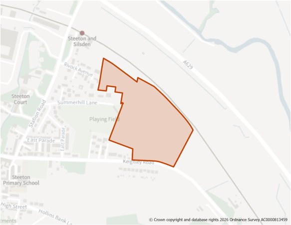
Site Size (ha) Gross: 7.37
Proposed Land Use: Housing
Minimum Development Capacity (Dwellings): 147
Site Type: Greenfield
Ward: Airedale
Settlement: Steeton
Ownership: Private
Delivery Timescale: Short 2025- 2030 (1-5)
Site Specific Requirements:
Design Principles
1. Development should provide at least 147 dwellings as part of a high quality built environment in line with Policies ST4 and DS1. This should include affordable housing (in line with Policy HO4) and an appropriate mix of dwellings (in line with Policy HO3 and having due regard to relevant housing needs evidence and the character of the area).
2. A sensitive design and layout will be required, giving appropriate consideration to topography, building heights and appropriate screening to reflect the site’s location on the eastern edge of the settlement and proximity to the Conservation Area as well as to mitigate any impacts on the landscape. Existing features such as trees, hedgerows and field boundaries should be retained.
3. It should also be in line with design and other relevant policies within the “made” Steeton with Eastburn and Silsden Neighbourhood Development Plan.
Site Access, Highways and Transport
4. A new site access is required and should be taken from Keighley Road at the south eastern corner of the site. Consideration will need to be given to difference in levels between Keighley Road and the site.
5. Consider opportunities to establish a more direct pedestrian and cycle route to Steeton and Silsden railway station.
Flooding, Water and Drainage
6. The site’s eastern/northern sections are located within Flood Zones 2 and 3b (functional flood plain). Development should not take place within the area of functional floodplain and also be directed away from areas within Flood Zone 2. Such areas should remain as open greenspace.
7. A culverted watercourse may be present beneath the south western boundary of the site and should be further investigated as part of a detailed Flood Risk Assessment. No development should take place over the culvert or within 8 metres either side of it. Consideration should be given to opportunities for opening it up and incorporating it within the site design as a blue green corridor.
8. A drainage strategy should be provided as part of any planning application. It should include modelled surface water flows and areas of ponding within the site layout and design. The flood risk assessment should consider historic sewer flooding, and ensure safe access and escape routes.
9. During the Flood Risk Assessment process, ongoing engagement should take place with the Council, the Environment Agency, Yorkshie Water and emergency services.
Natural and Historic Environment
10. The site lies within SPA/SAC Zone C (Recreational Pressure) - residential development resulting in a net increase in dwellings will be required to mitigate any recreational pressue on the SPA/SAC caused by such development in accordance with the South Pennine Moors SPD and Policy NE3.
11. The site contains an area of identified Wildlife Habitat Network and is partially within a bat alert area. An ecological survey will be required to establish the extent/impacts as well as to identify appropriate mitigation.
12. Parts of the site are identified in the West Yorkshire Local Nature Recovery Strategy (LNRS) with the preferred measures B4M02: Significantly boost biodiversity wherever possible where there are existing habitats alongside transport infrastructure, T2_M04: Extend and connect tree and woodland cover across the White Rose Forest area in West Yorkshire, and W4_M02: Create new reedbeds, wet grasslands, floodplain meadows, open standing water and wet woodland around known areas of lowland raised bog.
13. The site is located adjacent to the Steeton Conservation Area. Due to the size of the site and its proximity to the conservation area, it is expected that the layout, design and scale of dwellings should take design cues and be informed by the traditional style of development that characterises the older parts of Steeton and in particular the high-quality buildings within the conservation area.
14. Design, scale and layout of development should have a strong sense of local identity which should be reflected in the palate of building materials. Dwellings above 2 storeys in height would not be appropriate on this site, considering the topography, views into and out of the conservation area and the scale of existing buildings close to the site.
15. Careful consideration of the landscape strategy will be needed to ensure that the development has adequate areas of open space, trees and greenery so that it harmonises with the spacious and landscape qualities of the dwellings around Summerhill Lane. Where features such as stone boundary walls exist, these should also be incorporated to ensure that these important elements of the rural character are retained.
16. The site is classified as being a mixture of Grade 2 and Grade 3b agricultural land.
Environmental Protection
17. The site partially located within a Mineral Safeguarding Area for sand and gravel. A mineral resource assessment will be required to determine the extent and availability of any sand and gravel resource, in with Policy MIN3.
18. The site’s central and eastern areas are crossed by low voltage electricity transmission cables south south to north and south east to north west. Development should include a strategy for responding to the Northern Powergrid equipment present within the site which demonstrates how the Northern Powergrid and HSE Guidance have been applied as part of the design and layout and how the impact of the assets has been reduced through good design. Enquiries should be made with Northern Powergrid.
Open Space and Green / Blue Infrastructure
19. Open space should be provided in line with Policy NE2, having regard to the standards set out Appendix 11.
20. The site lies partially within the Keighley – Bingley – Shipley opportunity area, as identified in the Green and Blue Infrastructure Strategy (GBIS). The strategy should be consulted to identify opportunities for incorporating measures within the development that enhances the quality of, and connectivity to the green and blue infrastructure network, in line with Policies ST6 and NE1.
Landscape
21. The site is located within the Upper Airedale Settled Valley Floor Landscape Character area/type (G1).
22. The site is assessed as having moderate landscape sensitivity. Development should be located in the west of the site, within the area enclosed by existing development and in proximity to the existing settlement edge. Drystone walls should be retained and restored. Trees and tree belts should be included to help integrate the development into the landscape, and any existing vegetation protected and enhanced. Visibility of any development to and from the Steeton Conservation Area should be minimised.
Other Constraints
23. The site is located to east of Steeton Cricket Club. The design and layout of any development should not compromise the use of the cricket ground. Consideration should be given to potential impact of ball strike on any future development. A ball-strike assessment should be provided as part of any planning application to determine potential risk and mitigation measures.
Green Belt (and Golden Rules)
24. Site has been removed from the Green Belt. Development on the site should be consistent with the “Golden Rules” set out in the NPPF in relation to affordable housing, necessary improvements to infrastructure and accessible green space provision.
Infrastructure Requirements
25. Proportionate contributions to community infrastructure will be required, where appropriate, in line with Policies ID1 and ID2, and having regard to the Local Infrastructure Plan.
Planning Permission
26. A detailed planning application is currently pending on this site for 147 dwellings which may be determined before the Local Plan is adopted.
